Battle Hill

Hill, Mountain in Westmorland Eden

England

Battle Hill

Looking over Swindale The view from the bridleway at Helbeck looking over the wooded valley to the distant fells above Kirkby Stephen and Mallerstang.
Looking over Swindale Credit: Karl and Ali

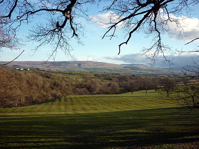
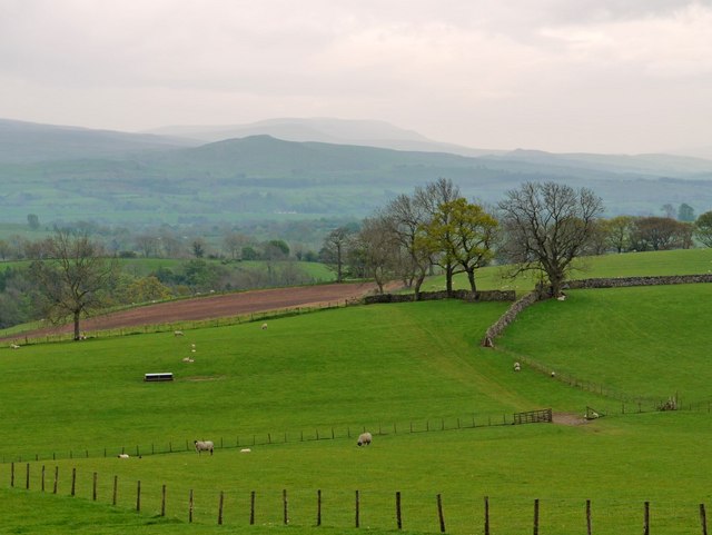
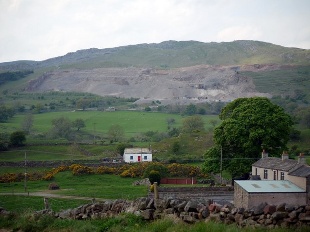
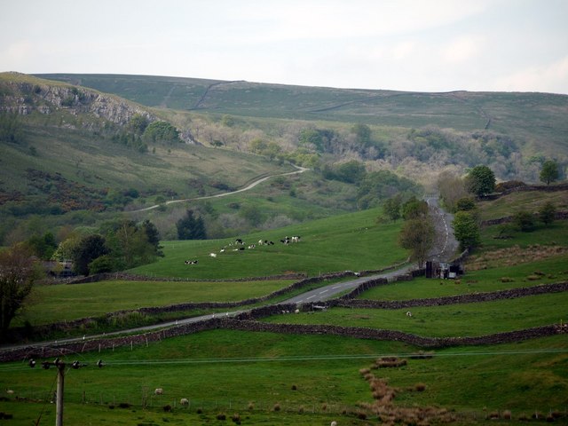
Battle Hill is a prominent hill located in Westmorland, a historic county in the northwestern region of England. Situated in the picturesque Lake District National Park, this hill stands at an elevation of approximately 1,545 feet (471 meters) above sea level. It forms part of the wider Pennines mountain range, known for its rugged and scenic landscapes.

The name "Battle Hill" is derived from its historical significance as an ancient battle site. It is believed that a battle took place here during the Viking Age, although the exact details and participants remain uncertain. Nonetheless, this historical association adds to the intrigue and allure of the hill.

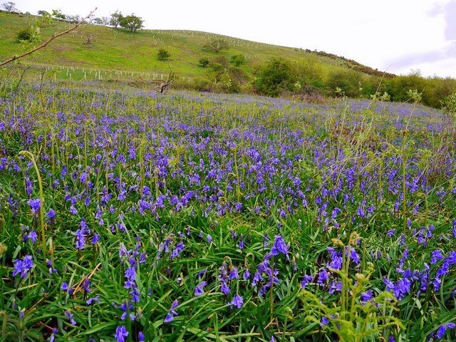
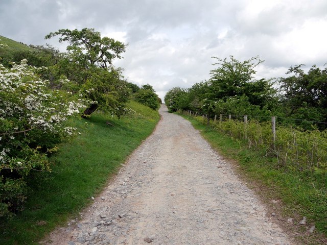
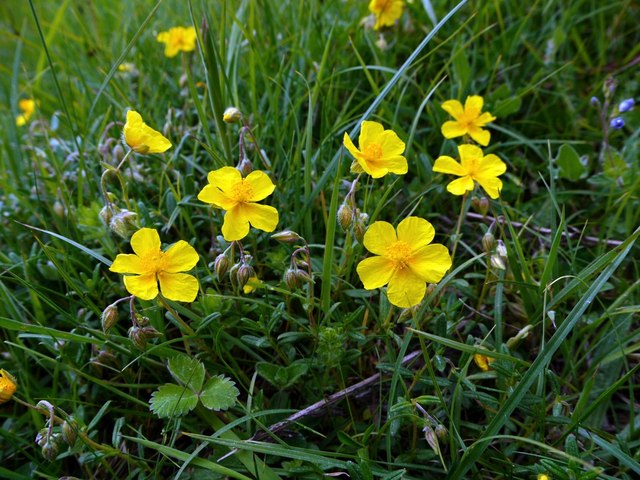
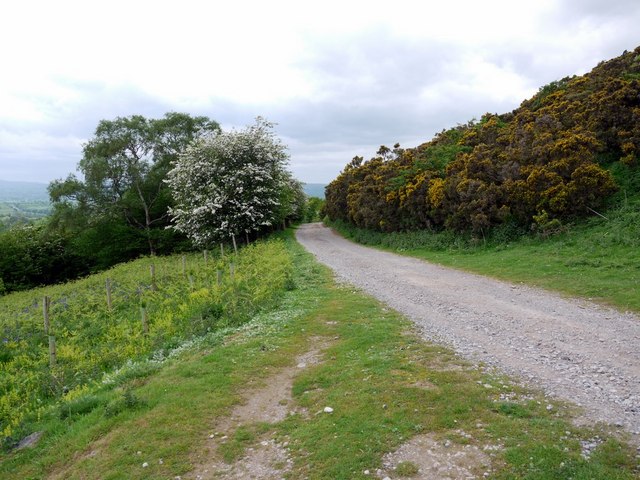
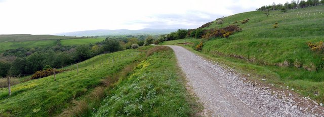
From the summit of Battle Hill, visitors are treated to breathtaking panoramic views of the surrounding countryside, including the nearby Lake District fells, lush valleys, and shimmering bodies of water. The hill's slopes are covered in heather and grasses, which provide a habitat for various plant and animal species.

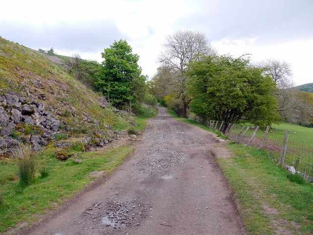
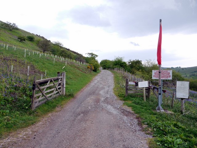
Hikers and outdoor enthusiasts are drawn to Battle Hill, as it offers a range of walking trails and routes that cater to different fitness levels. These trails allow visitors to experience the hill's natural beauty up close and personal, with opportunities for birdwatching, photography, and peaceful contemplation.

Despite its relatively modest height, Battle Hill's prominence and historical significance make it a popular destination for those seeking both natural beauty and a glimpse into England's past.

If you have any feedback on the listing, please let us know in the comments section below.
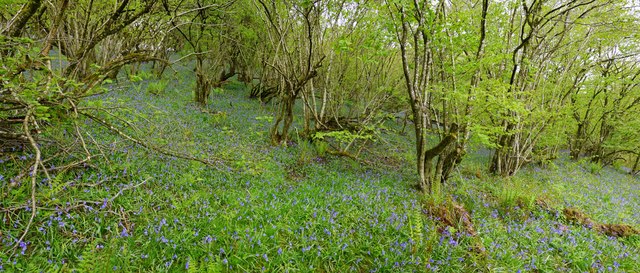
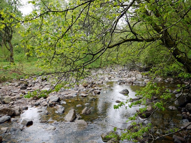
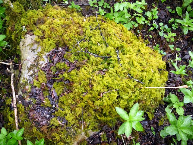
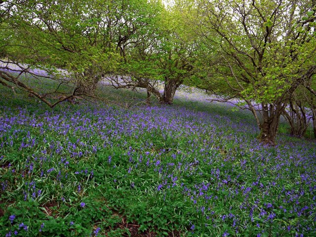
Battle Hill Images

Images are sourced within 2km of 54.522801/-2.2987127 or Grid Reference NY8014. Thanks to Geograph Open Source API. All images are credited.

Looking over Swindale The view from the bridleway at Helbeck looking over the wooded valley to the distant fells above Kirkby Stephen and Mallerstang.
Looking over Swindale
The view from the bridleway at Helbeck looking over the wooded valley to the distant fells above Kirkby Stephen and Mallerstang.
Track below Helbeck Quarry
Track east of Helbeck Quarry The footpath along the track which starts at the end of the minor road near Helbeck Quarry looked like a good place to walk. The extensive area of Warop Range was shown on my fairly recent 1:25000 map as starting west of Helbeck Wood <a href="https://www.geograph.org.uk/gridref/NY7816">NY7816</a> and well to the north <a href="https://www.geograph.org.uk/gridref/NY8018">NY8018</a>
However, the red flag flying here, a confusing sign which both implied that you were entering the range area but (maybe) not quite at danger for a distance 3800 metres from the flag, and the loud sound of gunfire were enough to put me off.
The range here is in use six and a half days of the week. Sunday afternoons and the few access days would be a better bet when I'm next across this way.
<span class="nowrap"><a title="http://www.mod.uk/DefenceInternet/AboutDefence/WhatWeDo/DefenceEstateandEnvironment/AccessRecreation/North/Warcop.htm" rel="nofollow ugc noopener" href="http://www.mod.uk/DefenceInternet/AboutDefence/WhatWeDo/DefenceEstateandEnvironment/AccessRecreation/North/Warcop.htm">Link</a><img style="margin-left:2px;" alt="External link" title="External link - shift click to open in new window" src="https://s1.geograph.org.uk/img/external.png" width="10" height="10"/></span>
Track east of Helbeck Quarry
The footpath along the track which starts at the end of the minor road near Helbeck Quarry looked like a good place to walk. The extensive area of Warop Range was shown on my fairly recent 1:25000 map as starting west of Helbeck Wood NY7816 and well to the north NY8018 However, the red flag flying here, a confusing sign which both implied that you were entering the range area but (maybe) not quite at danger for a distance 3800 metres from the flag, and the loud sound of gunfire were enough to put me off. The range here is in use six and a half days of the week. Sunday afternoons and the few access days would be a better bet when I'm next across this way. LinkExternal link
Bluebells above Swindale Beck
Hazel coppice and bluebells, Swindale Wood
Swindale Beck
Swindale Beck
Common Tamarisk-moss (Thuidium tamariscinum) A common and easily recognised moss growing on a boulder in Swindale Wood, near Swindale Beck.
<span class="nowrap"><a title="https://rbg-web2.rbge.org.uk/bbs/Activities/mosses/Thuidium%20tamariscinum.pdf" rel="nofollow ugc noopener" href="https://rbg-web2.rbge.org.uk/bbs/Activities/mosses/Thuidium%20tamariscinum.pdf">Link</a><img style="margin-left:2px;" alt="External link" title="External link - shift click to open in new window" src="https://s1.geograph.org.uk/img/external.png" width="10" height="10"/></span>
Common Tamarisk-moss (Thuidium tamariscinum)
A common and easily recognised moss growing on a boulder in Swindale Wood, near Swindale Beck. LinkExternal link
A carpet of bluebells in Swindale Wood
Fields east of Helbeck View south to the distinctive outline of Long Rigg Scar <a href="https://www.geograph.org.uk/photo/510493">NY8009 : Long Rigg</a> with High Seat in the distance. Birkett Hill, another hill with a distinctive profile, can be seen to the right, above the trees <a href="https://www.geograph.org.uk/photo/270752">NY7907 : Birkett Hill from Birkett Hill</a>
Fields east of Helbeck
View south to the distinctive outline of Long Rigg Scar NY8009 : Long Rigg with High Seat in the distance. Birkett Hill, another hill with a distinctive profile, can be seen to the right, above the trees NY7907 : Birkett Hill from Birkett Hill
Ash tree bole, Swindale Beck The common ash tree of Britain and Ireland is the species Fraxinus excelsior, whose range actually covers most of Europe. The limestone rock in this area has favoured growth of mature ash woodland with a dense under-storey of Hazel, commonly coppiced <a href="https://www.geograph.org.uk/photo/2397737">NY8015 : Hazel coppice and bluebells, Swindale Wood</a>. This is largely ancient woodland which has survived on the steep slopes above the Swindale Beck <a href="https://www.geograph.org.uk/photo/2040516">NY8015 : Wood by Swindale Beck</a>, and has been little affected by introduced tree species. Strangely, ash trees do not support a wide range of invertebrates which results in ash woodlands being unable to support as rich a collection of birds as most other broadleaved forests. The bark on the trunk is a greyish brown colour, with deep cracks often extended in a diamond pattern.
Ash tree bole, Swindale Beck
The common ash tree of Britain and Ireland is the species Fraxinus excelsior, whose range actually covers most of Europe. The limestone rock in this area has favoured growth of mature ash woodland with a dense under-storey of Hazel, commonly coppiced NY8015 : Hazel coppice and bluebells, Swindale Wood. This is largely ancient woodland which has survived on the steep slopes above the Swindale Beck NY8015 : Wood by Swindale Beck, and has been little affected by introduced tree species. Strangely, ash trees do not support a wide range of invertebrates which results in ash woodlands being unable to support as rich a collection of birds as most other broadleaved forests. The bark on the trunk is a greyish brown colour, with deep cracks often extended in a diamond pattern.
Helbeck Quarry above Brough An active and ever expanding limestone quarry opened in the 1920s operated by the Sherburn Stone Company. It quarries limestones formed during the Dinantian Epoch of the Carboniferous Period, from approximately 327 to 316 million years ago.
Helbeck Quarry above Brough
An active and ever expanding limestone quarry opened in the 1920s operated by the Sherburn Stone Company. It quarries limestones formed during the Dinantian Epoch of the Carboniferous Period, from approximately 327 to 316 million years ago.
Road from Brough to Middleton in Teesdale The wooded valley of the Swindale Beck can be seen beyond the road.
Road from Brough to Middleton in Teesdale
The wooded valley of the Swindale Beck can be seen beyond the road.
Past the red flag, east of Helbeck Quarry This afternoon the red warning flag wasn't flying so I decided to complete the walk I had planned earlier <a href="https://www.geograph.org.uk/photo/2397684">NY8015 : Track east of Helbeck Quarry</a>
This is the track just past the gate and red flag which warns of live firing on the MOD range.
Past the red flag, east of Helbeck Quarry
This afternoon the red warning flag wasn't flying so I decided to complete the walk I had planned earlier NY8015 : Track east of Helbeck Quarry This is the track just past the gate and red flag which warns of live firing on the MOD range.
Common Rock-rose (Helianthemum nummularium) Rock-rose is abundant in the short, rabbit-grazed grassland east of Helbeck Quarry reflecting the underlying limestone rock of this area <a href="https://www.geograph.org.uk/photo/2398903">NY8015 : Helbeck Quarry above Brough</a>
Common Rock-rose (Helianthemum nummularium)
Rock-rose is abundant in the short, rabbit-grazed grassland east of Helbeck Quarry reflecting the underlying limestone rock of this area NY8015 : Helbeck Quarry above Brough
Track below Spoonymire Hill
Track below Spoonymire Hill The track from Helbeck Quarry to Thornthwaite climbs below Spoonymire Hill on which new deciduous trees have been planted (tubed to protect them from rabbits) and the ancient woodland below of Swindale Wood.
Track below Spoonymire Hill
The track from Helbeck Quarry to Thornthwaite climbs below Spoonymire Hill on which new deciduous trees have been planted (tubed to protect them from rabbits) and the ancient woodland below of Swindale Wood.
Barn south of Woodside Panorama west over the wooded valley of Swindale Beck. Spoonymire Hill <a href="https://www.geograph.org.uk/photo/2425165">NY8016 : Track below Spoonymire Hill</a> and Carry Band <a href="https://www.geograph.org.uk/photo/2425249">NY8016 : Carry Band from track above Swindale</a> can be seen on the right.
Barn south of Woodside
Panorama west over the wooded valley of Swindale Beck. Spoonymire Hill NY8016 : Track below Spoonymire Hill and Carry Band NY8016 : Carry Band from track above Swindale can be seen on the right.
A66 east of Brough The A66 is a major road in northern England running from near Middlesbrough to Workington. The section between Scotch Corner and Penrith is a Trans-Pennine route between the A1 and M6, following an old Roman Road.
Wikipedia: <span class="nowrap"><a title="http://en.wikipedia.org/wiki/A66_road" rel="nofollow ugc noopener" href="http://en.wikipedia.org/wiki/A66_road">Link</a><img style="margin-left:2px;" alt="External link" title="External link - shift click to open in new window" src="https://s1.geograph.org.uk/img/external.png" width="10" height="10"/></span>
A66 east of Brough
The A66 is a major road in northern England running from near Middlesbrough to Workington. The section between Scotch Corner and Penrith is a Trans-Pennine route between the A1 and M6, following an old Roman Road. Wikipedia: LinkExternal link
Show me another place!

Battle Hill is located at Grid Ref: NY8014 (Lat: 54.522801, Lng: -2.2987127)

Administrative County: Cumbria

District: Eden

Police Authority: Cumbria

What 3 Words

///achieving.crash.sensibly. Near Kirkby Stephen, Cumbria

Nearby Locations

Battle Hill

Related Wikis

Verterae

Verterae was a Roman fort in the modern-day village of Brough, Cumbria, England. Occupied between the 1st and 5th centuries AD, it protected a key Roman...
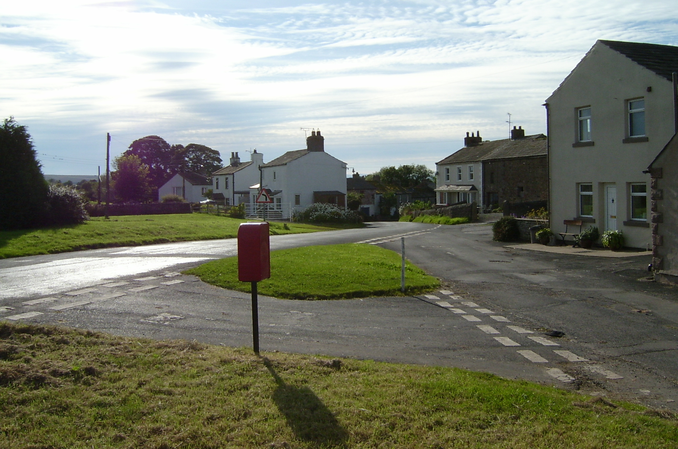
Brough, Cumbria

Brough (), sometimes known as Brough under Stainmore, is a village and civil parish in the Westmorland and Furness unitary authority of Cumbria, England...
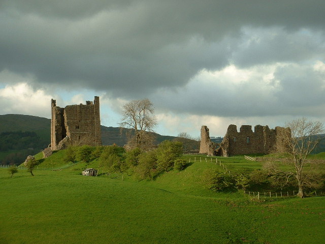
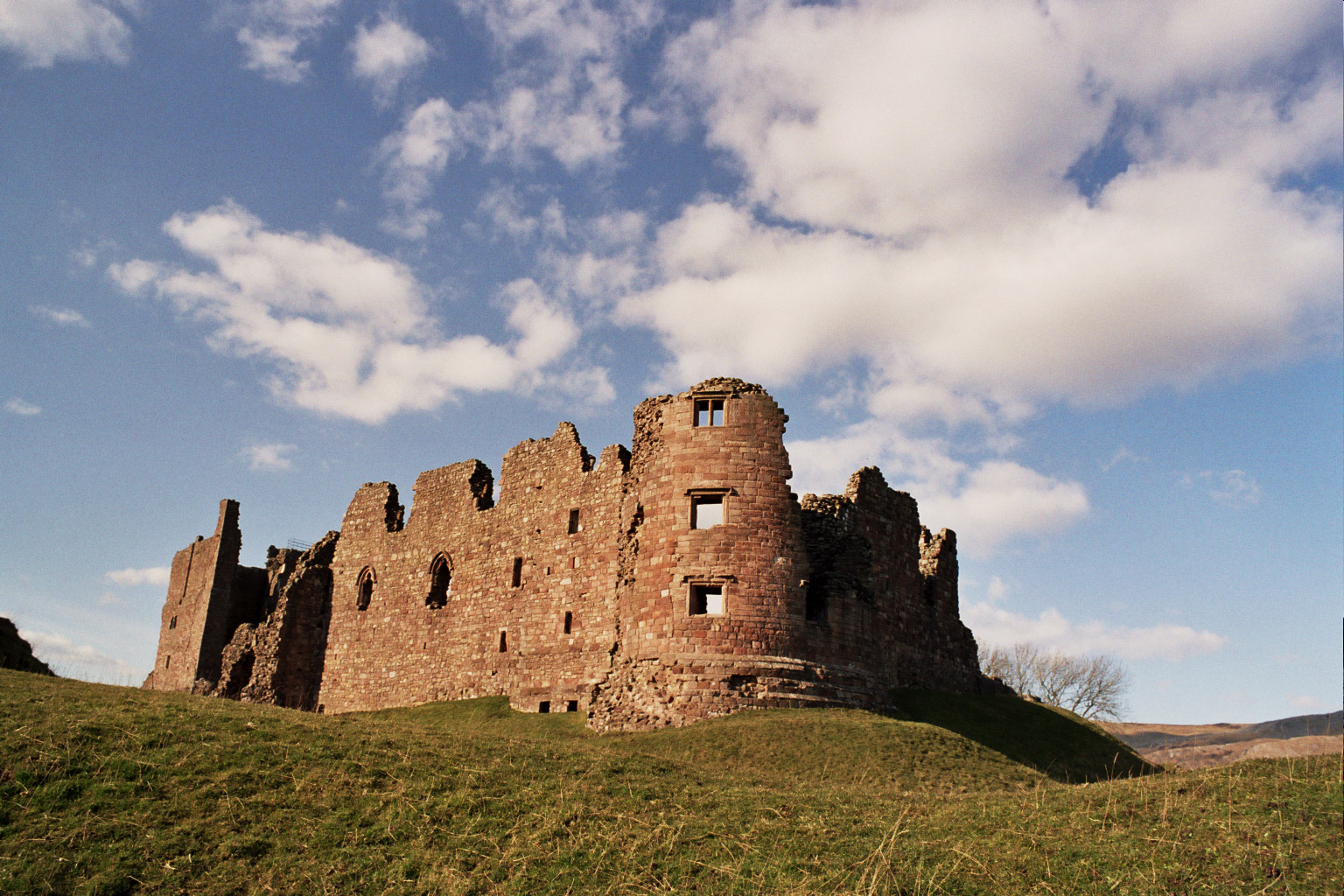
Brough Castle

Brough Castle is a ruined castle in the village of Brough, Cumbria, England. The castle was built by William Rufus around 1092 within the old Roman fort...

Helbeck

Helbeck is a settlement and civil parish near the village of Brough, in the Eden district, in the county of Cumbria, England. There is a wood called Helbeck...

Brough Sowerby

Brough Sowerby is a village and civil parish in the Eden district of Cumbria, England. It is located 22.3 miles south east of the town Penrith. According...

Stainmore

Stainmore is a remote geographic area in the Pennines on the border of Cumbria, County Durham and North Yorkshire. The name is used for a civil parish...

A66 road

The A66 is a major road in Northern England, which in part follows the course of the Roman road from Scotch Corner to Penrith. It runs from east of Middlesbrough...

Kaber, Cumbria

Kaber is a village and civil parish in the Eden District of Cumbria, England. == Location and topography == The village is located about 2 miles (3.2 km...

Nearby Amenities

Located within 500m of 54.522801,-2.2987127
Parking
Fee: no
Park Ride: no
Parking: lane
Supervised: no
Surface: asphalt
Lat/Long: 54.5256828/-2.3032127
Parking
Access: yes
Check Date Fee: 2022-02-05
Fee: no
Park Ride: no
Parking: lane
Supervised: no
Surface: asphalt
Lat/Long: 54.526303/-2.3024108
Augill Castle
Addr Postcode: CA17 4DE
Addr Street: Leacett Lane
Phone: +44 1768 341937
Tourism: hotel
Website: https://stayinacastle.com/
Lat/Long: 54.5194351/-2.3014254
Battle Hill
Place: locality
Lat/Long: 54.5228107/-2.3002747
Power: pole
Lat/Long: 54.5185945/-2.3002138
Power: pole
Lat/Long: 54.5184751/-2.2986556
The data included in this document is from www.openstreetmap.org. The data is made available under ODbL.

Have you been to Battle Hill?

Leave your review of Battle Hill below (or comments, questions and feedback).