Black Hill

Hill, Mountain in Northumberland

England

Black Hill

The Pennine Way near Kelly's Pike
The Pennine Way near Kelly's Pike Credit: Dave Kelly

Black Hill is a prominent hill located in Northumberland, England. Situated within the North Pennines Area of Outstanding Natural Beauty, it is part of the Pennine range and reaches a summit of 609 meters (1,998 feet) above sea level, making it one of the highest points in the county.

This iconic landmark is a popular destination for hikers, nature lovers, and outdoor enthusiasts. Its distinctive black appearance is due to the presence of heather and peat, which cover the hillside. The surrounding landscape is characterized by rolling hills, deep valleys, and vast moorlands, providing visitors with breathtaking views and a sense of tranquility.

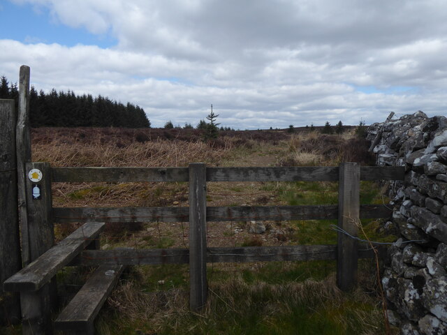
Black Hill offers a variety of walking trails and paths, catering to all levels of ability. The Pennine Way, a renowned long-distance footpath, passes through the area, attracting walkers from all over the country. The hill's summit provides panoramic views across the Northumberland countryside, including adjacent hills such as Cross Fell and Great Dun Fell.

The hill is also home to a diverse range of flora and fauna. Heather, bilberry, and cotton grass are among the plant species that thrive in this habitat. Birdwatchers can spot various species, including curlews, lapwings, and red grouse.

With its natural beauty and rich biodiversity, Black Hill offers a peaceful and rewarding experience for those seeking to connect with nature and explore the stunning Northumberland countryside.

If you have any feedback on the listing, please let us know in the comments section below.

Black Hill Images

Images are sourced within 2km of 55.251276/-2.3042345 or Grid Reference NY8095. Thanks to Geograph Open Source API. All images are credited.

The Pennine Way near Kelly's Pike
The Pennine Way near Rooken Knowe
Pennine Way joins forest road At this point, the Pennine Way comes off the moors above Bellingham to join a forest road which runs northwards through Redesdale Forest.
Pennine Way joins forest road
At this point, the Pennine Way comes off the moors above Bellingham to join a forest road which runs northwards through Redesdale Forest.
Gate into Redesdale Forest At this point the old road which runs all the way from Bellingham to Byrness leaves the privately owned Gibshiel Forest to enter the Forestry Commission-owned Redesdale Forest. The signpost shows where the Pennine Way comes in off the moors to join the forest road.
Gate into Redesdale Forest
At this point the old road which runs all the way from Bellingham to Byrness leaves the privately owned Gibshiel Forest to enter the Forestry Commission-owned Redesdale Forest. The signpost shows where the Pennine Way comes in off the moors to join the forest road.
Pennine Way in Redesdale Forest At this point, the Pennine Way takes a slightly more direct route than the broad forest road for 500 metres. It is unlikely that most weary walkers would want to bash their way through the vegetation rather than stick to the road.
Pennine Way in Redesdale Forest
At this point, the Pennine Way takes a slightly more direct route than the broad forest road for 500 metres. It is unlikely that most weary walkers would want to bash their way through the vegetation rather than stick to the road.
Switchback road through Redesdale Forest The old road which runs all the way from Bellingham to Byrness has here been upgraded to a good forestry road. The Pennine Way generally follows this alignment, although at this point it is about 50 metres to the west.
Switchback road through Redesdale Forest
The old road which runs all the way from Bellingham to Byrness has here been upgraded to a good forestry road. The Pennine Way generally follows this alignment, although at this point it is about 50 metres to the west.
Track through Redesdale forest. The Pennine way.
Track through Redesdale forest.
The Pennine way.
The Pennine Way near Gibshiel
The Pennine Way near Gorless Crag A scramble as the plantation encrouches on the PW path.
The Pennine Way near Gorless Crag
A scramble as the plantation encrouches on the PW path.
Interesting flora and fauna to the side of the Pennine Way
The Pennine Way near Gorless Crag
The Pennine Way near Brownrigg Head
The Pennine Way near Kelly's Pike
Two diminutive black rams at Gibshiel Hebridean breed (identification courtesy of Adrian Cable and his wife).
Two diminutive black rams at Gibshiel
Hebridean breed (identification courtesy of Adrian Cable and his wife).
Gibshiel Farm Remote farm on the edge of Redesdale Forest.
Gibshiel Farm
Remote farm on the edge of Redesdale Forest.
Gated road to Gibshiel Redesdale Forest on the skyline.
Gated road to Gibshiel
Redesdale Forest on the skyline.
New planting in Gibshiel Plantation Tuley tubes protect the young saplings in this cleared area of forest.
New planting in Gibshiel Plantation
Tuley tubes protect the young saplings in this cleared area of forest.
New planting in Gibshiel Plantation Tuley tubes protect the young saplings in this cleared area. The forestry road is part of an old road which runs all the way from Bellingham to Byrness.
New planting in Gibshiel Plantation
Tuley tubes protect the young saplings in this cleared area. The forestry road is part of an old road which runs all the way from Bellingham to Byrness.
Show me another place!

Black Hill is located at Grid Ref: NY8095 (Lat: 55.251276, Lng: -2.3042345)

Unitary Authority: Northumberland

Police Authority: Northumbria

What 3 Words

///serves.edge.kiosk. Near Rochester, Northumberland

Nearby Locations

Black Hill

Related Wikis

Border Moors and Forests

Border Moors and Forests NCA is an upland plateau region in Northern England between the North East and North West regions, and touching the Anglo-Scottish...

Bremenium

Bremenium is an ancient Roman fort (castrum) located at Rochester, Northumberland, England. The fort is one of the defensive structures built along Dere...

Rochester, Northumberland

Rochester is a small village and civil parish in north Northumberland, England. It is 5 miles (8 km) north-west of Otterburn on the A68 road between Corbridge...

A68 road

The A68 is a major road in the United Kingdom, running from Darlington in England to the A720 in Edinburgh, the capital of Scotland. It crosses the Anglo...

Kielderhead and Emblehope Moors

Kielderhead and Emblehope Moors are contiguous areas of moorland in northern Northumberland, England. A section of Kielderhead Moor is part of neighbouring...

Black Middens Bastle House

Black Middens Bastle House lies about 7 miles (11 km) northwest of Bellingham, Northumberland. It is a two-storey fortified stone farmhouse from the 16th...

Cottonshopeburnfoot

Cottonshopeburnfoot is a hamlet in Redesdale in Northumberland, England. It lies on the A68 road, 2 miles south east of the village of Byrness. The hamlet...
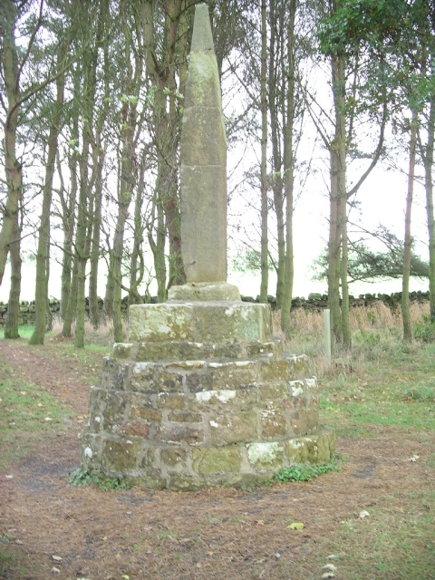
Percy Cross

The Percy Cross (also Battle Stone) is located just off the A696, 1 kilometre (0.62 mi) from Otterburn, Northumberland, England. It was erected before...

Nearby Amenities

Located within 500m of 55.251276,-2.3042345
Black Hill
Place: locality
Lat/Long: 55.2500408/-2.3045535
The data included in this document is from www.openstreetmap.org. The data is made available under ODbL.

Have you been to Black Hill?

Leave your review of Black Hill below (or comments, questions and feedback).