Birkett Hill

Hill, Mountain in Westmorland Eden

England

Birkett Hill

Footpath in groove en route for Nine Standards Rigg The path, seen looking to the west - downhill - is one of the main routes to the summit of Nine Standards Rigg and is a variant of the 'Coast to Coast' long distance path.
Footpath in groove en route for Nine Standards Rigg Credit: Trevor Littlewood

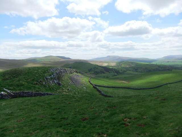
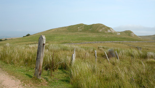
Birkett Hill is a prominent hill located in the historic county of Westmorland in North West England. Situated within the renowned Lake District National Park, it stands at an elevation of approximately 568 meters (1,864 feet) above sea level. Birkett Hill is part of the larger Pennines range, which spans across several counties in Northern England.

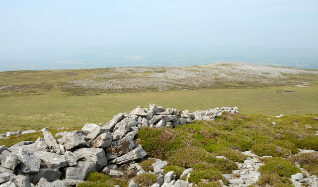
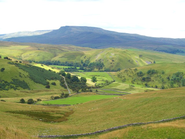
The hill offers breathtaking panoramic views of the surrounding picturesque landscape, including the nearby Haweswater Reservoir and the dramatic peaks of the High Street range. It is a popular destination for hikers and outdoor enthusiasts, who are drawn to its rugged beauty and the challenging terrain it presents.

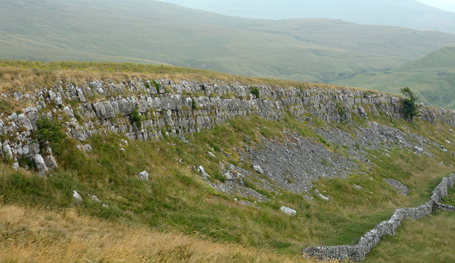
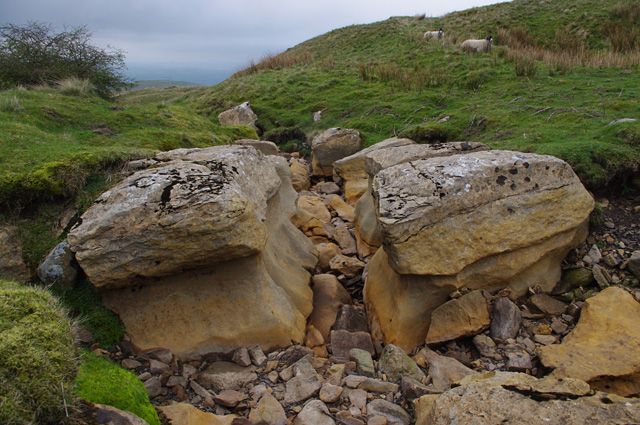
The ascent to the summit of Birkett Hill is mainly via well-defined footpaths, which wind through heather-clad slopes and rocky outcrops. The hill's distinct shape and prominent position make it easily identifiable from a distance. On a clear day, it is possible to see as far as the Cumbrian coast to the west and the Yorkshire Dales to the east.

Despite its relative accessibility, Birkett Hill retains a wild and untouched quality, with a rich variety of flora and fauna inhabiting its slopes. It provides a habitat for various bird species, including the elusive ring ouzel and peregrine falcon.

Birkett Hill's natural beauty, combined with its historical and cultural significance, continues to attract visitors from all over the world, who come to experience the tranquility and majesty of this remarkable Westmorland landmark.

If you have any feedback on the listing, please let us know in the comments section below.

Birkett Hill Images

Images are sourced within 2km of 54.464479/-2.3081918 or Grid Reference NY8007. Thanks to Geograph Open Source API. All images are credited.

Footpath in groove en route for Nine Standards Rigg The path, seen looking to the west - downhill - is one of the main routes to the summit of Nine Standards Rigg and is a variant of the 'Coast to Coast' long distance path.
Footpath in groove en route for Nine Standards Rigg
The path, seen looking to the west - downhill - is one of the main routes to the summit of Nine Standards Rigg and is a variant of the 'Coast to Coast' long distance path.
Little Longrigg Scar
Limestone edge on Birkett Hill
Birkett Hill Birkett Hill as seen from the farm/estate road that is also the route of the Coast to Coast Walk.
Birkett Hill
Birkett Hill as seen from the farm/estate road that is also the route of the Coast to Coast Walk.
Road on Hartley Fell This estate and/or farm road climbs from the village of Hartley, close to Kirkby Stephen, towards Nine Standards Rigg; it also acts as the route for the Coast to Coast Walk.
Road on Hartley Fell
This estate and/or farm road climbs from the village of Hartley, close to Kirkby Stephen, towards Nine Standards Rigg; it also acts as the route for the Coast to Coast Walk.
Little Longrigg Scar Little Longrigg Scar is an outcropping band of limestone; it's west-facing and about 3 km from Kirkby Stephen.
Little Longrigg Scar
Little Longrigg Scar is an outcropping band of limestone; it's west-facing and about 3 km from Kirkby Stephen.
Scattered rocks and wall fragment on Collin Hill North from Nine Standards high ground descends gradually and mainly is grass covered but some rock is exposed. Gritstone has been quarried on a small scale but in this image and certainly on the distant hill to the north  there's much scattered white rock; limestone surely. The purpose of the short section of dry stone walling is unknown.
Scattered rocks and wall fragment on Collin Hill
North from Nine Standards high ground descends gradually and mainly is grass covered but some rock is exposed. Gritstone has been quarried on a small scale but in this image and certainly on the distant hill to the north there's much scattered white rock; limestone surely. The purpose of the short section of dry stone walling is unknown.
Section of ruined wall on Collin Hill Collin Hill is a minor fearture of the hill country north of Nine Standards and Nine Standards Rigg. The image shows densely scattered white rocks (presumably limestone), on lower ground beyond the stretch of dry stone walling with a bog in between.
Section of ruined wall on Collin Hill
Collin Hill is a minor fearture of the hill country north of Nine Standards and Nine Standards Rigg. The image shows densely scattered white rocks (presumably limestone), on lower ground beyond the stretch of dry stone walling with a bog in between.
Track to Hartley Fell The public bridleway passes through a bog. This is part of Wainwright's Coast to Coast route.
In the background is the north-eastern Birkett Hill (405m - slightly higher than the other).
Track to Hartley Fell
The public bridleway passes through a bog. This is part of Wainwright's Coast to Coast route. In the background is the north-eastern Birkett Hill (405m - slightly higher than the other).
Track to Hartley Fell This public bridleway is part of Wainwright's Coast to Coast route.
In the background is the south-western Birkett Hill (383m - slightly lower than the other).
Track to Hartley Fell
This public bridleway is part of Wainwright's Coast to Coast route. In the background is the south-western Birkett Hill (383m - slightly lower than the other).
Ruined barn, Reigill In the background on the right is Tailbridge Hill.
Ruined barn, Reigill
In the background on the right is Tailbridge Hill.
Dry stream bed, Reigill A continuation of Faraday Gill, looking downstream.
Dry stream bed, Reigill
A continuation of Faraday Gill, looking downstream.
Footbridge below Nine Standards Rigg Another view of <a href="https://www.geograph.org.uk/photo/2105768">NY8106 : Inadequate Footbridge</a>, when in low cloud.
This concessionary footpath is part of Wainwright's Coast to Coast route.
Footbridge below Nine Standards Rigg
Another view of NY8106 : Inadequate Footbridge, when in low cloud. This concessionary footpath is part of Wainwright's Coast to Coast route.
Mildred and Buttercup posing on Fell Lane A herd of heifers on Fell Lane, adding their own contributions to the natural hazards on this route.
Mildred and Buttercup posing on Fell Lane
A herd of heifers on Fell Lane, adding their own contributions to the natural hazards on this route.
Long Rigg An interesting carboniferous limestone feature forming a steep scarp and scar overlooking Hartley and Kirkby Stephen. The view here is northwards along the rigg towards the upper Eden valley and the northern Pennines.
Long Rigg
An interesting carboniferous limestone feature forming a steep scarp and scar overlooking Hartley and Kirkby Stephen. The view here is northwards along the rigg towards the upper Eden valley and the northern Pennines.
The view west from Long Rigg Looking west from the highest point on Long Rigg towards Kirkby Stephen and the distant High Street range in the Lake District.
The view west from Long Rigg
Looking west from the highest point on Long Rigg towards Kirkby Stephen and the distant High Street range in the Lake District.
The view SSW from Long Rigg The view from the highest point of Long Rigg, looking SSW towards Wild Boar Fell.
The view SSW from Long Rigg
The view from the highest point of Long Rigg, looking SSW towards Wild Boar Fell.
Little Longrigg Scar Exposed limestone on this steep edge overlooking Hartley. The view is towards the distant bulk of Wild Boar Fell.
Little Longrigg Scar
Exposed limestone on this steep edge overlooking Hartley. The view is towards the distant bulk of Wild Boar Fell.
Show me another place!

Birkett Hill is located at Grid Ref: NY8007 (Lat: 54.464479, Lng: -2.3081918)

Administrative County: Cumbria

District: Eden

Police Authority: Cumbria

What 3 Words

///skips.flamingo.quail. Near Kirkby Stephen, Cumbria

Nearby Locations

Birkett Hill

Related Wikis

Hartley Castle

Hartley Castle was a castle near Kirkby Stephen, Cumbria, England. == History == The manor was confiscated circa 1315 from Roger de Clifford and granted...

Hartley, Cumbria

Hartley is a village and civil parish in the Eden district of Cumbria, England. It is about 0.5 miles (0.8 km) east of Kirkby Stephen. The area has many...

Nine Standards Rigg

Nine Standards Rigg is the summit of Hartley Fell in the Pennine Hills of England. It lies near the boundary between Cumbria and North Yorkshire, a few...

Stainmore Railway Company

Stainmore Railway Company is a volunteer-run, non-profit preservation company formed in 2000 with the aim of restoring Kirkby Stephen East railway station...
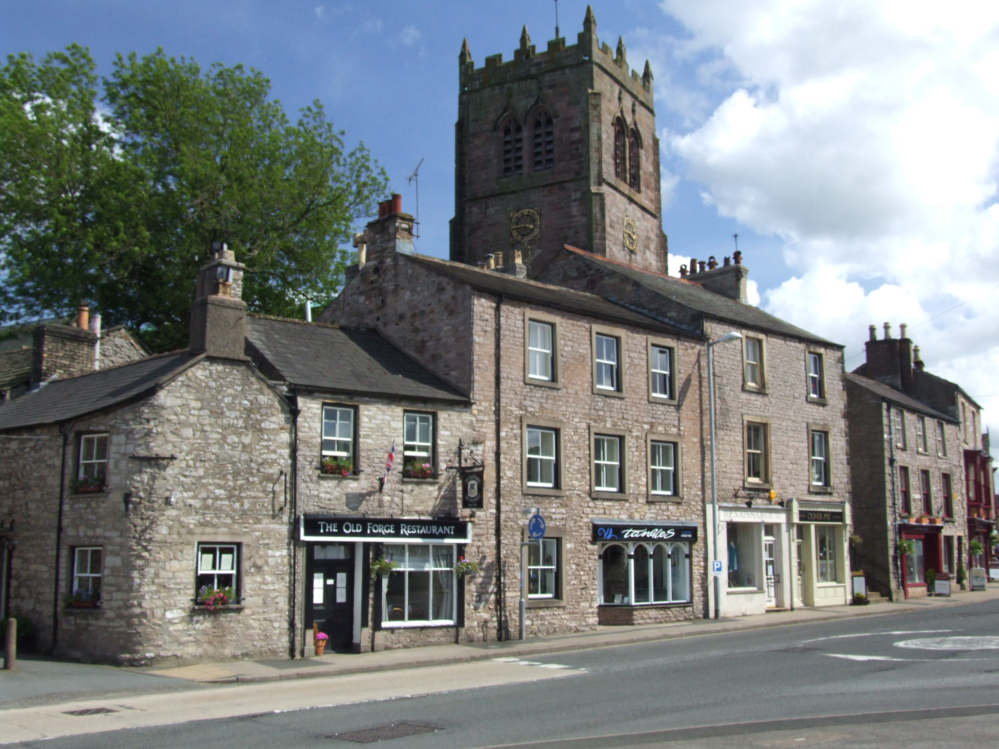
Kirkby Stephen

Kirkby Stephen () is a market town and civil parish in Westmorland and Furness, Cumbria, England. Historically part of Westmorland, it lies on the A685...

Devil's Grinding Mill

The Devil's Grinding Mill, sometimes known as the Devil's Hole, is part of The Angel's Drainpipe, a partially collapsed cave system on the River Eden in...

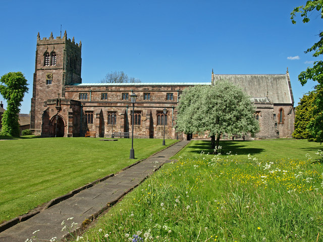
St Stephen's Church, Kirkby Stephen

The Parish Church, Kirkby Stephen is an Anglican parish church in Kirkby Stephen, Cumbria. == History == Kirkby Stephen Parish Church is often called the...

Nateby, Cumbria

Nateby is a village and civil parish in the Eden district of Cumbria, England. The parish had a population of 110 in 2001, increasing to 120 at the 2011...

Nearby Amenities

Located within 500m of 54.464479,-2.3081918
Barrier: cattle_grid
Source: survey
Lat/Long: 54.4628923/-2.3118825
Access: yes
Barrier: cattle_grid
Foot: yes
Source: survey
Lat/Long: 54.4670676/-2.3121288
Bench
Rest a While
Lat/Long: 54.4623309/-2.3109901
Birkett Hill
Ele: 404
Natural: peak
Lat/Long: 54.4644812/-2.3083741
Passing Place
Lat/Long: 54.4666352/-2.3113148
Historic: yes
Type: mine_shaft
Lat/Long: 54.4678398/-2.306335
Abandoned: yes
Historic: mine_shaft
Man Made: mineshaft
Lat/Long: 54.4672225/-2.3064852
Abandoned: yes
Historic: mine_shaft
Man Made: mineshaft
Lat/Long: 54.4668983/-2.3068821
Abandoned: yes
Historic: mine_shaft
Man Made: mineshaft
Lat/Long: 54.4668796/-2.3065281
Abandoned: yes
Historic: mine_shaft
Man Made: mineshaft
Lat/Long: 54.4673223/-2.3060989
Historic: yes
Type: mine_shaft
Lat/Long: 54.467765/-2.3060131
Abandoned: yes
Historic: mine_shaft
Man Made: mineshaft
Lat/Long: 54.4668921/-2.3061847
Abandoned: yes
Historic: mine_shaft
Man Made: mineshaft
Lat/Long: 54.4670604/-2.3026013
Abandoned: yes
Historic: mine_shaft
Man Made: mineshaft
Lat/Long: 54.4672163/-2.3034972
Abandoned: yes
Historic: mine_shaft
Man Made: mineshaft
Lat/Long: 54.4662716/-2.3077512
Abandoned: yes
Historic: mine_shaft
Man Made: mineshaft
Lat/Long: 54.4660066/-2.3080033
Natural: sinkhole
Lat/Long: 54.4599984/-2.3082129
Natural: sinkhole
Lat/Long: 54.4602385/-2.3080359
Hartley Birkett
Place: locality
Lat/Long: 54.4661687/-2.3101321
Abandoned: yes
Historic: mine_shaft
Man Made: mineshaft
Lat/Long: 54.4649162/-2.3079086
Abandoned: yes
Historic: mine_shaft
Man Made: mineshaft
Lat/Long: 54.4651614/-2.308322
Abandoned: yes
Historic: mine_shaft
Man Made: mineshaft
Lat/Long: 54.465367/-2.3073291
Abandoned: yes
Historic: mine_shaft
Man Made: mineshaft
Lat/Long: 54.4653076/-2.307312
Abandoned: yes
Historic: mine_shaft
Man Made: mineshaft
Lat/Long: 54.4652977/-2.3069242
Abandoned: yes
Historic: mine_shaft
Man Made: mineshaft
Lat/Long: 54.4650302/-2.306775
Abandoned: yes
Historic: mine_shaft
Man Made: mineshaft
Lat/Long: 54.4646413/-2.3069796
Abandoned: yes
Historic: mine_shaft
Man Made: mineshaft
Lat/Long: 54.465632/-2.3068816
Abandoned: yes
Historic: mine_shaft
Man Made: mineshaft
Lat/Long: 54.467151/-2.3062235
Abandoned: yes
Historic: mine_shaft
Man Made: mineshaft
Lat/Long: 54.467219/-2.3067466
Power: pole
Lat/Long: 54.4639356/-2.3154252
Power: pole
Lat/Long: 54.4648651/-2.3149136
Power: pole
Lat/Long: 54.4657635/-2.3144155
Power: pole
Lat/Long: 54.4664983/-2.3137611
Power: pole
Lat/Long: 54.4672798/-2.3130798
Power: pole
Lat/Long: 54.468074/-2.3123695
The data included in this document is from www.openstreetmap.org. The data is made available under ODbL.

Have you been to Birkett Hill?

Leave your review of Birkett Hill below (or comments, questions and feedback).