Cowshaw Hill

Hill, Mountain in Yorkshire Richmondshire

England

Cowshaw Hill

Barn in field on east side of B6259 at junction with footpath to How Beck Bridge The barn is now losing its roof: compare with 2013 photo <a href="https://www.geograph.org.uk/photo/3771178">SD7895 : Barn beside B6259 opposite White Birch Cottage</a>
Barn in field on east side of B6259 at junction with footpath to How Beck Bridge Credit: Luke Shaw

Cowshaw Hill is a small hill located in Yorkshire, England. Situated within the metropolitan borough of Calderdale, it forms part of the South Pennines, a range of hills and moorland in northern England. Cowshaw Hill is known for its scenic beauty and natural surroundings, attracting visitors who enjoy outdoor activities such as hiking and birdwatching.

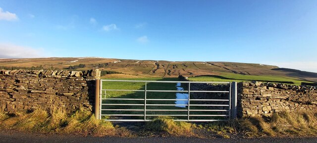
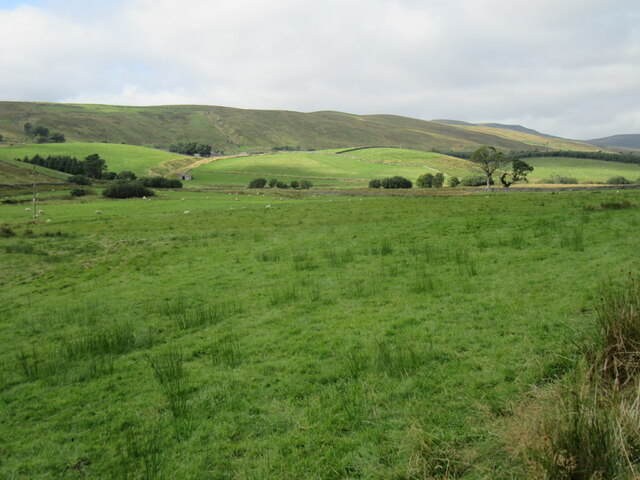
With an elevation of approximately 400 meters (1,312 feet) above sea level, Cowshaw Hill offers stunning panoramic views of the surrounding countryside. The hill is characterized by its gentle slopes and green pastures, dotted with sheep and cows grazing peacefully. The area is also home to a variety of wildlife, including birds such as curlews, lapwings, and red grouse.

The hill is intersected by several footpaths and trails, making it easily accessible for walkers and hikers of all abilities. These paths meander through heather-clad moorland, providing ample opportunities to explore the diverse flora and fauna of the region. Additionally, the hill is a popular spot for paragliding enthusiasts, who take advantage of the favorable wind conditions and breathtaking views.

Cowshaw Hill is steeped in history, with evidence of human presence dating back thousands of years. Ancient burial mounds and stone circles can be found in the vicinity, serving as a reminder of the hill's significance in the past. Today, it remains a cherished natural landmark, offering a peaceful retreat for locals and visitors alike.

If you have any feedback on the listing, please let us know in the comments section below.

Cowshaw Hill Images

Images are sourced within 2km of 54.344674/-2.3180312 or Grid Reference SD7994. Thanks to Geograph Open Source API. All images are credited.

Barn in field on east side of B6259 at junction with footpath to How Beck Bridge The barn is now losing its roof: compare with 2013 photo <a href="https://www.geograph.org.uk/photo/3771178">SD7895 : Barn beside B6259 opposite White Birch Cottage</a>
Barn in field on east side of B6259 at junction with footpath to How Beck Bridge
The barn is now losing its roof: compare with 2013 photo SD7895 : Barn beside B6259 opposite White Birch Cottage
Track heading down towards Shaw Paddock Old Maps from 1853 to 1957 show an Ordnance Survey benchmark levelled at 1142.5 feet above Liverpool Datum at the left hand side of the track here.
Track heading down towards Shaw Paddock
Old Maps from 1853 to 1957 show an Ordnance Survey benchmark levelled at 1142.5 feet above Liverpool Datum at the left hand side of the track here.
How Beck Bridge taking track over River Ure
Green Bridge taking bridleway over moorland stream
Lime Kiln at High Way, on north side of bridleway
School House at Beck Rigg
Shaw Paddock Farm
Shaw Paddock Farm
Gated Field at Quarry Farm
Poly-wrapped Bales near Shaw Paddock
Thistles beside Grisedale Road
Sheep grazing on Grisedale Common
Remains of barn on SW side of track near Fea Fow
Horses grazing beside track on Grisedale Brow
Near Blades Looking NW towards Swarth Fell.
Near Blades
Looking NW towards Swarth Fell.
Lunds Viaduct Lunds viaduct on the Settle - Carlisle railway.
Lunds Viaduct
Lunds viaduct on the Settle - Carlisle railway.
Calf Moss Ford This ford on The High Road is found at Calf Moss.
Calf Moss Ford
This ford on The High Road is found at Calf Moss.
Field barn above slope with buttercups The barn is built into a wall and is close to Low West End Farm.
The partly misted hill in the distance is Wild Boar Fell.
Field barn above slope with buttercups
The barn is built into a wall and is close to Low West End Farm. The partly misted hill in the distance is Wild Boar Fell.
Road, rail and a very fine hill The B6259 heading into Mallerstang alongside the Settle-Carlisle railway line, with the sharp profile of Wild Boar Fell in the background.
Road, rail and a very fine hill
The B6259 heading into Mallerstang alongside the Settle-Carlisle railway line, with the sharp profile of Wild Boar Fell in the background.
Show me another place!

Cowshaw Hill is located at Grid Ref: SD7994 (Lat: 54.344674, Lng: -2.3180312)

Division: North Riding

Administrative County: North Yorkshire

District: Richmondshire

Police Authority: North Yorkshire

What 3 Words

///speeded.reader.overcomes. Near Sedbergh, Cumbria

Nearby Locations

Shaws Cowshaw Hill

Related Wikis

Lunds, North Yorkshire

Lunds is a hamlet in North Yorkshire, England, near to the watershed of the Eden and Ure rivers. It is on the border between Cumbria and North Yorkshire...

Hawes Junction rail crash

The Hawes Junction rail crash occurred at 5.49 am on 24 December 1910, just north of Lunds Viaduct between Hawes Junction (now known as Garsdale station...
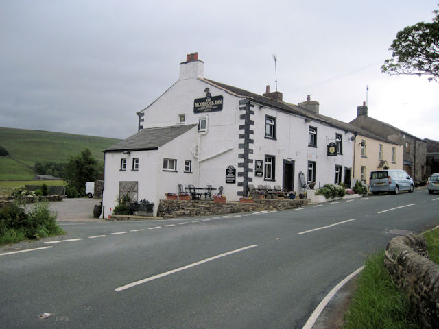
Moorcock Inn

The Moorcock Inn is a public house at the watershed of the Eden, Clough and Ure rivers, in Upper Wensleydale, North Yorkshire, England. It is adjacent...

Grisedale

Grisedale (sometimes Grisdale, or Grizedale [archaic]) is a south east facing Dale in Cumbria, England, 8 miles (13 km) east of Sedbergh, and 7 miles...

Nearby Amenities

Located within 500m of 54.344674,-2.3180312
Cowshaw Hill
Natural: peak
Source: OS OpenData StreetView
Lat/Long: 54.3449471/-2.3180267
Barrier: stile
Lat/Long: 54.3472748/-2.3168979
Barrier: stile
Material: stone
Stile: stepover
Lat/Long: 54.3425969/-2.3169971
Barrier: stile
Lat/Long: 54.3467945/-2.3177436
Barrier: stile
Material: wood
Stile: stepover
Lat/Long: 54.3406995/-2.3155943
Barrier: stile
Material: stone
Source: survey;gps
Stile: stepover
Lat/Long: 54.3437837/-2.3172747
Ford: yes
Lat/Long: 54.3461374/-2.3200911
Barrier: stile
Material: stone
Source: survey;gps
Stile: stepover
Lat/Long: 54.3475889/-2.3193659
Ford: yes
Lat/Long: 54.3424652/-2.3169056
Barrier: stile
Material: stone
Source: survey;gps
Stile: stepover
Lat/Long: 54.3457271/-2.3184779
Barrier: stile
Material: stone
Source: survey;gps
Stile: squeezer
Lat/Long: 54.3463259/-2.3186091
Barrier: stile
Material: stone
Source: survey;gps
Stile: stepover
Lat/Long: 54.3483975/-2.3197269
Barrier: stile
Material: stone
Source: survey;gps
Stile: stepover
Lat/Long: 54.34173/-2.3237235
Barrier: stile
Material: wood
Source: survey;gps
Stile: stepover
Lat/Long: 54.3417499/-2.3237424
Barrier: stile
Material: wood
Source: survey;gps
Stile: stepover
Lat/Long: 54.3439553/-2.3217629
Barrier: stile
Material: stone
Source: survey;gps
Stile: squeezer
Lat/Long: 54.3464865/-2.3215236
Power: pole
Lat/Long: 54.3406329/-2.3146391
Power: pole
Lat/Long: 54.3414781/-2.3148671
Power: pole
Lat/Long: 54.3424303/-2.3151326
Power: pole
Lat/Long: 54.343445/-2.3154183
Power: pole
Lat/Long: 54.3443151/-2.3156557
Power: pole
Lat/Long: 54.3453916/-2.31594
Power: pole
Lat/Long: 54.3467143/-2.3189722
Power: pole
Lat/Long: 54.3477609/-2.3198104
Power: pole
Lat/Long: 54.3487623/-2.3206285
The data included in this document is from www.openstreetmap.org. The data is made available under ODbL.

Have you been to Cowshaw Hill?

Leave your review of Cowshaw Hill below (or comments, questions and feedback).