Birkett Hill

Hill, Mountain in Westmorland Eden

England

Birkett Hill

Footpath in groove en route for Nine Standards Rigg The path, seen looking to the west - downhill - is one of the main routes to the summit of Nine Standards Rigg and is a variant of the 'Coast to Coast' long distance path.
Footpath in groove en route for Nine Standards Rigg Credit: Trevor Littlewood

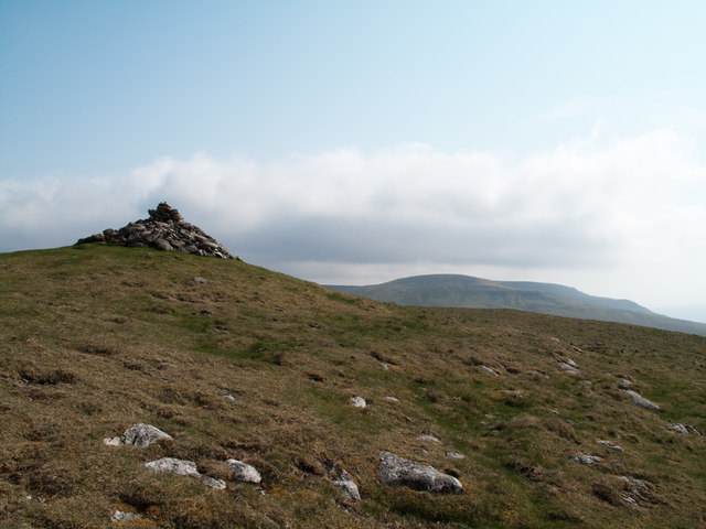
Birkett Hill is a prominent hill located in the county of Westmorland, in the northwestern region of England. Rising to an elevation of approximately 1,520 feet (463 meters), this hill is considered one of the notable peaks in the region and provides stunning panoramic views of the surrounding countryside.

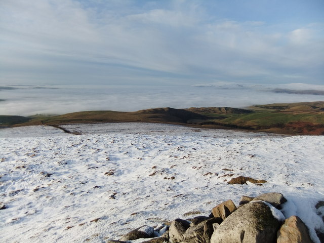
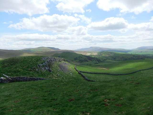
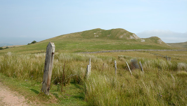
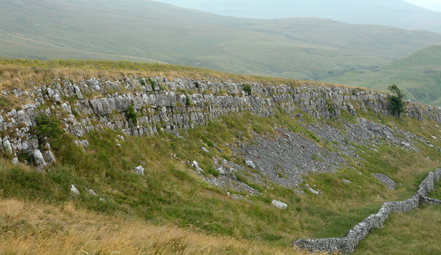
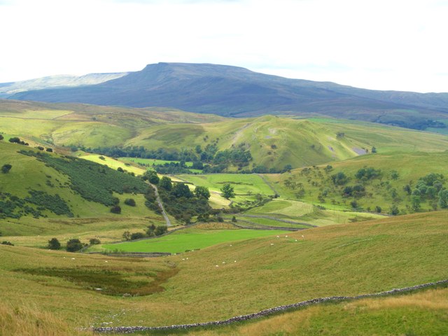
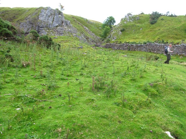
Situated within the picturesque Lake District National Park, Birkett Hill is known for its rugged and rocky terrain, characterized by steep slopes and craggy outcrops. The hill is predominantly covered by grass and heather, creating a beautiful landscape that changes colors with the seasons.

Birkett Hill is a popular destination for hikers and nature enthusiasts, offering a range of walking routes and trails to explore its slopes. The ascent to the summit can be challenging but rewarding, with breathtaking vistas of the nearby fells, valleys, and lakes, including the famous Lake Windermere.

The hill is also home to a diverse array of wildlife, including birds such as peregrine falcons, golden eagles, and kestrels, as well as various species of mammals and insects. The surrounding area provides a habitat for rare plant species, adding to the ecological significance of Birkett Hill.

In addition to its natural beauty, Birkett Hill holds historical importance, with evidence of ancient settlements and archaeological sites found in its vicinity. The hill is a testament to the rich cultural and natural heritage of the Westmorland region, attracting visitors from far and wide.

If you have any feedback on the listing, please let us know in the comments section below.

Birkett Hill Images

Images are sourced within 2km of 54.45714/-2.3207541 or Grid Reference NY7906. Thanks to Geograph Open Source API. All images are credited.
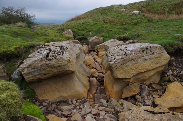
Footpath in groove en route for Nine Standards Rigg The path, seen looking to the west - downhill - is one of the main routes to the summit of Nine Standards Rigg and is a variant of the 'Coast to Coast' long distance path.
Footpath in groove en route for Nine Standards Rigg
The path, seen looking to the west - downhill - is one of the main routes to the summit of Nine Standards Rigg and is a variant of the 'Coast to Coast' long distance path.
Summit area of Tailbridge Hill, with summit cairn A few minor limestone rocks protrude from the grassy covering of Tailbridge Hill and there are exposures of limestone pavement elsewhere on it. The distant hills are those of the west side of the Mallerstang valley.
Summit area of Tailbridge Hill, with summit cairn
A few minor limestone rocks protrude from the grassy covering of Tailbridge Hill and there are exposures of limestone pavement elsewhere on it. The distant hills are those of the west side of the Mallerstang valley.
From Tailbridge Hill Eden Valley under the mist
From Tailbridge Hill
Eden Valley under the mist
Little Longrigg Scar
Limestone edge on Birkett Hill
Birkett Hill Birkett Hill as seen from the farm/estate road that is also the route of the Coast to Coast Walk.
Birkett Hill
Birkett Hill as seen from the farm/estate road that is also the route of the Coast to Coast Walk.
Road on Hartley Fell This estate and/or farm road climbs from the village of Hartley, close to Kirkby Stephen, towards Nine Standards Rigg; it also acts as the route for the Coast to Coast Walk.
Road on Hartley Fell
This estate and/or farm road climbs from the village of Hartley, close to Kirkby Stephen, towards Nine Standards Rigg; it also acts as the route for the Coast to Coast Walk.
Little Longrigg Scar Little Longrigg Scar is an outcropping band of limestone; it's west-facing and about 3 km from Kirkby Stephen.
Little Longrigg Scar
Little Longrigg Scar is an outcropping band of limestone; it's west-facing and about 3 km from Kirkby Stephen.
Track to Hartley Fell The public bridleway passes through a bog. This is part of Wainwright's Coast to Coast route.
In the background is the north-eastern Birkett Hill (405m - slightly higher than the other).
Track to Hartley Fell
The public bridleway passes through a bog. This is part of Wainwright's Coast to Coast route. In the background is the north-eastern Birkett Hill (405m - slightly higher than the other).
Track to Hartley Fell This public bridleway is part of Wainwright's Coast to Coast route.
In the background is the south-western Birkett Hill (383m - slightly lower than the other).
Track to Hartley Fell
This public bridleway is part of Wainwright's Coast to Coast route. In the background is the south-western Birkett Hill (383m - slightly lower than the other).
Ruined barn, Reigill In the background on the right is Tailbridge Hill.
Ruined barn, Reigill
In the background on the right is Tailbridge Hill.
Dry stream bed, Reigill A continuation of Faraday Gill, looking downstream.
Dry stream bed, Reigill
A continuation of Faraday Gill, looking downstream.
The view SSW from Long Rigg The view from the highest point of Long Rigg, looking SSW towards Wild Boar Fell.
The view SSW from Long Rigg
The view from the highest point of Long Rigg, looking SSW towards Wild Boar Fell.
Little Longrigg Scar Exposed limestone on this steep edge overlooking Hartley. The view is towards the distant bulk of Wild Boar Fell.
Little Longrigg Scar
Exposed limestone on this steep edge overlooking Hartley. The view is towards the distant bulk of Wild Boar Fell.
Traces of old industry at Little Longrigg The eye is drawn to the middle distance where there is evidence of some workings on the slopes of Birkett Hill. In the foreground is the crescent shaped outline of an old turf and stone dam, almost certainly used in the 18thC for the purpose of hushing on nearby slopes in the search for galena [lead ore].
Traces of old industry at Little Longrigg
The eye is drawn to the middle distance where there is evidence of some workings on the slopes of Birkett Hill. In the foreground is the crescent shaped outline of an old turf and stone dam, almost certainly used in the 18thC for the purpose of hushing on nearby slopes in the search for galena [lead ore].
Site of Hartley smelt mill This was once the site of a lead smelting mill, although evidence is now hard to find. Records show a single hearth mill here between 1714 & 1777, after which it may have fallen into disuse. Apart from a small area of flattened ground and a few protruding stones, there is little to see, although some of the stones in the wall to the right are dressed and others show signs of heating. This was small scale lead production almost a century earlier than the bigger mills such as Old Gang, Surrender and Grinton over in Swaledale.
Site of Hartley smelt mill
This was once the site of a lead smelting mill, although evidence is now hard to find. Records show a single hearth mill here between 1714 & 1777, after which it may have fallen into disuse. Apart from a small area of flattened ground and a few protruding stones, there is little to see, although some of the stones in the wall to the right are dressed and others show signs of heating. This was small scale lead production almost a century earlier than the bigger mills such as Old Gang, Surrender and Grinton over in Swaledale.
Limestone outcrops by Birkett Hill For those of us used to the relatively flat bedded limestones of the Yorkshire Dales, these outcrops come as something of a surprise as they are steeply angled and in close proximity to both shales and sandstones. The reason must be the nearby northern extension to the Dent fault which runs along the western margins of the central Pennines.
Limestone outcrops by Birkett Hill
For those of us used to the relatively flat bedded limestones of the Yorkshire Dales, these outcrops come as something of a surprise as they are steeply angled and in close proximity to both shales and sandstones. The reason must be the nearby northern extension to the Dent fault which runs along the western margins of the central Pennines.
Track up Hartley Fell
Show me another place!

Birkett Hill is located at Grid Ref: NY7906 (Lat: 54.45714, Lng: -2.3207541)

Administrative County: Cumbria

District: Eden

Police Authority: Cumbria

What 3 Words

///unsettled.walked.hobbies. Near Kirkby Stephen, Cumbria

Related Wikis

Hartley Castle

Hartley Castle was a castle near Kirkby Stephen, Cumbria, England. == History == The manor was confiscated circa 1315 from Roger de Clifford and granted...

Nateby, Cumbria

Nateby is a village and civil parish in Cumbria, England. The parish had a population of 110 in 2001, increasing to 120 at the 2011 Census.The village...

Devil's Grinding Mill

The Devil's Grinding Mill, sometimes known as the Devil's Hole, is part of The Angel's Drainpipe, a partially collapsed cave system on the River Eden in...

Hartley, Cumbria

Hartley is a village and civil parish in the Eden district of Cumbria, England. It is about 0.5 miles (0.8 km) east of Kirkby Stephen. The area has many...

Nearby Amenities

Located within 500m of 54.45714,-2.3207541
Barrier: stile
Stile: stepover
Lat/Long: 54.4588168/-2.3234271
Birkett Hill
Ele: 382
Natural: peak
Lat/Long: 54.4565928/-2.3209189
Barrier: stile
Stile: squeezer
Lat/Long: 54.4584549/-2.3179095
Ladthwaite Bottom
Place: locality
Lat/Long: 54.4573322/-2.3174366
Power: pole
Lat/Long: 54.45744/-2.3272681
Power: pole
Lat/Long: 54.4578619/-2.3256844
Power: pole
Lat/Long: 54.4582943/-2.3240918
Power: pole
Lat/Long: 54.4588526/-2.3226109
Power: pole
Lat/Long: 54.4594136/-2.321121
Power: pole
Lat/Long: 54.4599874/-2.3196066
Power: pole
Lat/Long: 54.4606262/-2.3182776
The data included in this document is from www.openstreetmap.org. The data is made available under ODbL.

Have you been to Birkett Hill?

Leave your review of Birkett Hill below (or comments, questions and feedback).