Bank Hill

Hill, Mountain in Lancashire Pendle

England

Bank Hill

View over Pendleton Moor Looking north along the Clitheroe Road. A public right of way starts at this point and heads north west to Pendleton. Pendle Hill is away to the east, just out of shot.
View over Pendleton Moor Credit: Marika Reinholds

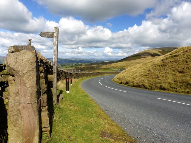
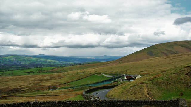
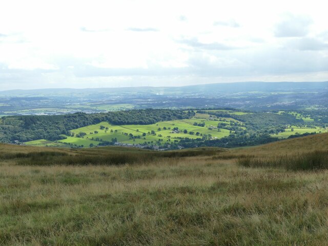
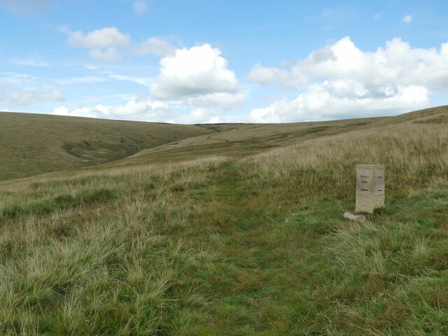
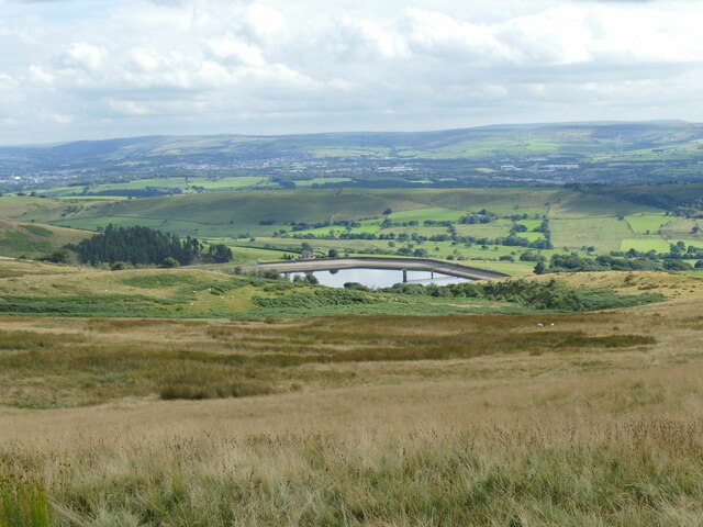
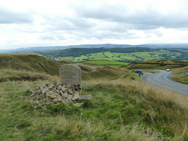
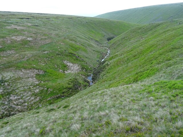
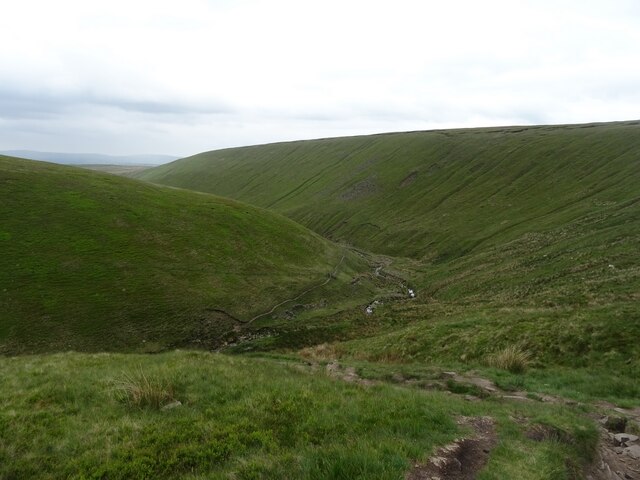
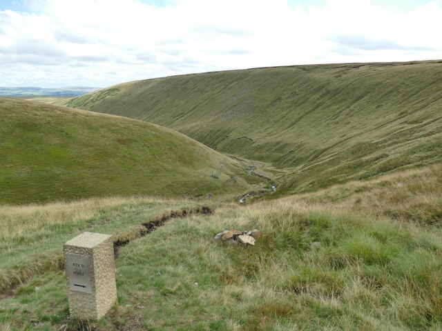
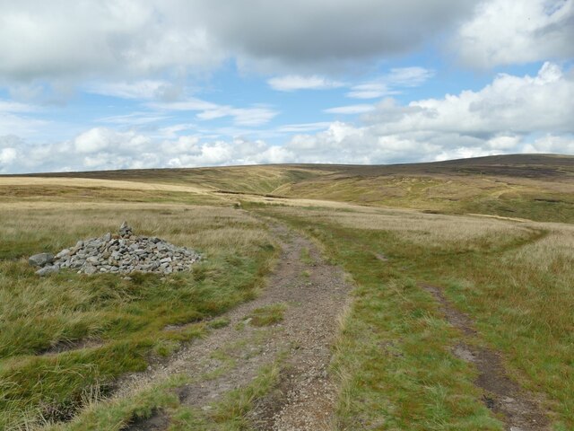
Bank Hill is a prominent hill located in Lancashire, England. Situated in the southern part of the county, it forms part of the West Pennine Moors, a picturesque and expansive upland area. With an elevation of approximately 1,148 feet (350 meters), Bank Hill offers breathtaking panoramic views of the surrounding countryside and the nearby towns of Darwen and Blackburn.

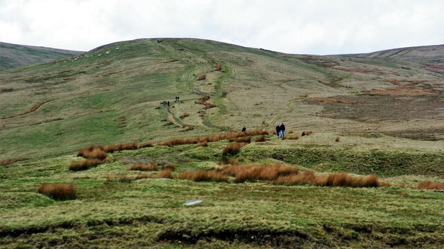
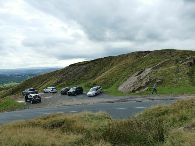
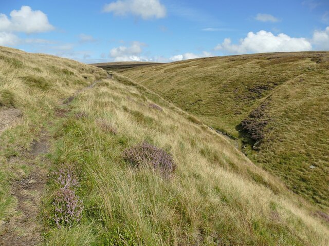
The hill is characterized by its steep slopes, which are covered in heather and grasses, creating a beautiful patchwork of colors. It is a popular destination for outdoor enthusiasts, offering various walking and hiking trails that cater to all abilities. The ascent to the summit can be challenging, but the rewarding views make it well worth the effort.

Bank Hill is also home to an array of wildlife, including several bird species such as curlews and lapwings. The hill provides a habitat for various plants and insects too, contributing to the ecological diversity of the area. The surrounding countryside features a mix of farmland and moorland, adding to the scenic beauty of the region.

Additionally, Bank Hill has historical significance, with evidence of Bronze Age settlements found in the vicinity. It has also been the site of mining activities in the past, adding an industrial heritage layer to its story.

Overall, Bank Hill in Lancashire offers a stunning natural landscape, recreational opportunities, and a glimpse into the region's history. Whether visitors seek outdoor adventures, wildlife observation, or simply a tranquil escape, Bank Hill is a destination that showcases the beauty and charm of the Lancashire countryside.

If you have any feedback on the listing, please let us know in the comments section below.
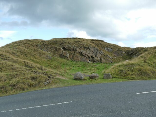
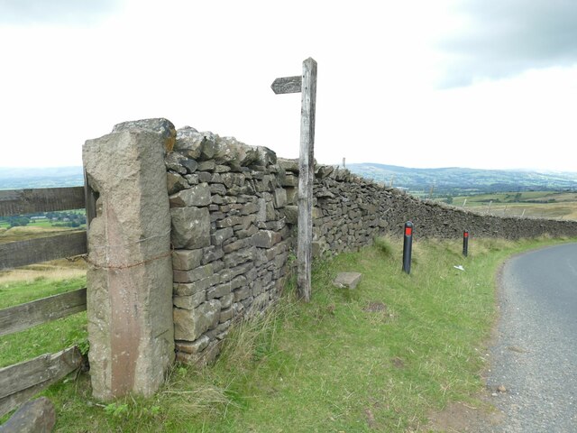
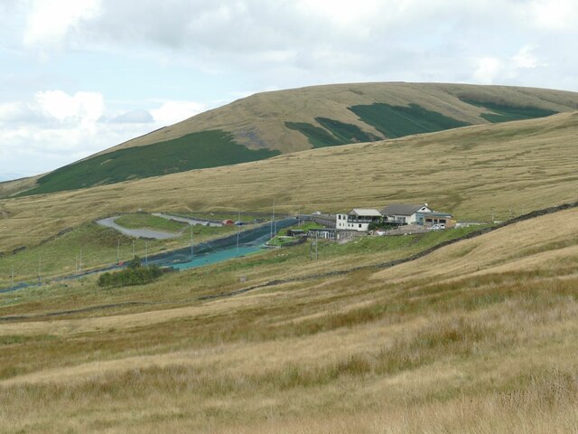
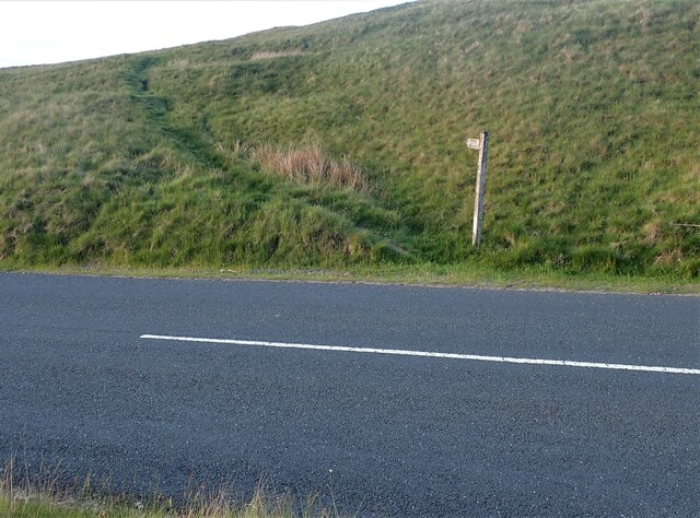
Bank Hill Images

Images are sourced within 2km of 53.844827/-2.3194256 or Grid Reference SD7938. Thanks to Geograph Open Source API. All images are credited.

View over Pendleton Moor Looking north along the Clitheroe Road. A public right of way starts at this point and heads north west to Pendleton. Pendle Hill is away to the east, just out of shot.
View over Pendleton Moor
Looking north along the Clitheroe Road. A public right of way starts at this point and heads north west to Pendleton. Pendle Hill is away to the east, just out of shot.
Nick o' Pendle Dry Ski Slope View from the hill top car park
Nick o' Pendle Dry Ski Slope
View from the hill top car park
Path to Pendleton Moor Summit Start of the path from Nick of Pendle car parks on the flanks of Pendle Hill
Path to Pendleton Moor Summit
Start of the path from Nick of Pendle car parks on the flanks of Pendle Hill
View south-west from Spence Moor A bit of sunlight on a generally dull day lit up fields on the hillside above Sabden.
View south-west from Spence Moor
A bit of sunlight on a generally dull day lit up fields on the hillside above Sabden.
Direction stone on Badger Wells Hill The stone points to Mearley Moor (left) and Summit (right, i.e. the summit of Pendle).
Direction stone on Badger Wells Hill
The stone points to Mearley Moor (left) and Summit (right, i.e. the summit of Pendle).
Church Clough Reservoir from Apronfull Hill Reservoir levels were low in a very dry summer.
Church Clough Reservoir from Apronfull Hill
Reservoir levels were low in a very dry summer.
The airmen's memorial at Nick of Pendle The memorial is to Australian and American aircrew whose planes crashed in the area in World War II. It does not mark the exact site of either incident, but is conveniently located close to a public road. <a href="https://www.geograph.org.uk/photo/4470275">SD7738 : Memorial at Nick of Pendle</a> gives the full text.
The airmen's memorial at Nick of Pendle
The memorial is to Australian and American aircrew whose planes crashed in the area in World War II. It does not mark the exact site of either incident, but is conveniently located close to a public road. SD7738 : Memorial at Nick of Pendle gives the full text.
Car park at Nick of Pendle An old quarry offers limited parking at the summit of the road from Padiham to Clitheroe (295 metres).
Car park at Nick of Pendle
An old quarry offers limited parking at the summit of the road from Padiham to Clitheroe (295 metres).
Quarry at Nick of Pendle An old stone quarry, one of several around the summit of the road from Padiham to Clitheroe. The borough boundary is immediately to the right of the quarry - Ribble Valley this side, Pendle District beyond.
Quarry at Nick of Pendle
An old stone quarry, one of several around the summit of the road from Padiham to Clitheroe. The borough boundary is immediately to the right of the quarry - Ribble Valley this side, Pendle District beyond.
Gate and stile at Nick of Pendle The path beyond the stile leads down to Pendleton village. On the stone gatepost is a benchmark, shown on the 1912 map as 974.5 feet.
Gate and stile at Nick of Pendle
The path beyond the stile leads down to Pendleton village. On the stone gatepost is a benchmark, shown on the 1912 map as 974.5 feet.
Pendle Hill Ski Slope The slope is on the western flank of the hill on the road over to Padiham. <a href="https://www.geograph.org.uk/photo/774073">SD7739 : The ski run at Pendle Ski Club on the slopes of Pendle Hill</a> shows the artificial slope more clearly; it is just over the gridline into the next square, but the buildings are in this one.
Pendle Hill Ski Slope
The slope is on the western flank of the hill on the road over to Padiham. SD7739 : The ski run at Pendle Ski Club on the slopes of Pendle Hill shows the artificial slope more clearly; it is just over the gridline into the next square, but the buildings are in this one.
Footpath on Pendle The footpath and sign for Pendleton Moor going towards Howcroft Barn. The path is located just past the Wellsprings heading towards Clitheroe. Another view can be seen here - <a title="https://www.geograph.org.uk/photo/4470227" href="https://www.geograph.org.uk/photo/4470227">Link</a>
Footpath on Pendle
The footpath and sign for Pendleton Moor going towards Howcroft Barn. The path is located just past the Wellsprings heading towards Clitheroe. Another view can be seen here - Link
Looking up Ogden Clough
Looking down Ogden Clough
Ogden Clough A footpath follows the western side of the clough at this point.
Ogden Clough
A footpath follows the western side of the clough at this point.
Direction stone in Ogden Clough One path heads on down the clough, another turns right towards Nick of Pendle.
Direction stone in Ogden Clough
One path heads on down the clough, another turns right towards Nick of Pendle.
Cairn on the moor above Ogden Clough The cairn marks a path junction: one path (right) heads on down the clough, another keeps up on high ground towards Mearley Moor.
Cairn on the moor above Ogden Clough
The cairn marks a path junction: one path (right) heads on down the clough, another keeps up on high ground towards Mearley Moor.
Cairn at SW end of Mearley Moor, Pendle Hill
Show me another place!

Bank Hill is located at Grid Ref: SD7938 (Lat: 53.844827, Lng: -2.3194256)

Administrative County: Lancashire

District: Pendle

Police Authority: Lancashire

What 3 Words

///multiples.trading.mulled. Near Sabden, Lancashire

Nearby Locations

Wood House Dole Bank Hill

Related Wikis

Sabden

Sabden is a village and civil parish in the Ribble Valley, Lancashire, England. Sabden is located south of Pendle Hill, in a valley about three miles north...

Pendle Water

Pendle Water is a minor river in Lancashire, England. Rising on Pendle Hill, Pendle Water cuts a deep valley between Barley Moor and Spence Hill, where...

Ogden Reservoirs

Upper and Lower Ogden Reservoirs are half a mile to the west of the village of Barley, in the Borough of Pendle, England. They supply drinking water to...

Higham, Lancashire

Higham is a village in the Borough of Pendle in Lancashire, England, south of Pendle Hill. The civil parish is named Higham with West Close Booth. The...

Related Videos

Walking up Pendle Hill with Spring Vale Rambling Class

An experimental video filmed using my iPhone on a DJI Osmo Mobile 6 selfie stick. This was a 6-mile walk from Barley, ...

Pendle Hill

Fellwalking in Lancashire. A 6 mile circuit taking in Pendle Hill.

Pendle hill

A walk round the classic route on Pendle hill, followed by a short walk down the riverside after lunch GPX Here: ...

Nearby Amenities

Located within 500m of 53.844827,-2.3194256
Ford: yes
Lat/Long: 53.8429332/-2.3261894
Barrier: stile
Material: wood
Step Count: 2
Stile: stepover
Lat/Long: 53.8429154/-2.3261025
Ford: yes
Lat/Long: 53.8427703/-2.3258465
The data included in this document is from www.openstreetmap.org. The data is made available under ODbL.

Have you been to Bank Hill?

Leave your review of Bank Hill below (or comments, questions and feedback).