Black Halls

Hill, Mountain in Roxburghshire

Scotland

Black Halls

The Pennine Way near Brownhart Law
The Pennine Way near Brownhart Law Credit: Dave Kelly

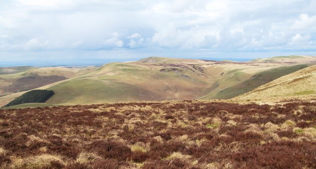
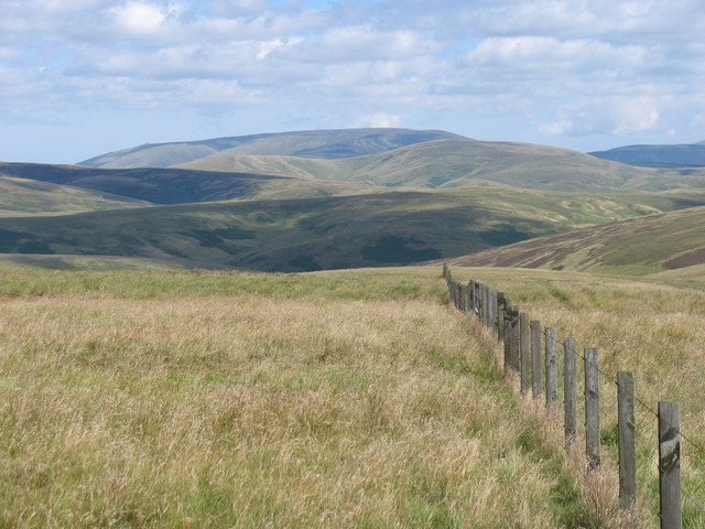
Black Halls is a prominent hill located in the county of Roxburghshire, Scotland. Situated near the village of Hawick, it forms part of the expansive Southern Uplands range. Known locally as a mountain, it stands at an impressive height of approximately 577 meters (1,893 feet) above sea level.

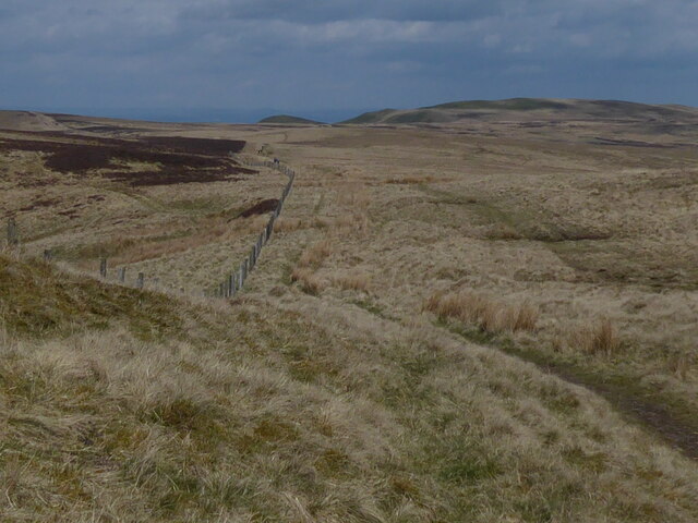
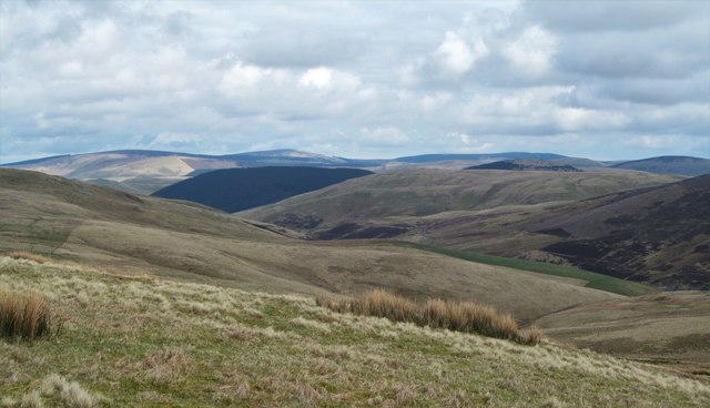
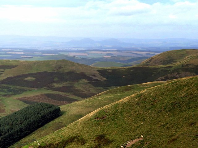
The hill is characterized by its distinct black appearance, which is a result of the underlying rock formation known as greywacke. This unique feature gives Black Halls its name and makes it easily recognizable from afar. The hill is surrounded by rolling green landscapes and offers breathtaking panoramic views of the surrounding countryside.

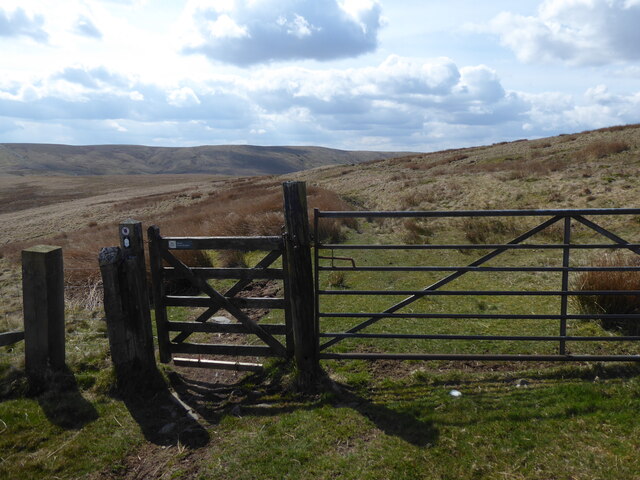
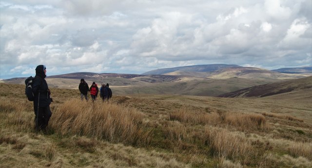
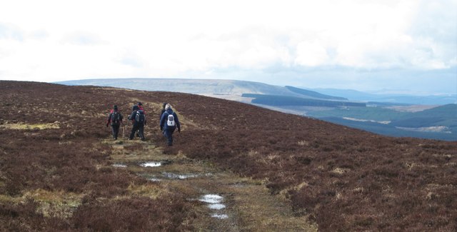
Black Halls is a popular destination for outdoor enthusiasts, attracting hikers, mountaineers, and nature lovers alike. Several well-marked trails lead to its summit, providing various levels of challenge for visitors. The ascent offers an opportunity to immerse oneself in the natural beauty of the area, with diverse flora and fauna to be observed along the way.

At the top of Black Halls, visitors are rewarded with stunning vistas of the surrounding hills, valleys, and the winding River Teviot. On clear days, it is even possible to see as far as the distant Cheviot Hills on the Scottish-English border.

With its striking appearance and captivating views, Black Halls stands as a prominent landmark in the Roxburghshire region, attracting both locals and tourists seeking an unforgettable outdoor experience amidst Scotland's natural wonders.

If you have any feedback on the listing, please let us know in the comments section below.

Black Halls Images

Images are sourced within 2km of 55.391928/-2.3355931 or Grid Reference NT7810. Thanks to Geograph Open Source API. All images are credited.
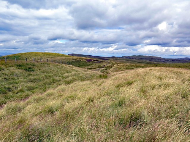
The Pennine Way near Brownhart Law
Dere Street and the Pennine Way: Scotland ahead A somewhat boggy section as the routes head into Scotland.
Dere Street and the Pennine Way: Scotland ahead
A somewhat boggy section as the routes head into Scotland.
Feral Cheviot goats A herd of approximately thirty feral goats was encountered not long after re-entering Scotland along the route of Dere Street/Pennine Way.  Here, two individuals are captured with the distinctive outline of the Eildon Hills in the distance.
Feral Cheviot goats
A herd of approximately thirty feral goats was encountered not long after re-entering Scotland along the route of Dere Street/Pennine Way. Here, two individuals are captured with the distinctive outline of the Eildon Hills in the distance.
Grazing the hillside Part of a thirty-strong herd of Cheviot feral goats grazing the hillside above Hind Hope.  Rubers Law can be noted in the distance.
Grazing the hillside
Part of a thirty-strong herd of Cheviot feral goats grazing the hillside above Hind Hope. Rubers Law can be noted in the distance.
On Brownhart Law Following and indistinct path across the slopes of Brownhart Law on the English side of the border. The Cheviot is prominent in the distance, with the small 'pimple' of Auchope Cairn just visible on the left of the distant ridge.
On Brownhart Law
Following and indistinct path across the slopes of Brownhart Law on the English side of the border. The Cheviot is prominent in the distance, with the small 'pimple' of Auchope Cairn just visible on the left of the distant ridge.
Waymarker post on Brownhart Law The comfort of a green dotted line on the map and also a waymarker to show that we are just on the English side of the border. Scotland [with heather] appears on the right hand edge of the photo.
Waymarker post on Brownhart Law
The comfort of a green dotted line on the map and also a waymarker to show that we are just on the English side of the border. Scotland [with heather] appears on the right hand edge of the photo.
Looking east from Brownhart Law The view eastwards from around the 500m contour is towards the head of the Coquet valley with the first green field visible in the middle distance and the big block of conifers at Carshope Plantation further away.
Looking east from Brownhart Law
The view eastwards from around the 500m contour is towards the head of the Coquet valley with the first green field visible in the middle distance and the big block of conifers at Carshope Plantation further away.
Scottish heather Having just crossed the border fence via a gate, the land immediately changes from rough moorland grasses to heather clad hilltops, although there's nothing to suggest that this might be a grouse moor due to a lack of grouse and butts.
Scottish heather
Having just crossed the border fence via a gate, the land immediately changes from rough moorland grasses to heather clad hilltops, although there's nothing to suggest that this might be a grouse moor due to a lack of grouse and butts.
Sneaking into Scotland A rather soggy track on the Scottish side of the border fence. There were no guards at the crossing point and not even a kilted piper, so slightly disappointing.
Sneaking into Scotland
A rather soggy track on the Scottish side of the border fence. There were no guards at the crossing point and not even a kilted piper, so slightly disappointing.
Towards the Cheviot The moorland grass around Chew Sike is turning an autumnal yellow. The weather is fine and the dark hills of the high Cheviot to the north-east are clear of cloud.
Rising on the right in the foreground is Deel's Hill; beyond, dead centre, is the little peak that tops the hardly ever visited Yearning Law <a href="https://www.geograph.org.uk/photo/1812502">NT8111 : Yearning Law</a> above the valley of Buckham's Walls Burn. Behind on the left is Cheviot itself, guarding it is Comb Fell, Coldlaw cairn almost directly in line with Cheviot' summit. On the extreme right is Hedgehope. A huge expanse of empty wild country lies between there and here.

"Isolated from the outer world by many miles of 'mountain, moss and moor', its all pervading stillness, broken only by the bleating of the hill-sheep and the plaintive cry of the curlew and the plover, conveys to the mind a feeling of impressive solitude. Yet there was a time when this lone spot resounded to the clang of weapons and the tramp of armed men; when the trained legions of the Romans marched along the newly-made Watling Street and garrisoned the camp below; when the moors around was the scene of many a sanguinary struggle, where now the bent and purple heath hides the stain of ancient battle."
Upper Coquetdale by David Dippie Dixon (1903).
Towards the Cheviot
The moorland grass around Chew Sike is turning an autumnal yellow. The weather is fine and the dark hills of the high Cheviot to the north-east are clear of cloud. Rising on the right in the foreground is Deel's Hill; beyond, dead centre, is the little peak that tops the hardly ever visited Yearning Law NT8111 : Yearning Law above the valley of Buckham's Walls Burn. Behind on the left is Cheviot itself, guarding it is Comb Fell, Coldlaw cairn almost directly in line with Cheviot' summit. On the extreme right is Hedgehope. A huge expanse of empty wild country lies between there and here. "Isolated from the outer world by many miles of 'mountain, moss and moor', its all pervading stillness, broken only by the bleating of the hill-sheep and the plaintive cry of the curlew and the plover, conveys to the mind a feeling of impressive solitude. Yet there was a time when this lone spot resounded to the clang of weapons and the tramp of armed men; when the trained legions of the Romans marched along the newly-made Watling Street and garrisoned the camp below; when the moors around was the scene of many a sanguinary struggle, where now the bent and purple heath hides the stain of ancient battle." Upper Coquetdale by David Dippie Dixon (1903).
The Scottish Cheviots above Hind Hope View towards the Eildon Hills from the ridge below Brownhart Moor. Just east of the Eildon Hills, near Newstead, was the Roman Fort of Trimontium. It was an advance post of the Romans in their province of Valenti <a href="https://www.geograph.org.uk/photo/157017">NT5634 : Monument marking site of Roman Fort of Trimontium</a>

This is a possible site to which messages could have been passed from the proposed Roman Signal Station located close to the location of this photo on the Roman Road of Dere Street, just below Brownhart Law <a href="https://www.geograph.org.uk/photo/5129638">NT7909 : Location of Roman Signal Station, Brownhart Law</a>. Trimontium also lies on Dere Street, on route to Edinburgh, and is some 20 miles distant. Messages, however sent over these distances, could possibly have been relayed via the Roman Signal Station located on Eildon Hill North <a href="https://www.geograph.org.uk/photo/2735734">NT5532 : Eildon Mid Hill and Eildon Hill North</a>. Another possibility is signalling to Ruber's Law in the west. 

On Hadrian's Wall, the Romans had clever signalling systems based on letters sent by two groups of five flags. They also had a coded system, with which they could send only one of a dozen fixed messages, depending on the time for which they showed a flag or fire signal at night <span class="nowrap"><a title="http://www.romanobritain.org/8-military/mil_signalling_systems.htm#.V-a2bCSltsA" rel="nofollow ugc noopener" href="http://www.romanobritain.org/8-military/mil_signalling_systems.htm#.V-a2bCSltsA">Link</a><img style="margin-left:2px;" alt="External link" title="External link - shift click to open in new window" src="https://s1.geograph.org.uk/img/external.png" width="10" height="10"/></span>

There is a similar view here: <a href="https://www.geograph.org.uk/photo/157017">NT5634 : Monument marking site of Roman Fort of Trimontium</a>
The Scottish Cheviots above Hind Hope
View towards the Eildon Hills from the ridge below Brownhart Moor. Just east of the Eildon Hills, near Newstead, was the Roman Fort of Trimontium. It was an advance post of the Romans in their province of Valenti NT5634 : Monument marking site of Roman Fort of Trimontium This is a possible site to which messages could have been passed from the proposed Roman Signal Station located close to the location of this photo on the Roman Road of Dere Street, just below Brownhart Law NT7909 : Location of Roman Signal Station, Brownhart Law. Trimontium also lies on Dere Street, on route to Edinburgh, and is some 20 miles distant. Messages, however sent over these distances, could possibly have been relayed via the Roman Signal Station located on Eildon Hill North NT5532 : Eildon Mid Hill and Eildon Hill North. Another possibility is signalling to Ruber's Law in the west. On Hadrian's Wall, the Romans had clever signalling systems based on letters sent by two groups of five flags. They also had a coded system, with which they could send only one of a dozen fixed messages, depending on the time for which they showed a flag or fire signal at night LinkExternal link There is a similar view here: NT5634 : Monument marking site of Roman Fort of Trimontium
Location of Roman Signal Station, Brownhart Law Grass growing within the heather pick out sub-circular boundary ditches of the proposed Roman Signal Station located below the hill of Brownhart Law near to Dere Street. The Border fence is just behind. There is a description here: <a href="https://www.geograph.org.uk/photo/3421197">NT7909 : Site of Roman Signal Station, Brownhart Law</a>

Although there are good views west and north-west into the Scottish Borders there is no direct view south to the Roman Forts at Chew Green although further south along Dere Street would be visible.

A more recent interpretation of the site suggests that it is a well-preserved example of a small Roman fortlet, used for observing and policing the traffic along the Roman road. The views that the site commands, and its intervisibility with other Roman sites, are said to have led to an earlier classification as a signal station.
<span class="nowrap"><a title="https://canmore.org.uk/site/57887/brownhart-law" rel="nofollow ugc noopener" href="https://canmore.org.uk/site/57887/brownhart-law">Link</a><img style="margin-left:2px;" alt="External link" title="External link - shift click to open in new window" src="https://s1.geograph.org.uk/img/external.png" width="10" height="10"/></span>
Location of Roman Signal Station, Brownhart Law
Grass growing within the heather pick out sub-circular boundary ditches of the proposed Roman Signal Station located below the hill of Brownhart Law near to Dere Street. The Border fence is just behind. There is a description here: NT7909 : Site of Roman Signal Station, Brownhart Law Although there are good views west and north-west into the Scottish Borders there is no direct view south to the Roman Forts at Chew Green although further south along Dere Street would be visible. A more recent interpretation of the site suggests that it is a well-preserved example of a small Roman fortlet, used for observing and policing the traffic along the Roman road. The views that the site commands, and its intervisibility with other Roman sites, are said to have led to an earlier classification as a signal station. LinkExternal link
England-Scotland Border near Brownhart Law Close to the Roman Signal Station <a href="https://www.geograph.org.uk/photo/5129638">NT7909 : Location of Roman Signal Station, Brownhart Law</a>, Border fence and Pennine Way, looking north.
England-Scotland Border near Brownhart Law
Close to the Roman Signal Station NT7909 : Location of Roman Signal Station, Brownhart Law, Border fence and Pennine Way, looking north.
View to the east from Brownhart Law View to the east down the Coquet valley from the Pennine Way crossing Brownhart Law.  The dark green in the distance is the Carshope Plantation forestry plantation.
View to the east from Brownhart Law
View to the east down the Coquet valley from the Pennine Way crossing Brownhart Law. The dark green in the distance is the Carshope Plantation forestry plantation.
The view from Brownhart Law Looking north-east towards The Cheviot in the distance.
The view from Brownhart Law
Looking north-east towards The Cheviot in the distance.
Bridleway on The Dodd towards Deel's Hill
Boggy moorland north-east of Brownhart Law Old cross-Border tracks diverge at this point, one going north-east (right) to Black Halls, the other continuing to Brownhart Law and Coquet Head.
Boggy moorland north-east of Brownhart Law
Old cross-Border tracks diverge at this point, one going north-east (right) to Black Halls, the other continuing to Brownhart Law and Coquet Head.
Show me another place!

Black Halls is located at Grid Ref: NT7810 (Lat: 55.391928, Lng: -2.3355931)

Unitary Authority: The Scottish Borders

Police Authority: The Lothians and Scottish Borders

What 3 Words

///crew.prompting.hourglass. Near Rochester, Northumberland

Related Wikis

Chew Green

Chew Green is the site of the ancient Roman encampment, commonly but erroneously called Ad Fines (Latin: The Limits) on the 1885-1900 edition of the Ordnance...

Pennymuir Roman camps

The Pennymuir Roman camps are situated southeast of Jedburgh in the Scottish Borders area of Scotland, near the Anglo-Scottish border, in the former Roxburghshire...

Featherwood Roman Camps

Featherwood Roman Camps are neighbouring archaeological sites in Northumberland, England, 1 mile (1.6 km) north of Featherwood and about 3 miles (5 km...

Barrow Burn

Barrowburn is a hamlet in Upper Coquetdale in the county of Northumberland, England. It comprises a working farm with associated buildings and two holiday...

Have you been to Black Halls?

Leave your review of Black Halls below (or comments, questions and feedback).