Blue Scar Hill

Hill, Mountain in Yorkshire Richmondshire

England

Blue Scar Hill

Barn in field on east side of B6259 at junction with footpath to How Beck Bridge The barn is now losing its roof: compare with 2013 photo <a href="https://www.geograph.org.uk/photo/3771178">SD7895 : Barn beside B6259 opposite White Birch Cottage</a>
Barn in field on east side of B6259 at junction with footpath to How Beck Bridge Credit: Luke Shaw

Blue Scar Hill is a prominent feature located in Yorkshire, England. Situated in the picturesque Nidderdale region of the Yorkshire Dales, it forms part of the Pennine Range, which stretches across northern England. Rising to an elevation of approximately 570 meters (1,870 feet), Blue Scar Hill is considered a notable hill in the area.

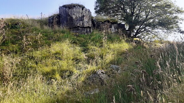
The hill gets its name from the distinctive blue-gray limestone that forms its craggy slopes and cliffs. This geological feature gives the hill a unique appearance, especially when contrasted against the surrounding lush greenery. Blue Scar Hill offers breathtaking panoramic views of the surrounding countryside, including the Nidderdale Valley and the nearby rolling hills.

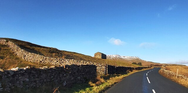
The hill is a popular destination for outdoor enthusiasts, particularly hikers, walkers, and nature lovers. There are several well-maintained footpaths that lead to the summit, providing a range of routes suitable for different abilities. Along the way, visitors can enjoy the diverse flora and fauna that thrive in the area, including heather, bilberry, and various bird species.

Blue Scar Hill is also steeped in history, with evidence of human activity dating back thousands of years. Ancient settlements and burial grounds can be found in the vicinity, adding to the hill's cultural significance. Visitors can explore these historical sites while immersing themselves in the natural beauty of the surrounding landscape.

Overall, Blue Scar Hill offers a unique and rewarding experience for those seeking outdoor adventures or a tranquil escape in the heart of Yorkshire.

If you have any feedback on the listing, please let us know in the comments section below.

Blue Scar Hill Images

Images are sourced within 2km of 54.361053/-2.3330695 or Grid Reference SD7896. Thanks to Geograph Open Source API. All images are credited.

Barn in field on east side of B6259 at junction with footpath to How Beck Bridge The barn is now losing its roof: compare with 2013 photo <a href="https://www.geograph.org.uk/photo/3771178">SD7895 : Barn beside B6259 opposite White Birch Cottage</a>
Barn in field on east side of B6259 at junction with footpath to How Beck Bridge
The barn is now losing its roof: compare with 2013 photo SD7895 : Barn beside B6259 opposite White Birch Cottage
Rock outcrop and rowan tree on SE bank of Far Cote Gill The 1898 1:2500 Map shows an Ordnance Survey benchmark levelled at 1277.4 feet above Liverpool Datum near here, but unable to locate it
Rock outcrop and rowan tree on SE bank of Far Cote Gill
The 1898 1:2500 Map shows an Ordnance Survey benchmark levelled at 1277.4 feet above Liverpool Datum near here, but unable to locate it
Looking down Far Cote Gill to bridge taking B6259 over Settle-Carlisle Railway
Sheepfolds on east side of Hell Gill
Track heading down towards Shaw Paddock Old Maps from 1853 to 1957 show an Ordnance Survey benchmark levelled at 1142.5 feet above Liverpool Datum at the left hand side of the track here.
Track heading down towards Shaw Paddock
Old Maps from 1853 to 1957 show an Ordnance Survey benchmark levelled at 1142.5 feet above Liverpool Datum at the left hand side of the track here.
How Beck Bridge taking track over River Ure
Green Bridge taking bridleway over moorland stream
Lime kiln at Hell Gill Green
Waterfall on Hell Gill Beck
Lime Kiln at High Way, on north side of bridleway
Hell Gill Beck north of Sour Hill
Looking SW along Hell Gill Beck north of Sour Hill
Looking NE along Hell Gill Beck
Valley with Hell Gill Beck
New forestry on west bank of Hell Gill Beck seen over wall of sheepfold Is that a meadow pipit on the wall?
New forestry on west bank of Hell Gill Beck seen over wall of sheepfold
Is that a meadow pipit on the wall?
Shaw Paddock Farm
Shaw Paddock Farm
Poly-wrapped Bales near Shaw Paddock
The B6259 near White Birch Cottage
Show me another place!

Blue Scar Hill is located at Grid Ref: SD7896 (Lat: 54.361053, Lng: -2.3330695)

Division: North Riding

Administrative County: North Yorkshire

District: Richmondshire

Police Authority: North Yorkshire

What 3 Words

///frightens.washroom.cabbies. Near Kirkby Stephen, Cumbria

Related Wikis

Aisgill

Aisgill is the southernmost of the hamlets that form the parish of Mallerstang in the English county of Cumbria. It is on the B6259 road, at the head of...

Eden Sike Cave

Eden Sike Cave is a small cave in Mallerstang in the Eden valley in Cumbria, England 400 metres (440 yd) north of Hell Gill. The entrance is 391 metres...

1913 Ais Gill rail accident

The Ais Gill rail accident occurred on the Settle–Carlisle line in Northwest England on 2 September 1913. Two long trains were both ascending a steep gradient...

Lunds, North Yorkshire

Lunds is a hamlet in North Yorkshire, England, near to the watershed of the Eden and Ure rivers. It is on the border between Cumbria and North Yorkshire...

1995 Ais Gill rail accident

The 1995 Ais Gill rail accident occurred near Aisgill, Cumbria, UK, at about 18:55 hrs on 31 January 1995 when a class 156 Super-Sprinter was derailed...

Hawes Junction rail crash

The Hawes Junction rail crash occurred at 5.49 am on 24 December 1910, just north of Lunds Viaduct between Hawes Junction (now known as Garsdale station...

Swarth Fell

Swarth Fell is an approximately 1 mile (1.5 km) stretch of high ground (consisting mainly of limestone capped with millstone grit) situated to the south...

Grisedale

Grisedale (sometimes Grisdale, or Grizedale [archaic]) is a south east facing Dale in Cumbria, England, 8 miles (13 km) east of Sedbergh, and 7 miles...

Related Videos

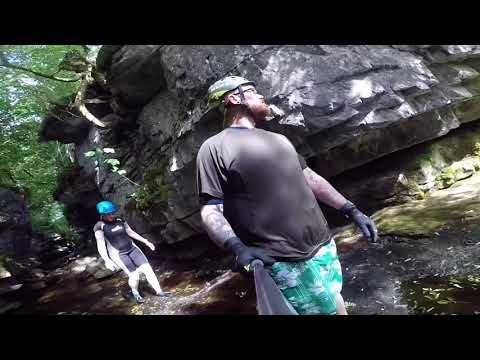
A trip to Hell Gill & Kisdon Force

A day out in Yorkshire giving canyoning a go at Hell Gill then on to Keld to visit Kisdon Force and do some more swimming.

Hell Gill

Another trip down Hell Gill.

Nearby Amenities

Located within 500m of 54.361053,-2.3330695
Blue Scar Hill
Natural: peak
Source: OS OpenData StreetView
Lat/Long: 54.3624917/-2.3327681
White Birks Hill
Natural: peak
Source: OS OpenData StreetView
Lat/Long: 54.3634419/-2.3375961
Hell Gill Green
Natural: fell
Source: OS OpenData StreetView
Lat/Long: 54.3639295/-2.3288199
Power: pole
Lat/Long: 54.3653658/-2.3340991
Power: pole
Lat/Long: 54.3652262/-2.3353776
Power: pole
Lat/Long: 54.362713/-2.339745
Power: pole
Lat/Long: 54.3618746/-2.3389404
Power: pole
Lat/Long: 54.3577989/-2.3350279
Power: pole
Lat/Long: 54.3586085/-2.3358098
Power: pole
Lat/Long: 54.3594407/-2.3366091
Power: pole
Lat/Long: 54.3602683/-2.3374003
Power: pole
Lat/Long: 54.3610911/-2.3381862
Natural: sinkhole
Lat/Long: 54.3642166/-2.3276372
Natural: sinkhole
Lat/Long: 54.3641042/-2.3276014
Natural: sinkhole
Lat/Long: 54.3639892/-2.3276058
Natural: sinkhole
Lat/Long: 54.3638689/-2.3276014
Natural: sinkhole
Lat/Long: 54.3635082/-2.3274847
Natural: sinkhole
Lat/Long: 54.3633044/-2.3273726
Natural: sinkhole
Lat/Long: 54.3630848/-2.3271169
Natural: sinkhole
Lat/Long: 54.3631659/-2.3271931
Natural: sinkhole
Lat/Long: 54.362894/-2.3268971
Natural: sinkhole
Lat/Long: 54.3627241/-2.326767
Natural: sinkhole
Lat/Long: 54.362549/-2.3264888
Natural: sinkhole
Lat/Long: 54.3634957/-2.339488
Natural: sinkhole
Lat/Long: 54.3634208/-2.3393985
Natural: sinkhole
Lat/Long: 54.3630363/-2.3386492
Natural: sinkhole
Lat/Long: 54.3629711/-2.3385429
Natural: sinkhole
Lat/Long: 54.3629386/-2.3380172
Natural: sinkhole
Lat/Long: 54.3633752/-2.3380284
Natural: sinkhole
Lat/Long: 54.3631732/-2.3376482
Natural: sinkhole
Lat/Long: 54.3630428/-2.3373238
Natural: sinkhole
Lat/Long: 54.3629483/-2.3373685
Natural: sinkhole
Lat/Long: 54.362326/-2.3371672
Natural: sinkhole
Lat/Long: 54.3621794/-2.337005
Power: pole
Lat/Long: 54.3655007/-2.3329172
The data included in this document is from www.openstreetmap.org. The data is made available under ODbL.

Have you been to Blue Scar Hill?

Leave your review of Blue Scar Hill below (or comments, questions and feedback).