Black Hillock
Hill, Mountain in Aberdeenshire
Scotland
Black Hillock

Black Hillock is a prominent hill located in Aberdeenshire, Scotland. Rising to an elevation of 440 meters (1,444 feet), it is part of the Cairngorm Mountains range. Situated approximately 32 kilometers (20 miles) southwest of Aberdeen, it offers breathtaking panoramic views of the surrounding countryside.
The hill is characterized by its distinctive dark color, which is attributed to the presence of heather and peat on its slopes. This unique feature contributes to its name, "Black Hillock." The terrain of Black Hillock is mostly rugged and uneven, with rocky outcrops scattered across its surface.
Black Hillock is a popular destination for outdoor enthusiasts, particularly hikers and walkers, who are drawn to its challenging trails and stunning vistas. The hill provides various routes for exploration, ranging from gentle ascents suitable for beginners to more demanding paths for experienced climbers. Among the most popular routes is the Black Hillock Circular Walk, which offers a 7-kilometer (4.3-mile) loop around the hill, showcasing its natural beauty and offering opportunities for wildlife spotting.
The area surrounding Black Hillock is rich in biodiversity, with an array of flora and fauna that thrive in the diverse habitats of moorland, woodland, and open meadows. It is home to a variety of bird species, including golden eagles, peregrine falcons, and red grouse, making it a haven for birdwatchers.
Overall, Black Hillock is a captivating natural landmark that offers outdoor enthusiasts a chance to immerse themselves in the rugged beauty of Aberdeenshire's countryside while enjoying a challenging hike or a peaceful stroll.
If you have any feedback on the listing, please let us know in the comments section below.
Black Hillock Images
Images are sourced within 2km of 57.242866/-2.3624662 or Grid Reference NJ7816. Thanks to Geograph Open Source API. All images are credited.


Black Hillock is located at Grid Ref: NJ7816 (Lat: 57.242866, Lng: -2.3624662)
Unitary Authority: Aberdeenshire
Police Authority: North East
What 3 Words
///dish.unguarded.crinkled. Near Kintore, Aberdeenshire
Nearby Locations
Related Wikis
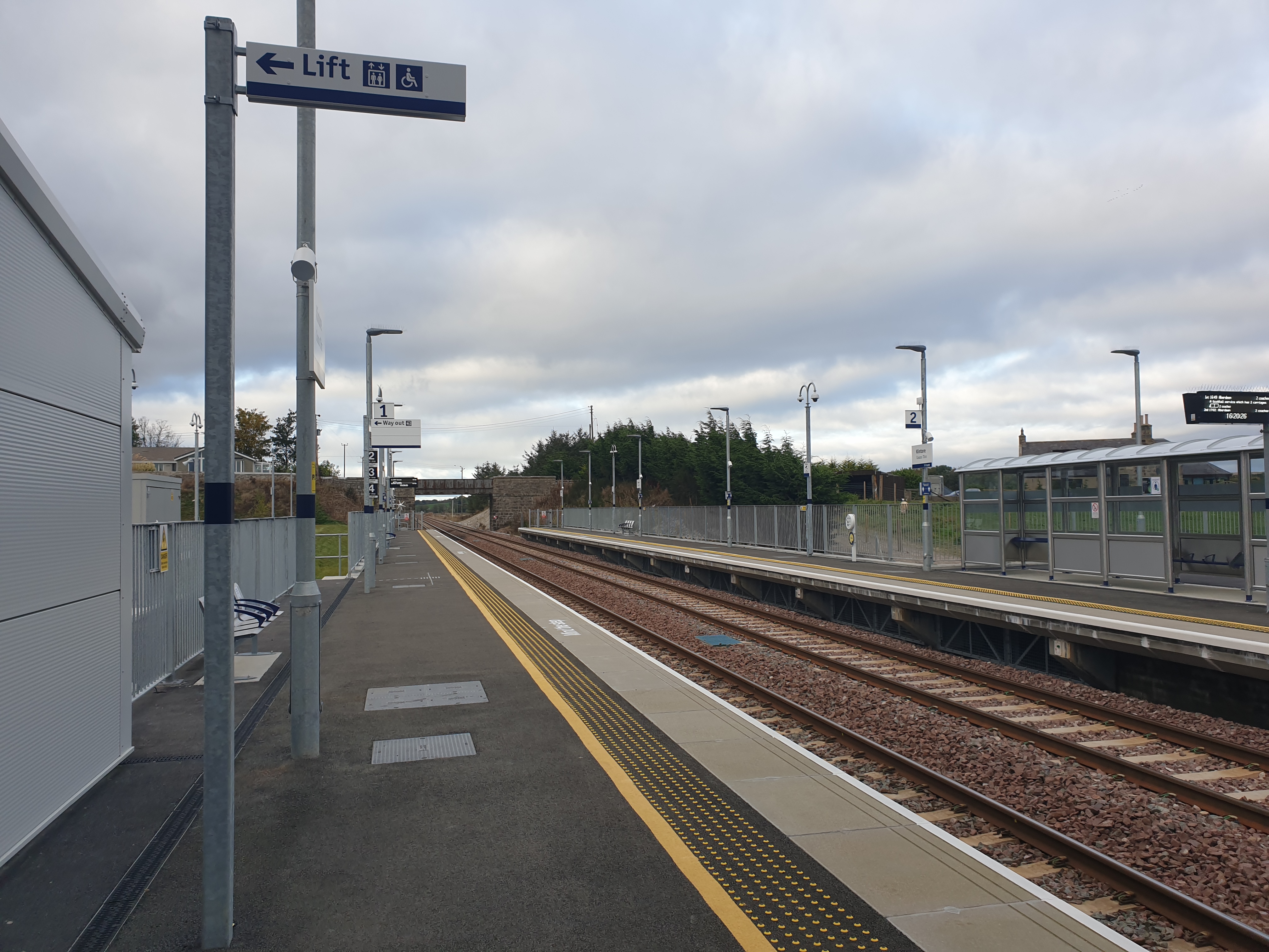
Kintore railway station
Kintore railway station is in Kintore, Scotland on the Aberdeen–Inverness line. Originally opened in 1854, it closed in 1964 but was reopened on a different...

Deers Den
Deers Den is an archaeological site at Kintore, Scotland in Aberdeenshire. The site has mesolithic remains, Iron Age artefacts and is a known Roman Camp...
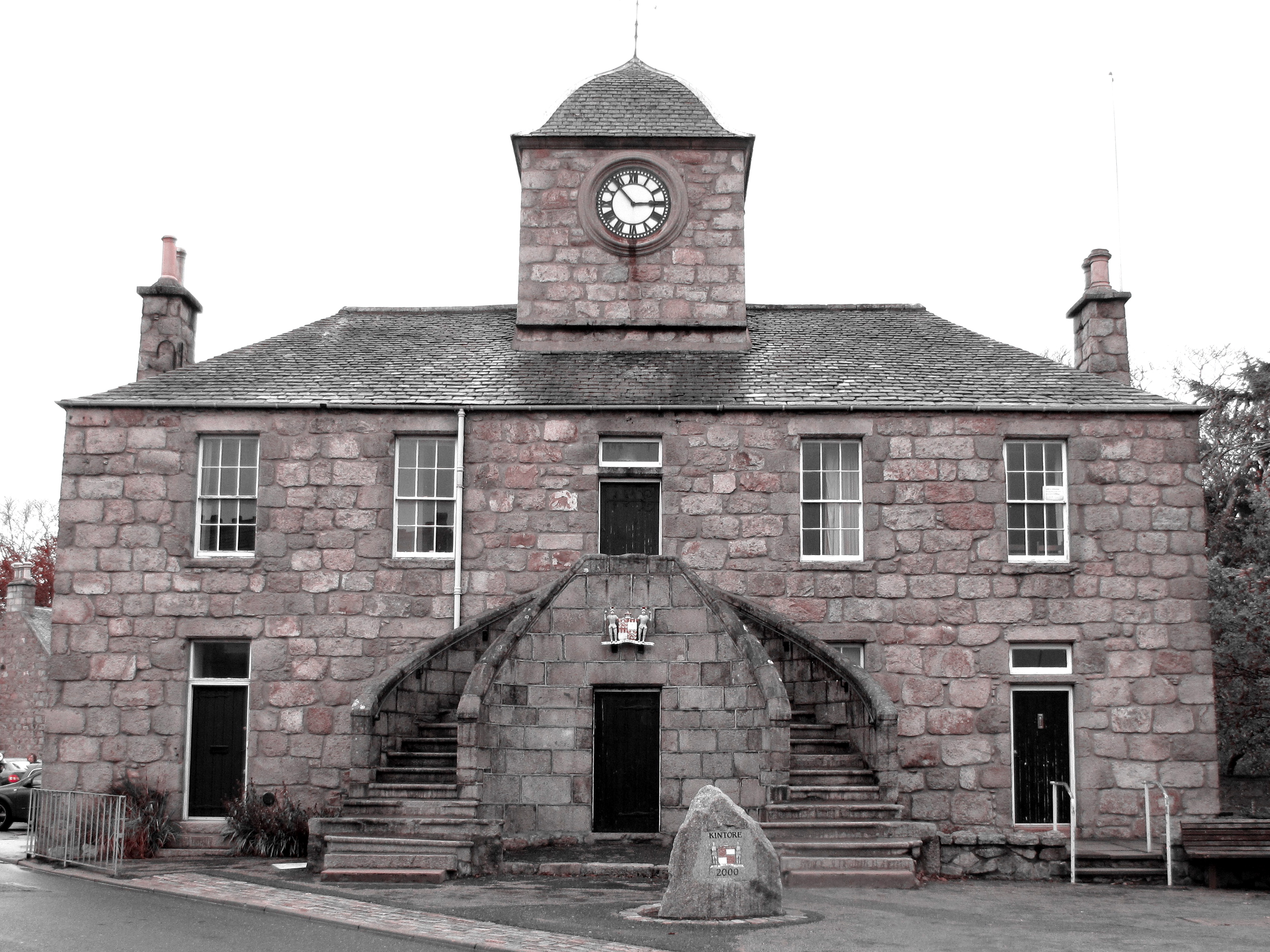
Kintore Town House
Kintore Town House is a municipal structure in The Square, Kintore, Aberdeenshire, Scotland. The structure, which is used as commercial offices, is a Category...

Kintore, Aberdeenshire
Kintore (; Scottish Gaelic: Ceann Tòrr) is a town and former royal burgh near Inverurie in Aberdeenshire, Scotland, now bypassed by the A96 road between...
Nearby Amenities
Located within 500m of 57.242866,-2.3624662Have you been to Black Hillock?
Leave your review of Black Hillock below (or comments, questions and feedback).