Blackhall Hill

Hill, Mountain in Roxburghshire

Scotland

Blackhall Hill

The Scottish Cheviots above Hind Hope View towards the Eildon Hills from the ridge below Brownhart Moor. Just east of the Eildon Hills, near Newstead, was the Roman Fort of Trimontium. It was an advance post of the Romans in their province of Valenti <a href="https://www.geograph.org.uk/photo/157017">NT5634 : Monument marking site of Roman Fort of Trimontium</a>

This is a possible site to which messages could have been passed from the proposed Roman Signal Station located close to the location of this photo on the Roman Road of Dere Street, just below Brownhart Law <a href="https://www.geograph.org.uk/photo/5129638">NT7909 : Location of Roman Signal Station, Brownhart Law</a>. Trimontium also lies on Dere Street, on route to Edinburgh, and is some 20 miles distant. Messages, however sent over these distances, could possibly have been relayed via the Roman Signal Station located on Eildon Hill North <a href="https://www.geograph.org.uk/photo/2735734">NT5532 : Eildon Mid Hill and Eildon Hill North</a>. Another possibility is signalling to Ruber's Law in the west. 

On Hadrian's Wall, the Romans had clever signalling systems based on letters sent by two groups of five flags. They also had a coded system, with which they could send only one of a dozen fixed messages, depending on the time for which they showed a flag or fire signal at night <span class="nowrap"><a title="http://www.romanobritain.org/8-military/mil_signalling_systems.htm#.V-a2bCSltsA" rel="nofollow ugc noopener" href="http://www.romanobritain.org/8-military/mil_signalling_systems.htm#.V-a2bCSltsA">Link</a><img style="margin-left:2px;" alt="External link" title="External link - shift click to open in new window" src="https://s1.geograph.org.uk/img/external.png" width="10" height="10"/></span>

There is a similar view here: <a href="https://www.geograph.org.uk/photo/157017">NT5634 : Monument marking site of Roman Fort of Trimontium</a>
The Scottish Cheviots above Hind Hope Credit: Andrew Curtis

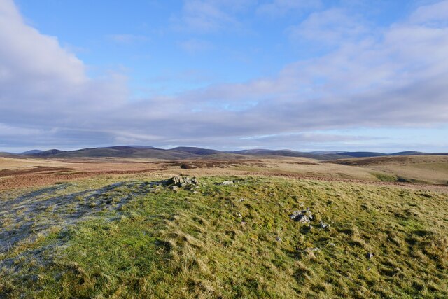
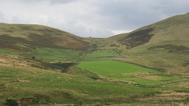
Blackhall Hill is a prominent hill located in the county of Roxburghshire in the Scottish Borders region of Scotland. It is part of the Southern Uplands, a range of rolling hills and mountains that stretch across southern Scotland. The summit of Blackhall Hill stands at an elevation of 343 meters (1,125 feet) above sea level, making it a modest but significant landmark in the area.

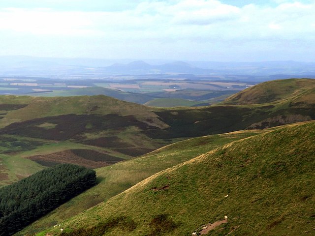
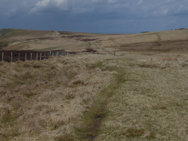
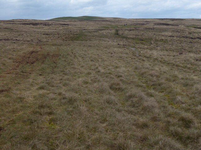
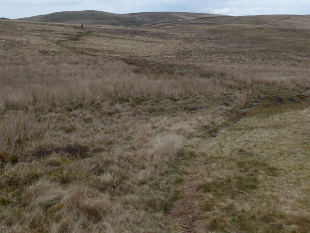
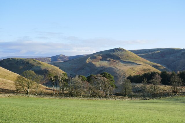
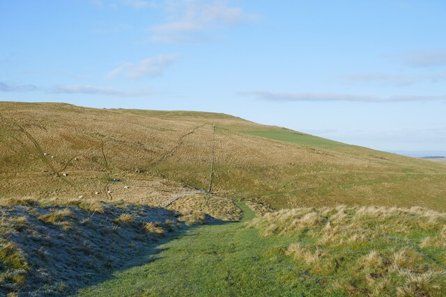
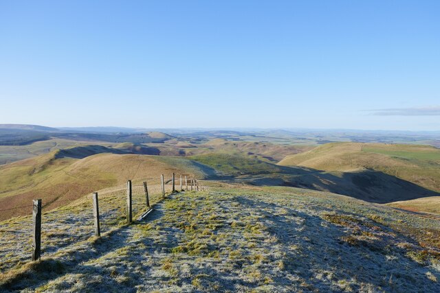
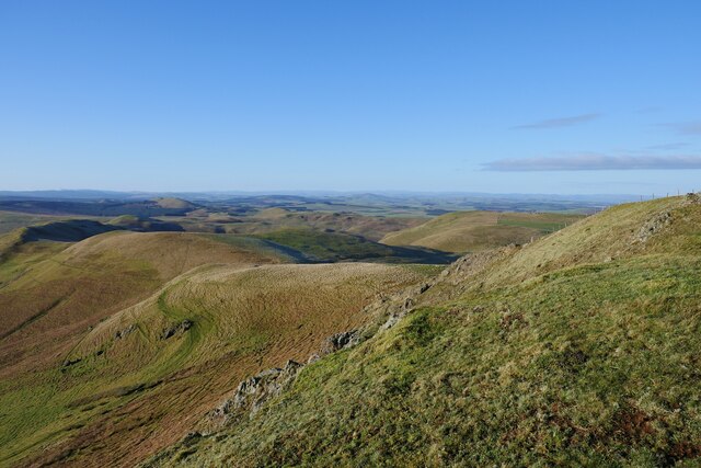
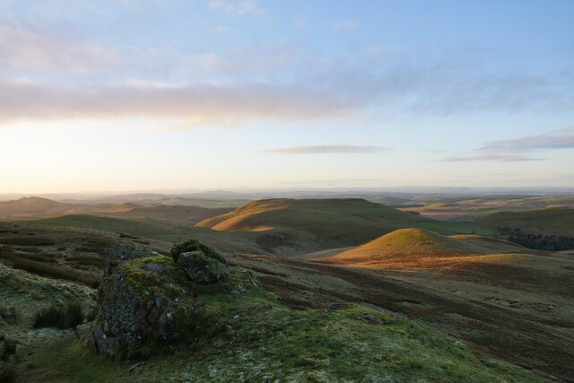
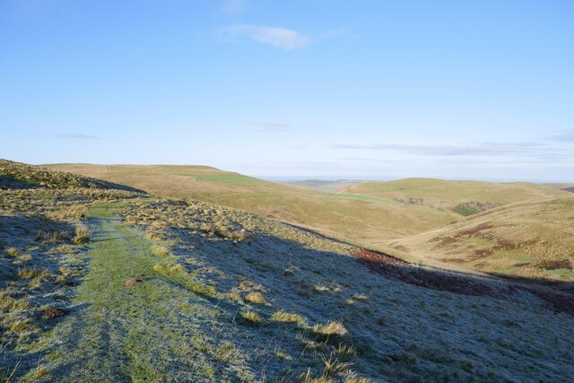
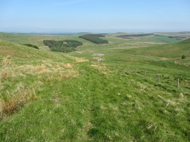
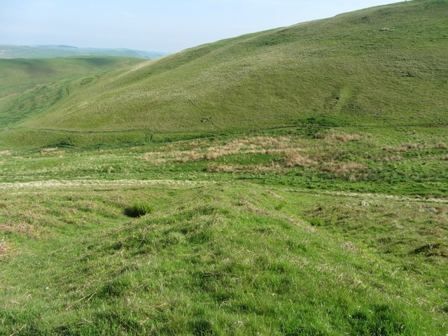
The hill is characterized by its gentle slopes and grassy terrain, offering visitors a relatively easy climb and panoramic views of the surrounding countryside. The summit provides a vantage point from which one can admire the picturesque landscape of Roxburghshire, including the nearby River Teviot and the lush green fields that stretch into the distance.

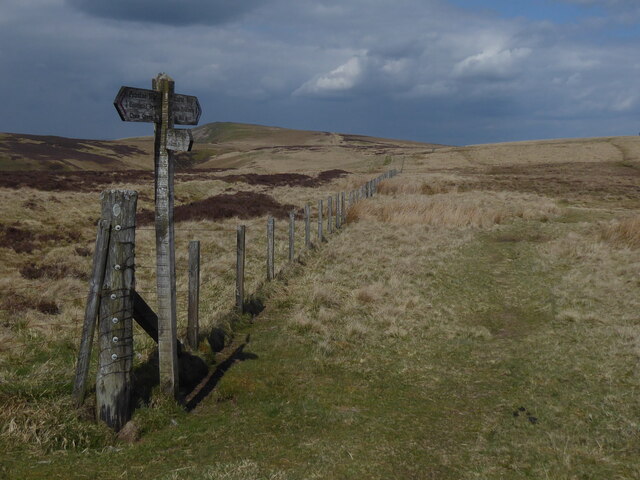
Blackhall Hill is a popular destination for outdoor enthusiasts, including hikers, walkers, and nature lovers. Its accessibility and relatively low elevation make it an excellent choice for individuals of all ages and fitness levels. The hill is also home to a variety of flora and fauna, including heather, wildflowers, and various bird species, adding to its natural beauty and appeal.

Located approximately 4 kilometers (2.5 miles) northeast of the town of Jedburgh, Blackhall Hill is easily accessible by road and offers ample parking facilities nearby. Whether one seeks a peaceful stroll or a more challenging hike, Blackhall Hill provides a serene and picturesque setting for outdoor activities and exploration in the heart of Roxburghshire.

If you have any feedback on the listing, please let us know in the comments section below.

Blackhall Hill Images

Images are sourced within 2km of 55.399496/-2.3479731 or Grid Reference NT7811. Thanks to Geograph Open Source API. All images are credited.

The Scottish Cheviots above Hind Hope View towards the Eildon Hills from the ridge below Brownhart Moor. Just east of the Eildon Hills, near Newstead, was the Roman Fort of Trimontium. It was an advance post of the Romans in their province of Valenti <a href="https://www.geograph.org.uk/photo/157017">NT5634 : Monument marking site of Roman Fort of Trimontium</a>

This is a possible site to which messages could have been passed from the proposed Roman Signal Station located close to the location of this photo on the Roman Road of Dere Street, just below Brownhart Law <a href="https://www.geograph.org.uk/photo/5129638">NT7909 : Location of Roman Signal Station, Brownhart Law</a>. Trimontium also lies on Dere Street, on route to Edinburgh, and is some 20 miles distant. Messages, however sent over these distances, could possibly have been relayed via the Roman Signal Station located on Eildon Hill North <a href="https://www.geograph.org.uk/photo/2735734">NT5532 : Eildon Mid Hill and Eildon Hill North</a>. Another possibility is signalling to Ruber's Law in the west. 

On Hadrian's Wall, the Romans had clever signalling systems based on letters sent by two groups of five flags. They also had a coded system, with which they could send only one of a dozen fixed messages, depending on the time for which they showed a flag or fire signal at night <span class="nowrap"><a title="http://www.romanobritain.org/8-military/mil_signalling_systems.htm#.V-a2bCSltsA" rel="nofollow ugc noopener" href="http://www.romanobritain.org/8-military/mil_signalling_systems.htm#.V-a2bCSltsA">Link</a><img style="margin-left:2px;" alt="External link" title="External link - shift click to open in new window" src="https://s1.geograph.org.uk/img/external.png" width="10" height="10"/></span>

There is a similar view here: <a href="https://www.geograph.org.uk/photo/157017">NT5634 : Monument marking site of Roman Fort of Trimontium</a>
The Scottish Cheviots above Hind Hope
View towards the Eildon Hills from the ridge below Brownhart Moor. Just east of the Eildon Hills, near Newstead, was the Roman Fort of Trimontium. It was an advance post of the Romans in their province of Valenti NT5634 : Monument marking site of Roman Fort of Trimontium This is a possible site to which messages could have been passed from the proposed Roman Signal Station located close to the location of this photo on the Roman Road of Dere Street, just below Brownhart Law NT7909 : Location of Roman Signal Station, Brownhart Law. Trimontium also lies on Dere Street, on route to Edinburgh, and is some 20 miles distant. Messages, however sent over these distances, could possibly have been relayed via the Roman Signal Station located on Eildon Hill North NT5532 : Eildon Mid Hill and Eildon Hill North. Another possibility is signalling to Ruber's Law in the west. On Hadrian's Wall, the Romans had clever signalling systems based on letters sent by two groups of five flags. They also had a coded system, with which they could send only one of a dozen fixed messages, depending on the time for which they showed a flag or fire signal at night LinkExternal link There is a similar view here: NT5634 : Monument marking site of Roman Fort of Trimontium
The Pennine Way near Black Halls
The Pennine Way near Blackhall Hill
The Pennine Way near Raeshaw Fell
Alongside Dere Street A view across sheep pasture adjacent to the route of Dere Street.  Standard Knowe stands prominent in the background.
Alongside Dere Street
A view across sheep pasture adjacent to the route of Dere Street. Standard Knowe stands prominent in the background.
On Dere Street looking back to Woden Law The route of Dere Street with a view back to Woden Law.  The remains of earthworks labelled on the 1:25k map are evident to the left of shot.
On Dere Street looking back to Woden Law
The route of Dere Street with a view back to Woden Law. The remains of earthworks labelled on the 1:25k map are evident to the left of shot.
On Blackhall Hill Upland pasture just off the route of Dere Street.
On Blackhall Hill
Upland pasture just off the route of Dere Street.
The summit of Blackhall Hill The rather unspectacular summit of Blackhall Hill - blink and you'll miss it.
The summit of Blackhall Hill
The rather unspectacular summit of Blackhall Hill - blink and you'll miss it.
A view to Hunthall Hill and Hindhope Hill A view from Blackhall Hill towards Hunthall Hill and Hindhope Hill on a crisp winter afternoon.
A view to Hunthall Hill and Hindhope Hill
A view from Blackhall Hill towards Hunthall Hill and Hindhope Hill on a crisp winter afternoon.
Greyhen Rock late on a winter afternoon The earthenware pots used to transport illicit whisky were called 'grey hens', hence the name of this feature just above the route of Dere Street.
Greyhen Rock late on a winter afternoon
The earthenware pots used to transport illicit whisky were called 'grey hens', hence the name of this feature just above the route of Dere Street.
On the route of Dere Street below Hunthall Hill Woden Law remains conspicuous in the background.
On the route of Dere Street below Hunthall Hill
Woden Law remains conspicuous in the background.
Woden Law Rough pasture in the Cheviot Hills.
Woden Law
Rough pasture in the Cheviot Hills.
Hindhope Hill A spur above the Kale Water. There is a lot of bracken here.
Hindhope Hill
A spur above the Kale Water. There is a lot of bracken here.
Dere Street Dere Street uses a pass between Langside Law and Woden Law. Woden Law is heavily fortified, presumably by Romans.
Dere Street
Dere Street uses a pass between Langside Law and Woden Law. Woden Law is heavily fortified, presumably by Romans.
Sheep pens beside Dere Street Hangingshaw Hill is behind with the valley of Hangingshaw Sike to the right.
Sheep pens beside Dere Street
Hangingshaw Hill is behind with the valley of Hangingshaw Sike to the right.
Dere Street below Woden Law
Linear earthwork across Dere Street The massive earthwork bank flanked by ditches on both sides starts just above the Dere Street path on the lower slopes of Woden Law, becomes lost in the valley of the tributary of Hangingshaw Sike, and can be seen again higher up on the south-west slope of Langside Law.

Canmore describes the earthwork as a possible boundary-marker, the wide gap between the two sections being due to traffic on the Dere Street trackway and washouts where it crossed the valley.
Linear earthwork across Dere Street
The massive earthwork bank flanked by ditches on both sides starts just above the Dere Street path on the lower slopes of Woden Law, becomes lost in the valley of the tributary of Hangingshaw Sike, and can be seen again higher up on the south-west slope of Langside Law. Canmore describes the earthwork as a possible boundary-marker, the wide gap between the two sections being due to traffic on the Dere Street trackway and washouts where it crossed the valley.
Show me another place!

Blackhall Hill is located at Grid Ref: NT7811 (Lat: 55.399496, Lng: -2.3479731)

Unitary Authority: The Scottish Borders

Police Authority: The Lothians and Scottish Borders

What 3 Words

///growth.condition.images. Near Rochester, Northumberland

Nearby Locations

Blackhall Hill Gaisty Law

Related Wikis

Chew Green

Chew Green is the site of the ancient Roman encampment, commonly but erroneously called Ad Fines (Latin: The Limits) on the 1885-1900 edition of the Ordnance...

Pennymuir Roman camps

The Pennymuir Roman camps are situated southeast of Jedburgh in the Scottish Borders area of Scotland, near the Anglo-Scottish border, in the former Roxburghshire...

Featherwood Roman Camps

Featherwood Roman Camps are neighbouring archaeological sites in Northumberland, England, 1 mile (1.6 km) north of Featherwood and about 3 miles (5 km...

Hownam

Hownam or Hounam is a small village and parish situated 8 miles east of Jedburgh in the Scottish Borders area of Scotland, near the Anglo-Scottish border...

Windy Gyle

Windy Gyle is a mountain in the Cheviot Hills range, on the border between England and Scotland. Like the other hills in the area, it is rounded and grass...

Barrow Burn

Barrowburn is a hamlet in Upper Coquetdale in the county of Northumberland, England. It comprises a working farm with associated buildings and two holiday...

Ramshope

Ramshope is a hamlet and former civil parish, now in the parish of Rochester in Northumberland, England located in Northumberland National Park. It lies...

Barrow Burn Meadows

Barrow Burn Meadows is a Site of Special Scientific Interest (SSSI) in north Northumberland, England. The site is a species-rich hay meadow of a sort now...

Have you been to Blackhall Hill?

Leave your review of Blackhall Hill below (or comments, questions and feedback).