East Horse Hill
Hill, Mountain in Northumberland
England
East Horse Hill

East Horse Hill is a prominent hill located in the county of Northumberland, in the northeastern part of England. Situated within the picturesque Northumberland National Park, this natural landmark stands at an elevation of approximately 306 meters (1,004 feet) above sea level. The hill is part of the Cheviot Hills range, known for their rolling landscapes and stunning views.
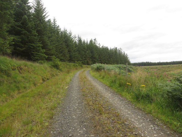
East Horse Hill offers visitors and outdoor enthusiasts a captivating experience with its rugged terrain and breathtaking vistas. The hill is characterized by its distinctive shape, featuring steep slopes and a gently rounded summit. Its grassy slopes are covered with heather and scattered with rocky outcrops, creating a diverse and visually appealing landscape.
The hill provides a range of recreational opportunities for those who enjoy outdoor activities. Hiking and walking trails traverse the area, allowing visitors to explore the surrounding countryside and take in the stunning panoramic views of the Northumberland countryside. The summit offers a particularly impressive vantage point, granting unobstructed views of the surrounding hills, valleys, and the North Sea coastline.
East Horse Hill is also home to a variety of wildlife, including several species of birds such as curlews, lapwings, and skylarks. The hill's diverse ecosystem supports a rich array of plant life, with wildflowers and grasses adding vibrant colors to the landscape during the warmer months.
With its natural beauty and recreational opportunities, East Horse Hill is a popular destination for nature lovers and outdoor enthusiasts seeking tranquility and adventure amidst the stunning Northumberland countryside.
If you have any feedback on the listing, please let us know in the comments section below.
East Horse Hill Images
Images are sourced within 2km of 55.103271/-2.3653599 or Grid Reference NY7678. Thanks to Geograph Open Source API. All images are credited.


East Horse Hill is located at Grid Ref: NY7678 (Lat: 55.103271, Lng: -2.3653599)
Unitary Authority: Northumberland
Police Authority: Northumbria
What 3 Words
///standard.hourglass.nightfall. Near Bellingham, Northumberland
Nearby Locations
Related Wikis
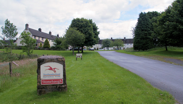
Stonehaugh
Stonehaugh is a small settlement in Northumberland about 5 miles (8 km) west of Wark on Tyne and 4 Roman miles (6 km) north of Hadrian's Wall. It was purpose...

Wark Forest
Wark Forest is the southern part of Kielder Forest in Northumberland, England. Wark Forest is found within the south-west tip of Northumberland National...

Dally Castle
Dally Castle is a ruined 13th-century stone motte-and-bailey fortress in Northumberland, and one of the first hall houses in Northumberland. It lies 5...

Greystead
Greystead is a village and civil parish in Northumberland, England west of Bellingham. The population as of the 2011 census was less than 100. It shares...

Hesleyside Hall
Hesleyside Hall is a privately owned 18th-century country house and the ancestral home of the Border reiver Charlton family about 2 miles (3 km) west of...
Tarset railway station
Tarset railway station served the civil parish of Tarset, Northumberland, England from 1862 to 1958 on the Border Counties Railway. == History == The station...

Tarset Castle
Tarset Castle is a ruin near Tarset in Northumberland. == History == A licence to crenellate was granted to John Comyn in 1267, and the castle was built...
Tarset
Tarset is a civil parish in Northumberland, England, created in 1955 from parts of Bellingham, Tarset West and Thorneyburn parishes. It is 4 miles (6 km...
Nearby Amenities
Located within 500m of 55.103271,-2.3653599Have you been to East Horse Hill?
Leave your review of East Horse Hill below (or comments, questions and feedback).