Blake Beck Hill

Hill, Mountain in Yorkshire South Lakeland

England

Blake Beck Hill

Signpost at the bottom of Coal Road The signpost is of a type common in the area, see <a href="https://www.geograph.org.uk/photo/1370306">SD7686 : Cowgill Signpost</a> for a close-up; adjacent is a community notice board.
Signpost at the bottom of Coal Road Credit: Stephen Craven

Blake Beck Hill is a prominent geographical feature located in the county of Yorkshire, England. Rising to an elevation of approximately 307 meters (1,007 feet), it is classified as a hill rather than a mountain due to its moderate height. Situated in the North York Moors National Park, Blake Beck Hill offers breathtaking panoramic views of the surrounding landscapes.

The hill is renowned for its natural beauty and is covered in a mixture of heather moorland and grass, creating a picturesque scenery that attracts nature enthusiasts and hikers. Its location within the national park provides a habitat for various wildlife species, including birds, rabbits, and occasional deer.

The terrain of Blake Beck Hill is generally gentle, making it accessible for both experienced and novice hikers. Several well-marked trails traverse the hill, allowing visitors to explore its diverse flora and fauna. The most popular route to the summit begins from the nearby village of Blakey Ridge, offering a rewarding ascent that showcases the stunning vistas of the surrounding valleys and moors.

Aside from its natural appeal, Blake Beck Hill also holds historical significance. In the past, it served as a landmark for travelers and was used as a navigational point due to its prominent position within the landscape. Today, it stands as a testament to the region's rich cultural and geological heritage.

Overall, Blake Beck Hill in Yorkshire is a captivating destination that combines natural beauty, recreational opportunities, and historical significance. Whether one seeks a serene hike or a glimpse into the region's past, this hill offers an enriching experience for all who venture to its summit.

If you have any feedback on the listing, please let us know in the comments section below.

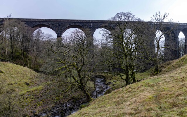
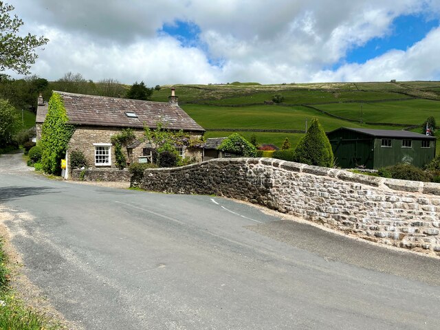
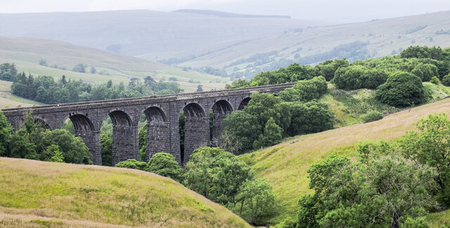
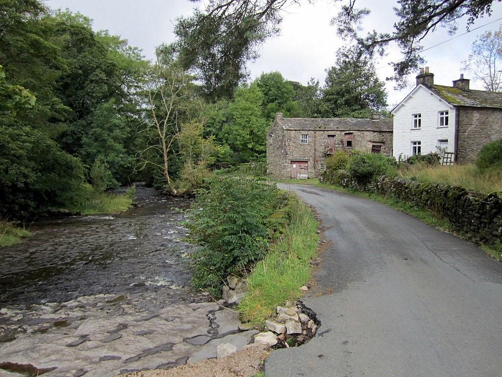
Blake Beck Hill Images

Images are sourced within 2km of 54.259639/-2.3646722 or Grid Reference SD7684. Thanks to Geograph Open Source API. All images are credited.

Signpost at the bottom of Coal Road The signpost is of a type common in the area, see <a href="https://www.geograph.org.uk/photo/1370306">SD7686 : Cowgill Signpost</a> for a close-up; adjacent is a community notice board.
Signpost at the bottom of Coal Road
The signpost is of a type common in the area, see SD7686 : Cowgill Signpost for a close-up; adjacent is a community notice board.
Artengill viaduct from Lea Yeat Brow A well known feature of the Settle-Carlisle line, dramatic seen close up, but this photo shows its setting in the landscape of Upper Dentdale.  Unusually it is both a listed structure (grade II, list entry 1383817) and a scheduled monument (1007242).
Artengill viaduct from Lea Yeat Brow
A well known feature of the Settle-Carlisle line, dramatic seen close up, but this photo shows its setting in the landscape of Upper Dentdale. Unusually it is both a listed structure (grade II, list entry 1383817) and a scheduled monument (1007242).
Arten Gill Viaduct, 1968 On the Settle and Carlisle Line, a grade II listed structure. The train crossing, of nineteen hopper wagons and a brake van, appears to be hauled by a class 40 locomotive.
Arten Gill Viaduct, 1968
On the Settle and Carlisle Line, a grade II listed structure. The train crossing, of nineteen hopper wagons and a brake van, appears to be hauled by a class 40 locomotive.
Early morning Dent Head Viaduct
Fingerpost - Cowgill
Track descending Arten Gill towards Arten Gill Viaduct
Arten Gill Viaduct
Arten Gill Viaduct
Track leading down to Stone House, Dentdale
The Sportsman Inn, Stone House, Dentdale
The Dales Way, east of Ewegales Bridge, Cowgill
How Gill View of How Gill in Dentdale, seen from Lea Yeat Brow.  In the foreground is Hill Farm and Hill View and in the middle distance is Hobsons Cottage.
How Gill
View of How Gill in Dentdale, seen from Lea Yeat Brow. In the foreground is Hill Farm and Hill View and in the middle distance is Hobsons Cottage.
Fell End Gill
Fell End Gill
Dent Head Viaduct
Dent Head Viaduct
Lea Yeat The minor road from Dent to Newby Head crosses the River Dee at Lea Yeat.
Repairs have been undertaken to the bridge parapet, on the face of which there is an Ordnance Survey cut benchmark (photograph <a href="https://www.geograph.org.uk/photo/7186508">SD7686 : Benchmark, Lea Yeat Bridge</a>).
Lea Yeat
The minor road from Dent to Newby Head crosses the River Dee at Lea Yeat. Repairs have been undertaken to the bridge parapet, on the face of which there is an Ordnance Survey cut benchmark (photograph SD7686 : Benchmark, Lea Yeat Bridge).
Benchmark, Lea Yeat Bridge Detail of an Ordnance Survey cut benchmark on the east parapet of Lea Yeat Bridge. The benchmark marks a height of 223.3514m above Ordnance Datum Newlyn last verified in 1953 (location photograph <a href="https://www.geograph.org.uk/photo/7186503">SD7686 : Lea Yeat</a>).
Benchmark, Lea Yeat Bridge
Detail of an Ordnance Survey cut benchmark on the east parapet of Lea Yeat Bridge. The benchmark marks a height of 223.3514m above Ordnance Datum Newlyn last verified in 1953 (location photograph SD7686 : Lea Yeat).
Dent Head Viaduct The ten-arched Dent Head Viaduct is one of a number of such structures on the Settle to Carlisle Railway line.
Dent Head Viaduct
The ten-arched Dent Head Viaduct is one of a number of such structures on the Settle to Carlisle Railway line.
Narrow bridge in Dentdale Stonehouse Bridge carries a minor road over the River Dee in Dentdale; roadside warnings are given to traffic in advance alerting them to the narrow space between its parapets. Buildings at Stonehouse Farm lie beyond the bridge.
Narrow bridge in Dentdale
Stonehouse Bridge carries a minor road over the River Dee in Dentdale; roadside warnings are given to traffic in advance alerting them to the narrow space between its parapets. Buildings at Stonehouse Farm lie beyond the bridge.
Ford on Arten Gill This is one of 28 fords on the track leading up Arten Gill. The viaduct is Artengill Viaduct on the Settle to Carlisle line.
Ford on Arten Gill
This is one of 28 fords on the track leading up Arten Gill. The viaduct is Artengill Viaduct on the Settle to Carlisle line.
Show me another place!

Blake Beck Hill is located at Grid Ref: SD7684 (Lat: 54.259639, Lng: -2.3646722)

Division: West Riding

Administrative County: Cumbria

District: South Lakeland

Police Authority: Cumbria

What 3 Words

///cookies.hotspots.organs. Near Sedbergh, Cumbria

Related Wikis

Stone House, Cumbria

Stone House is a locality at Dent Head on the River Dee, in the county of Cumbria, England, to the south-east of Cowgill and to the north-west of Newby...
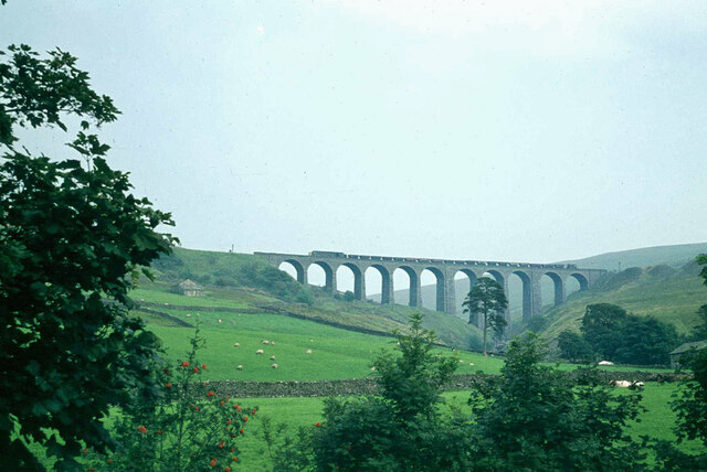
Arten Gill Viaduct

Arten Gill Viaduct is an eleven-arch railway bridge in Dentdale, Cumbria, England. The viaduct carries the Settle to Carlisle railway line over Artengill...

Dent Head Viaduct

Dent Head Viaduct is a railway viaduct on the Settle–Carlisle line in Dentdale, Cumbria, England. It is the second major viaduct on the line northwards...
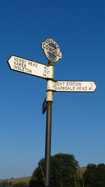
Cowgill, Cumbria

Cowgill is a village in Westmorland and Furness, Cumbria, England. It is within the historic boundaries of the West Riding of Yorkshire, and is located...

St John the Evangelist's Church, Cowgill

St John the Evangelist's Church is the Church of England parish church of the village of Cowgill, Cumbria, England. It is in the deanery of Kendal, the...
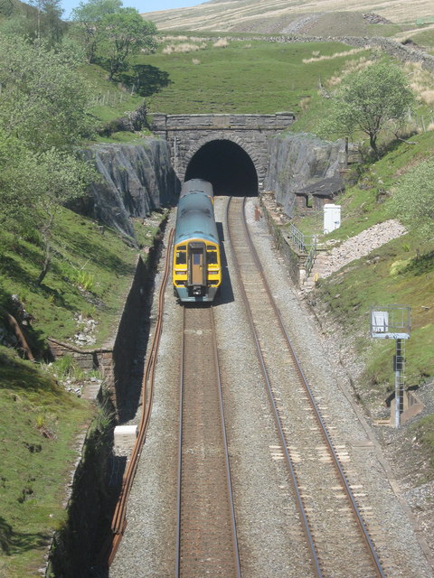
Blea Moor Tunnel

Blea Moor Tunnel is a 2,629 yards (1.494 mi)(2,404 m) railway tunnel located between Ribblehead Viaduct and Dent railway station in England. It is the...

Dent railway station

Dent is a railway station on the Settle and Carlisle Line, which runs between Carlisle and Leeds via Settle. The station, situated 58 miles 29 chains...

Newby Head

Newby Head, Newby Head Farm or Newby Head Inn is part of the Beresford Estate and was a popular drovers' inn in North Yorkshire, England. Now a farmhouse...

Have you been to Blake Beck Hill?

Leave your review of Blake Beck Hill below (or comments, questions and feedback).