Long Knowe

Hill, Mountain in Roxburghshire

Scotland

Long Knowe

Old milestone First photographed for the Milestone Society in 2010 this milestone in the Kale Water valley south of Chatto has gained a few more lichens and some moss.   H is for Hindhope which is at the end of tarmac but this would have been an old drovers' route over the hills southwards into England.
Old milestone Credit: Chris Minto

Long Knowe is a prominent hill located in the county of Roxburghshire, Scotland. Situated near the small village of Eckford, it forms part of the Southern Uplands range. With an elevation of approximately 392 meters (1,286 feet), it offers breathtaking views of the surrounding countryside.

The hill is characterized by its gently sloping sides, covered with lush green vegetation, including heather, grasses, and scattered shrubs. Its summit is relatively flat and provides a perfect vantage point to admire the picturesque landscape. On clear days, visitors can enjoy panoramic vistas of the rolling hills, fertile valleys, and meandering rivers that stretch for miles. The peak also offers glimpses of nearby landmarks, such as the Eildon Hills and the Cheviot Hills.

Long Knowe is a popular destination for hikers and outdoor enthusiasts, as it offers various walking routes to suit different abilities. Its well-maintained paths and trails make it accessible for both experienced walkers and beginners. The hill provides an opportunity to explore the region's rich biodiversity, as it is home to a diverse range of flora and fauna.

The area surrounding Long Knowe is steeped in history and folklore. Nearby, you can find the remains of ancient settlements, including Iron Age forts and burial cairns, which provide insight into the area's past. The hill's name, Long Knowe, is derived from the Old Norse language, meaning "long barrow" or "long hill."

Overall, Long Knowe offers visitors a chance to immerse themselves in the natural beauty and cultural heritage of Roxburghshire, providing a captivating experience for those seeking outdoor adventure and historical exploration.

If you have any feedback on the listing, please let us know in the comments section below.
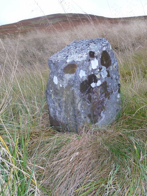
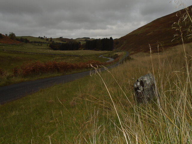
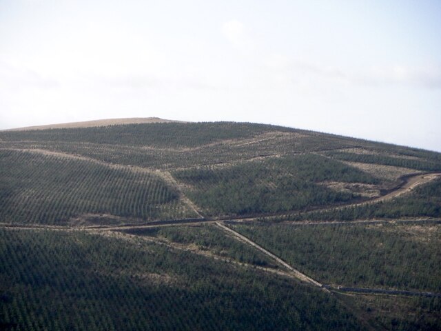
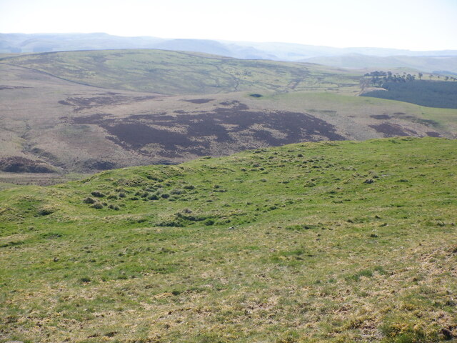
Long Knowe Images

Images are sourced within 2km of 55.446037/-2.3881405 or Grid Reference NT7516. Thanks to Geograph Open Source API. All images are credited.

Old milestone First photographed for the Milestone Society in 2010 this milestone in the Kale Water valley south of Chatto has gained a few more lichens and some moss.   H is for Hindhope which is at the end of tarmac but this would have been an old drovers' route over the hills southwards into England.
Old milestone
First photographed for the Milestone Society in 2010 this milestone in the Kale Water valley south of Chatto has gained a few more lichens and some moss. H is for Hindhope which is at the end of tarmac but this would have been an old drovers' route over the hills southwards into England.
Old milestone The view northwards on a dull day from the milestone towards Chatto with the Kale Water alongside the road.  This area of the Borders was Roxburghshire prior to the 1970s.
Old milestone
The view northwards on a dull day from the milestone towards Chatto with the Kale Water alongside the road. This area of the Borders was Roxburghshire prior to the 1970s.
Hare Law The new forestry on Hare Law. Previously there were some smaller plantations and upland pasture.
Hare Law
The new forestry on Hare Law. Previously there were some smaller plantations and upland pasture.
Young trees on Hare Law The foreground has also been planted.
Young trees on Hare Law
The foreground has also been planted.
On Katie Fisher's Knowe A view towards the Cheviot Hills from the forestry track on Katie Fisher's Knowe.
On Katie Fisher's Knowe
A view towards the Cheviot Hills from the forestry track on Katie Fisher's Knowe.
Dere Street Climbing Whitton Edge where it joins the tarred road between Oxnam and Hownam. The field on the right is now a conifer plantation.
Dere Street
Climbing Whitton Edge where it joins the tarred road between Oxnam and Hownam. The field on the right is now a conifer plantation.
Dere Street The small woodland has taken a battering from the storms of 2021-22.
Dere Street
The small woodland has taken a battering from the storms of 2021-22.
Quarry, Scaw'd Law
Quarry, Scaw'd Law
New forest road, Scaw'd Law The road serving the new plantation starts north of Thirlestane Law and ends above a quarry just to the west of here. There is no direct connection with Dere Street but it is only a short walk to bridge the gap with a useful gate just north of the quarry.
New forest road, Scaw'd Law
The road serving the new plantation starts north of Thirlestane Law and ends above a quarry just to the west of here. There is no direct connection with Dere Street but it is only a short walk to bridge the gap with a useful gate just north of the quarry.
View towards Hare Law A new bit of forestry from around 2016.
View towards Hare Law
A new bit of forestry from around 2016.
New forest road, Scaw'd Law The road ends on the skyline by a fenced off quarry.  Getting from there to Dere Street is a short easy walk along the edge of the conifers to a gate a short distance to the north.
New forest road, Scaw'd Law
The road ends on the skyline by a fenced off quarry. Getting from there to Dere Street is a short easy walk along the edge of the conifers to a gate a short distance to the north.
Dere Street Climbing Whitton Edge with a very young conifer plantation on the right.
Dere Street
Climbing Whitton Edge with a very young conifer plantation on the right.
Dere Street, Scaw'd Law The summit of a ridge crossing. Looking south towards the main Cheviot ridge.
Dere Street, Scaw'd Law
The summit of a ridge crossing. Looking south towards the main Cheviot ridge.
Woodland end, Scaw'd Law The col between Cunzierton Hill and Dere Street.
Woodland end, Scaw'd Law
The col between Cunzierton Hill and Dere Street.
Summit, Cunzierton Hill
Hill fort rampart, Cunzierton Hill A single rampart and ditch.
Hill fort rampart, Cunzierton Hill
A single rampart and ditch.
Hill fort rampart, Cunzierton Hill A single rampart, view towards Swinside and The Law.
Hill fort rampart, Cunzierton Hill
A single rampart, view towards Swinside and The Law.
Cunzierton View from Cunzierton Hill.
Cunzierton
View from Cunzierton Hill.
Show me another place!

Long Knowe is located at Grid Ref: NT7516 (Lat: 55.446037, Lng: -2.3881405)

Unitary Authority: The Scottish Borders

Police Authority: The Lothians and Scottish Borders

What 3 Words

///storming.tricky.witless. Near Jedburgh, Scottish Borders

Nearby Locations

Long Knowe Trestle Cairn

Related Wikis

Pennymuir Roman camps

The Pennymuir Roman camps are situated southeast of Jedburgh in the Scottish Borders area of Scotland, near the Anglo-Scottish border, in the former Roxburghshire...

Hownam

Hownam or Hounam is a small village and parish situated 8 miles east of Jedburgh in the Scottish Borders area of Scotland, near the Anglo-Scottish border...

Oxnam

Oxnam (Scots: Owsenam) is a village near Jedburgh, in Roxburghshire in the Scottish Borders area of Scotland. It is a primarily residential village. The...

Cessford, Scottish Borders

Cessford is a hamlet and former barony about a mile south of the B6401 road, in the Scottish Borders area of Scotland. The placename is from Gaelic 'ceis...

Nearby Amenities

Located within 500m of 55.446037,-2.3881405
Threstle
Place: locality
Lat/Long: 55.4425089/-2.3923657
The data included in this document is from www.openstreetmap.org. The data is made available under ODbL.

Have you been to Long Knowe?

Leave your review of Long Knowe below (or comments, questions and feedback).