Great Hill

Hill, Mountain in Yorkshire Ribble Valley

England

Great Hill

Moorland road north of Bowland Knotts On the horizon are the 'Three Peaks' of Yorkshire.
Moorland road north of Bowland Knotts Credit: John H Darch

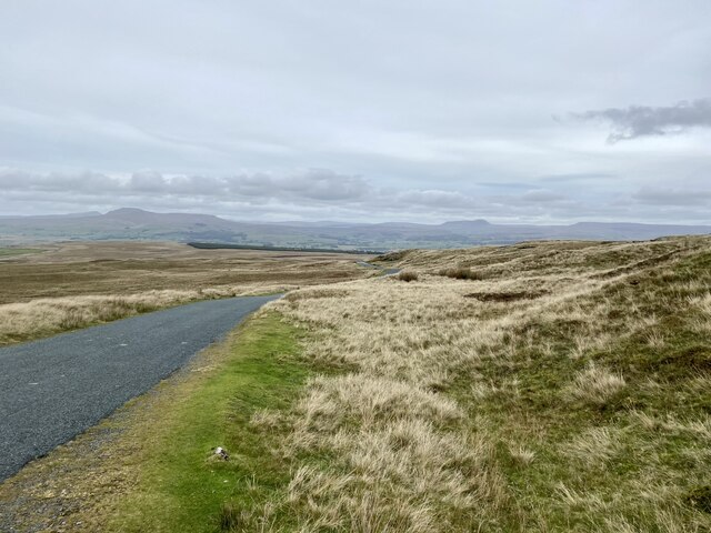
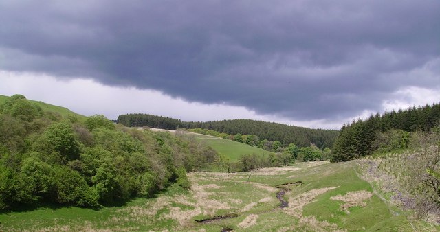
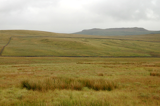
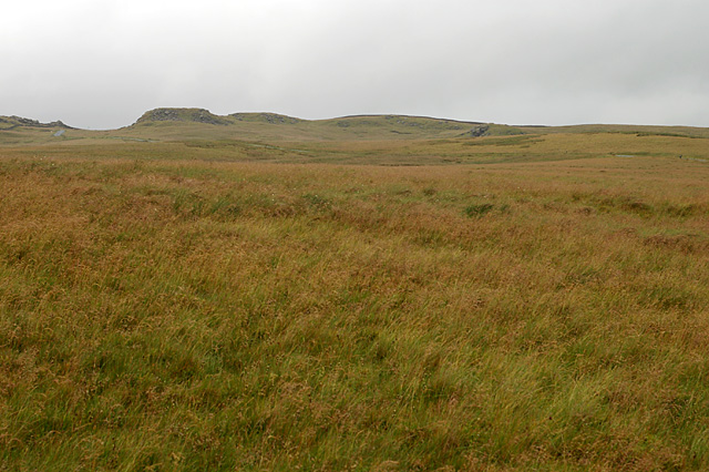
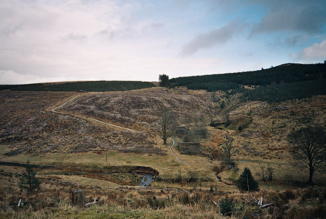
Great Hill is a prominent natural feature located in the county of Yorkshire, England. It is categorized as a hill, although it is often referred to as a mountain due to its impressive size and elevation. Standing at an approximate height of 1,250 feet (381 meters) above sea level, Great Hill offers breathtaking panoramic views of the surrounding landscape.

Situated within the expansive Yorkshire Dales National Park, Great Hill is part of the Pennine Range, which stretches across northern England. The hill is composed mainly of millstone grit, a type of sandstone that gives it a distinctive appearance and contributes to its rugged charm.

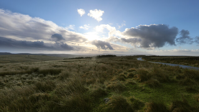
Great Hill is a popular destination for outdoor enthusiasts and nature lovers alike. It boasts several well-maintained hiking trails that cater to different levels of difficulty, allowing visitors to explore its slopes and reach its summit. The ascent can be challenging but rewarding, with each step revealing ever-changing views of the picturesque countryside.

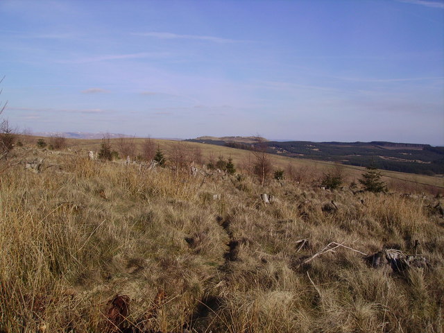
Flora and fauna are abundant on Great Hill, with heather, grasses, and wildflowers covering its slopes during the warmer months. The hill is also home to a variety of bird species, including peregrine falcons and red grouse, providing opportunities for birdwatchers to observe these magnificent creatures in their natural habitat.

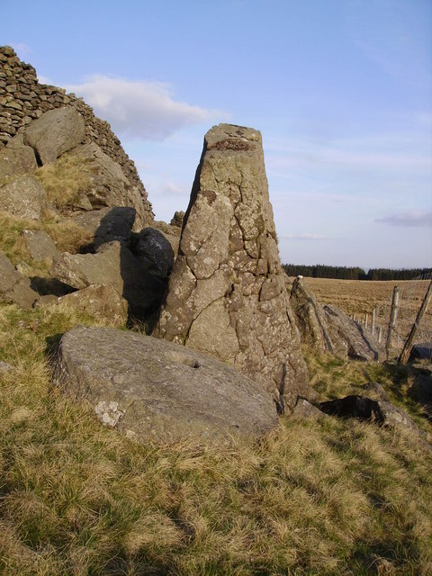
Great Hill is not only a natural wonder but also holds historical significance. It has remnants of ancient settlements and archaeological sites, offering glimpses into the region's past. The hill's rich cultural heritage combined with its stunning natural beauty makes it a must-visit destination for anyone exploring Yorkshire's diverse landscapes.

If you have any feedback on the listing, please let us know in the comments section below.
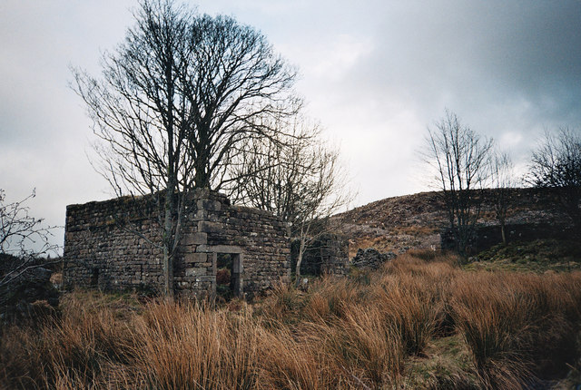
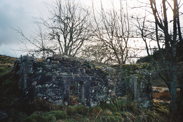
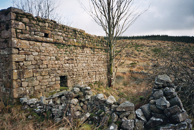
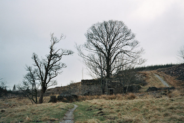
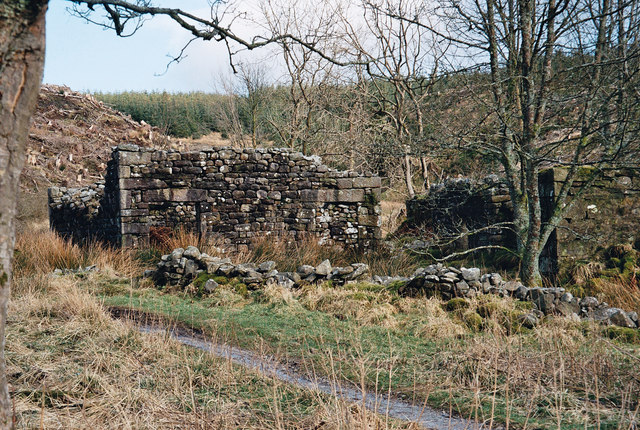
Great Hill Images

Images are sourced within 2km of 54.044266/-2.3867285 or Grid Reference SD7460. Thanks to Geograph Open Source API. All images are credited.

Moorland road north of Bowland Knotts On the horizon are the 'Three Peaks' of Yorkshire.
Moorland road north of Bowland Knotts
On the horizon are the 'Three Peaks' of Yorkshire.
The northern marches of Gisburn Forest The most recently planted part of Gisburn Forest is also the most northerly and forms an isolated outpost not visited by the main mountain bike trails. The Keasden road descends to it over Crutchenber Fell, passing through it to reach the more mature and popular sections around Stocks reservoir.
The northern marches of Gisburn Forest
The most recently planted part of Gisburn Forest is also the most northerly and forms an isolated outpost not visited by the main mountain bike trails. The Keasden road descends to it over Crutchenber Fell, passing through it to reach the more mature and popular sections around Stocks reservoir.
Crutchenber Fell Looking towards Gisburn Forest
Crutchenber Fell
Looking towards Gisburn Forest
Millstone Whelp Stone Crag Not the first abandoned millstone I have encountered in Bowland. Looks like it fell off the natural Trig Point shaped rock behind it. Perhaps it's a message saying 'Finding vacant squares to photo is becoming a bit of a millstone....'
Millstone Whelp Stone Crag
Not the first abandoned millstone I have encountered in Bowland. Looks like it fell off the natural Trig Point shaped rock behind it. Perhaps it's a message saying 'Finding vacant squares to photo is becoming a bit of a millstone....'
Dob Beck Dob Dale runs along Gisburn Forest Edge at this point before cutting into the Forest on the right. Typical Bank Holiday cloud overhead.
Dob Beck
Dob Dale runs along Gisburn Forest Edge at this point before cutting into the Forest on the right. Typical Bank Holiday cloud overhead.
Birch Clough Rigg With Whelp Stone Crag on the horizon
Birch Clough Rigg
With Whelp Stone Crag on the horizon
Crutchenber Fell Knotteranum on the horizon
Crutchenber Fell
Knotteranum on the horizon
Felled Forest - Bowland Looking down and over Dob Dale Beck one can see the old farm house ruins of 'Dob Dale' just between the narrow track and the stream to the right which joins Dob Dale Beck. Many years ago this farm was known by locals as 'Dob Dol. I believe this farm was already abandoned decades before the 1920s clearance of farms in this area for Catchment land of the 'Stocks Reservoir' being constructed late 20s early 30s. A large area has been felled here as elsewhere in this the Gisburn Forest in Bowland.
Felled Forest - Bowland
Looking down and over Dob Dale Beck one can see the old farm house ruins of 'Dob Dale' just between the narrow track and the stream to the right which joins Dob Dale Beck. Many years ago this farm was known by locals as 'Dob Dol. I believe this farm was already abandoned decades before the 1920s clearance of farms in this area for Catchment land of the 'Stocks Reservoir' being constructed late 20s early 30s. A large area has been felled here as elsewhere in this the Gisburn Forest in Bowland.
Forest Commission Track - Bowland A forestry track in 'Gisburn Forest' descending to a unwalled bridge that crosses the 'Dob Dale Beck. The conifer trees on the left are now felled.
Forest Commission Track - Bowland
A forestry track in 'Gisburn Forest' descending to a unwalled bridge that crosses the 'Dob Dale Beck. The conifer trees on the left are now felled.
Mini Ford - Gisburn Forest - Bowland Approaching the small ford through the 'Dob Dale Beck'. Some of these tracks in 'Gisburn Forest' are popular with mountain bikers besides the traveller on foot. A short distance ahead are the old farm ruins of 'Dob Dale' which can be seen to the left of the near tree as a right angle on the sky line.
Mini Ford - Gisburn Forest - Bowland
Approaching the small ford through the 'Dob Dale Beck'. Some of these tracks in 'Gisburn Forest' are popular with mountain bikers besides the traveller on foot. A short distance ahead are the old farm ruins of 'Dob Dale' which can be seen to the left of the near tree as a right angle on the sky line.
Dob Dale Farm Ruins - Gisburn Forest - Bowland I'd walked through the forest 'n' found a stream with no name, it was good to be out in the wild. In the reed grass there's a stream flowing by collecting the rain from the sky, in a short run or two the stream with no name joins the 'Dob Dale Beck' running by; la la la lal, la la lal, lal la la la lah! (The oldie song 'A Horse With No Name' (changed lyrics) in the Desert etc sung by 'America' you older ones may 'get it'!!)  The farm ruin of 'Dob Dale' known many years ago by locals as 'Dob Dol'!
Dob Dale Farm Ruins - Gisburn Forest - Bowland
I'd walked through the forest 'n' found a stream with no name, it was good to be out in the wild. In the reed grass there's a stream flowing by collecting the rain from the sky, in a short run or two the stream with no name joins the 'Dob Dale Beck' running by; la la la lal, la la lal, lal la la la lah! (The oldie song 'A Horse With No Name' (changed lyrics) in the Desert etc sung by 'America' you older ones may 'get it'!!) The farm ruin of 'Dob Dale' known many years ago by locals as 'Dob Dol'!
Farm Ruins - Gisburn Forest - Bowland Good solid stone work at the farm ruins of 'Dob Dol', this is the very old name for the farm abandoned I believe in the late 19th or possible very early 20th century, the official name of this isolated ruin is 'Dob Dale'.
Farm Ruins - Gisburn Forest - Bowland
Good solid stone work at the farm ruins of 'Dob Dol', this is the very old name for the farm abandoned I believe in the late 19th or possible very early 20th century, the official name of this isolated ruin is 'Dob Dale'.
Dob Dale Ruins - Bowland Solid walls standing at the old farm ruin of 'Dob Dale' in the 'Gisburn Forest'.
Dob Dale Ruins - Bowland
Solid walls standing at the old farm ruin of 'Dob Dale' in the 'Gisburn Forest'.
Dob Dale Farm Ruins - Gisburn Forest in Bowland Having just crossed the small ford through 'Dob Dale Beck' we approach the farm ruins of 'Dob Dale'. A little further ahead one can see the marsh grass just before the ruins, this is where the narrow track crosses yet another stream by a small ford. This stream is nameless, it flows from right to left, in a short distance joining the 'Dob Dale Beck'.
Dob Dale Farm Ruins - Gisburn Forest in Bowland
Having just crossed the small ford through 'Dob Dale Beck' we approach the farm ruins of 'Dob Dale'. A little further ahead one can see the marsh grass just before the ruins, this is where the narrow track crosses yet another stream by a small ford. This stream is nameless, it flows from right to left, in a short distance joining the 'Dob Dale Beck'.
Old Farm Ruins of Dob Dale (Dob Dol) Gisburn Forest - Bowland
Farm road at Halsteads
Lime kiln on Howe Hill
Confluence of Dob Dale Beck and Brock Clough Beck Note the ancient Lime Kiln in the background
Confluence of Dob Dale Beck and Brock Clough Beck
Note the ancient Lime Kiln in the background
Show me another place!

Great Hill is located at Grid Ref: SD7460 (Lat: 54.044266, Lng: -2.3867285)

Division: West Riding

Administrative County: Lancashire

District: Ribble Valley

Police Authority: Lancashire

What 3 Words

///pampered.speaking.skies. Near Settle, North Yorkshire

Nearby Locations

Great Hill

Related Wikis

Eldroth

Eldroth is a village in North Yorkshire, England. It is in the civil parish of Lawkland, part of the former Craven District, some 3.25 miles (5.23 km)...

Easington, Lancashire

Easington () is a civil parish within the Ribble Valley district of Lancashire, England, with a population in 2001 of 52. The Census 2011 population details...

Tosside

Tosside is a small village on the modern border of North Yorkshire and Lancashire in Northern England. It lies within the Forest of Bowland, and is between...

Stocks Reservoir

Stocks Reservoir is a reservoir situated at the head of the Hodder valley in the Forest of Bowland, Lancashire, England (historically in the West Riding...

Rathmell

Rathmell is a village and civil parish in the Craven district of North Yorkshire, England. The population of the civil parish in the 2011 census was 305...

Giggleswick railway station

Giggleswick is a railway station on the Bentham Line, which runs between Leeds and Morecambe via Skipton. The station, situated 41+1⁄4 miles (66 km) north...

Gisburn Forest

Gisburn Forest is a civil parish in the Ribble Valley, in Lancashire, England. Mainly lying within the Forest of Bowland Area of Outstanding Natural Beauty...

Lawkland

Lawkland is a civil parish in North Yorkshire, England, near the A65 and 4 miles (6.4 km) west of Settle. It lies within the Forest of Bowland Area of...

Have you been to Great Hill?

Leave your review of Great Hill below (or comments, questions and feedback).