Halstead Fell

Hill, Mountain in Yorkshire Ribble Valley

England

Halstead Fell

The northern marches of Gisburn Forest The most recently planted part of Gisburn Forest is also the most northerly and forms an isolated outpost not visited by the main mountain bike trails. The Keasden road descends to it over Crutchenber Fell, passing through it to reach the more mature and popular sections around Stocks reservoir.
The northern marches of Gisburn Forest Credit: Andy Waddington

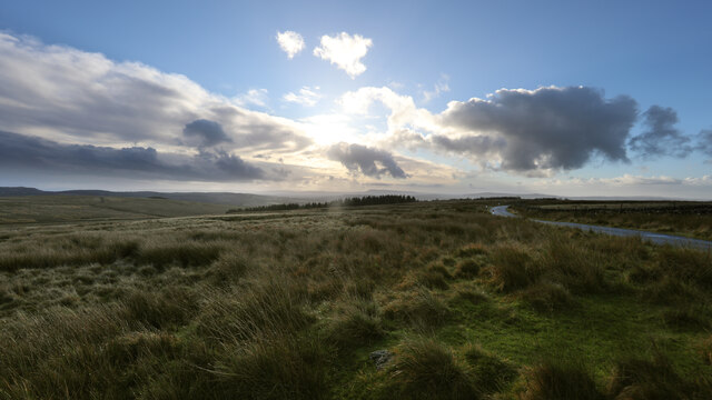
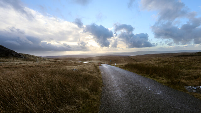
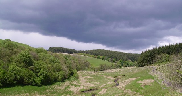
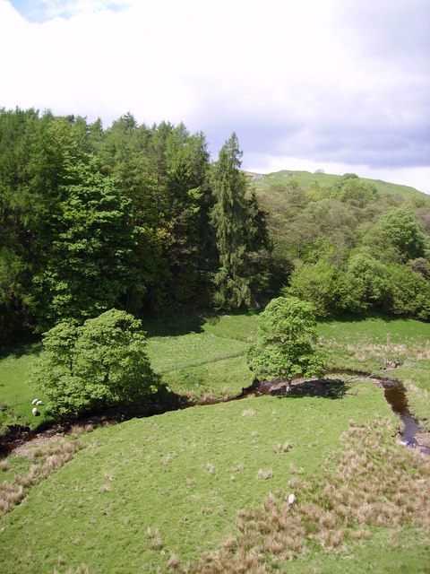
Halstead Fell is a picturesque hill located in the county of Yorkshire, England. Rising to an elevation of 386 meters (1,266 feet), it is considered one of the prominent fells in the region. Situated near the village of Halstead, the fell offers breathtaking panoramic views of the surrounding countryside.

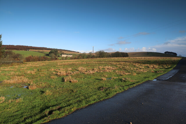
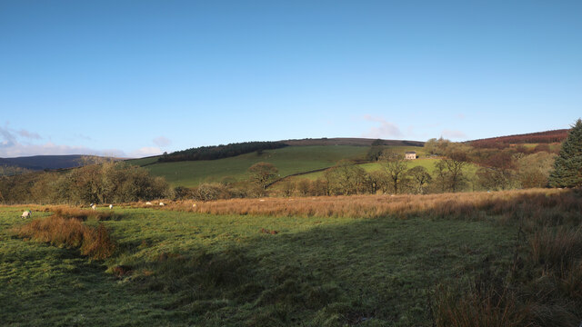
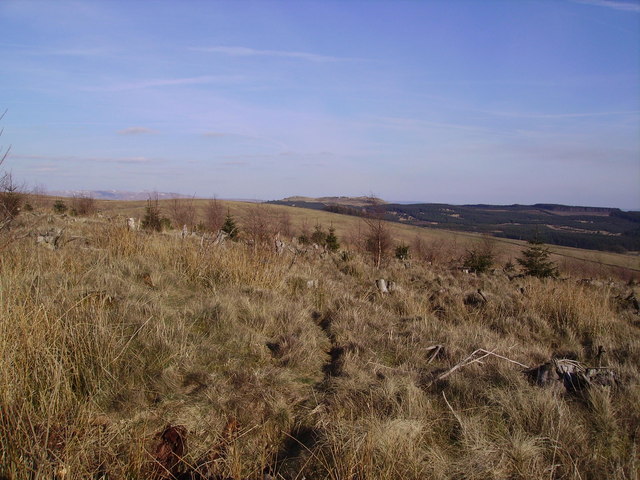
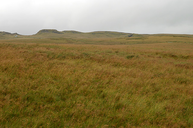
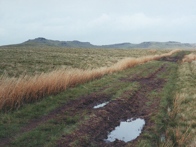
Covered in lush green vegetation, Halstead Fell is a haven for nature enthusiasts. The hill comprises a mixture of grassy slopes and rocky outcrops, providing an ideal habitat for a diverse range of flora and fauna. Visitors can explore the well-maintained footpaths that crisscross the fell, allowing them to fully appreciate the natural beauty and tranquility of the area.

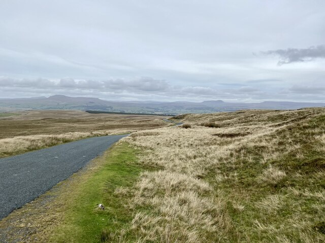
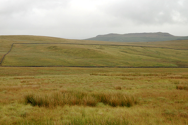
The summit of Halstead Fell offers spectacular vistas of the Yorkshire Dales and the distant peaks of the Pennines. On a clear day, one can see as far as the famous Three Peaks, a group of three prominent summits in the region. Photographers and artists are often drawn to the fell, capturing its beauty in their works.

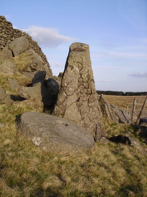
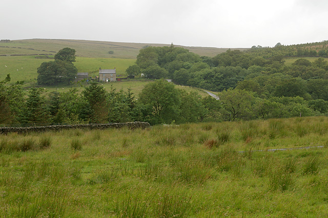
The hill is also steeped in history. Evidence of ancient settlements can be found on its slopes, including remnants of stone circles and burial mounds. These archaeological sites add a layer of intrigue to the fell, attracting history enthusiasts and researchers.

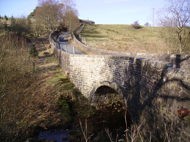
Halstead Fell is easily accessible, with a car park located nearby, and is a popular destination for hikers, cyclists, and families looking to enjoy the great outdoors. Its natural beauty, combined with its historical significance, make Halstead Fell a must-visit location for anyone exploring the Yorkshire countryside.

If you have any feedback on the listing, please let us know in the comments section below.

Halstead Fell Images

Images are sourced within 2km of 54.039189/-2.4002102 or Grid Reference SD7360. Thanks to Geograph Open Source API. All images are credited.

The northern marches of Gisburn Forest The most recently planted part of Gisburn Forest is also the most northerly and forms an isolated outpost not visited by the main mountain bike trails. The Keasden road descends to it over Crutchenber Fell, passing through it to reach the more mature and popular sections around Stocks reservoir.
The northern marches of Gisburn Forest
The most recently planted part of Gisburn Forest is also the most northerly and forms an isolated outpost not visited by the main mountain bike trails. The Keasden road descends to it over Crutchenber Fell, passing through it to reach the more mature and popular sections around Stocks reservoir.
Looking over Coat Rakes to Dale House Dale House is just by the road north from Gisburn Forest towards Clapham in the Yorkshire Dales. The track here goes to Halsteads Farm, whilst a rougher track to the right goes to Cocklick End, not a place to mention in social media posts, as an AI is likely to take exception...
Looking over Coat Rakes to Dale House
Dale House is just by the road north from Gisburn Forest towards Clapham in the Yorkshire Dales. The track here goes to Halsteads Farm, whilst a rougher track to the right goes to Cocklick End, not a place to mention in social media posts, as an AI is likely to take exception...
Higher Clough On the west side of the Keasden road, land rises to Green Pike above Higher Clough (the farmhouse in the sun). The moor on the far horizon is CROW Access Land, but most of what is visible in this view has no public access.
Higher Clough
On the west side of the Keasden road, land rises to Green Pike above Higher Clough (the farmhouse in the sun). The moor on the far horizon is CROW Access Land, but most of what is visible in this view has no public access.
Moorland road north of Bowland Knotts On the horizon are the 'Three Peaks' of Yorkshire.
Moorland road north of Bowland Knotts
On the horizon are the 'Three Peaks' of Yorkshire.
Keasden road heads down Crutchenber Fell Despite rain overngight and an unpromising sky in the morning, the weather is clearing up enough for a good day out in Gisburn Forest. The Keasden road crosses the watershed at Bowland Knotts and heads south for the forest and Stocks reservoir en route for Slaidburn. This used to be a very quiet road when last I passed this way (probably thirty years ago) but now carries a lot of people to the extensive carparks, paths and bike trails provided by the forestry and water companies.
Keasden road heads down Crutchenber Fell
Despite rain overngight and an unpromising sky in the morning, the weather is clearing up enough for a good day out in Gisburn Forest. The Keasden road crosses the watershed at Bowland Knotts and heads south for the forest and Stocks reservoir en route for Slaidburn. This used to be a very quiet road when last I passed this way (probably thirty years ago) but now carries a lot of people to the extensive carparks, paths and bike trails provided by the forestry and water companies.
Crutchenber Fell Looking towards Gisburn Forest
Crutchenber Fell
Looking towards Gisburn Forest
Coat Rakes Bridge On Hasgill Beck
Coat Rakes Bridge
On Hasgill Beck
Millstone Whelp Stone Crag Not the first abandoned millstone I have encountered in Bowland. Looks like it fell off the natural Trig Point shaped rock behind it. Perhaps it's a message saying 'Finding vacant squares to photo is becoming a bit of a millstone....'
Millstone Whelp Stone Crag
Not the first abandoned millstone I have encountered in Bowland. Looks like it fell off the natural Trig Point shaped rock behind it. Perhaps it's a message saying 'Finding vacant squares to photo is becoming a bit of a millstone....'
Dob Beck Dob Dale runs along Gisburn Forest Edge at this point before cutting into the Forest on the right. Typical Bank Holiday cloud overhead.
Dob Beck
Dob Dale runs along Gisburn Forest Edge at this point before cutting into the Forest on the right. Typical Bank Holiday cloud overhead.
Dob Dale Beck Soon to become Bottoms Beck Gisburn Forest
Dob Dale Beck
Soon to become Bottoms Beck Gisburn Forest
Old Hedge Line On the edge of Gisburn Forest. It appears to be on the line of a public footpath which looks like it's never used except by Geographers looking for elusive squares like the one with Halstead Farm in view ahead.
Old Hedge Line
On the edge of Gisburn Forest. It appears to be on the line of a public footpath which looks like it's never used except by Geographers looking for elusive squares like the one with Halstead Farm in view ahead.
Gnarled oak, Dob Dale Beck On the forest edge. Halstead farm in view.
Gnarled oak, Dob Dale Beck
On the forest edge. Halstead farm in view.
Higher Clough Farm
Higher Clough Farm
Birch Clough Rigg With Whelp Stone Crag on the horizon
Birch Clough Rigg
With Whelp Stone Crag on the horizon
Crutchenber Fell Knotteranum on the horizon
Crutchenber Fell
Knotteranum on the horizon
Track towards Bowland Knotts A footpath across the peaty moorland.
Track towards Bowland Knotts
A footpath across the peaty moorland.
Cattle Grid, Crutchenber Fell Gate
Young Forestry near Crutchenber Fell Gate
Show me another place!

Halstead Fell is located at Grid Ref: SD7360 (Lat: 54.039189, Lng: -2.4002102)

Division: West Riding

Administrative County: Lancashire

District: Ribble Valley

Police Authority: Lancashire

What 3 Words

///vesting.breathy.scrub. Near Settle, North Yorkshire

Related Wikis

Easington, Lancashire

Easington () is a civil parish within the Ribble Valley district of Lancashire, England, with a population in 2001 of 52. The Census 2011 population details...

Stocks Reservoir

Stocks Reservoir is a reservoir situated at the head of the Hodder valley in the Forest of Bowland, Lancashire, England (historically in the West Riding...

Tosside

Tosside is a small village on the modern border of North Yorkshire and Lancashire in Northern England. It lies within the Forest of Bowland, and is between...

Eldroth

Eldroth is a village in North Yorkshire, England. It is in the civil parish of Lawkland, part of the former Craven District, some 3.25 miles (5.23 km)...

Nearby Amenities

Located within 500m of 54.039189,-2.4002102
Halstead Fell
Place: locality
Lat/Long: 54.035244/-2.4010399
Sheep Hill
Place: locality
Lat/Long: 54.0353995/-2.3973311
Halstead Fell
Place: locality
Lat/Long: 54.0401789/-2.3990825
Hell Hole
Place: locality
Lat/Long: 54.0360177/-2.4006286
The data included in this document is from www.openstreetmap.org. The data is made available under ODbL.

Have you been to Halstead Fell?

Leave your review of Halstead Fell below (or comments, questions and feedback).