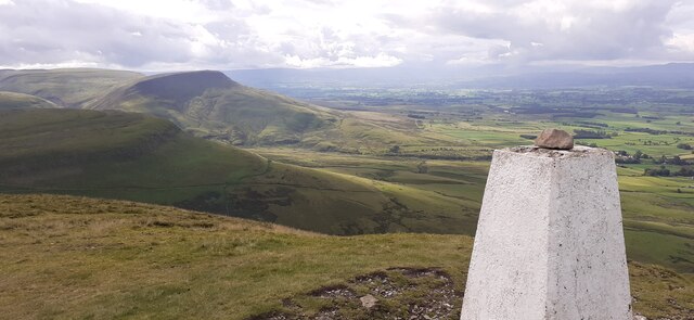
Blue Hill

Hill, Mountain in Westmorland Eden

England

Blue Hill

Looking towards High Cup Gill from near Harbour Flatt, Appleby
Looking towards High Cup Gill from near Harbour Flatt, Appleby Credit: habiloid

Blue Hill is a prominent hill located in Westmorland County, New Brunswick, Canada. Standing at an elevation of approximately 438 meters (1,437 feet), it is considered one of the highest peaks in the region. Blue Hill is situated within a picturesque rural landscape, surrounded by rolling hills and dense forests.

This natural landmark offers breathtaking panoramic views of the surrounding area, making it a popular destination for hikers, nature enthusiasts, and photographers. The hill is known for its distinct blue hue, which can be attributed to the abundance of blueberry bushes that cover its slopes during the summer months. This vibrant display of blueberries in bloom creates a stunning visual contrast against the lush greenery of the hillside.

Blue Hill is home to a diverse range of flora and fauna, with various species of birds, mammals, and insects inhabiting the area. Hikers can explore a network of well-maintained trails that wind through the hill, providing opportunities to observe wildlife and immerse themselves in the natural beauty of the surroundings.

In addition to its natural attractions, Blue Hill also holds cultural significance for the local community. It has been a gathering place for centuries, with Indigenous peoples considering it a sacred site. Today, it serves as a venue for community events, such as festivals and concerts, bringing people together to celebrate and appreciate the area's natural and cultural heritage.

Overall, Blue Hill in Westmorland County is a stunning and culturally significant natural landmark that offers visitors a chance to immerse themselves in the beauty of the Canadian wilderness while also connecting with the region's rich history and traditions.

If you have any feedback on the listing, please let us know in the comments section below.
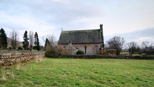
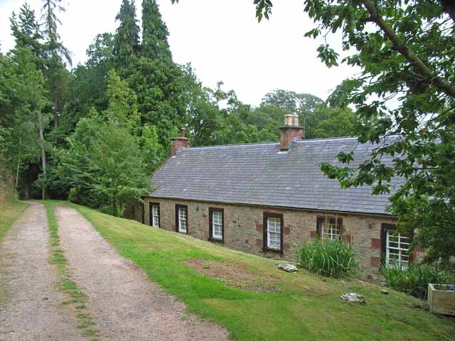
Blue Hill Images

Images are sourced within 2km of 54.591463/-2.413966 or Grid Reference NY7321. Thanks to Geograph Open Source API. All images are credited.

Looking towards High Cup Gill from near Harbour Flatt, Appleby
Bridge over Murton Beck, Murton
Bridge over Hilton Beck The bridge carries Leagarth Lane, Hilton's main road, over Hilton Beck, and is seen from the public footpath on the south bank heading for Langton and Brackenber. Water levels are quite high, and for those keen to try out little-known river descents, is almost at a paddleable level - this would be a convenient put-on, with parking to the left of the background trees. There's at least one livestock fence to watch out for downstream (but has a big eddy and can probably be sneaked via a broken panel, as of early 2022).
Bridge over Hilton Beck
The bridge carries Leagarth Lane, Hilton's main road, over Hilton Beck, and is seen from the public footpath on the south bank heading for Langton and Brackenber. Water levels are quite high, and for those keen to try out little-known river descents, is almost at a paddleable level - this would be a convenient put-on, with parking to the left of the background trees. There's at least one livestock fence to watch out for downstream (but has a big eddy and can probably be sneaked via a broken panel, as of early 2022).
Hilton Beck from Thornless Hill The larger scales of map show the public footpath here as being at the bottom of the steep bank, but invasive gorse rather deterred one from trying anything down there. The top of the bank, however, remains largely in keeping with the name of the rising ground behind the photographer - Thornless Hill. It is not improved pasture like the enclosed fields towards the village of Hilton, but is mainly free of prickly walker-deterrent vegetation. The road is the one to Hilton from Appleby and likely the one that a SatNav would bring you to, since the road south of Hilton passes through Warcop training area and is confusingly missing from such navigation technology (presumably because sometimes it is closed to the public).
Hilton Beck from Thornless Hill
The larger scales of map show the public footpath here as being at the bottom of the steep bank, but invasive gorse rather deterred one from trying anything down there. The top of the bank, however, remains largely in keeping with the name of the rising ground behind the photographer - Thornless Hill. It is not improved pasture like the enclosed fields towards the village of Hilton, but is mainly free of prickly walker-deterrent vegetation. The road is the one to Hilton from Appleby and likely the one that a SatNav would bring you to, since the road south of Hilton passes through Warcop training area and is confusingly missing from such navigation technology (presumably because sometimes it is closed to the public).
Footbridge over Murton Beck The public footpath west from Murton splits here with one way remaining on the north bank of Murton Beck to turn northwards shortly, heading for Brackenthwaite, whilst the footbridge carries the other branch across the beck, to head west to Shepherd's Cottage and Flakebridge (and the end of a minor road to Appleby).
Footbridge over Murton Beck
The public footpath west from Murton splits here with one way remaining on the north bank of Murton Beck to turn northwards shortly, heading for Brackenthwaite, whilst the footbridge carries the other branch across the beck, to head west to Shepherd's Cottage and Flakebridge (and the end of a minor road to Appleby).
Murton and Hilton church Situated midway between Murton and its smaller satellite Hilton, the church is dedicated to St. John the Baptist. Its graveyard lies just across the minor road between the villages, and slightly nearer to Hilton, and lies among the tall conifers seen on the left of the view.
Murton and Hilton church
Situated midway between Murton and its smaller satellite Hilton, the church is dedicated to St. John the Baptist. Its graveyard lies just across the minor road between the villages, and slightly nearer to Hilton, and lies among the tall conifers seen on the left of the view.
Track on lower slopes of Murton Pike
Trundale Adjacent valley to the more famous High Cup.
Trundale
Adjacent valley to the more famous High Cup.
Trundale Gill
Trundale Gill
Trig Point on Murton Pike
View to White Mines Former lead mine on the eastern side of Gasdale.
View to White Mines
Former lead mine on the eastern side of Gasdale.
Track on the slopes of Murton Pike
Cumbrian Red Sandstone house, Murton
White Mines Now disused, note abandoned tractor, left where it fell.
White Mines
Now disused, note abandoned tractor, left where it fell.
Murton Pike Looking along the escarpment
Murton Pike
Looking along the escarpment
Ordnance Survey Pivot This OS pivot can be found on the culvert NW side of the road. It marks a point 182.426m above mean sea level.
Ordnance Survey Pivot
This OS pivot can be found on the culvert NW side of the road. It marks a point 182.426m above mean sea level.
Ordnance Survey Cut Mark This OS cut mark can be found on the east angle of St John's Church. It marks a point 232.361m above mean sea level.
Ordnance Survey Cut Mark
This OS cut mark can be found on the east angle of St John's Church. It marks a point 232.361m above mean sea level.
Ordnance Survey Cut Mark This OS cut mark can be found on the toppled gatepost.
Ordnance Survey Cut Mark
This OS cut mark can be found on the toppled gatepost.
Show me another place!

Blue Hill is located at Grid Ref: NY7321 (Lat: 54.591463, Lng: -2.413966)

Administrative County: Cumbria

District: Eden

Police Authority: Cumbria

What 3 Words

///informer.booklets.husband. Near Appleby-in-Westmorland, Cumbria

Nearby Locations

Blue Hill

Related Wikis

Murton, Cumbria

Murton is a small village and civil parish in the Eden District of Cumbria, England. The parish had a population of 330 in 2001, rising to 360 at the 2011...

Hilton, Cumbria

Hilton is a village in Cumbria, England, in the civil parish of Murton, about 3 miles (4.8 km) east of Appleby-in-Westmorland and at an elevation of 752...

Keisley

Keisley is a small hamlet in the English county of Cumbria. It is located in the Dufton civil parish and the Eden district. == Location and geography... ==

Flakebridge

Flakebridge is a woodland and small hamlet in the Eden District, Cumbria, England, 3 kilometres (1.9 mi) south-west from the village of Dufton and 1.95...

Murton Fell

Murton Fell is a hill of 675 metres (2,215 ft) above the village of Murton, Cumbria in Eden district, in the North Pennines. It lies east of the dramatic...

High Cup Gill

High Cup Gill (or High Cup Nick or just High Cup), almost a geometrically perfect U-shaped chasm, is a valley deeply incised into the Pennine scarp to...

Warcop Training Area

The Warcop Training Area (WTA) is a UK Ministry of Defence military training area near the village of Warcop in Cumbria. Part of the Defence Training...

Brackenber

Brackenber is a hamlet in the civil parish of Murton in Cumbria, England. It is near the town of Appleby-in-Westmorland and the village of Hilton, Cumbria...

Nearby Amenities

Located within 500m of 54.591463,-2.413966
Ford: yes
Lat/Long: 54.5928162/-2.4172388
Grit Bin
Lat/Long: 54.5908178/-2.4216512
Information: board
Tourism: information
Lat/Long: 54.5924883/-2.4197037
Warcop Firing Range firing indicator
Man Made: flagpole
Operator: Ministry of Defence
Lat/Long: 54.5925043/-2.4191567
Thornarbour Scar
Place: locality
Lat/Long: 54.5949391/-2.4149147
Cringley Hill
Ele: 352
Natural: peak
Lat/Long: 54.595909/-2.4144592
Power: pole
Lat/Long: 54.5912456/-2.4210116
Power: pole
Lat/Long: 54.5915916/-2.4207684
Power: pole
Lat/Long: 54.5920006/-2.4206339
The data included in this document is from www.openstreetmap.org. The data is made available under ODbL.

Have you been to Blue Hill?

Leave your review of Blue Hill below (or comments, questions and feedback).