Ixworth Thorpe

Settlement in Suffolk West Suffolk

England

Ixworth Thorpe

Troston, St Mary
Troston, St Mary Credit: Dave Kelly

Ixworth Thorpe is a small village located in the county of Suffolk, England. Situated approximately 90 miles northeast of London, this rural settlement is part of the larger civil parish of Ixworth. The village is nestled amidst picturesque countryside, surrounded by rolling fields and farmland.

Ixworth Thorpe is characterized by its quaint and charming atmosphere. It is primarily a residential area, with a small population of around 150 residents. The village is known for its peaceful and tranquil surroundings, making it an ideal place for those seeking a quiet and idyllic lifestyle.

The village itself is relatively small, with a handful of residential properties and a few local amenities. These amenities include a village hall, a church, and a nearby pub, providing a sense of community and meeting places for residents. While there are limited facilities within the village, the nearby town of Ixworth offers a wider range of services, including shops, schools, and healthcare facilities.

Ixworth Thorpe is well-positioned for those who enjoy outdoor activities and exploring the natural beauty of the Suffolk countryside. The surrounding landscape offers opportunities for walking, cycling, and horse riding, with numerous footpaths and bridleways to explore. Additionally, the village is within close proximity to Thetford Forest Park, a large forested area known for its diverse wildlife and recreational activities.

Overall, Ixworth Thorpe is a charming and peaceful village, offering a rural escape while still providing access to essential amenities and the beautiful Suffolk countryside.

If you have any feedback on the listing, please let us know in the comments section below.

Ixworth Thorpe Images

Images are sourced within 2km of 52.321114/0.80919364 or Grid Reference TL9172. Thanks to Geograph Open Source API. All images are credited.

Troston, St Mary
Troston, St Mary
Troston, St. Mary's Church: Southern aspect
Troston, St. Mary's Church: Late c14th wall painting of St. George and the Dragon 1
Troston, St. Mary's Church: Late c14th wall painting of St. George and the Dragon 2 (detail)
Troston, St. Mary's Church: Late c14th wall painting of St. George and the Dragon 3 (detail)
Troston, St. Mary's Church: Late c14th wall painting of St. George and the Dragon 4 (detail)
Troston, St. Mary's Church: Late c14th wall paintings on the north nave wall
Troston, St. Mary's Church: Late c14th wall painting of The Martyrdom of St. Edmund 1
Troston, St. Mary's Church: Late c14th wall painting of The Martyrdom of St. Edmund 2 (detail)
Troston, St. Mary's Church: Late c14th wall painting of St. Christopher 1
Troston, St. Mary's Church: Late c14th wall painting of St. Christopher (detail)
Troston, St. Mary's Church: Small, crude wall painting of St. George and the Dragon The earliest wall painting (1350-1370).
Troston, St. Mary's Church: Small, crude wall painting of St. George and the Dragon
The earliest wall painting (1350-1370).
Troston, St. Mary's Church: Remains of a late medieval Doom painting over the chancel arch
Troston, St. Mary's Church: Remains of a late medieval Doom painting over the chancel arch The figure of Christ.
Troston, St. Mary's Church: Remains of a late medieval Doom painting over the chancel arch
The figure of Christ.
Troston, St. Mary's Church: The medieval screen
Troston, St. Mary's Church: The Lofft memorial
Troston, St. Mary's Church: The Maddockes memorial
Show me another place!

Ixworth Thorpe is located at Grid Ref: TL9172 (Lat: 52.321114, Lng: 0.80919364)

Administrative County: Suffolk

District: West Suffolk

Police Authority: Suffolk

What 3 Words

///kind.audible.lectured. Near Ixworth, Suffolk

Nearby Locations

Oak Grove Ixworth Thorpe

Related Wikis

Ixworth Thorpe

Ixworth Thorpe is a small village and civil parish in the West Suffolk district of the English county of Suffolk. The village is located on the A1088 road...

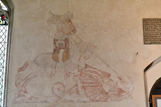
St Andrew's Church, Sapiston

St Andrew's Church is a redundant Anglican church in the village of Sapiston, Suffolk, England. It is recorded in the National Heritage List for England...

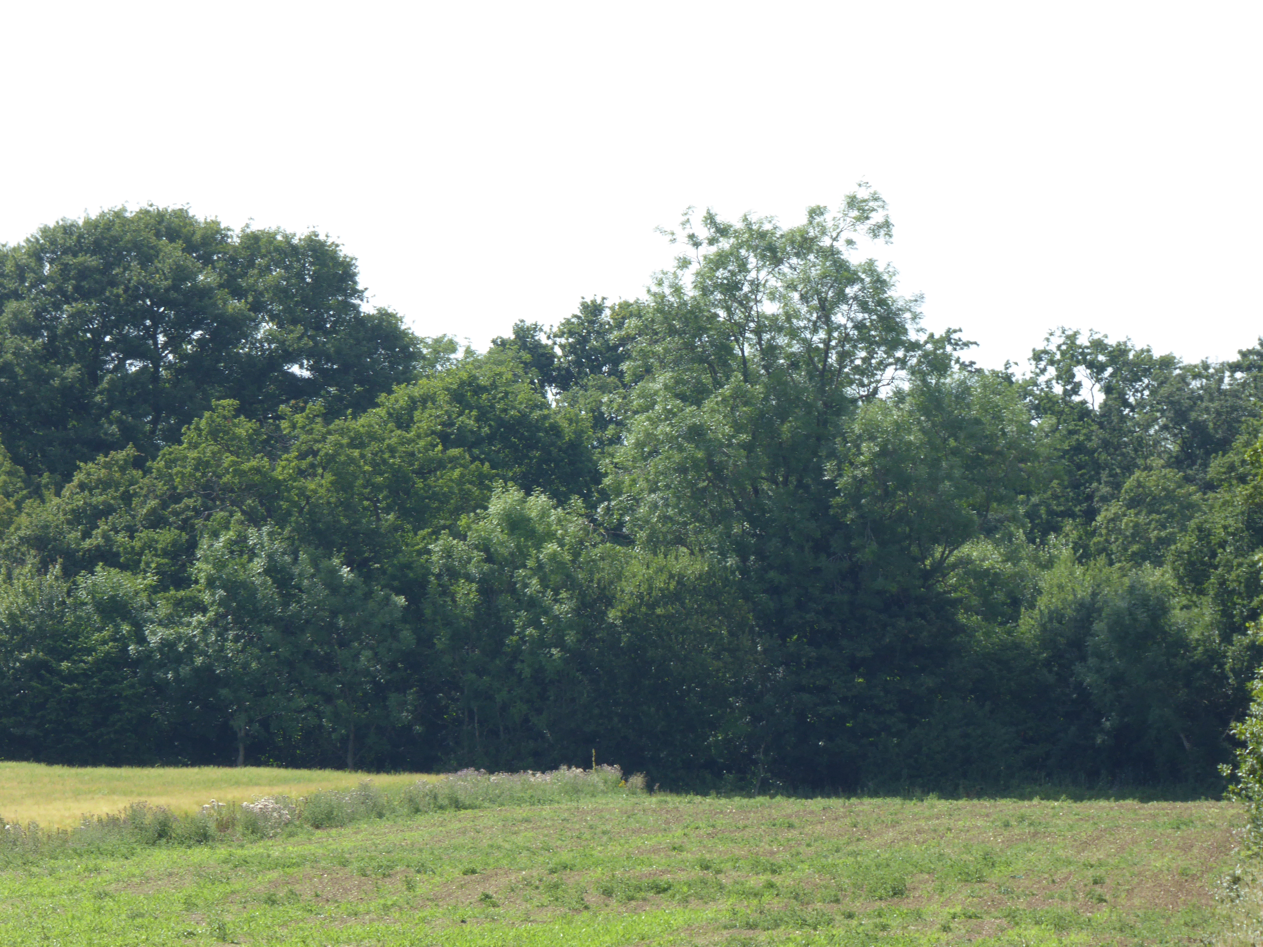
Bangrove Wood, Ixworth

Bangrove Wood is an 18.6-hectare (46-acre) biological Site of Special Scientific Interest north of Ixworth in Suffolk, England.This is ancient coppice...
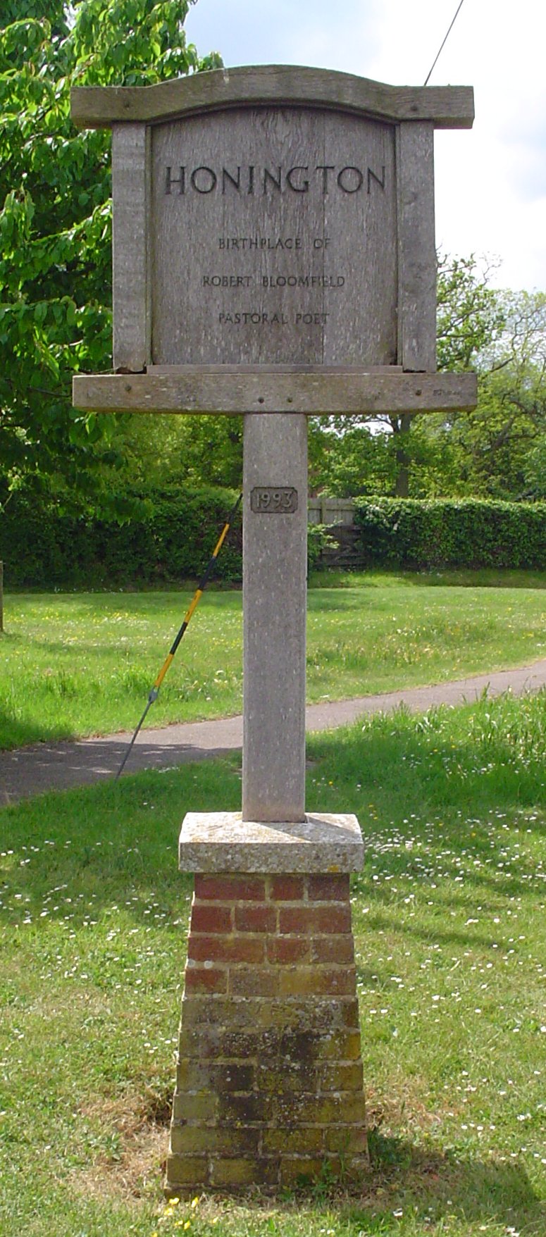
Honington, Suffolk

Honington is a village and civil parish located in Bardwell Ward and Pakenham and Troston Wards of West Suffolk District Council, Suffolk in eastern England...

Nearby Amenities

Located within 500m of 52.321114,0.80919364
Ixworth Thorpe
Place: village
Wikidata: Q2651695
Lat/Long: 52.3213594/0.8107106
Bus Stop
Royal Oak
Naptan AtcoCode: 390050610
Naptan Bearing: N
Naptan CommonName: Royal Oak
Naptan Indicator: o/s
Naptan Landmark: Royal Oak
Naptan NaptanCode: sufgjdpa
Naptan Street: Thetford Road
Naptan Verified: no
Source: naptan_import
Lat/Long: 52.3220172/0.8090656
Royal Oak
Naptan AtcoCode: 390050611
Naptan Bearing: S
Naptan BusStopType: CUS
Naptan CommonName: Royal Oak
Naptan Indicator: opp
Naptan Landmark: Royal Oak
Naptan NaptanCode: sufgjdpd
Naptan Street: Thetford Road
Naptan Verified: no
Source: naptan_import
Lat/Long: 52.3220579/0.8092443
Post Box
Collection Times: Mo-Fr 17:00; Sa 08:45
Operator: Royal Mail
Post Box Mounting: pier
Post Box Type: lamp
Ref: IP31 2014
Ref GB Uprn: 10015435738
Royal Cypher: EIIR
Royal Cypher Wikidata: Q33102113
Lat/Long: 52.3210862/0.8091689
Defibrillator
Access: yes
Booth: K6
Colour: red
Covered: booth
Defibrillator Location: Inside old red telephone box in layby off A1088 at Ixworth Thorpe.
Disused Amenity: telephone
Emergency: defibrillator
Man Made: telephone_box
Note: No phone inside as of 2017-07
Old Phone: +44 1359 269369
Ref: CHT-9427
Lat/Long: 52.3211154/0.8091359
Ixworth Thrope
Man Made: village_sign
Lat/Long: 52.3210213/0.8095257
Bench
Lat/Long: 52.3210339/0.8094127
Grit Bin
Lat/Long: 52.3210508/0.8091983
Waste Basket
Lat/Long: 52.3210355/0.8093644
Manor Farm
Place: farm
Lat/Long: 52.3188402/0.8122451
Give Way
Lat/Long: 52.3207452/0.8097763
Give Way
Lat/Long: 52.321965/0.8091527
Colour: red and white
Description: This is not a tall NTS/LTS marker, but a much shorter one. These are often seen paired with black pedestal markers, though I don't see one here.
Marker: aerial
Utility: gas
Lat/Long: 52.31757/0.8121931
The data included in this document is from www.openstreetmap.org. The data is made available under ODbL.

Have you been to Ixworth Thorpe?

Leave your review of Ixworth Thorpe below (or comments, questions and feedback).