Blirt Hill

Hill, Mountain in Westmorland Eden

England

Blirt Hill

'Sandbed'
'Sandbed' Credit: Roger Cornfoot

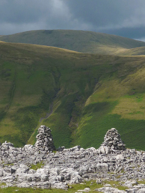
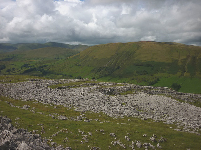
Blirt Hill is a prominent hill located in the county of Westmorland, in the northwest region of England. It forms part of the larger Pennine range, a well-known mountainous area in the country. Rising to an elevation of approximately 500 meters (1,640 feet), Blirt Hill offers stunning panoramic views of the surrounding countryside.

Situated in the Yorkshire Dales National Park, Blirt Hill is characterized by its rugged and rocky terrain, covered with heather and grasses. The hill is a popular destination for hikers and nature enthusiasts, who are drawn to its natural beauty and the tranquility it offers. The area is home to various species of wildlife, including birds, rabbits, and deer.

Blirt Hill also holds historical significance, as it is believed to have been used by settlers during the Iron Age. Remnants of ancient settlements and burial mounds have been discovered in the vicinity, adding to the hill's allure for history buffs.

Access to Blirt Hill is available via well-maintained footpaths that wind their way through the surrounding valleys and moorlands. Visitors can choose from a range of trails, catering to different fitness levels and preferences. The hill is also a popular spot for paragliding enthusiasts, who take advantage of the favorable wind conditions and the breathtaking views from the summit.

Overall, Blirt Hill is a captivating natural feature in Westmorland, offering a combination of scenic beauty, recreational opportunities, and a glimpse into the region's rich history.

If you have any feedback on the listing, please let us know in the comments section below.
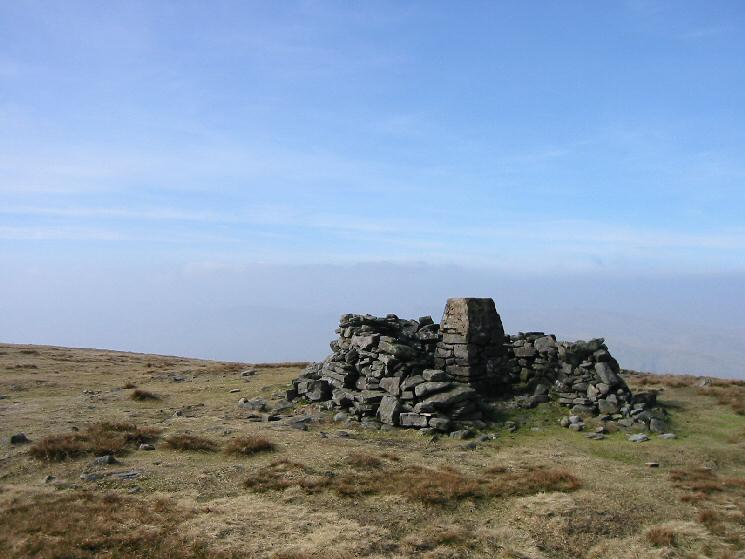
Blirt Hill Images

Images are sourced within 2km of 54.405788/-2.4228303 or Grid Reference NY7201. Thanks to Geograph Open Source API. All images are credited.

'Sandbed'
'Sandbed'
Converted Wesleyan Chapel
Wesleyan Chapel Conversion
Twin cairns, Fell End Clouds The shattered limestone of the Clouds contrasts sharply with the grassy flanks of the Howgill Fells beyond. Since 2016 everything in this area has been incorporated into the Yorkshire Dales National Park.
Twin cairns, Fell End Clouds
The shattered limestone of the Clouds contrasts sharply with the grassy flanks of the Howgill Fells beyond. Since 2016 everything in this area has been incorporated into the Yorkshire Dales National Park.
Barn below Harter Fell The steep flank of the fell is scored by the Five Gills.
Barn below Harter Fell
The steep flank of the fell is scored by the Five Gills.
Limestone pavements, Fell End Clouds The Clouds contain areas of pavement that contrast greatly with the smooth, grassy slopes of the adjacent Howgill Fells.
Limestone pavements, Fell End Clouds
The Clouds contain areas of pavement that contrast greatly with the smooth, grassy slopes of the adjacent Howgill Fells.
Old Milestone by the A683, Low Dovengill, Ravenstonedale parish Carved stone post by the A683, in parish of Ravenstonedale (Eden District), Low Dovengill, 150m Northeast of Methodist Chapel, on the verge, on West side of road. Sedbergh Kirkby stone, erected by the Sedbergh turnpike trust in the 18th century. 

Inscription reads:-
: KY STEPHEN / 7 / MILES : : SEDBERGH / 7 / MILES :

Grade II listed.  
List Entry Number: 1248962 <span class="nowrap"><a title="https://historicengland.org.uk/listing/the-list/list-entry/1248962" rel="nofollow ugc noopener" href="https://historicengland.org.uk/listing/the-list/list-entry/1248962">Link</a><img style="margin-left:2px;" alt="External link" title="External link - shift click to open in new window" src="https://s1.geograph.org.uk/img/external.png" width="10" height="10"/></span>

Milestone Society National ID: WE_SBKS07
Old Milestone by the A683, Low Dovengill, Ravenstonedale parish
Carved stone post by the A683, in parish of Ravenstonedale (Eden District), Low Dovengill, 150m Northeast of Methodist Chapel, on the verge, on West side of road. Sedbergh Kirkby stone, erected by the Sedbergh turnpike trust in the 18th century. Inscription reads:- : KY STEPHEN / 7 / MILES : : SEDBERGH / 7 / MILES : Grade II listed. List Entry Number: 1248962 LinkExternal link Milestone Society National ID: WE_SBKS07
Holiday Cottage at Sandbed
Converted Wesleyan Chapel
Great Scar limestone
Cairn on Fell End Clouds
A683 at Sandbed
A683 at Sandbed
Lime kiln 1 There are two lime kilns situated above the road and below Fell End Clouds. This is the left hand one as seen from below.
Lime kiln 1
There are two lime kilns situated above the road and below Fell End Clouds. This is the left hand one as seen from below.
Lime kiln 2 This kiln is at a similar level and around 100m to the right of lime kiln 1. Neither appear to have a quarry nearby, unless hidden in a fold of the fellside, but there was probably enough loose limestone available for burning nearby. Being close to a road, there would be transport away to 'sweeten' the ground across the valley on the acid soils of the Howgills.
Lime kiln 2
This kiln is at a similar level and around 100m to the right of lime kiln 1. Neither appear to have a quarry nearby, unless hidden in a fold of the fellside, but there was probably enough loose limestone available for burning nearby. Being close to a road, there would be transport away to 'sweeten' the ground across the valley on the acid soils of the Howgills.
Converted Wesleyan Chapel beside the A683
Rocks under snow Above Fell End Clouds.
Rocks under snow
Above Fell End Clouds.
The Fat Lamb
The Fat Lamb
Gated entry to property at Ellergill Ellergill is a farm lying to the west of the A683. The wall with its gateway lies beyond a small area of moorland which is classified as access land under the year 2000 CROW Act.
Gated entry to property at Ellergill
Ellergill is a farm lying to the west of the A683. The wall with its gateway lies beyond a small area of moorland which is classified as access land under the year 2000 CROW Act.
Show me another place!

Blirt Hill is located at Grid Ref: NY7201 (Lat: 54.405788, Lng: -2.4228303)

Administrative County: Cumbria

District: Eden

Police Authority: Cumbria

What 3 Words

///blunders.crab.shutting. Near Kirkby Stephen, Cumbria

Nearby Locations

Blirt Hill

Related Wikis

Ravenstonedale

Ravenstonedale is a village and large civil parish in Cumbria, on the watershed between the River Lune and River Eden. The village lies 4 miles (6 km)...

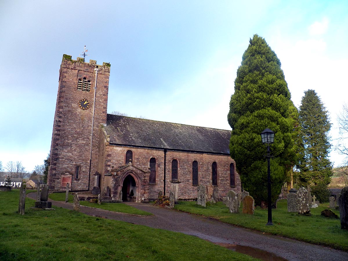
St Oswald's Church, Ravenstonedale

St Oswald's Church is in the village of Ravenstonedale, Cumbria, England. It is an active Anglican parish church in the deanery of Appleby, the archdeaconry...

Ravenstonedale Priory

Ravenstonedale Priory was a Gilbertine priory in Cumbria, England. It was founded in the reign of Henry II, when Torphin, son of Robert, son of Copsus...

Wild Boar Fell

Wild Boar Fell is a mountain in the Yorkshire Dales National Park, on the eastern edge of Cumbria, England. At 2,323 feet (708 m), it is either the 4th...

Randygill Top

Randygill Top is a mountain located in the Howgill Fells, Cumbria (historically Westmorland), England. == References ==

Weasdale

Weasdale is a small hamlet in Cumbria, England, 850 feet (260 m) above sea-level on the northern flanks of the Howgill Fells. It is located approximately...

Newbiggin-on-Lune

Newbiggin-on-Lune is a village in the Eden district of Cumbria, England. Historically in Westmorland it is about 4 miles (6.4 km) south west of Kirkby...

Brownber

Brownber is a hamlet surrounding Brownber Hall near Newbiggin-on-Lune in Cumbria, England.

Nearby Amenities

Located within 500m of 54.405788,-2.4228303
Blirt Hill
Place: locality
Lat/Long: 54.4066559/-2.4220981
High Stoups
Place: locality
Lat/Long: 54.4047477/-2.4234441
The data included in this document is from www.openstreetmap.org. The data is made available under ODbL.

Have you been to Blirt Hill?

Leave your review of Blirt Hill below (or comments, questions and feedback).