Ayle Common

Hill, Mountain in Northumberland

England

Ayle Common

Ayle Common A view over the South Tyne Valley from Ayle Common looking back on a section of Isaac's Tea Trail going back to Alston from near Kirkhaugh. Open air revivalist camp meetings were held by the Primitive Methodists at this place.
Ayle Common Credit: Roger Morris

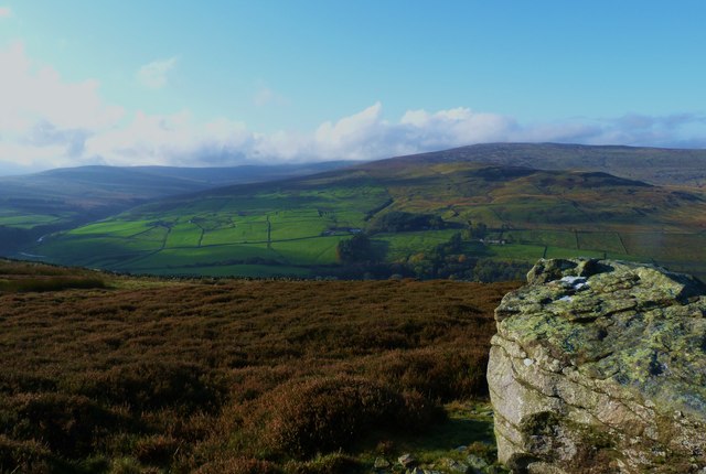
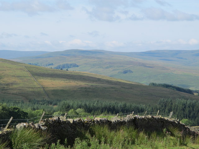
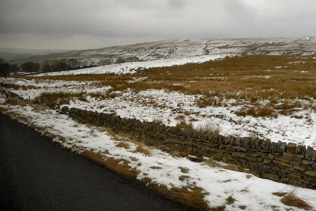
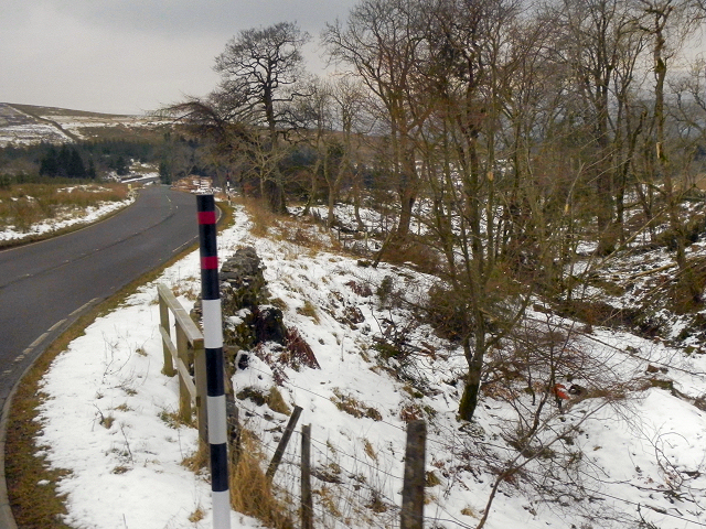
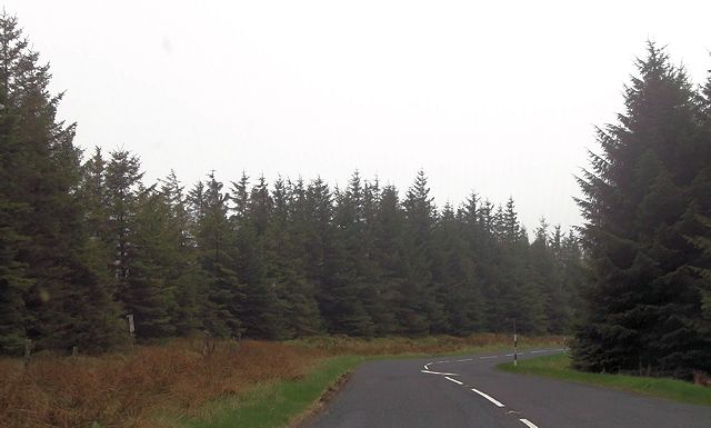
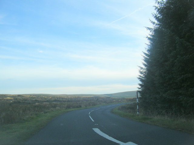
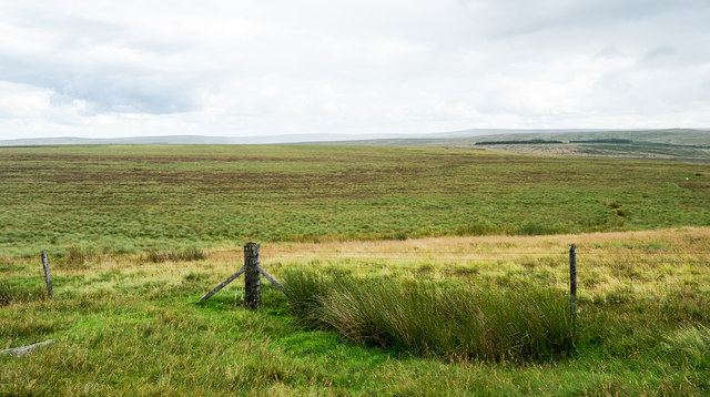
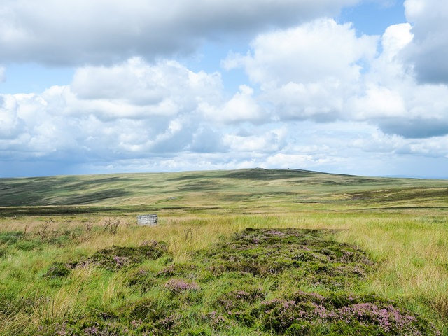
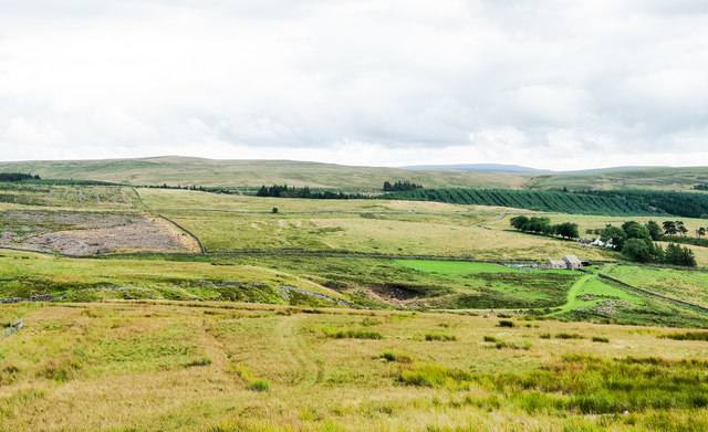
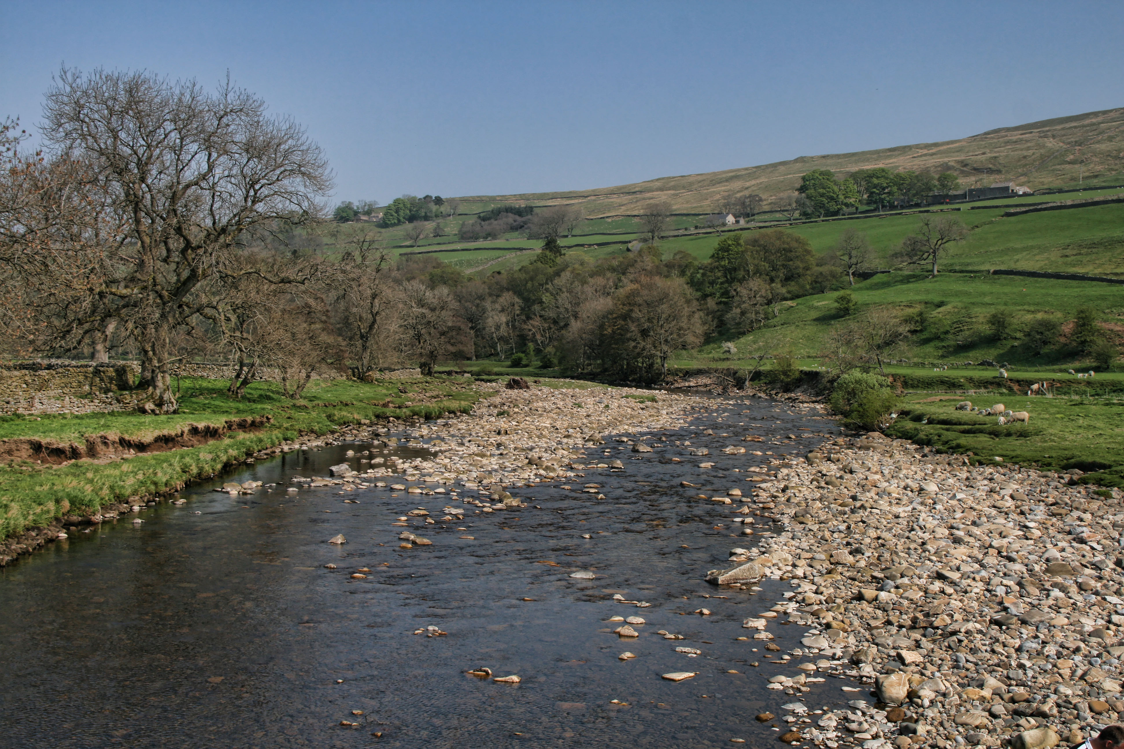
Ayle Common is a prominent hill located in Northumberland, England. It stands at an elevation of 285 meters (935 feet) above sea level and is positioned near the small village of Ayle. The hill is known for its stunning natural beauty and offers panoramic views of the surrounding countryside.

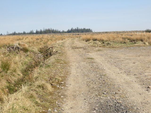
Ayle Common is covered in lush green vegetation, with a variety of plant species thriving in its fertile soil. The hill is predominantly composed of sandstone, giving it a distinctive reddish hue. This geological feature adds to the charm of the landscape, making it a popular destination for nature enthusiasts and hikers.

The hill provides ample opportunities for outdoor activities such as walking, climbing, and birdwatching. Its elevated position makes it an ideal spot for birdwatchers to observe a diverse range of avian species, including raptors and woodland birds. Additionally, the surrounding area is home to several walking trails that lead visitors through picturesque woodlands and open meadows.

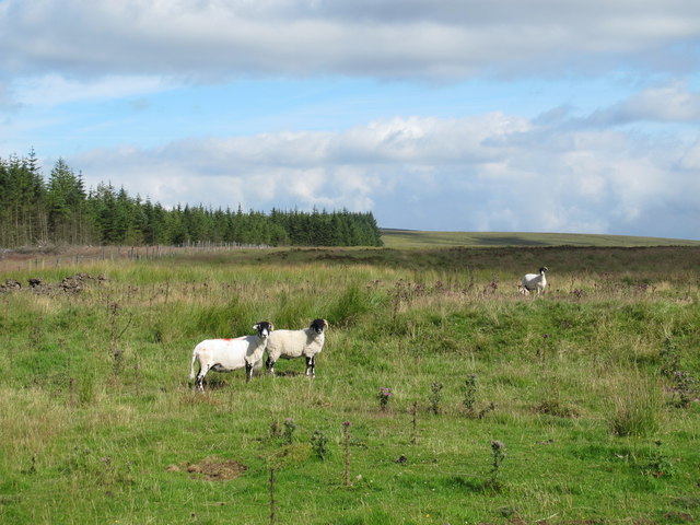
Ayle Common is also home to a rich variety of wildlife, including deer, rabbits, and various species of birds. The hill serves as an important habitat for these animals, providing a safe haven for them to thrive.

Overall, Ayle Common offers a peaceful and idyllic setting for visitors to immerse themselves in nature. Its stunning views, diverse flora and fauna, and recreational opportunities make it a must-visit destination for those seeking a tranquil escape in the heart of Northumberland.

If you have any feedback on the listing, please let us know in the comments section below.

Ayle Common Images

Images are sourced within 2km of 54.852978/-2.4310484 or Grid Reference NY7250. Thanks to Geograph Open Source API. All images are credited.

Ayle Common A view over the South Tyne Valley from Ayle Common looking back on a section of Isaac's Tea Trail going back to Alston from near Kirkhaugh. Open air revivalist camp meetings were held by the Primitive Methodists at this place.
Ayle Common
A view over the South Tyne Valley from Ayle Common looking back on a section of Isaac's Tea Trail going back to Alston from near Kirkhaugh. Open air revivalist camp meetings were held by the Primitive Methodists at this place.
Long Cross
Long Cross
View across Clargillhead
Ayle Common Looking to the west from the A686 over Alston Moor.
Ayle Common
Looking to the west from the A686 over Alston Moor.
A686, Alston Moor
A686, Alston Moor
A686 through the plantation near Moscow
A686 nears county boundary
A686 bend, north-east of Moscow
Track used by the Isaac's Tea Trail walk near Clargillhead Looking north-eastward.
Track used by the Isaac's Tea Trail walk near Clargillhead
Looking north-eastward.
Road (A686) leaving Cumbria and entering Northumberland Looking north-eastward.
Road (A686) leaving Cumbria and entering Northumberland
Looking north-eastward.
Wall crossing moorland on Ayle Common Ayle Common is another of those upland areas only vaguely defined by names printed on OS maps. The location here lies to the south-west of the minor rise of Kip Law where the vegetation is largely grassy moorland but with areas of heather, currently at its peak of flowering.
In the distance is the moorland hill, Grey Nag; it lies beyond the valley of the River South Tyne.
Wall crossing moorland on Ayle Common
Ayle Common is another of those upland areas only vaguely defined by names printed on OS maps. The location here lies to the south-west of the minor rise of Kip Law where the vegetation is largely grassy moorland but with areas of heather, currently at its peak of flowering. In the distance is the moorland hill, Grey Nag; it lies beyond the valley of the River South Tyne.
Willyshaw Rigg Willyshaw Rigg is an area of flat, desolate moorland lying to the west of the A686. The road lies out of view in front of the dark bands towards the right side of the image which are the remains of plantations on the east side of the road.
Willyshaw Rigg
Willyshaw Rigg is an area of flat, desolate moorland lying to the west of the A686. The road lies out of view in front of the dark bands towards the right side of the image which are the remains of plantations on the east side of the road.
Hill track rising on Ayle Common The image was recorded from a gate at which OS maps show the hill road / track ending but it clearly continues, rising to the high point ahead, Kip Law. The number 2, painted crudely on the wall indicates a gun stance when a grouse-shoot is taking place.
Hill track rising on Ayle Common
The image was recorded from a gate at which OS maps show the hill road / track ending but it clearly continues, rising to the high point ahead, Kip Law. The number 2, painted crudely on the wall indicates a gun stance when a grouse-shoot is taking place.
Moorland of Ayle Common Ayle Common is one  of those upland areas only vaguely defined by names printed on OS maps. The location here lies between the more certain features of Kip Law and Tarn Rigg. The vegetation is largely grassy moorland but with areas of heather, (currently at its peak of flowering), and rushes.
The valley of the River South Tyne lies beyond with Cold Fell being the highest hill in that direction.
Moorland of Ayle Common
Ayle Common is one of those upland areas only vaguely defined by names printed on OS maps. The location here lies between the more certain features of Kip Law and Tarn Rigg. The vegetation is largely grassy moorland but with areas of heather, (currently at its peak of flowering), and rushes. The valley of the River South Tyne lies beyond with Cold Fell being the highest hill in that direction.
Moorland slope descending towards valley of Ayle Burn The slope descends from a local high point at 524 m. named as Tarn Rigg. The Ayle Burn flows out of view below the sunlit trees at the centre of the image.
Moorland slope descending towards valley of Ayle Burn
The slope descends from a local high point at 524 m. named as Tarn Rigg. The Ayle Burn flows out of view below the sunlit trees at the centre of the image.
Moorland with grouse butt Moorland, largely grassy but with rushes and heather, on the north side of the minor upland feature, Tarn Rigg which appears to be part of Ayle Common. The grouse butt is one of a line.
The distant moorland hill is Whitfield Law.
Moorland with grouse butt
Moorland, largely grassy but with rushes and heather, on the north side of the minor upland feature, Tarn Rigg which appears to be part of Ayle Common. The grouse butt is one of a line. The distant moorland hill is Whitfield Law.
Moorland slope descending towards Ayle Burn The groove of the Ayle Burn is immediately below the foreground apron of moorland. Beyond the nearer moorland there's some rough grazing around the buildings in view which are barns and also the farm of Moscow, among the trees.
Moorland slope descending towards Ayle Burn
The groove of the Ayle Burn is immediately below the foreground apron of moorland. Beyond the nearer moorland there's some rough grazing around the buildings in view which are barns and also the farm of Moscow, among the trees.
Cairn atop wall at Kip Law Unusually, the cairn marking the summit of the moorland hill, Kip Law is perched on top of the junction of dry stone walls meeting there.
Grey Nag is the hill in the distance.
Cairn atop wall at Kip Law
Unusually, the cairn marking the summit of the moorland hill, Kip Law is perched on top of the junction of dry stone walls meeting there. Grey Nag is the hill in the distance.
Show me another place!

Ayle Common is located at Grid Ref: NY7250 (Lat: 54.852978, Lng: -2.4310484)

Unitary Authority: Northumberland

Police Authority: Northumbria

What 3 Words

///testers.committee.vanish. Near Alston, Cumbria

Related Wikis

Ayle

Ayle is a village in Northumberland, England, situated to the north of Alston. There are six residences in the hamlet. == Governance == Ayle is in the...
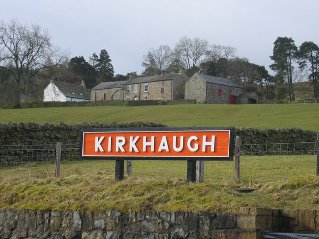
Kirkhaugh

Kirkhaugh is a very small village and former civil parish, now in the parish of Knaresdale with Kirkhaugh, adjacent to the River South Tyne in Northumberland...

South Tynedale Railway

The South Tynedale Railway is a preserved, 2 ft (610 mm) narrow gauge heritage railway in Northern England and at 875ft is England's second highest narrow...

Kirkhaugh railway station

Kirkhaugh is a railway station on the South Tynedale Railway, which runs between Slaggyford and Alston. The station serves the hamlet of Kirkhaugh in Northumberland...

Nearby Amenities

Located within 500m of 54.852978,-2.4310484
Tarn Rigg
Natural: peak
Lat/Long: 54.8529733/-2.4322857
The data included in this document is from www.openstreetmap.org. The data is made available under ODbL.

Have you been to Ayle Common?

Leave your review of Ayle Common below (or comments, questions and feedback).