Hasgill Fell

Hill, Mountain in Yorkshire Ribble Valley

England

Hasgill Fell

Moorland road north of Bowland Knotts On the horizon are the 'Three Peaks' of Yorkshire.
Moorland road north of Bowland Knotts Credit: John H Darch

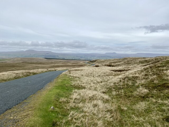
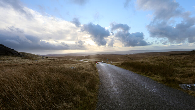
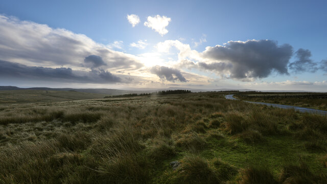
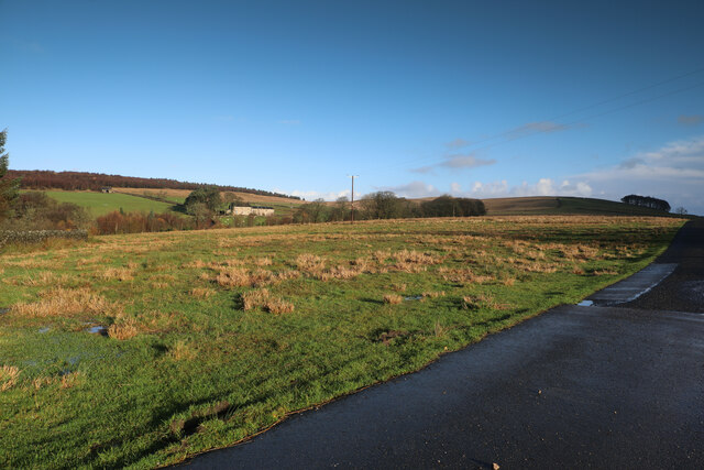
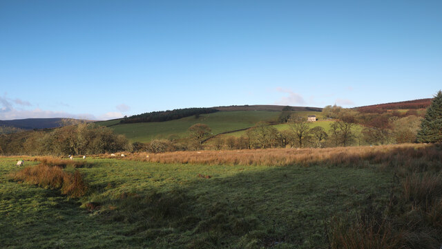
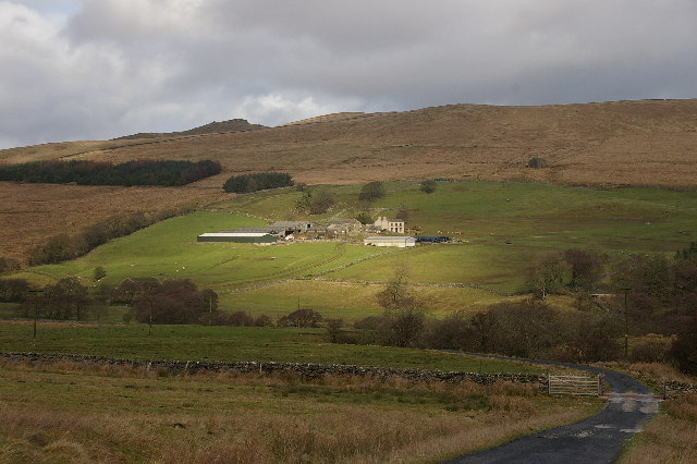
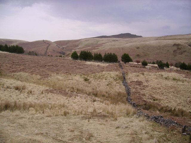
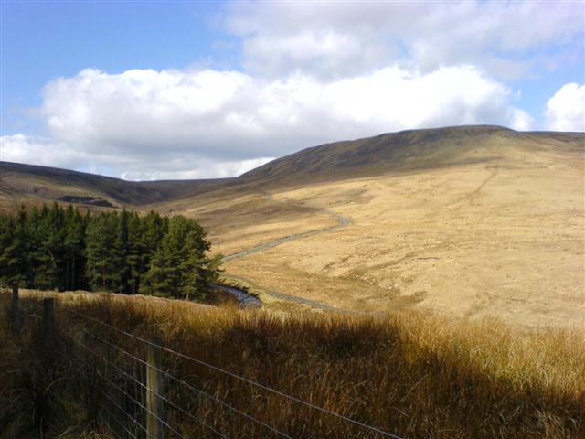
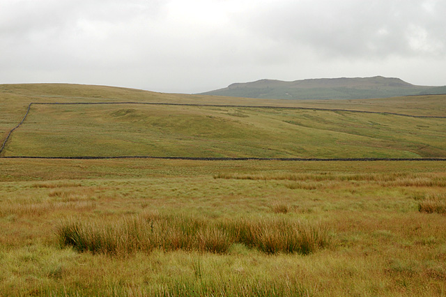
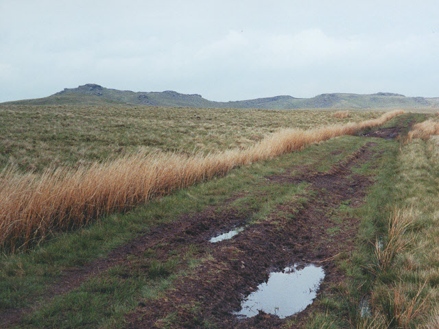
Hasgill Fell is a picturesque hill located in the county of Yorkshire, England. It forms part of the Yorkshire Dales National Park, renowned for its stunning landscapes and rugged terrain. Rising to an elevation of approximately 600 meters (1,969 feet), Hasgill Fell offers breathtaking panoramic views of the surrounding countryside.

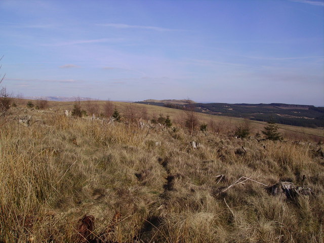
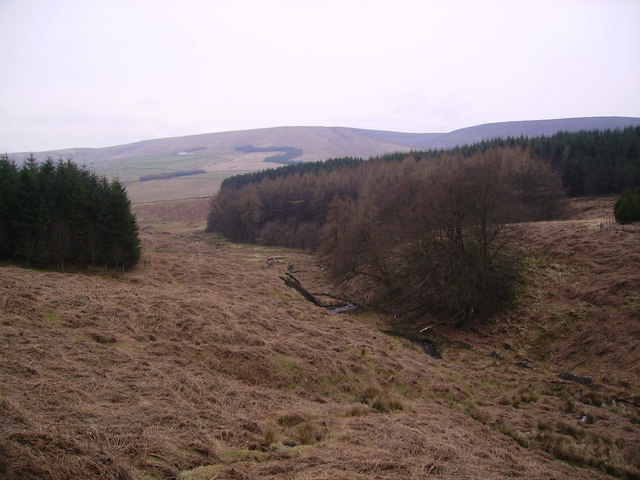
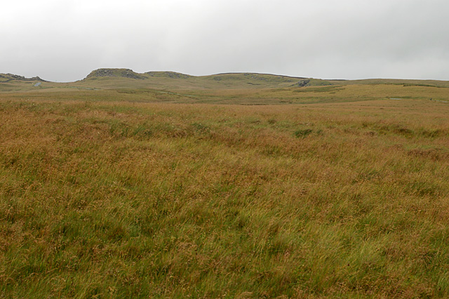
Covered in lush green vegetation, the hill is characterized by its gentle slopes and rocky outcrops. It is home to a variety of plant species, including heather, bracken, and grasses, providing a vibrant and diverse habitat for wildlife. The area is known for its birdlife, with species such as curlews, lapwings, and red grouse frequently spotted in the vicinity.

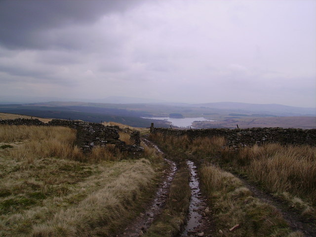
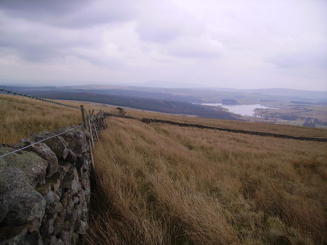
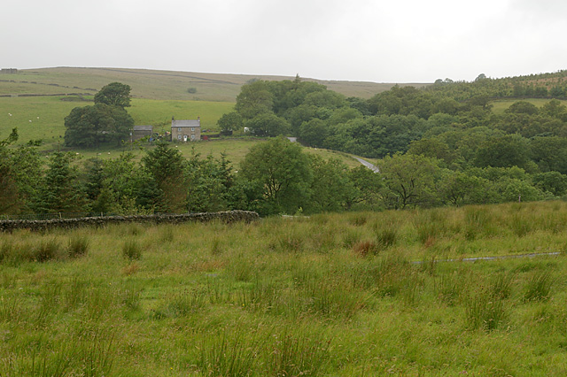
Hasgill Fell is a popular destination for outdoor enthusiasts, offering numerous walking and hiking trails that cater to all abilities. The paths wind through the hill's verdant landscape, providing visitors with the opportunity to explore the natural beauty of the area. The summit of Hasgill Fell provides a particularly rewarding experience, with breathtaking views stretching across the rolling hills and valleys.

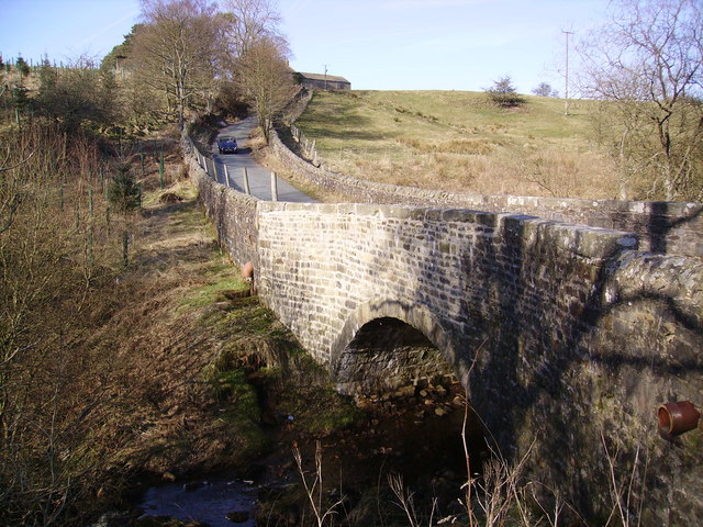
The hill is easily accessible, with nearby parking facilities and public transportation options available. It is an ideal location for those seeking tranquility and solitude, away from the bustling crowds. Hasgill Fell offers a serene and peaceful escape, allowing visitors to connect with nature and experience the beauty of the Yorkshire countryside.

If you have any feedback on the listing, please let us know in the comments section below.
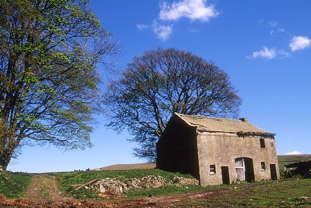
Hasgill Fell Images

Images are sourced within 2km of 54.033828/-2.4250756 or Grid Reference SD7259. Thanks to Geograph Open Source API. All images are credited.

Moorland road north of Bowland Knotts On the horizon are the 'Three Peaks' of Yorkshire.
Moorland road north of Bowland Knotts
On the horizon are the 'Three Peaks' of Yorkshire.
Keasden road heads down Crutchenber Fell Despite rain overngight and an unpromising sky in the morning, the weather is clearing up enough for a good day out in Gisburn Forest. The Keasden road crosses the watershed at Bowland Knotts and heads south for the forest and Stocks reservoir en route for Slaidburn. This used to be a very quiet road when last I passed this way (probably thirty years ago) but now carries a lot of people to the extensive carparks, paths and bike trails provided by the forestry and water companies.
Keasden road heads down Crutchenber Fell
Despite rain overngight and an unpromising sky in the morning, the weather is clearing up enough for a good day out in Gisburn Forest. The Keasden road crosses the watershed at Bowland Knotts and heads south for the forest and Stocks reservoir en route for Slaidburn. This used to be a very quiet road when last I passed this way (probably thirty years ago) but now carries a lot of people to the extensive carparks, paths and bike trails provided by the forestry and water companies.
The northern marches of Gisburn Forest The most recently planted part of Gisburn Forest is also the most northerly and forms an isolated outpost not visited by the main mountain bike trails. The Keasden road descends to it over Crutchenber Fell, passing through it to reach the more mature and popular sections around Stocks reservoir.
The northern marches of Gisburn Forest
The most recently planted part of Gisburn Forest is also the most northerly and forms an isolated outpost not visited by the main mountain bike trails. The Keasden road descends to it over Crutchenber Fell, passing through it to reach the more mature and popular sections around Stocks reservoir.
Looking over Coat Rakes to Dale House Dale House is just by the road north from Gisburn Forest towards Clapham in the Yorkshire Dales. The track here goes to Halsteads Farm, whilst a rougher track to the right goes to Cocklick End, not a place to mention in social media posts, as an AI is likely to take exception...
Looking over Coat Rakes to Dale House
Dale House is just by the road north from Gisburn Forest towards Clapham in the Yorkshire Dales. The track here goes to Halsteads Farm, whilst a rougher track to the right goes to Cocklick End, not a place to mention in social media posts, as an AI is likely to take exception...
Higher Clough On the west side of the Keasden road, land rises to Green Pike above Higher Clough (the farmhouse in the sun). The moor on the far horizon is CROW Access Land, but most of what is visible in this view has no public access.
Higher Clough
On the west side of the Keasden road, land rises to Green Pike above Higher Clough (the farmhouse in the sun). The moor on the far horizon is CROW Access Land, but most of what is visible in this view has no public access.
Catlow Farm Forest of Bowland Taken from the farm road leading to Catlow Farm, looking in a NE direction
Catlow Farm Forest of Bowland
Taken from the farm road leading to Catlow Farm, looking in a NE direction
Crutchenber Fell Looking towards Gisburn Forest
Crutchenber Fell
Looking towards Gisburn Forest
Coat Rakes Bridge On Hasgill Beck
Coat Rakes Bridge
On Hasgill Beck
Catlow Plantation Just above the original plantation. Looking towards Knot Clough and Bowland Knotts
Catlow Plantation
Just above the original plantation. Looking towards Knot Clough and Bowland Knotts
Catlow Plantation From Hasgill Fell. The small beck is called Kearsden Holes
Catlow Plantation
From Hasgill Fell. The small beck is called Kearsden Holes
Track and ruin, The Height Looking towards Stocks Reservoir.
Track and ruin, The Height
Looking towards Stocks Reservoir.
Walls Just in the north edge of the square looking down towards Stock Reservoir
Walls
Just in the north edge of the square looking down towards Stock Reservoir
Slaidburn Road Taken on the road from Slaidburn to High Bentham
Slaidburn Road
Taken on the road from Slaidburn to High Bentham
Higher Clough Farm
Higher Clough Farm
Birch Clough Rigg With Whelp Stone Crag on the horizon
Birch Clough Rigg
With Whelp Stone Crag on the horizon
Crutchenber Fell Knotteranum on the horizon
Crutchenber Fell
Knotteranum on the horizon
Track towards Bowland Knotts A footpath across the peaty moorland.
Track towards Bowland Knotts
A footpath across the peaty moorland.
Ruined barn at New House
Show me another place!

Hasgill Fell is located at Grid Ref: SD7259 (Lat: 54.033828, Lng: -2.4250756)

Division: West Riding

Administrative County: Lancashire

District: Ribble Valley

Police Authority: Lancashire

What 3 Words

///went.country.gullible. Near Settle, North Yorkshire

Nearby Locations

Hasgill Fell Swire Clough

Related Wikis

Easington, Lancashire

Easington () is a civil parish within the Ribble Valley district of Lancashire, England, with a population in 2001 of 52. The Census 2011 population details...

Stocks Reservoir

Stocks Reservoir is a reservoir situated at the head of the Hodder valley in the Forest of Bowland, Lancashire, England (historically in the West Riding...

White Hill (Forest of Bowland)

White Hill is a hill in the Forest of Bowland, north-western England. It lies between Slaidburn and High Bentham. The summit houses a tower and a trig...

Tosside

Tosside is a small village on the modern border of North Yorkshire and Lancashire in Northern England. It lies within the Forest of Bowland, and is between...

Nearby Amenities

Located within 500m of 54.033828,-2.4250756
Man Made: survey_point
Lat/Long: 54.0380056/-2.4257933
Bowland Knotts
Natural: peak
Lat/Long: 54.0379755/-2.4257778
The data included in this document is from www.openstreetmap.org. The data is made available under ODbL.

Have you been to Hasgill Fell?

Leave your review of Hasgill Fell below (or comments, questions and feedback).