Todlea Hill

Hill, Mountain in Berwickshire

Scotland

Todlea Hill

Looking across the confluence  Of Dye Water and Whiteadder towards Owl Wood.
Looking across the confluence Credit: Russel Wills

Todlea Hill is a prominent landmark located in Berwickshire, a historic county in the Scottish Borders region of Scotland. Standing at an elevation of approximately 330 meters (1,080 feet), it is classified as a hill rather than a mountain.

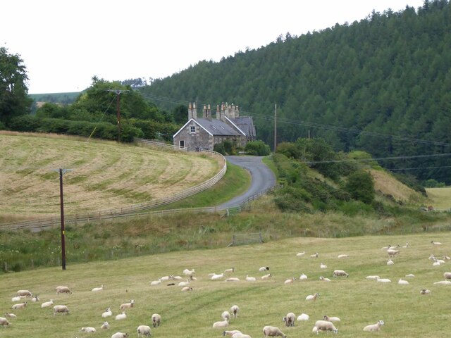
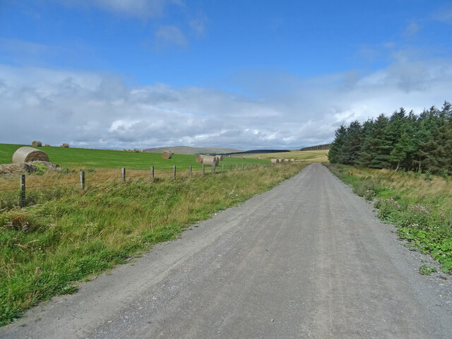
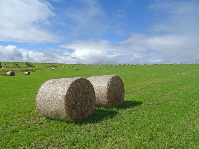
Situated near the village of Longformacus, Todlea Hill offers breathtaking panoramic views of the surrounding countryside. It is part of a larger hilly region known for its stunning natural beauty and is a popular destination for outdoor enthusiasts and nature lovers alike.

The hill is characterized by its gently sloping terrain and is covered in a mixture of grasses and heather. It is home to a diverse range of flora and fauna, including various bird species and small mammals.

Todlea Hill provides ample opportunities for outdoor activities such as hiking, walking, and birdwatching. There are several well-marked trails that lead to the summit, allowing visitors to explore and appreciate the scenic landscape. The climb to the top is relatively easy, making it suitable for individuals of all fitness levels.

The hill is also steeped in history and folklore, with tales of ancient settlements and mythical creatures associated with the area. It is said to have been a site of importance during the Iron Age, and remnants of ancient fortifications can still be found on its slopes.

Overall, Todlea Hill offers visitors a chance to immerse themselves in the natural beauty and rich history of Berwickshire, making it a must-visit destination for those seeking an authentic Scottish experience.

If you have any feedback on the listing, please let us know in the comments section below.

Todlea Hill Images

Images are sourced within 2km of 55.838879/-2.447198 or Grid Reference NT7260. Thanks to Geograph Open Source API. All images are credited.

Looking across the confluence  Of Dye Water and Whiteadder towards Owl Wood.
Looking across the confluence
Of Dye Water and Whiteadder towards Owl Wood.
Rosebay Willowherb and Meadowsweet Beside the Whiteadder Water.
Rosebay Willowherb and Meadowsweet
Beside the Whiteadder Water.
Ellemhaugh Beside Whiteadder Water.
Ellemhaugh
Beside Whiteadder Water.
Telephone box, bus shelter, road sign and info board, Ellemford There is also a road junction here, with the sign pointing to the villages of Whitchester and Longformaus.
Telephone box, bus shelter, road sign and info board, Ellemford
There is also a road junction here, with the sign pointing to the villages of Whitchester and Longformaus.
Pastures by the Whiteadder Water Looking southwest from Broombank, to the far bank of the river.
Pastures by the Whiteadder Water
Looking southwest from Broombank, to the far bank of the river.
Broombank A fine house on the B6355 between Cranshaws and Ellemford. Marked on the gb1900 map as Broombank Cottage <span class="nowrap"><a title="https://maps.nls.uk/projects/gb1900/#zoom=17&lat=55.8321&lon=-2.4723&layer=0" rel="nofollow ugc noopener" href="https://maps.nls.uk/projects/gb1900/#zoom=17&lat=55.8321&lon=-2.4723&layer=0">Link</a><img style="margin-left:2px;" alt="External link" title="External link - shift click to open in new window" src="https://s1.geograph.org.uk/img/external.png" width="10" height="10"/></span>.
Broombank
A fine house on the B6355 between Cranshaws and Ellemford. Marked on the gb1900 map as Broombank Cottage LinkExternal link.
Grains Burn at Broombank It's in there somewhere, and joins the Whiteadder Water in just under 1km.
Grains Burn at Broombank
It's in there somewhere, and joins the Whiteadder Water in just under 1km.
Ellemford Viewed from Ellemford Bridge.
Plenty of sheep!
Ellemford
Viewed from Ellemford Bridge. Plenty of sheep!
Ellemford Bridge Over Whiteadder Water.
Ellemford Bridge
Over Whiteadder Water.
Near Fellcleugh
Near Fellcleugh
Ellemford Bridge over Whiteadder Water, Ellemford, Scottish Borders
Whiteadder Water looking upstream from Ellemford Bridge
Weir and pool on Whiteadder Water, Ellemford Bridge
Whiteadder Water downstream from Ellemford Bridge, Ellemford
The B6355 road as it crosses Ellemford Bridge, Scottish Borders
Track, Kirkgate Hill Track between forest and recently harvested field on the east side of Kirkgate Hill.  Hill in the distance is Spartleton.
Track, Kirkgate Hill
Track between forest and recently harvested field on the east side of Kirkgate Hill. Hill in the distance is Spartleton.
Bales, Kirkgate Hill Bales on the south-east side of Kirkgate Hill in the Scottish Borders near Cranshaws. Presumably for animal feed and have been brought here from elsewhere, given that the field does not look like its recently been harvested.
Bales, Kirkgate Hill
Bales on the south-east side of Kirkgate Hill in the Scottish Borders near Cranshaws. Presumably for animal feed and have been brought here from elsewhere, given that the field does not look like its recently been harvested.
Ellemford to Fellcleugh Track On the good track from Ellemford to Fellcleugh near Cranshaws in the Scottish Borders.  Taken at the southwest corner of Ellemford Covert looking to woodland at Moor Law.
Ellemford to Fellcleugh Track
On the good track from Ellemford to Fellcleugh near Cranshaws in the Scottish Borders. Taken at the southwest corner of Ellemford Covert looking to woodland at Moor Law.
Show me another place!

Todlea Hill is located at Grid Ref: NT7260 (Lat: 55.838879, Lng: -2.447198)

Unitary Authority: The Scottish Borders

Police Authority: The Lothians and Scottish Borders

What 3 Words

///finishing.survivor.couriers. Near Duns, Scottish Borders

Nearby Locations

Black Bog Wood Todlea Hill

Related Wikis

Dye Water

The Dye Water (Scottish Gaelic: Uisge DhĂ idh) is a river in the Lammermuir Hills in the Scottish Borders area of Scotland. It rises in the Hope Hills,...

Bothwell Water

The Bothwell Water is a river in the Scottish Borders area of Scotland. It rises in the Lammermuir Hills near Caldercleugh and continues past the Upper...

Cranshaws Castle

Cranshaws Castle or Cranshaws Tower is a privately owned 15th-century pele situated by the village of Cranshaws in Berwickshire, Scotland. The building...

Abbey St Bathans

Abbey St Bathans (Scottish Gaelic: Abaid Bhaoithin) is a parish in the Lammermuir district of Berwickshire, in the eastern part of the Scottish Borders...

Nearby Amenities

Located within 500m of 55.838879,-2.447198
The data included in this document is from www.openstreetmap.org. The data is made available under ODbL.

Have you been to Todlea Hill?

Leave your review of Todlea Hill below (or comments, questions and feedback).