Aye Gill Pike

Hill, Mountain in Yorkshire South Lakeland

England

Aye Gill Pike

Swarthgill Service Station
Swarthgill Service Station Credit: Anthony Parkes

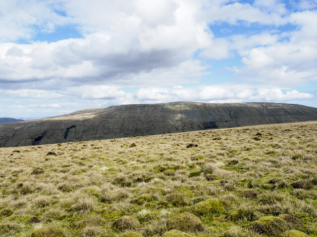
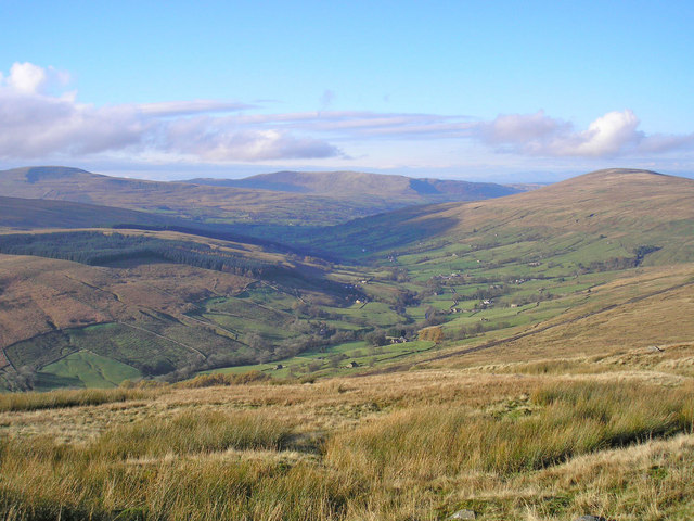
Aye Gill Pike is a prominent hill located in the Yorkshire Dales National Park, in Yorkshire, England. It stands at an elevation of 556 meters (1,824 feet) above sea level, making it one of the notable peaks in the area. Aye Gill Pike is situated in the western part of the national park, near the village of Dent, and offers breathtaking views of the surrounding countryside.

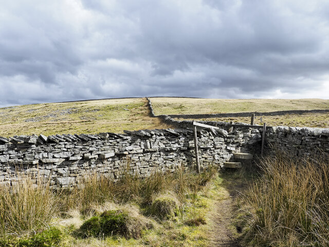
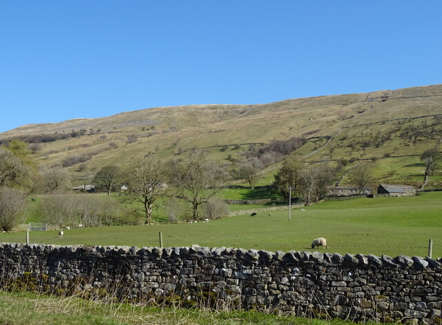
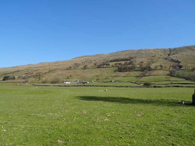
The hill is characterized by its rugged and rocky terrain, covered with heather and grasses. Its slopes are moderately steep, providing an enjoyable challenge for hikers and climbers. A network of footpaths and trails crisscross the area, allowing visitors to explore the hill's diverse flora and fauna.

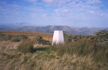
Aye Gill Pike is renowned for its panoramic vistas, which encompass vast stretches of the Yorkshire Dales and the nearby Howgill Fells. On a clear day, one can also catch glimpses of the Lake District mountains in the distance. The summit of Aye Gill Pike offers an ideal spot for photographers and nature enthusiasts to capture stunning images of the surrounding landscape.

The hill is a popular destination for outdoor activities such as hiking, hillwalking, and birdwatching. Visitors can spot a variety of bird species, including peregrine falcons, curlews, and red grouse. The surrounding area also supports a rich diversity of wildlife, including deer, foxes, and various species of small mammals.

Overall, Aye Gill Pike is a captivating natural landmark, attracting both locals and tourists alike who seek to experience the beauty and tranquility of the Yorkshire Dales.

If you have any feedback on the listing, please let us know in the comments section below.

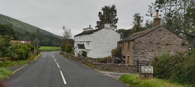
Aye Gill Pike Images

Images are sourced within 2km of 54.292369/-2.430639 or Grid Reference SD7288. Thanks to Geograph Open Source API. All images are credited.

Swarthgill Service Station
Little Winterscales Ford This irish bridge ford on the River Clough is found at Little Winterscales.
Little Winterscales Ford
This irish bridge ford on the River Clough is found at Little Winterscales.
Limekiln in Dentdale See also <a href="https://www.geograph.org.uk/photo/5957533">SD7286 : Disused Lime Kiln </a>. Listed grade II (list entry 1383901) as "A good example of its type, relatively well preserved... Conspicuous feature of the landscape at this point in Dentdale".
Limekiln in Dentdale
See also SD7286 : Disused Lime Kiln . Listed grade II (list entry 1383901) as "A good example of its type, relatively well preserved... Conspicuous feature of the landscape at this point in Dentdale".
Stile with walls beyond The stile and other similar ones allow easy access along the ridge rising to Aye Gill Pike, the highest point along a ridge between Garsdale and Dentdale.
Stile with walls beyond
The stile and other similar ones allow easy access along the ridge rising to Aye Gill Pike, the highest point along a ridge between Garsdale and Dentdale.
Trig point at Aye Gill Pike Aye Gill Pike is the highest point along the hill ridge separating Garsdale and Dentdale. The view is along the ridge, east-south-east. Great Knoutberry Hill is probably the hill cone right of centre on the horizon.
Trig point at Aye Gill Pike
Aye Gill Pike is the highest point along the hill ridge separating Garsdale and Dentdale. The view is along the ridge, east-south-east. Great Knoutberry Hill is probably the hill cone right of centre on the horizon.
Moorland of, or above Copplethwaite The moorland is along the ridge north-west of Aye Gill Pike.
Baugh Fell is the hill beyond.
Moorland of, or above Copplethwaite
The moorland is along the ridge north-west of Aye Gill Pike. Baugh Fell is the hill beyond.
Old Bridge Marker on Church Bridge, River Dee Bridge Marker at the east end of the parapet of Church Bridge, River Dee, on the northwest side of Beech Hill. Dent parish. WR in raised lettering on adjacent faces to the extent of roadway adjoining the bridge that the County was obliged to maintain.

Milestone Society National ID: YW_DENT08br
Old Bridge Marker on Church Bridge, River Dee
Bridge Marker at the east end of the parapet of Church Bridge, River Dee, on the northwest side of Beech Hill. Dent parish. WR in raised lettering on adjacent faces to the extent of roadway adjoining the bridge that the County was obliged to maintain. Milestone Society National ID: YW_DENT08br
Public Footpath — underwater and overgrown
River Dee
River Dee
Swarthgill House
Swarthgill House
Grazing, Garsdale Looking towards East Rackenthwaite.
Grazing, Garsdale
Looking towards East Rackenthwaite.
A twisty A684, Rackenthwaite Towards Sedbergh.
A twisty A684, Rackenthwaite
Towards Sedbergh.
Grazing near Swarthgill House
Swarthgill Service Station On the A684.
Probably not in use for a while.
Swarthgill Service Station
On the A684. Probably not in use for a while.
A684, Swarthgill Towards Sedbergh.
A684, Swarthgill
Towards Sedbergh.
Swarthgill Filling Station on the A684
Swarth Gill House, Garsdale This prominent house on the A684 is a late 17th century dwelling and Grade II listed <span class="nowrap"><a title="http://www.britishlistedbuildings.co.uk/en-484483-swarth-gill-garsdale" rel="nofollow ugc noopener" href="http://www.britishlistedbuildings.co.uk/en-484483-swarth-gill-garsdale">Link</a><img style="margin-left:2px;" alt="External link" title="External link - shift click to open in new window" src="https://s1.geograph.org.uk/img/external.png" width="10" height="10"/></span>
Swarth Gill House, Garsdale
This prominent house on the A684 is a late 17th century dwelling and Grade II listed LinkExternal link
Swarthgill Service Station, Garsdale Not a lot happening here (or for many years). I have a vague recollection of stopping here as a teenaged boy when walking en route to/from the old Garsdale Head Youth Hostel. I may have bought a chocolate bar - fascinating stuff I know.
Swarthgill Service Station, Garsdale
Not a lot happening here (or for many years). I have a vague recollection of stopping here as a teenaged boy when walking en route to/from the old Garsdale Head Youth Hostel. I may have bought a chocolate bar - fascinating stuff I know.
Show me another place!

Aye Gill Pike is located at Grid Ref: SD7288 (Lat: 54.292369, Lng: -2.430639)

Division: West Riding

Administrative County: Cumbria

District: South Lakeland

Police Authority: Cumbria

What 3 Words

///walled.lecturing.taps. Near Sedbergh, Cumbria

Nearby Locations

Aye Gill Pike Fanny Hill

Related Wikis

Aye Gill Pike

Aye Gill Pike is a Marilyn in the Yorkshire Dales, the highest point of the ridge of Rise Hill between Dentdale and Garsdale in Cumbria, England.

Dentdale

Dentdale is a dale or valley in the north-west of the Yorkshire Dales National Park in Cumbria, England. It is the valley of the River Dee, but takes...

St Andrew's Church, Dent

St Andrew's Church is in the village of Dent, Cumbria, England. It is an active Anglican parish church in the Western Dales Mission Community in the deanery...
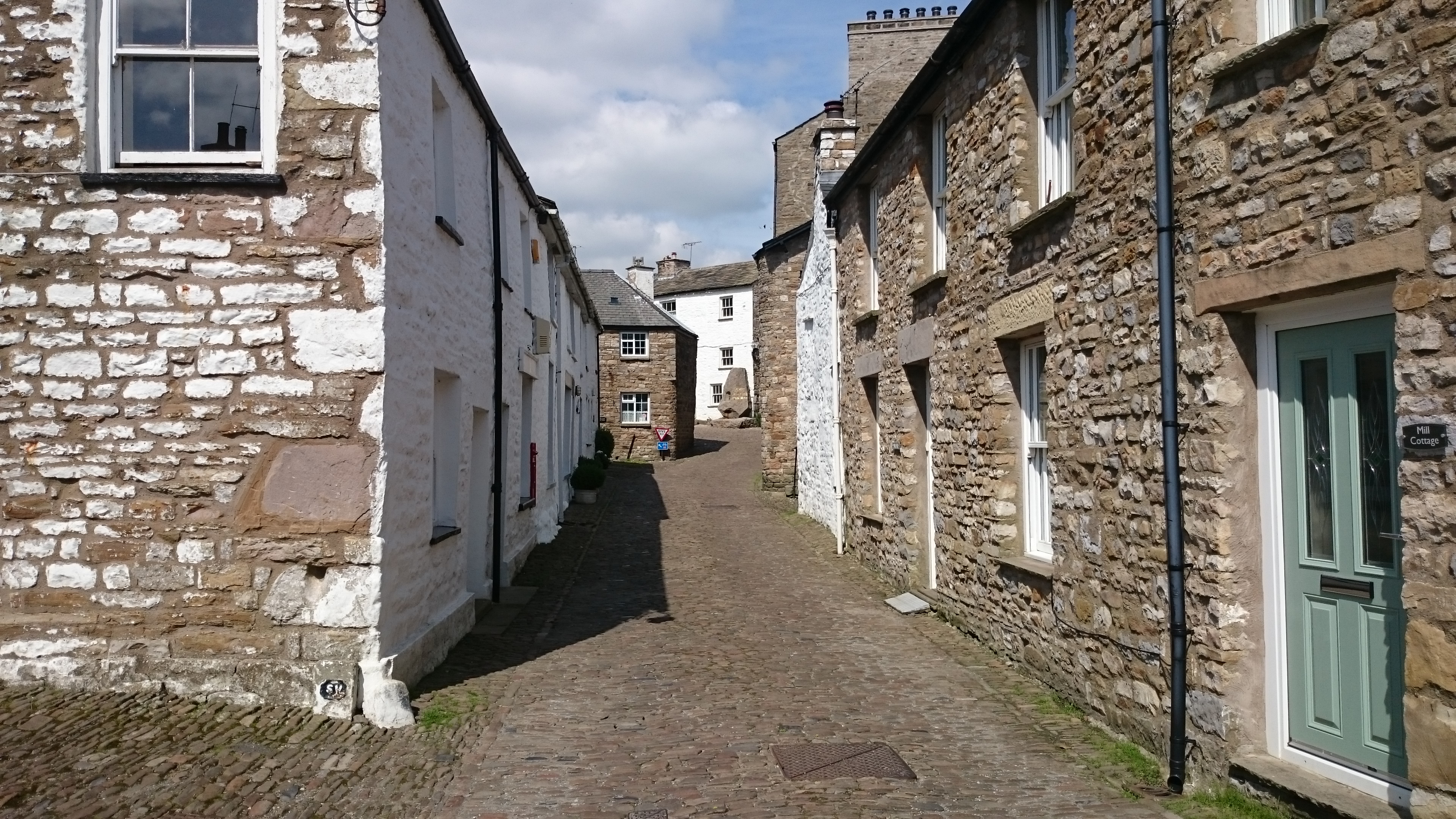
Dent, Cumbria

Dent is a village and civil parish in Cumbria, England, within the historic boundaries of the West Riding of Yorkshire. It lies in Dentdale, a narrow valley...

Nearby Amenities

Located within 500m of 54.292369,-2.430639
Aye Gill Pike
Ele: 556.3
Man Made: survey_point
Natural: peak
Source: npe
Wikidata: Q4831117
Wikipedia: en:Aye Gill Pike
Lat/Long: 54.2923807/-2.4306318
Barrier: stile
Lat/Long: 54.2921241/-2.4283633
Barrier: stile
Lat/Long: 54.2941739/-2.4364086
The data included in this document is from www.openstreetmap.org. The data is made available under ODbL.

Have you been to Aye Gill Pike?

Leave your review of Aye Gill Pike below (or comments, questions and feedback).