Begin Hill

Hill, Mountain in Westmorland Eden

England

Begin Hill

Ewefell Mire A bog at the base of Great Ewe Fell.
Ewefell Mire Credit: Karl and Ali

Begin Hill is a prominent geographical feature located in the rural county of Westmorland, England. Rising to an elevation of approximately 450 meters (1476 feet), it is classified as a hill and is situated in the northern part of the county, close to the town of Kendal.

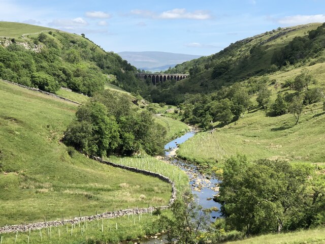
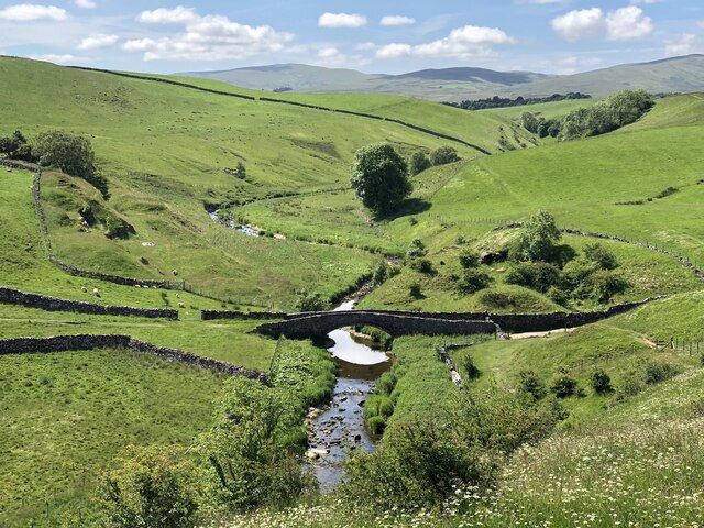
With its commanding position, Begin Hill offers breathtaking panoramic views of the surrounding countryside. On clear days, visitors can enjoy vistas that stretch across the rolling hills and valleys of Westmorland, providing a picturesque backdrop for outdoor enthusiasts and nature lovers alike.

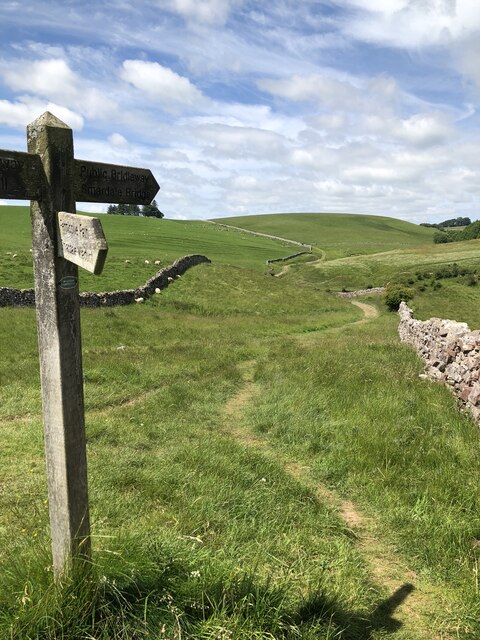
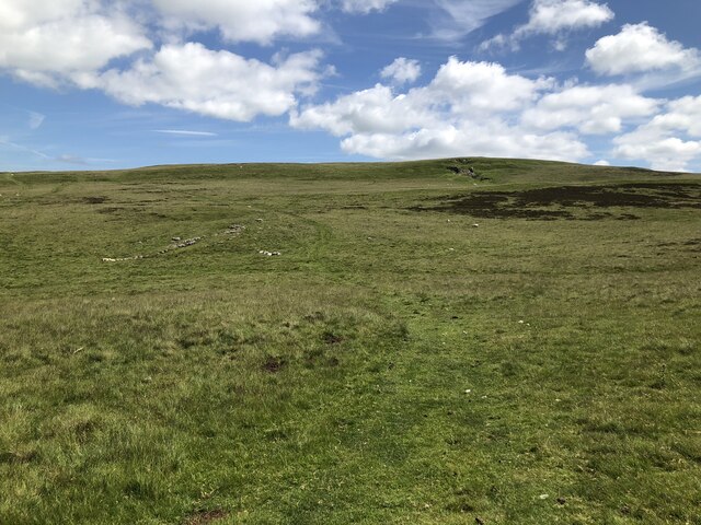
The hill is covered in lush green vegetation, consisting mainly of grasses, heather, and occasional patches of woodland. Its slopes are gentle and relatively easy to navigate, making it an ideal location for hikers and walkers of all abilities. The summit, marked by a trig point, is accessible via well-maintained paths and trails, ensuring a pleasant and rewarding experience for those who venture to the top.

Begin Hill holds historical significance as it was once part of the ancient kingdom of Northumbria. Archaeological remains, such as burial mounds and stone circles, can be found in the vicinity, adding to the hill's allure for history enthusiasts.

Overall, Begin Hill in Westmorland is a stunning natural landmark, offering visitors the opportunity to immerse themselves in the beauty of the English countryside while experiencing its rich historical heritage.

If you have any feedback on the listing, please let us know in the comments section below.
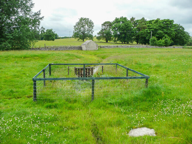
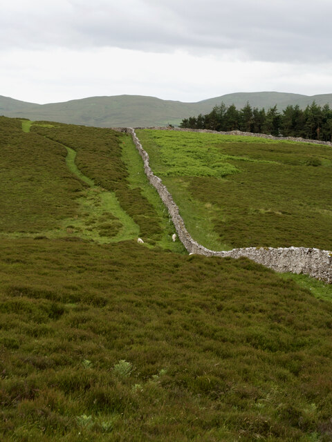
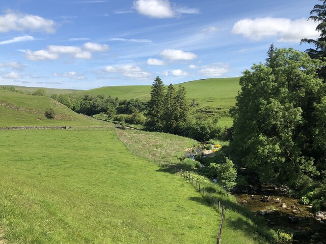
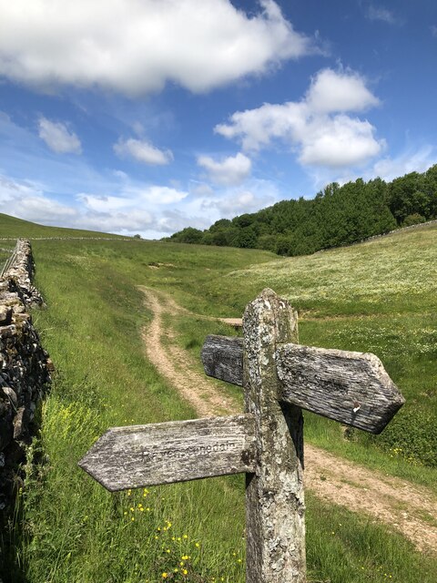
Begin Hill Images

Images are sourced within 2km of 54.453682/-2.4374982 or Grid Reference NY7106. Thanks to Geograph Open Source API. All images are credited.

Ewefell Mire A bog at the base of Great Ewe Fell.
Ewefell Mire
A bog at the base of Great Ewe Fell.
Farmland south of Crosby Garrett Fell The wall marks the southern boundary of a large area of CROW Access Land covering Crosby Garrett Fell and to the south, mainly pasture is enclosed by drystone walls. In the dip among the trees lies Newbiggin-on-Lune beyond which the cloud lies brooding over Wild Boar Fell. The day's quite lengthy sunny intervals were punctuated by heavy localised showers, sweeping up the Eden Valley and, to our great good fortune, almost always missing us on our walk - though we did get caught for a few minutes on our return to almost the same point a few hours later.
Farmland south of Crosby Garrett Fell
The wall marks the southern boundary of a large area of CROW Access Land covering Crosby Garrett Fell and to the south, mainly pasture is enclosed by drystone walls. In the dip among the trees lies Newbiggin-on-Lune beyond which the cloud lies brooding over Wild Boar Fell. The day's quite lengthy sunny intervals were punctuated by heavy localised showers, sweeping up the Eden Valley and, to our great good fortune, almost always missing us on our walk - though we did get caught for a few minutes on our return to almost the same point a few hours later.
St Helen's Well, Newbiggin-on-Lune A bit of a disappointment. Other photographs show a small pool, so perhaps it is a spring rather than a well. See <a href="https://www.geograph.org.uk/photo/6154687">NY7005 : St Helen's Well</a> for a zoomed-in view and also photographs on the 'megalithic' website.
St Helen's Well, Newbiggin-on-Lune
A bit of a disappointment. Other photographs show a small pool, so perhaps it is a spring rather than a well. See NY7005 : St Helen's Well for a zoomed-in view and also photographs on the 'megalithic' website.
Bessy Beck trout fishery
Drystone walls above Bents farm camping barn Mallerstang Edge on the horizon.
Drystone walls above Bents farm camping barn
Mallerstang Edge on the horizon.
Wall at Lingy Intake
Long Plantation The name that appears on the 1862 6" O.S. map. with a wood symbol — see Maps.nls.uk. (2022). View map: Westmorland XXX (includes: Kirkby Stephen; Mallerstang; Nateby; Ravenstonedale; ...) - Ordnance Survey Six-inch England and Wales, 1842-1952. [online] Available at: <span class="nowrap"><a title="https://maps.nls.uk/view/102347880#zoom=6&lat=9304&lon=2399&layers=BT" rel="nofollow ugc noopener" href="https://maps.nls.uk/view/102347880#zoom=6&lat=9304&lon=2399&layers=BT">Link</a><img style="margin-left:2px;" alt="External link" title="External link - shift click to open in new window" src="https://s1.geograph.org.uk/img/external.png" width="10" height="10"/></span> [Accessed 26 Jun. 2022].
Long Plantation
The name that appears on the 1862 6" O.S. map. with a wood symbol — see Maps.nls.uk. (2022). View map: Westmorland XXX (includes: Kirkby Stephen; Mallerstang; Nateby; Ravenstonedale; ...) - Ordnance Survey Six-inch England and Wales, 1842-1952. [online] Available at: LinkExternal link [Accessed 26 Jun. 2022].
Scandal Beck Scandal Beck is a tributary of the River Eden, joining to the north of Kirkby Stephen. A moraine to the West of Ravenstonedale forms the watershed between the Lune and Eden tributaries, forcing Scandal Beck north through the narrow Smardale Gill to join the Eden.
Scandal Beck
Scandal Beck is a tributary of the River Eden, joining to the north of Kirkby Stephen. A moraine to the West of Ravenstonedale forms the watershed between the Lune and Eden tributaries, forcing Scandal Beck north through the narrow Smardale Gill to join the Eden.
Coast to Coast route at Smardale Bridge Despite its popularity since its inception by Alfred Wainwright in his 1973 book, the Coast to Coast Walk remains an unofficial long distance path.
Coast to Coast route at Smardale Bridge
Despite its popularity since its inception by Alfred Wainwright in his 1973 book, the Coast to Coast Walk remains an unofficial long distance path.
Scandal Beck entering Smardale Gill Scandal Beck is forced north to join the River Eden through the narrow Smardale Gill. The beck is crossed by the disused Smardalegill viaduct, which now carries a permissive footpath. The viaduct was designed by Sir Thomas Bouch for the South Durham & Lancashire Union Railway, opening in 1861 and closing in 1962.
Scandal Beck entering Smardale Gill
Scandal Beck is forced north to join the River Eden through the narrow Smardale Gill. The beck is crossed by the disused Smardalegill viaduct, which now carries a permissive footpath. The viaduct was designed by Sir Thomas Bouch for the South Durham & Lancashire Union Railway, opening in 1861 and closing in 1962.
Coast to Coast route east of Smardale Bridge Devised by Alfred Wainwright and first published in his 1973 book, this popular route remains an unofficial long distance path without its own dedicated waymarks for much of its length.
Coast to Coast route east of Smardale Bridge
Devised by Alfred Wainwright and first published in his 1973 book, this popular route remains an unofficial long distance path without its own dedicated waymarks for much of its length.
Smardale Bridge Smardale Bridge is a Grade II listed C18th pack-horse bridge crossing Scandal Beck to the south of Smardale Gill.
Smardale Bridge
Smardale Bridge is a Grade II listed C18th pack-horse bridge crossing Scandal Beck to the south of Smardale Gill.
Bridleway crossing Smardale Fell
Smardale Gill Viaduct The viaduct is the man made highlight of the Smardale Nature Reserve.
Smardale Gill Viaduct
The viaduct is the man made highlight of the Smardale Nature Reserve.
Smardale Gill Viaduct The viaduct is the man made highlight of the Smardale Nature Reserve.
Smardale Gill Viaduct
The viaduct is the man made highlight of the Smardale Nature Reserve.
Scandal Beck and Smardale Gill
Smardalegill and Scandal Beck seen from the viaduct
'Aidans' a private residence, previously St Aidan's Church, on NE side Main Street
Show me another place!

Begin Hill is located at Grid Ref: NY7106 (Lat: 54.453682, Lng: -2.4374982)

Administrative County: Cumbria

District: Eden

Police Authority: Cumbria

What 3 Words

///duos.essential.fresh. Near Kirkby Stephen, Cumbria

Nearby Locations

Begin Hill

Related Wikis

Newbiggin-on-Lune

Newbiggin-on-Lune is a village in the Eden district of Cumbria, England. Historically in Westmorland it is about 4 miles (6.4 km) south west of Kirkby...

Ravenstonedale railway station

Ravenstonedale railway station was situated on the South Durham & Lancashire Union Railway (SD&LUR) between Tebay and Kirkby Stephen East. It served the...
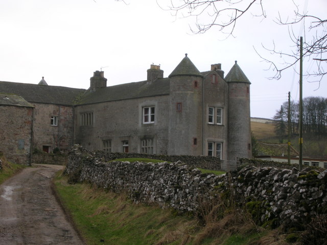
Brownber

Brownber is a hamlet surrounding Brownber Hall near Newbiggin-on-Lune in Cumbria, England.

Ravenstonedale Priory

Ravenstonedale Priory was a Gilbertine priory in Cumbria, England. It was founded in the reign of Henry II, when Torphin, son of Robert, son of Copsus...

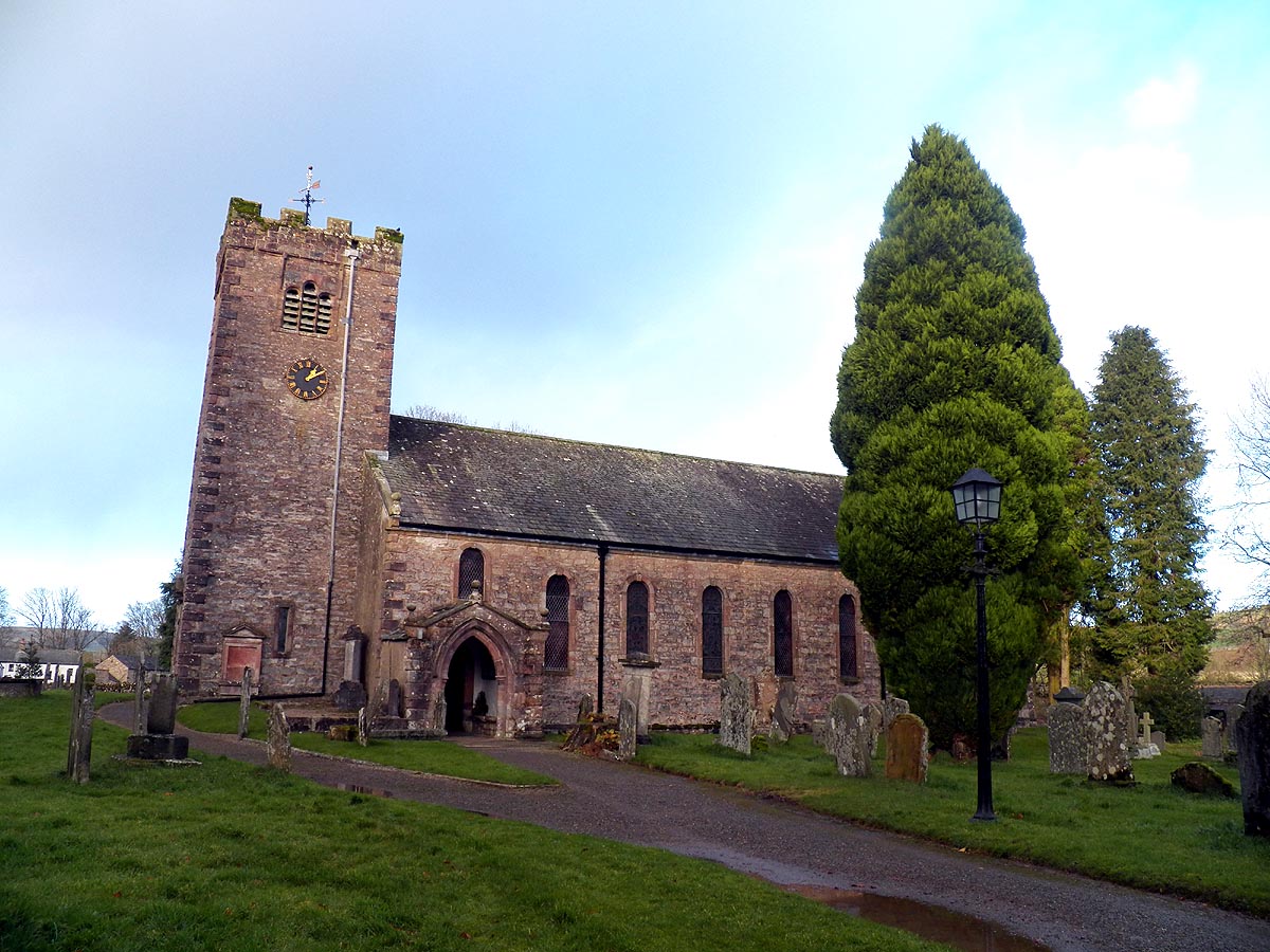
St Oswald's Church, Ravenstonedale

St Oswald's Church is in the village of Ravenstonedale, Cumbria, England. It is an active Anglican parish church in the deanery of Appleby, the archdeaconry...

Ravenstonedale

Ravenstonedale is a village and large civil parish in Cumbria, on the watershed between the River Lune and River Eden. The village lies 4 miles (6 km)...

Smardale

Smardale is a small village and former civil parish, now in the parish of Waitby, in the Eden district, in Cumbria, England. In 1891 the parish had a population...

Smardale railway station

Smardale railway station was a minor station on the South Durham & Lancashire Union Railway between Tebay and Kirkby Stephen East. It served the villages...

Nearby Amenities

Located within 500m of 54.453682,-2.4374982
Barrier: stile
Ele: 301
Foot: designated
Material: stone
Stile: stepover
Lat/Long: 54.4553596/-2.4395047
Begin Hill
Ele: 310.0
Is In Country Code: GB
Is In County: Cumbria
Man Made: cairn
Natural: peak
Source: NPE
Lat/Long: 54.4529536/-2.438109
Barrier: kissing_gate
Source: survey;gps
Lat/Long: 54.4501308/-2.440534
Barrier: kissing_gate
Source: survey;gps
Lat/Long: 54.4499761/-2.4405877
Power: pole
Lat/Long: 54.4578483/-2.4371007
Power: pole
Lat/Long: 54.457117/-2.4381843
Power: pole
Lat/Long: 54.4563857/-2.4392518
Power: pole
Lat/Long: 54.4558291/-2.4400699
Power: pole
Lat/Long: 54.4552241/-2.4409202
Power: pole
Lat/Long: 54.4546425/-2.4417409
Power: pole
Lat/Long: 54.4539954/-2.4427334
Power: pole
Lat/Long: 54.453264/-2.4437633
Power: pole
Lat/Long: 54.4525343/-2.4448201
The data included in this document is from www.openstreetmap.org. The data is made available under ODbL.

Have you been to Begin Hill?

Leave your review of Begin Hill below (or comments, questions and feedback).