Brown Hill

Hill, Mountain in Kincardineshire

Scotland

Brown Hill

A waterfall in the forest Found this while out geocaching and I think only geocachers will have seen it
A waterfall in the forest Credit: Ralph Greig

Brown Hill, located in Kincardineshire, is a prominent hill with an elevation of approximately 395 meters (1,296 feet) above sea level. Situated in the eastern part of Scotland, it is part of the Grampian Mountains, offering stunning panoramic views of the surrounding landscape.

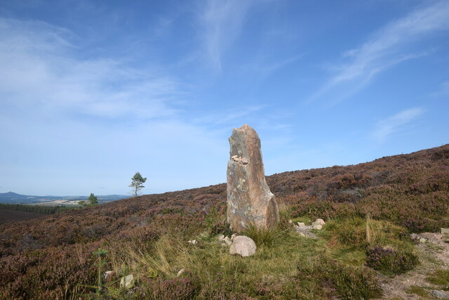
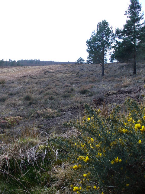
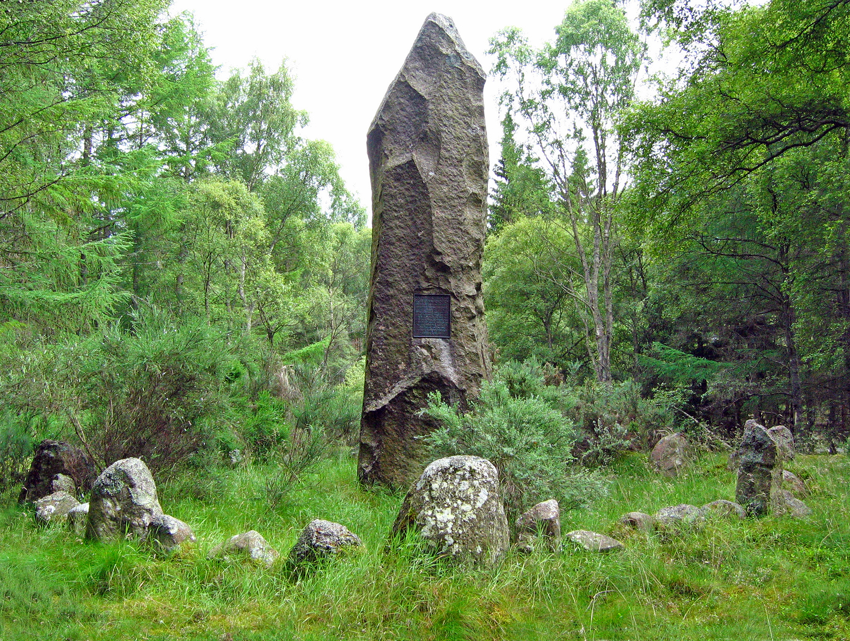
Known for its distinctive brownish hue, the hill is covered in heather, grasses, and scattered shrubs, creating a picturesque scene throughout the year. The terrain is diverse, with gentle slopes and rocky outcrops, making it a popular destination for hikers, nature enthusiasts, and photographers.

Brown Hill is easily accessible, with well-marked trails leading to its summit. The climb is relatively moderate, making it suitable for both experienced hikers and beginners looking for a scenic adventure. Along the way, visitors might encounter a variety of wildlife, including birds of prey, such as buzzards and kestrels, as well as occasional sightings of deer and hares.

At the top of Brown Hill, on a clear day, visitors are rewarded with breathtaking views of the surrounding countryside, including the picturesque coastal town of Stonehaven and the North Sea. The hill's strategic location also offers panoramic vistas of the Grampian Mountains, including the iconic Cairngorms National Park.

For those interested in history, Brown Hill holds significance as it was once an important landmark for ancient settlements. Archaeological remains, such as stone circles and burial mounds, can be found scattered across the hill, providing insight into the region's rich cultural heritage.

Overall, Brown Hill in Kincardineshire offers a beautiful and accessible mountain experience, combining natural beauty, outdoor activities, and a glimpse into the area's historical past.

If you have any feedback on the listing, please let us know in the comments section below.

Brown Hill Images

Images are sourced within 2km of 57.107637/-2.4912339 or Grid Reference NJ7001. Thanks to Geograph Open Source API. All images are credited.

A waterfall in the forest Found this while out geocaching and I think only geocachers will have seen it
A waterfall in the forest
Found this while out geocaching and I think only geocachers will have seen it
Access to Craigton (March) Across B977, from near Hattonburn (off right).
Access to Craigton (March)
Across B977, from near Hattonburn (off right).
Track on Greymore Hill, Aberdeenshire
Moorland landscape Mither Tap, the most prominent summit of the Bennachie range, some 20 km distant, just peeps into the picture.
Moorland landscape
Mither Tap, the most prominent summit of the Bennachie range, some 20 km distant, just peeps into the picture.
Trees on the trail across the moor
Standing stone It is not marked on maps and is presumably modern.
Standing stone
It is not marked on maps and is presumably modern.
Moorland near Hill of Fare, Aberdeenshire Heather covered hills on a summer evening.
Moorland near Hill of Fare, Aberdeenshire
Heather covered hills on a summer evening.
Forest Felling in Howe of Corrichie Large stands of conifers on the northern slopes of Brown Hill have been recently felled. At the bottom of the slope is the Burn of Corrichie.
Forest Felling in Howe of Corrichie
Large stands of conifers on the northern slopes of Brown Hill have been recently felled. At the bottom of the slope is the Burn of Corrichie.
Clear-felled Forest Area on Hill of Fare. Large areas of coniferous plantations in the Howe of Corrichie have recently been felled. The distant top is Greymore.
Clear-felled Forest Area on Hill of Fare.
Large areas of coniferous plantations in the Howe of Corrichie have recently been felled. The distant top is Greymore.
Myriehill Wood Thick coniferous woodland on Myrie Hill, part of Hill of Fare. Blooming gorse lines the forest track in places.
Myriehill Wood
Thick coniferous woodland on Myrie Hill, part of Hill of Fare. Blooming gorse lines the forest track in places.
Moorland on Brown Hill One of the many tops of heathery Hill of Fare.
Moorland on Brown Hill
One of the many tops of heathery Hill of Fare.
Raemoir Quarry Deep, flooded former granite quarry on the southern slopes of Myrie Hill, part of Hill of Fare.
Raemoir Quarry
Deep, flooded former granite quarry on the southern slopes of Myrie Hill, part of Hill of Fare.
Raemoir Quarry Face Disused granite quarry on Hill of Fare - now flooded.
Raemoir Quarry Face
Disused granite quarry on Hill of Fare - now flooded.
View towards Myrie Hill from B977 The wooded summit <a href="https://www.geograph.org.uk/gridref/NJ7000">NJ7000</a> is 283m asl.
View towards Myrie Hill from B977
The wooded summit NJ7000 is 283m asl.
Craigton Looking north from the B977.
Craigton
Looking north from the B977.
Access to Craigton (May) From B977 near Hattonburn.
Access to Craigton (May)
From B977 near Hattonburn.
Craigton Converted steading.
Craigton
Converted steading.
Craigton farmhouse
Craigton farmhouse
Show me another place!

Brown Hill is located at Grid Ref: NJ7001 (Lat: 57.107637, Lng: -2.4912339)

Unitary Authority: Aberdeenshire

Police Authority: North East

What 3 Words

///rectangular.imprints.improve. Near Banchory, Aberdeenshire

Nearby Locations

Brown Hill

Related Wikis

Battle of Corrichie

The Battle of Corrichie was fought on the slopes of the Hill of Fare in Aberdeenshire, Scotland, on 28 October 1562. It was fought between the forces of...

Raemoir House

Raemoir House is a Category B listed Georgian mansion house located in Banchory, Aberdeenshire, Scotland. Its origins date back to the Ha'Hoose (Hall House...

Cluny Crichton Castle

Cluny Crichton Castle (also known as Clounie Crighton Castle) is a ruined 3-story tower house on the southern slopes of the Hill of Fare in Aberdeenshire...

Hill of Fare

The Hill of Fare is a small hill in Aberdeenshire, Scotland. It is located about 5 km (3 miles) northeast of the village of Torphins. The hill is long...

Nearby Amenities

Located within 500m of 57.107637,-2.4912339
Brown Hill
Ele: 280
Natural: peak
Lat/Long: 57.1076347/-2.4910711
The data included in this document is from www.openstreetmap.org. The data is made available under ODbL.

Have you been to Brown Hill?

Leave your review of Brown Hill below (or comments, questions and feedback).