Hog Hill

Hill, Mountain in Roxburghshire

Scotland

Hog Hill

Road, Hass Through mainly forested land between the A68 and A6088.
Road, Hass Credit: Richard Webb

Hog Hill is a prominent hill located in Roxburghshire, a historic county in the Scottish Borders region of Scotland. Situated in the southern part of the county, Hog Hill is part of the expansive Cheviot Hills range, known for its rugged beauty and stunning landscapes.

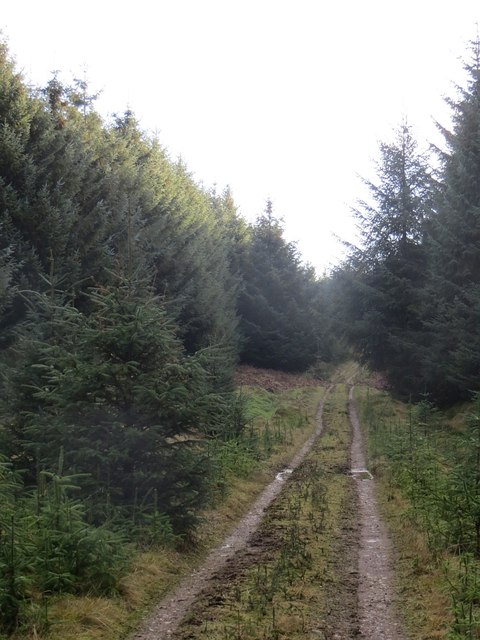
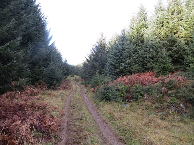
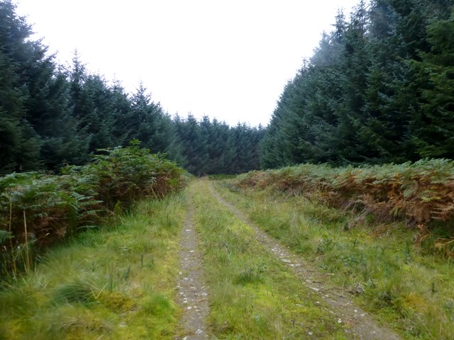
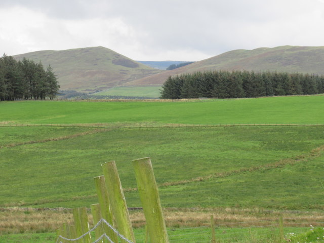
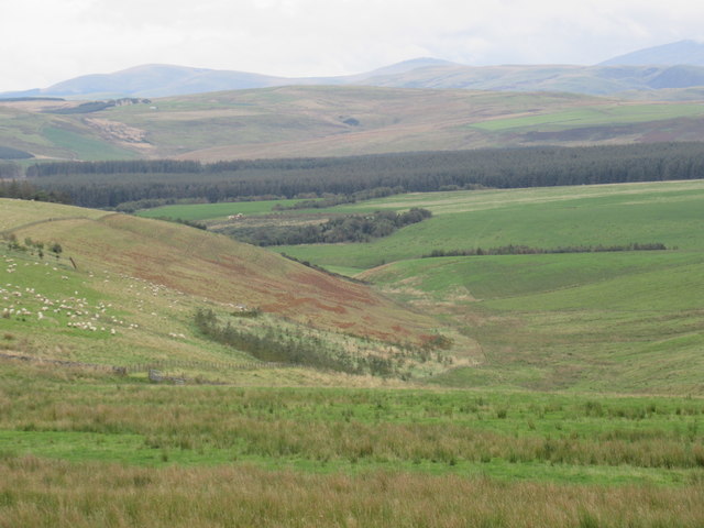
Standing at an elevation of approximately 451 meters (1,480 feet), Hog Hill offers panoramic views of the surrounding countryside. Its distinctive conical shape and smooth slopes make it a popular spot for hiking and hillwalking enthusiasts, attracting both locals and tourists alike.

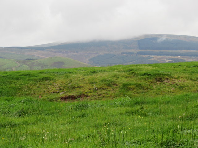
The hill is covered in a mix of heather moorland and grassy slopes, with scattered patches of woodland adding to its visual appeal. Its diverse vegetation supports a rich array of wildlife, including various bird species, such as red grouse and skylarks, as well as mammals like red deer and mountain hares.

Hog Hill is accessible via well-maintained footpaths and trails, making it easily reachable for outdoor enthusiasts of all skill levels. The summit of the hill offers breathtaking vistas of the surrounding countryside, including the nearby River Teviot, rolling farmland, and the distant Cheviot Hills.

Aside from its natural beauty, Hog Hill is also steeped in history and folklore. The area around the hill is dotted with ancient archaeological sites, including Iron Age hill forts and burial mounds, adding a sense of intrigue and mystery to the already captivating landscape.

Overall, Hog Hill in Roxburghshire is a must-visit destination for nature lovers and those seeking a peaceful retreat in the heart of Scotland's stunning countryside.

If you have any feedback on the listing, please let us know in the comments section below.

Hog Hill Images

Images are sourced within 2km of 55.390618/-2.4737103 or Grid Reference NT7010. Thanks to Geograph Open Source API. All images are credited.

Road, Hass Through mainly forested land between the A68 and A6088.
Road, Hass
Through mainly forested land between the A68 and A6088.
Edgerston from the air Looking up the A68 road, past Hass towards Edgerston.
Edgerston from the air
Looking up the A68 road, past Hass towards Edgerston.
Rough grazing and woodland near Hass
A68 near Hass Towards Corbridge.
A68 near Hass
Towards Corbridge.
Moorland and fields east of A68 As the A68 descends north from Carter Bar into Scotland moorland begins to give way to agricultural land. Goshen Hill with Philip Law behind lie at the right side of the image whilst in the distance, left of centre, is The Cheviot.
Moorland and fields east of A68
As the A68 descends north from Carter Bar into Scotland moorland begins to give way to agricultural land. Goshen Hill with Philip Law behind lie at the right side of the image whilst in the distance, left of centre, is The Cheviot.
Road, Leithope Forest It is used enough to keep the self seeded Sitka at bay. The track is a dead end for vehicles, but you can get through to Fawhope by unpowered means. Hoof prints suggest that the route is open to horses.
Road, Leithope Forest
It is used enough to keep the self seeded Sitka at bay. The track is a dead end for vehicles, but you can get through to Fawhope by unpowered means. Hoof prints suggest that the route is open to horses.
Road, Leithope Forest It is possible to escape the forest at the eastern end of the road by a path over Ephope Law.
Road, Leithope Forest
It is possible to escape the forest at the eastern end of the road by a path over Ephope Law.
Track, Knock Hills Farm road out of Wooplaw.
Track, Knock Hills
Farm road out of Wooplaw.
Farm track, Knock Hills A track out of Wooplaw.
Farm track, Knock Hills
A track out of Wooplaw.
Forestry Track Near Ettles Knowe Forestry track used en route between Fawhope Rig and Philip Law.
Forestry Track Near Ettles Knowe
Forestry track used en route between Fawhope Rig and Philip Law.
Ordnance Survey Cut Mark This OS cut mark can be found on the south angle of Hass House. It marks a point 245.769m above mean sea level.
Ordnance Survey Cut Mark
This OS cut mark can be found on the south angle of Hass House. It marks a point 245.769m above mean sea level.
Ordnance Survey 1GL Bolt This OS Bolt can be found on the north face of Edgerston Church. It marks a point 235.165m above mean sea level.
Ordnance Survey 1GL Bolt
This OS Bolt can be found on the north face of Edgerston Church. It marks a point 235.165m above mean sea level.
A68 lay-by near Haas Lochs
Road to the Hass Lochs Descends steeply towards a fishery.
Road to the Hass Lochs
Descends steeply towards a fishery.
Old Milestone by the A68, Edgerston church, Jedburgh parish Stone post by the A68, in parish of Jedburgh (Roxburgh District), Edgerston Church, on verge 10m North of church wall.

Inscription reads:-
JEDBURGH
7
MILES

Surveyed

Milestone Society National ID: BD_JBNC07
Old Milestone by the A68, Edgerston church, Jedburgh parish
Stone post by the A68, in parish of Jedburgh (Roxburgh District), Edgerston Church, on verge 10m North of church wall. Inscription reads:- JEDBURGH 7 MILES Surveyed Milestone Society National ID: BD_JBNC07
Dod Hill summit in the Scottish Borders Carter Bar in the background with an HGV at nine seven in photo contouring its way to Jedburgh.
Dod Hill summit in the Scottish Borders
Carter Bar in the background with an HGV at nine seven in photo contouring its way to Jedburgh.
View south off Dod Hill near Edgerston in the Scottish Borders
View east off Dod Hill near Edgerston in the Scottish Borders
Show me another place!

Hog Hill is located at Grid Ref: NT7010 (Lat: 55.390618, Lng: -2.4737103)

Unitary Authority: The Scottish Borders

Police Authority: The Lothians and Scottish Borders

What 3 Words

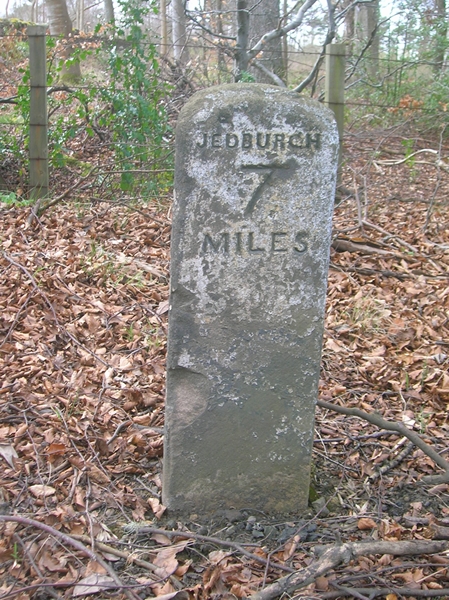
///rejoins.briefing.screamed. Near Jedburgh, Scottish Borders

Nearby Locations

Hog Hill Fendies Cleuch

Related Wikis

Edgerston

Edgerston is a village and an estate about 4 miles (6.4 km) north of the Anglo-Scottish border, and 8 miles (13 km) south of Jedburgh in the Scottish Borders...

Camptown, Scottish Borders

Camptown is a small settlement on the A68, in the Scottish Borders area of Scotland, 5m (8 km) south of Jedburgh, and the same distance south to Carter...

Scottish Borders

The Scottish Borders (Scots: the Mairches, lit. 'the Marches'; Scottish Gaelic: Crìochan na h-Alba) is one of 32 council areas of Scotland. It is bordered...

Raid of the Redeswire

The Raid of the Redeswire, also known as the Redeswire Fray, was a border skirmish between England and Scotland on 7 July 1575 which took place at Carter...

Carter Bar

Carter Bar is a pass in the Cheviot Hills, on the Anglo-Scottish border. It lies east of Carter Fell at the head of Redesdale, and is crossed by the A68...

Pennymuir Roman camps

The Pennymuir Roman camps are situated southeast of Jedburgh in the Scottish Borders area of Scotland, near the Anglo-Scottish border, in the former Roxburghshire...

Whitelee Moor

Whitelee Moor is nature reserve of the Northumberland Wildlife Trust, in Northumberland, England, near Carter Bar. A large part of the moor is blanket...

Bairnkine

Bairnkine is a hamlet on the Jed Water in the Scottish Borders area of Scotland, on the A68, south of Jedburgh. Other places nearby include Abbotrule,...

Nearby Amenities

Located within 500m of 55.390618,-2.4737103
Well Knowe
Natural: peak
Lat/Long: 55.3905397/-2.4739345
Power: pole
Lat/Long: 55.3916673/-2.4805303
Power: pole
Lat/Long: 55.3919042/-2.4785707
Power: pole
Lat/Long: 55.3920417/-2.4776206
Power: pole
Lat/Long: 55.3930171/-2.4794977
Power: pole
Lat/Long: 55.3925989/-2.4790291
Power: pole
Lat/Long: 55.3915532/-2.4775871
Power: pole
Lat/Long: 55.3912154/-2.4766138
Power: pole
Lat/Long: 55.3908775/-2.4756224
Power: pole
Lat/Long: 55.3910179/-2.4743993
Power: pole
Lat/Long: 55.3911276/-2.473444
Power: pole
Lat/Long: 55.3912783/-2.4723857
Power: pole
Lat/Long: 55.3913996/-2.4713351
Power: pole
Lat/Long: 55.3912636/-2.4700399
Power: pole
Lat/Long: 55.3911481/-2.4687627
Power: pole
Lat/Long: 55.3913792/-2.4675679
Power: pole
Lat/Long: 55.3916102/-2.4664401
Power: pole
Lat/Long: 55.390762/-2.4669911
Power: pole
Lat/Long: 55.3901433/-2.4663989
The data included in this document is from www.openstreetmap.org. The data is made available under ODbL.

Have you been to Hog Hill?

Leave your review of Hog Hill below (or comments, questions and feedback).