Gavelock Hill

Hill, Mountain in Cumberland Carlisle

England

Gavelock Hill

Minor road, Gowk Bank Looking along the minor road to the south of Butterburn.
Minor road, Gowk Bank Credit: Graham Robson

Gavelock Hill is a prominent geographical feature located in the county of Cumberland in Northwest England. It is classified as a hill and falls within the broader category of mountains due to its significant elevation. The hill is situated in the Lake District National Park, a renowned area renowned for its natural beauty and stunning landscapes.

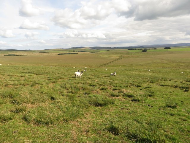
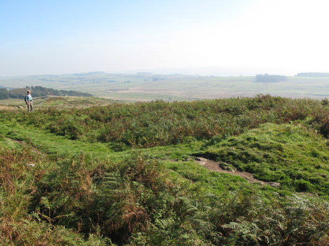
Gavelock Hill stands at an impressive height of approximately 605 meters (1,985 feet) above sea level, making it one of the tallest hills in the region. Its summit offers breathtaking panoramic views of the surrounding countryside, including the picturesque valleys, rolling hills, and nearby bodies of water.

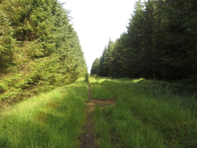
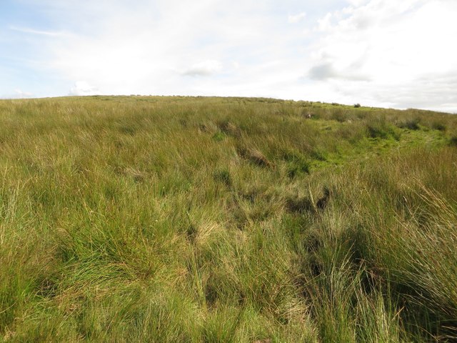
The hill is composed mainly of rocky and rugged terrain, with scattered vegetation covering its slopes. It is a popular destination for hikers, climbers, and outdoor enthusiasts, who are drawn to its challenging trails and the opportunity to immerse themselves in the stunning natural surroundings.

Gavelock Hill is also home to a diverse range of wildlife, including various bird species, mammals, and plant life. The hillside is adorned with colorful wildflowers during the warmer months, adding to its visual appeal.

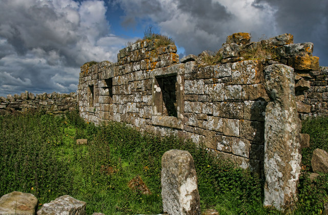
Access to Gavelock Hill is facilitated by a network of footpaths and trails, allowing visitors to explore its beauty and enjoy the peaceful and serene environment. The hill is located in close proximity to several small villages, providing amenities such as parking, accommodation, and refreshments for those looking to spend more time in the area.

Overall, Gavelock Hill is a majestic and awe-inspiring natural landmark in Cumberland, offering visitors a chance to connect with nature and experience the beauty of the Lake District National Park.

If you have any feedback on the listing, please let us know in the comments section below.

Gavelock Hill Images

Images are sourced within 2km of 55.04466/-2.4914637 or Grid Reference NY6872. Thanks to Geograph Open Source API. All images are credited.

Minor road, Gowk Bank Looking along the minor road to the south of Butterburn.
Minor road, Gowk Bank
Looking along the minor road to the south of Butterburn.
Minor road crossing Rough Sike A minor road crossing Rough Sike via a small road bridge. The road has thick conifer plantations on both sides.
Minor road crossing Rough Sike
A minor road crossing Rough Sike via a small road bridge. The road has thick conifer plantations on both sides.
Rural power lines Power lines cutting through an unplanted gap in a large plantation between the isolated settlements around Butterburn.
Rural power lines
Power lines cutting through an unplanted gap in a large plantation between the isolated settlements around Butterburn.
Bridge crossing East Sike A small stone arched bridge carrying a minor road across the small stream of East Sike.
Bridge crossing East Sike
A small stone arched bridge carrying a minor road across the small stream of East Sike.
Sheep grazing, White Side Sheep grazing in the long and rough grass in front of the edge of a seemingly never ending plantation.
Sheep grazing, White Side
Sheep grazing in the long and rough grass in front of the edge of a seemingly never ending plantation.
The River Irthing Looking downstream along the River Irthing from its south bank close to the derelict buildings at Rotheryhaugh.
The River Irthing
Looking downstream along the River Irthing from its south bank close to the derelict buildings at Rotheryhaugh.
Derelict farm at Rotheryhaugh The derelict and decaying remains of the farm steading at Rotheryhaugh. The buildings stand close to the River Irthing.
Derelict farm at Rotheryhaugh
The derelict and decaying remains of the farm steading at Rotheryhaugh. The buildings stand close to the River Irthing.
Bridleway at Rotheryhaugh The bridleway just south of Rotheryhaugh. Passage requires one to pick their way through a variety of tussocks and patches of boggy ground.
Bridleway at Rotheryhaugh
The bridleway just south of Rotheryhaugh. Passage requires one to pick their way through a variety of tussocks and patches of boggy ground.
Bridleway between trees The bridleway picks its way between dense blocks of coniferous plantation.
Bridleway between trees
The bridleway picks its way between dense blocks of coniferous plantation.
Path and forest riding A nearby bridleway heads through the block of mature trees on the left, however much safer, easier and quicker progress is made by following the ride between the blocks of trees.
Path and forest riding
A nearby bridleway heads through the block of mature trees on the left, however much safer, easier and quicker progress is made by following the ride between the blocks of trees.
Forest track and public bridleway A forest track used to access a deeper part of the plantation.
Forest track and public bridleway
A forest track used to access a deeper part of the plantation.
Path on Burn Divot A path approaching the top of Burn Divot from the north west where it meets the boundary of a never ending coniferous plantation known as Wark Forest.
Path on Burn Divot
A path approaching the top of Burn Divot from the north west where it meets the boundary of a never ending coniferous plantation known as Wark Forest.
Sheep grazing on Burn Divot The upland pasture around Burn Divot is grazed by a number of sheep which are spread out across the landscape.
Sheep grazing on Burn Divot
The upland pasture around Burn Divot is grazed by a number of sheep which are spread out across the landscape.
The Butterburn Road Leaving the Wark Forest and heading south-west, back to Gilsland.
The Butterburn Road
Leaving the Wark Forest and heading south-west, back to Gilsland.
Rough Sike Fairly dry at present, but flowing into the upper River Irthing.
Rough Sike
Fairly dry at present, but flowing into the upper River Irthing.
Entry into Wark Forest Seen from the Butterburn Road, this access is clearly not for private cars! But the forest hereabouts is shown as Access Land, and so presumably walkers would be free to roam (subject to any local restrictions, e.g. when felling was in progress). In this sort of forest they would be well advised to stick to the clear tracks.
Entry into Wark Forest
Seen from the Butterburn Road, this access is clearly not for private cars! But the forest hereabouts is shown as Access Land, and so presumably walkers would be free to roam (subject to any local restrictions, e.g. when felling was in progress). In this sort of forest they would be well advised to stick to the clear tracks.
The Butterburn Road Looking back towards Horseholme and Gilsland.
The Butterburn Road
Looking back towards Horseholme and Gilsland.
Burn Divot The derelict cottage at Burn Divot.
Burn Divot
The derelict cottage at Burn Divot.
Show me another place!

Gavelock Hill is located at Grid Ref: NY6872 (Lat: 55.04466, Lng: -2.4914637)

Administrative County: Cumbria

District: Carlisle

Police Authority: Cumbria

What 3 Words

///hatter.face.fluffed. Near Haltwhistle, Northumberland

Related Wikis

Northumbria

Northumbria (; Old English: Norþanhymbra rīċe; Latin: Regnum Northanhymbrorum) was an early medieval Anglo-Saxon kingdom in what is now Northern England...

Churnsike Lodge

Churnsike Lodge is an early Victorian hunting lodge situated in the parish of Greystead, West Northumberland, England. Constructed in 1850 by the Charlton...

Milecastle 44

Milecastle 44 (Allolee) was a milecastle on Hadrian's Wall (grid reference NY68886694). == Description == Milecastle 44 is located about 1.5 kilometres...

Allolee to Walltown

Allolee to Walltown is the name given to a Site of Special Scientific Interest (SSSI) in Northumberland, England. The site, which follows the path of a...

Milecastle 43

Milecastle 43 (Great Chesters) was a milecastle on Hadrian's Wall (grid reference NY70356684). It was obliterated when the fort at Great Chesters (Aesica...
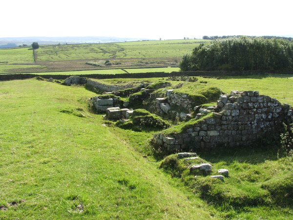
Aesica

Aesica (with the modern name of Great Chesters) was a Roman fort, one and a half miles north of the small town of Haltwhistle in Northumberland, England...
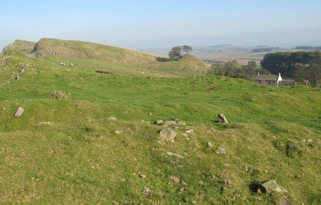
Milecastle 45

Milecastle 45 (Walltown) was a milecastle on Hadrian's Wall (grid reference NY67716657). == Description == Milecastle 45 is on the top of Walltown Crags...

Alloa Lea Quarry Cave

Alloa Lea Quarry Cave is a short cave in the Five Yard Limestone of the Alston Block in Northumberland, England. It is situated in an old quarry on the...

Nearby Amenities

Located within 500m of 55.04466,-2.4914637
Gravelock Hill
Place: locality
Lat/Long: 55.0443054/-2.49196
The data included in this document is from www.openstreetmap.org. The data is made available under ODbL.

Have you been to Gavelock Hill?

Leave your review of Gavelock Hill below (or comments, questions and feedback).