Clay Hill

Hill, Mountain in Gloucestershire Forest of Dean

England

Clay Hill

Across the River Severn towards Newnham, Gloucestershire From Arlingham.
Across the River Severn towards Newnham, Gloucestershire Credit: Jaggery

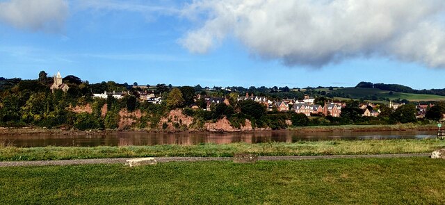
Clay Hill is a prominent hill located in the county of Gloucestershire, England. Situated near the village of Uley, it is a part of the Cotswold Hills, which is renowned for its picturesque landscapes and historic landmarks. Clay Hill stands at an elevation of approximately 221 meters (725 feet), making it a noticeable feature in the area.

This hill is predominantly composed of clay, as its name suggests, which gives it a distinctive reddish-brown color. The clay formation is a result of geological processes that occurred millions of years ago, and it has since become an important source of local pottery production.

The hill offers breathtaking views of the surrounding countryside, with rolling hills, lush valleys, and charming villages dotting the landscape. Its strategic location has made it an ideal spot for outdoor enthusiasts, offering opportunities for walking, hiking, and birdwatching. The hill is also home to a variety of wildlife, including foxes, badgers, and a diverse range of bird species.

In addition to its natural beauty, Clay Hill has historical significance. It is believed that the hill was once used as a defensive location during ancient times, with remnants of Iron Age fortifications still visible today. These archaeological features add to the allure of the hill and attract visitors interested in exploring the area's rich history.

Overall, Clay Hill in Gloucestershire is a captivating destination that combines natural beauty, historical significance, and outdoor recreational opportunities, making it a cherished landmark in the region.

If you have any feedback on the listing, please let us know in the comments section below.
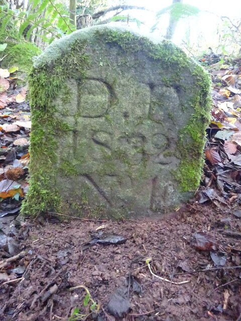
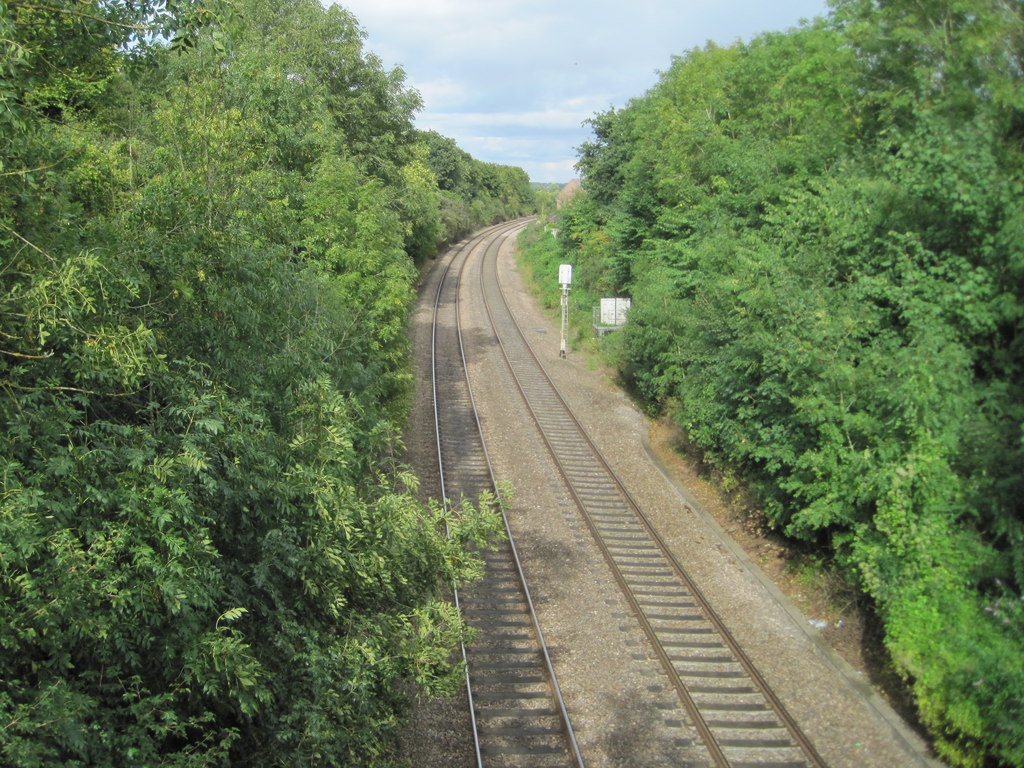
Clay Hill Images

Images are sourced within 2km of 51.806551/-2.456776 or Grid Reference SO6812. Thanks to Geograph Open Source API. All images are credited.

Across the River Severn towards Newnham, Gloucestershire From Arlingham.
Across the River Severn towards Newnham, Gloucestershire
From Arlingham.
Grade II Listed old milestone, Arlingham Probably dating from the 18th century, the milestone is located outside the Old Passage Inn <a title="https://www.geograph.org.uk/photo/6972380" href="https://www.geograph.org.uk/photo/6972380">Link</a> on the east bank of the River Severn in Arlingham, Gloucestershire.
Grade II Listed old milestone, Arlingham
Probably dating from the 18th century, the milestone is located outside the Old Passage Inn Link on the east bank of the River Severn in Arlingham, Gloucestershire.
Marshfield Farm Real Dairy Ice Cream board, Arlingham On the east bank of the River Severn. 
The Old Passage Inn <a title="https://www.geograph.org.uk/photo/6972345" href="https://www.geograph.org.uk/photo/6972345">Link</a> is behind the camera. 
Newnham on the west bank of the Severn is in the background.
Marshfield Farm Real Dairy Ice Cream board, Arlingham
On the east bank of the River Severn. The Old Passage Inn Link is behind the camera. Newnham on the west bank of the Severn is in the background.
Corrugated roof, Arlingham The building is on the north side of Passage Road.
Corrugated roof, Arlingham
The building is on the north side of Passage Road.
Private Property notice on a gate, Arlingham Viewed across Passage Road in September 2021. The notice shows
"Private Property / No Parking / No Dumping / CCTV operating on these premises".
Private Property notice on a gate, Arlingham
Viewed across Passage Road in September 2021. The notice shows "Private Property / No Parking / No Dumping / CCTV operating on these premises".
Passage Farm, Arlingham Viewed across Passage Road in the west of Arlingham.
Passage Farm, Arlingham
Viewed across Passage Road in the west of Arlingham.
Solar panels in a field, Arlingham Viewed from Passage Road.
Solar panels in a field, Arlingham
Viewed from Passage Road.
Timberyard in Arlingham On the north side of Passage Road in the west of Arlingham.
Timberyard in Arlingham
On the north side of Passage Road in the west of Arlingham.
Eco Arb nameboard, Passage Road, Arlingham In September 2021 the ECO ARB Tree Services Ltd sign on a gate shows
" TREE SURGERY | FORESTRY | SITE CLEARANCE | SAW MILLING
FEEL FREE TO COME IN AND BROWSE".
Eco Arb nameboard, Passage Road, Arlingham
In September 2021 the ECO ARB Tree Services Ltd sign on a gate shows " TREE SURGERY | FORESTRY | SITE CLEARANCE | SAW MILLING FEEL FREE TO COME IN AND BROWSE".
7-bar field gate in the west of Arlingham Set back from a bend in Passage Road.
7-bar field gate in the west of Arlingham
Set back from a bend in Passage Road.
Electricity pole in a field, Arlingham Viewed from this <a title="https://www.geograph.org.uk/photo/7000535" href="https://www.geograph.org.uk/photo/7000535">Link</a> gate near Passage Road.
Electricity pole in a field, Arlingham
Viewed from this Link gate near Passage Road.
The Old Passage Inn, Arlingham, Gloucestershire
River cliff and the village of Newnham-on-Severn, Gloucestershire
Eastwards over Severn to Arlingham - Newnham on Severn, Gloucestershire On the track from Aram's to Tanhouse Farm at Newnham on Severn, looking eastwards across the River Severn to the Arlingham peninsula. Memory fails me as to whether this was Gloucester Ramblers or Stroud Rambling Club but no matter. The villages of Arlingham and Fretherne lie on this expanse of flat land enclosed by a loop of  the River Severn as it makes its way from Plynlimon to the Bristol Channel. Time photo taken not available.

<a href="https://www.geograph.org.uk/photo/7732417">SO6911 : Arlingham across the Severn – Newnham on Severn, Gloucestershire</a>
Eastwards over Severn to Arlingham - Newnham on Severn, Gloucestershire
On the track from Aram's to Tanhouse Farm at Newnham on Severn, looking eastwards across the River Severn to the Arlingham peninsula. Memory fails me as to whether this was Gloucester Ramblers or Stroud Rambling Club but no matter. The villages of Arlingham and Fretherne lie on this expanse of flat land enclosed by a loop of the River Severn as it makes its way from Plynlimon to the Bristol Channel. Time photo taken not available. SO6911 : Arlingham across the Severn – Newnham on Severn, Gloucestershire
Outfall Drip, Newnham On the base wall of the Old Drill Hall, facing the Severn. Drip ledge to a discontinued outfall on the side of a long forgotten quay, in the area of the old ferry and fording point.
Outfall Drip, Newnham
On the base wall of the Old Drill Hall, facing the Severn. Drip ledge to a discontinued outfall on the side of a long forgotten quay, in the area of the old ferry and fording point.
Old Boundary Stone, Blaise Bailey Marking the boundary of the "Forest of Dean" seen from Forestry Commission land but actually just in the private field beyond. One of the few originals.

Inscription: D. F. / Nᴼ. 218 / 1832

Milestone Society National ID: GL_DFRUSU218em
Old Boundary Stone, Blaise Bailey
Marking the boundary of the "Forest of Dean" seen from Forestry Commission land but actually just in the private field beyond. One of the few originals. Inscription: D. F. / Nᴼ. 218 / 1832 Milestone Society National ID: GL_DFRUSU218em
Boundary Stone, Grange At the end of Gloucestershire bridleway ENE4, near Grange Village. Signposted to "Precious Pets" boarding kennels.

Inscription: D.F / Nᴼ. 2 / 2007

Milestone Society National ID: GL_DFNEWN2em
Boundary Stone, Grange
At the end of Gloucestershire bridleway ENE4, near Grange Village. Signposted to "Precious Pets" boarding kennels. Inscription: D.F / Nᴼ. 2 / 2007 Milestone Society National ID: GL_DFNEWN2em
Old Boundary Stone, Grange Just after the end of Gloucestershire footpath ENE34 marking the boundary of the "Forest of Dean". A modern companion stone, Nᴼ.3, can be seen 50m North at <a href="https://www.geograph.org.uk/photo/7352881">SO6711 : Boundary Stone, Blaise Bailey</a>.

Inscription: D. F. / 1832 / Nᴼ. 4

Milestone Society National ID: GL_DFNEWN4em
Old Boundary Stone, Grange
Just after the end of Gloucestershire footpath ENE34 marking the boundary of the "Forest of Dean". A modern companion stone, Nᴼ.3, can be seen 50m North at SO6711 : Boundary Stone, Blaise Bailey. Inscription: D. F. / 1832 / Nᴼ. 4 Milestone Society National ID: GL_DFNEWN4em
Show me another place!

Clay Hill is located at Grid Ref: SO6812 (Lat: 51.806551, Lng: -2.456776)

Administrative County: Gloucestershire

District: Forest of Dean

Police Authority: Gloucestershire

What 3 Words

///musically.bachelor.boater. Near Cinderford, Gloucestershire

Nearby Locations

Clay Hill

Related Wikis

Newnham railway station

Newnham railway station was a station serving the village of Newnham on Severn, Gloucestershire. == History == The South Wales Railway was formed in 1845...

Newnham on Severn

Newnham or Newnham on Severn is a village in west Gloucestershire, England. It lies in the Royal Forest of Dean, on the west bank of the River Severn,...

Ruddle Road Halt railway station

Ruddle Road Halt railway station was a minor station on the Gloucester-Newport Railway on the outskirts of Newnham, Gloucestershire. It was also the start...
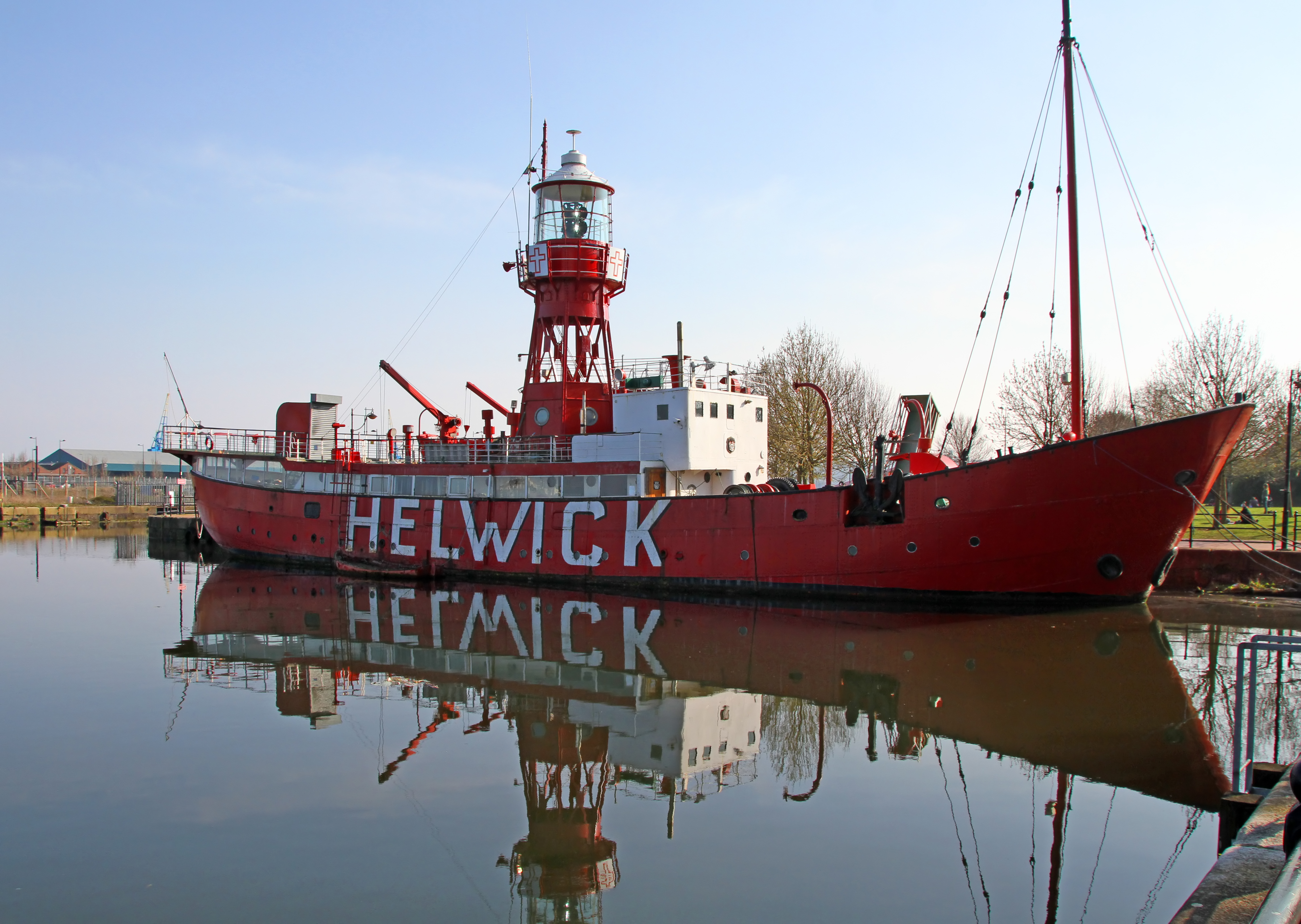
Lightship 2000

Lightship 2000 (Welsh: Goleulong 2000) was a restored old red lightvessel with a cafe and chapel on board situated in Cardiff Bay. During the redevelopment...

Nearby Amenities

Located within 500m of 51.806551,-2.456776
Newnham
Historic Railway: station
Railway: site
Wikidata: Q15262176
Wikipedia: en:Newnham railway station
Lat/Long: 51.8081148/-2.4528888
Newnham on Severn
Is In: Gloucestershire, England, UK
Place: village
Postal Code: GL14 1
Source: NPE + local knowledge
Lat/Long: 51.804971/-2.4523397
Orchard Rise school stop
Naptan AtcoCode: 1600GLA06399
Naptan Bearing: N
Naptan BusStopType: CUS
Naptan CommonName: Orchard Rise school stop
Naptan NaptanCode: glogpmtm
Naptan Street: Dean View
Naptan Verified: no
Source: naptan_import
Lat/Long: 51.8037715/-2.4533691
Bus Stop
Penby Lawn
Naptan AtcoCode: 1600GLF791
Naptan Bearing: NW
Naptan CommonName: Penby Lawn
Naptan Indicator: Opp
Naptan NaptanCode: gloamawt
Naptan Street: Dean Rd
Naptan Verified: no
Source: naptan_import
Lat/Long: 51.8040723/-2.4540697
Bus Stop
Penby Lawn
Naptan AtcoCode: 1600GLF792
Naptan Bearing: SE
Naptan CommonName: Penby Lawn
Naptan NaptanCode: gloamdad
Naptan Street: Dean Rd
Naptan Verified: no
Source: naptan_import
Lat/Long: 51.8040371/-2.4538808
Turning Circle
Lat/Long: 51.8078491/-2.4527601
Barrier: stile
Foot: yes
Material: wood
Stile: stepover
Lat/Long: 51.8032164/-2.4527514
Barrier: kissing_gate
Foot: yes
Lat/Long: 51.8054886/-2.4602192
Barrier: stile
Foot: yes
Material: wood
Stile: stepover
Lat/Long: 51.80538/-2.4602036
Power: pole
Lat/Long: 51.8104961/-2.4565221
Power: pole
Lat/Long: 51.8098931/-2.4571693
Power: pole
Lat/Long: 51.80938/-2.4577205
Power: pole
Lat/Long: 51.808597/-2.4585751
Power: pole
Lat/Long: 51.8079116/-2.4593307
Power: pole
Lat/Long: 51.8073276/-2.4599685
Power: pole
Lat/Long: 51.8066594/-2.4606714
Power: pole
Lat/Long: 51.8058514/-2.4615756
Power: pole
Lat/Long: 51.8051047/-2.4623528
Power: pole
Lat/Long: 51.804448/-2.463096
Design: triangle
Material: metal
Power: pole
Structure: lattice
Lat/Long: 51.8109497/-2.4563456
Design: triangle
Material: metal
Power: pole
Structure: lattice
Lat/Long: 51.8097723/-2.4576384
Design: triangle
Material: metal
Power: pole
Structure: lattice
Lat/Long: 51.8086944/-2.4588132
Design: triangle
Material: metal
Power: pole
Structure: lattice
Lat/Long: 51.8077756/-2.4598002
Design: triangle
Material: metal
Power: pole
Structure: lattice
Lat/Long: 51.8067656/-2.4613211
Post Box
Collection Times: Mo-Fr 09:00; Sa 07:00
Operator: Royal Mail
Post Box Type: lamp
Ref: GL14 381D
Royal Cypher: EIIR
Royal Cypher Wikidata: Q33102113
Lat/Long: 51.8040301/-2.4538165
Post Box
Collection Times: Mo-Fr 09:00; Sa 07:00
Operator: Royal Mail
Post Box Type: lamp
Ref: GL14 338D
Royal Cypher: EIIR
Royal Cypher Wikidata: Q33102113
Lat/Long: 51.8061155/-2.4519363
Barrier: kissing_gate
Foot: yes
Lat/Long: 51.8069759/-2.4503444
Barrier: stile
Lat/Long: 51.8025476/-2.4581784
Playground: structure
Lat/Long: 51.8070299/-2.4512675
Playground: roundabout
Lat/Long: 51.8069025/-2.4512741
Covered: no
Leisure: picnic_table
Lat/Long: 51.8070388/-2.4509275
Defibrillator
Emergency: defibrillator
Indoor: no
Lat/Long: 51.8054788/-2.4497791
Bench
Backrest: yes
Material: wood
Lat/Long: 51.8061815/-2.4608064
Barrier: stile
Material: wood
Stile: squeezer
Lat/Long: 51.8062021/-2.460927
The data included in this document is from www.openstreetmap.org. The data is made available under ODbL.

Have you been to Clay Hill?

Leave your review of Clay Hill below (or comments, questions and feedback).