Gallow Hillock

Hill, Mountain in Kincardineshire

Scotland

Gallow Hillock

Minor road passing between farm buildings at Bent Looking south-westward.
Minor road passing between farm buildings at Bent Credit: Peter Wood

Gallow Hillock, located in Kincardineshire, Scotland, is a prominent hill/mountain that stands at an elevation of approximately 309 meters (1,014 feet) above sea level. It is situated near the village of Muchalls, about 15 kilometers south of Aberdeen. The hill is part of the larger Garvock Hills range, which stretches across the northeastern part of Scotland.

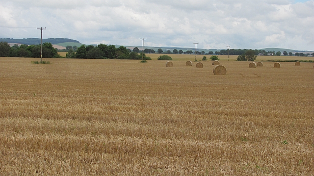
Gallow Hillock offers breathtaking panoramic views of the surrounding countryside, including the North Sea coastline to the east and the rolling hills to the west. Its prominent position makes it a popular destination for hikers, nature enthusiasts, and photographers.

The terrain of Gallow Hillock is mainly composed of heather-covered moorland, interspersed with rocky outcrops and patches of woodland. The hill is home to a diverse range of flora and fauna, including various bird species, such as red grouse and kestrels, as well as deer and rabbits.

The summit of Gallow Hillock is easily accessible via a well-marked trail that starts at the base of the hill. The hike to the top is of moderate difficulty, with some steep sections and uneven terrain, but the reward of reaching the summit is well worth the effort.

Gallow Hillock is not only a natural landmark but also holds historical significance. It is believed to have been used as a site for public executions during the medieval period, hence its name "Gallow" Hillock. Today, the hill is a peaceful and picturesque destination, offering visitors a chance to connect with nature and soak in the beauty of the Scottish landscape.

If you have any feedback on the listing, please let us know in the comments section below.

Gallow Hillock Images

Images are sourced within 2km of 56.847817/-2.5226452 or Grid Reference NO6873. Thanks to Geograph Open Source API. All images are credited.

Minor road passing between farm buildings at Bent Looking south-westward.
Minor road passing between farm buildings at Bent
Looking south-westward.
Minor road near to Bridgend Cottage Looking north-eastward. According to signage this is the road to 'The' Bent.
Minor road near to Bridgend Cottage
Looking north-eastward. According to signage this is the road to 'The' Bent.
Landends approaching Gallow Hillock Looking south-eastward.
Landends approaching Gallow Hillock
Looking south-eastward.
Track between Greenbottom Wood and a crop of peas Looking south-westward.
Track between Greenbottom Wood and a crop of peas
Looking south-westward.
Landends between woodland and a field of polytunnels Looking north-westward. To my untrained eye it looked like a crop of blueberries were being raised. Happy to be corrected.
Landends between woodland and a field of polytunnels
Looking north-westward. To my untrained eye it looked like a crop of blueberries were being raised. Happy to be corrected.
Minor road and housing under construction at Pitnamoon Looking north-westward. Obviously a sale has been agreed since this picture was taken : <a title="https://www.geograph.org.uk/photo/5462828" href="https://www.geograph.org.uk/photo/5462828">Link</a>
Minor road and housing under construction at Pitnamoon
Looking north-westward. Obviously a sale has been agreed since this picture was taken : Link
Minor road between Pitnamoon and Easthills Looking south-eastward. The crop on the left was broad beans with wheat (I think) on the right.
Minor road between Pitnamoon and Easthills
Looking south-eastward. The crop on the left was broad beans with wheat (I think) on the right.
Ordnance Survey Flush Bracket G867 This bracket can be found on the wall of Bridgend Cottage - a private dwelling.
The recorded details give a height of 56.2231 metres above sea level.
For more detail see : <span class="nowrap"><a title="https://www.bench-marks.org.uk/bm355" rel="nofollow ugc noopener" href="https://www.bench-marks.org.uk/bm355">Link</a><img style="margin-left:2px;" alt="External link" title="External link - shift click to open in new window" src="https://s1.geograph.org.uk/img/external.png" width="10" height="10"/></span>
Ordnance Survey Flush Bracket G867
This bracket can be found on the wall of Bridgend Cottage - a private dwelling. The recorded details give a height of 56.2231 metres above sea level. For more detail see : LinkExternal link
Farmland near Kilnhill
Round bales, Blackiemuir Stubble and baled straw in a large arable field. This would have been a Winter planted crop, the spring barley was only just turning at this time.
Round bales, Blackiemuir
Stubble and baled straw in a large arable field. This would have been a Winter planted crop, the spring barley was only just turning at this time.
Thornton Home Farm Was originally called Burgarton.  Now two houses, farm buildings not used.
(based on 1863 survey OS maps <span class="nowrap"><a title="http://maps.nls.uk/os/6inch/view/?sid=74427609" rel="nofollow ugc noopener" href="http://maps.nls.uk/os/6inch/view/?sid=74427609">Link</a><img style="margin-left:2px;" alt="External link" title="External link - shift click to open in new window" src="https://s1.geograph.org.uk/img/external.png" width="10" height="10"/></span> )
Thornton Home Farm
Was originally called Burgarton. Now two houses, farm buildings not used. (based on 1863 survey OS maps LinkExternal link )
Mains of Thornton farm house Originally called West Mains of Thornton 
as per 1863 survey OS map <span class="nowrap"><a title="http://maps.nls.uk/os/6inch/view/?sid=74427609" rel="nofollow ugc noopener" href="http://maps.nls.uk/os/6inch/view/?sid=74427609">Link</a><img style="margin-left:2px;" alt="External link" title="External link - shift click to open in new window" src="https://s1.geograph.org.uk/img/external.png" width="10" height="10"/></span>
Mains of Thornton farm house
Originally called West Mains of Thornton as per 1863 survey OS map LinkExternal link
Mains of Thornton farm buildings Taken from edge of Knowlies Plantation
Mains of Thornton farm buildings
Taken from edge of Knowlies Plantation
Coldstream Farm workers' houses
B9120 from Fettercairn to Laurencekirk
Minor road at Haughhead
Minor road near Bent
Show me another place!

Gallow Hillock is located at Grid Ref: NO6873 (Lat: 56.847817, Lng: -2.5226452)

Unitary Authority: Aberdeenshire

Police Authority: North East

What 3 Words

///focus.questions.merit. Near Laurencekirk, Aberdeenshire

Nearby Locations

Gallow Hillock

Related Wikis

Thornton Castle, Marykirk

Thornton Castle, Marykirk, Aberdeenshire is a fortress or fortified residence in Marykirk, Aberdeenshire. Parts of the house date from 1531.It was the...

Kincardine, Aberdeenshire

Kincardine was a burgh in Scotland, near the present-day village of Fettercairn. It served as the first county town of Kincardineshire. The settlement...

Fettercairn

Fettercairn (, Scottish Gaelic: Fothair Chàrdain) is a small village in Aberdeenshire, Scotland, northwest of Laurencekirk in Aberdeenshire on the B966...

Fettercairn distillery

Fettercairn distillery is a whisky distillery in Fettercairn. Situated under the Grampian foothills in the Howe of Mearns, Fettercairn town’s name is...

Nearby Amenities

Located within 500m of 56.847817,-2.5226452
Power: pole
Lat/Long: 56.8520774/-2.5214952
Power: pole
Lat/Long: 56.85133/-2.5218575
Power: pole
Lat/Long: 56.8507001/-2.5214489
Power: pole
Lat/Long: 56.8500263/-2.5210129
Power: pole
Lat/Long: 56.8493583/-2.5205938
Power: pole
Lat/Long: 56.8486903/-2.5201473
Power: pole
Lat/Long: 56.8480477/-2.5206296
Power: pole
Lat/Long: 56.8474234/-2.5210803
Power: pole
Lat/Long: 56.8470042/-2.5213962
Power: pole
Lat/Long: 56.8464283/-2.5217964
Power: pole
Lat/Long: 56.8457176/-2.5223419
Power: pole
Lat/Long: 56.8453145/-2.5226283
Power: pole
Lat/Long: 56.8447662/-2.523039
Power: pole
Lat/Long: 56.8442006/-2.5234581
Power: pole
Lat/Long: 56.8436235/-2.5239046
Power: pole
Lat/Long: 56.8434542/-2.5226725
The data included in this document is from www.openstreetmap.org. The data is made available under ODbL.

Have you been to Gallow Hillock?

Leave your review of Gallow Hillock below (or comments, questions and feedback).