Dirrington Hill

Hill, Mountain in Berwickshire

Scotland

Dirrington Hill

Benchmark on wall near Rawburn Farm Ordnance Survey benchmark. For database entry, see <span class="nowrap"><a title="https://www.bench-marks.org.uk/bm189613" rel="nofollow ugc noopener" href="https://www.bench-marks.org.uk/bm189613">Link</a><img style="margin-left:2px;" alt="External link" title="External link - shift click to open in new window" src="https://s1.geograph.org.uk/img/external.png" width="10" height="10"/></span>.
Benchmark on wall near Rawburn Farm Credit: Becky Williamson

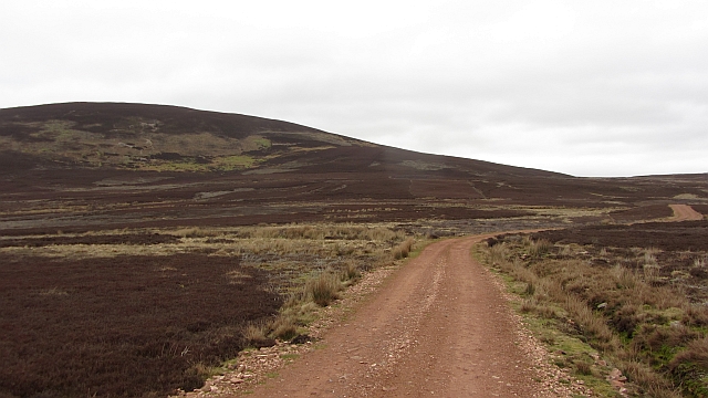
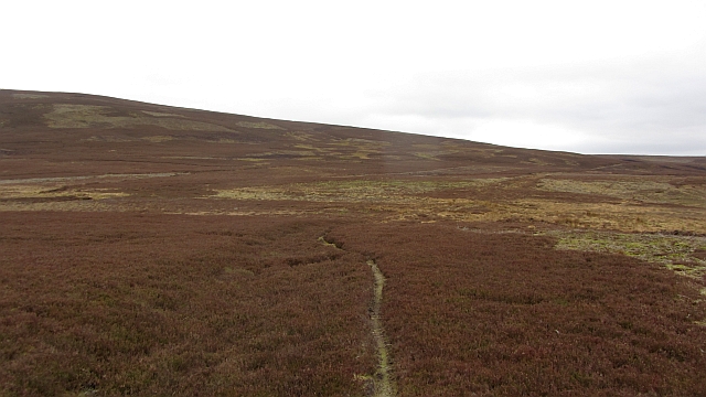
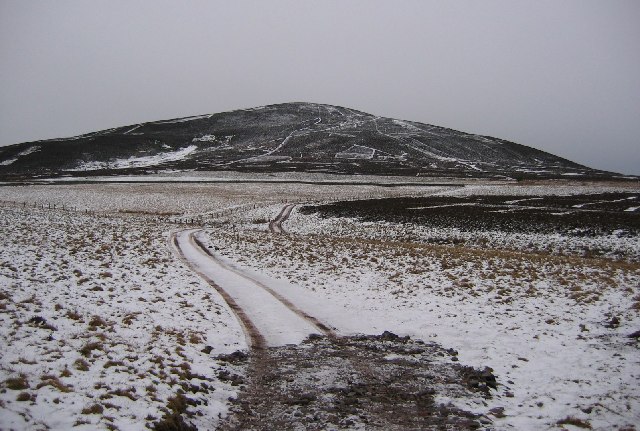
Dirrington Hill is a prominent hill located in Berwickshire, Scotland. It rises to an elevation of 288 meters (945 feet) above sea level and offers stunning panoramic views of the surrounding countryside. The hill is a popular destination for hikers and nature enthusiasts, thanks to its well-maintained trails and diverse flora and fauna.

Dirrington Hill is known for its distinctive conical shape, which is the result of volcanic activity that occurred millions of years ago. The hill is composed mainly of igneous rock, which gives it a rugged and dramatic appearance. The slopes of the hill are covered in grasses, heather, and shrubs, providing a habitat for a variety of wildlife such as birds, insects, and small mammals.

At the summit of Dirrington Hill, visitors can enjoy breathtaking views of the Berwickshire coastline, the Cheviot Hills, and the surrounding farmland. On a clear day, it is possible to see as far as the North Sea and the Isle of May. Overall, Dirrington Hill is a popular destination for outdoor enthusiasts looking to explore the natural beauty of Berwickshire.

If you have any feedback on the listing, please let us know in the comments section below.

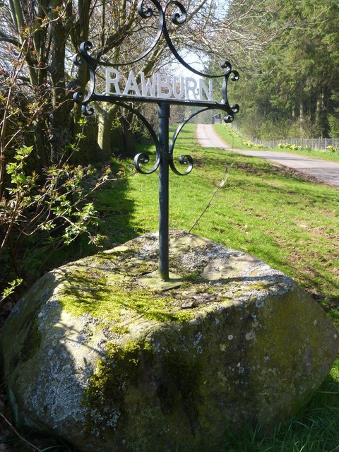
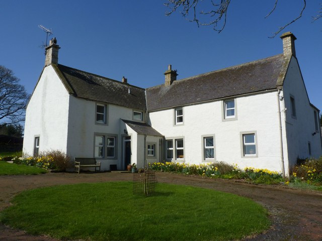
Dirrington Hill Images

Images are sourced within 2km of 55.78915/-2.5088687 or Grid Reference NT6855. Thanks to Geograph Open Source API. All images are credited.

Benchmark on wall near Rawburn Farm Ordnance Survey benchmark. For database entry, see <span class="nowrap"><a title="https://www.bench-marks.org.uk/bm189613" rel="nofollow ugc noopener" href="https://www.bench-marks.org.uk/bm189613">Link</a><img style="margin-left:2px;" alt="External link" title="External link - shift click to open in new window" src="https://s1.geograph.org.uk/img/external.png" width="10" height="10"/></span>.
Benchmark on wall near Rawburn Farm
Ordnance Survey benchmark. For database entry, see LinkExternal link.
Sign at Rawburn Farm
Rawburn Farm, near Longformacus Apparently a Covenanter, Margaret Tunnock, lived here in the seventeenth century.
Rawburn Farm, near Longformacus
Apparently a Covenanter, Margaret Tunnock, lived here in the seventeenth century.
Dirrington Great Law Moorland slopes of Dirrington Great Law. The hill is quite steep.
Dirrington Great Law
Moorland slopes of Dirrington Great Law. The hill is quite steep.
Butt, Dirrington Great Law One of a line of grouse butts on the steep slopes of Dirrington Great Law.  The ballot for the guns will be interesting here, get the top butt and expect some exercise.
Butt, Dirrington Great Law
One of a line of grouse butts on the steep slopes of Dirrington Great Law. The ballot for the guns will be interesting here, get the top butt and expect some exercise.
Triangulation pillar, Dirrington Great Law Since my last visit, the pillar has been dug up and has fallen over.
Triangulation pillar, Dirrington Great Law
Since my last visit, the pillar has been dug up and has fallen over.
Dyke, Dirrington Great Law A dyke and electric fence runs over the southern shoulder of Dirrington Great Law.
Dyke, Dirrington Great Law
A dyke and electric fence runs over the southern shoulder of Dirrington Great Law.
Track on Dirrington Great Law The track goes to the summit, but by spiraling around the west side of the hill and finishing from the south. This avoids steep ground. Black Hill power station is in the background.
Track on Dirrington Great Law
The track goes to the summit, but by spiraling around the west side of the hill and finishing from the south. This avoids steep ground. Black Hill power station is in the background.
Grouse butt, Dirrington Little Law Moorland between the two Dirrington Laws. The Ordnance Survey have taken a path off the 1:50,000 map here which is good as it does not exist. The route is a core path and is easily followed.
Grouse butt, Dirrington Little Law
Moorland between the two Dirrington Laws. The Ordnance Survey have taken a path off the 1:50,000 map here which is good as it does not exist. The route is a core path and is easily followed.
Young trees, Kippetlaw A shelter belt for the newly renovated Kippetlaw.
Young trees, Kippetlaw
A shelter belt for the newly renovated Kippetlaw.
Kippetlaw road Surfaced in the local red stone, a newish road.
Kippetlaw road
Surfaced in the local red stone, a newish road.
Dirrington Wood The road is new and continues leftward up to Dirrington Hill.
Dirrington Wood
The road is new and continues leftward up to Dirrington Hill.
Kippetlaw Burn The burn is deepened as a drain in an area of wetland beneath Dirrington Great Law.
Kippetlaw Burn
The burn is deepened as a drain in an area of wetland beneath Dirrington Great Law.
Dirrington Wood A burnt strip of heather before Dirrington Wood.
Dirrington Wood
A burnt strip of heather before Dirrington Wood.
Moorland, Dirrington Little Law The path shown on the map exists in places but is incorrectly shown on the 1:25,000 map.
Moorland, Dirrington Little Law
The path shown on the map exists in places but is incorrectly shown on the 1:25,000 map.
Crossing place A gate, almost impossible to open in a dyke. There is moorland on both sides.  The map shows a path running southwards on the west side of the dyke, lies!  There is no crossing place over the next dyke on this side. If heading south towards the road you should ignore the Ordnance Survey and stay on the eastern side of the dyke here.
Crossing place
A gate, almost impossible to open in a dyke. There is moorland on both sides. The map shows a path running southwards on the west side of the dyke, lies! There is no crossing place over the next dyke on this side. If heading south towards the road you should ignore the Ordnance Survey and stay on the eastern side of the dyke here.
Moorland, Dirrington Heather moorland to the north of Dirrington Little Law.
Moorland, Dirrington
Heather moorland to the north of Dirrington Little Law.
Map error A dyke and electric fence blocks the path shown by the Ordnance Survey. The near dyke should be followed on the east side to a crossing place on the far dyke.
Map error
A dyke and electric fence blocks the path shown by the Ordnance Survey. The near dyke should be followed on the east side to a crossing place on the far dyke.
Show me another place!

Dirrington Hill is located at Grid Ref: NT6855 (Lat: 55.78915, Lng: -2.5088687)

Unitary Authority: The Scottish Borders

Police Authority: The Lothians and Scottish Borders

What 3 Words

///dolphins.tooth.necklaces. Near Duns, Scottish Borders

Related Wikis

Dirrington Great Law

Dirrington Great Law is a hill in the Scottish Borders area of Scotland, in the former county of Berwickshire. The summit is around 2.5 kilometres (1.6...

Longformacus

Longformacus (Scottish Gaelic: Longphort Mhacais) is a small village in Berwickshire in the Scottish Borders area of Scotland. It is around 10 kilometres...

Watch Water

The Watch Water is a river in the Scottish Borders area of Scotland. It rises in the Lammermuir Hills, around 8 kilometres (5.0 mi) west of Longformacus...

Longformacus House

Longformacus House is a mansion near the village of Longformacus, Scottish Borders, Scotland. == History == The estate was once owned by the Earls of...

Have you been to Dirrington Hill?

Leave your review of Dirrington Hill below (or comments, questions and feedback).