Tire Beggar Hill

Hill, Mountain in Kincardineshire

Scotland

Tire Beggar Hill

Forest clearing A clearing in forestry plantations to the south-west of Tire Beggar Hill
Forest clearing Credit: William Starkey

Tire Beggar Hill, located in Kincardineshire, is a prominent hill/mountain in the eastern part of Scotland. Rising to an elevation of approximately 1,208 feet (368 meters), it is known for its distinctive shape and scenic views.

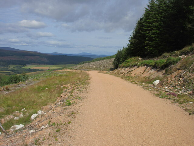
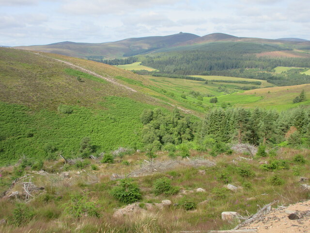
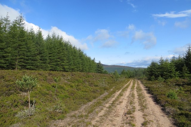
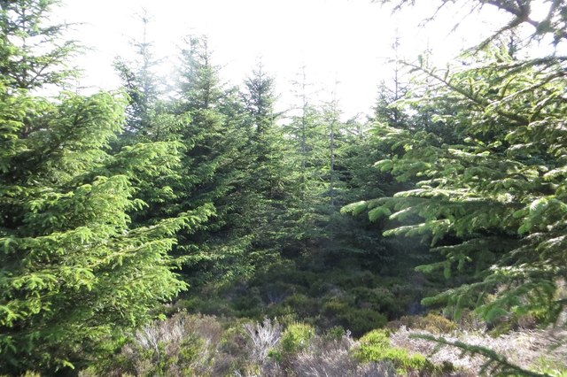
Situated within the picturesque Cairngorms National Park, Tire Beggar Hill is surrounded by rolling hills, lush green meadows, and dense forests. The hill itself is covered with heather and grass, providing a vibrant and varied landscape.

One of the main attractions of Tire Beggar Hill is its accessibility. The hill is easily accessible via a well-maintained trail that starts from the nearby village of Ballater. The trail, though steep in some sections, is suitable for both experienced hikers and beginners.

Reaching the summit of Tire Beggar Hill rewards hikers with breathtaking panoramic views of the surrounding countryside. On a clear day, one can see the distant peaks of the Cairngorms and the sparkling waters of Loch Muick. The hill's summit also offers a perfect vantage point to witness stunning sunrises and sunsets.

Tire Beggar Hill is a haven for wildlife enthusiasts, as it is home to a diverse range of flora and fauna. Red deer, mountain hares, and various bird species can often be spotted during a hike up the hill.

Overall, Tire Beggar Hill is a popular destination for outdoor enthusiasts, offering a challenging yet rewarding hike, stunning views, and a chance to immerse oneself in the natural beauty of the Scottish Highlands.

If you have any feedback on the listing, please let us know in the comments section below.

Tire Beggar Hill Images

Images are sourced within 2km of 56.959611/-2.5306062 or Grid Reference NO6785. Thanks to Geograph Open Source API. All images are credited.

Forest clearing A clearing in forestry plantations to the south-west of Tire Beggar Hill
Forest clearing
A clearing in forestry plantations to the south-west of Tire Beggar Hill
Tipperweir Hill The southern flank of Tipperweir, with extensive growth of heather and bog making progress on foot here difficult.
Tipperweir Hill
The southern flank of Tipperweir, with extensive growth of heather and bog making progress on foot here difficult.
Heathland to the west of Aikenhead Heather covered ground between Tipperweir (visible on the skyline) and the Hill of Gothie. The source of the Burn of Duglenny lies in the area clear of heather in the middle distance. The terrain here makes for difficult walking.
Heathland to the west of Aikenhead
Heather covered ground between Tipperweir (visible on the skyline) and the Hill of Gothie. The source of the Burn of Duglenny lies in the area clear of heather in the middle distance. The terrain here makes for difficult walking.
View from the Hill of Gothie The summit area of the Hill of Gothie, with Fetteresso Forest, farmland south of Stonehaven and the North Sea visible in the distance.
View from the Hill of Gothie
The summit area of the Hill of Gothie, with Fetteresso Forest, farmland south of Stonehaven and the North Sea visible in the distance.
Conifers on the Hill of Gothie A small conifer plantation on the summit of the Hill of Gothie. The trees are curiously stunted, with few exceeding three metres in height.
Conifers on the Hill of Gothie
A small conifer plantation on the summit of the Hill of Gothie. The trees are curiously stunted, with few exceeding three metres in height.
The Burn of Duglenny Bright green moss growing by the Burn of Duglenny, viewed here near its source between the Hill of Gothie and Tipperweir.
The Burn of Duglenny
Bright green moss growing by the Burn of Duglenny, viewed here near its source between the Hill of Gothie and Tipperweir.
Burn of Duglenny Moss growing by the peat-coloured water of the Burn of Duglenny, viewed near its source north of the Hill of Gothie.
Burn of Duglenny
Moss growing by the peat-coloured water of the Burn of Duglenny, viewed near its source north of the Hill of Gothie.
Builg path The Builg path, viewed to the east of Tipperweir Hill. This is an ancient right of way from Feughside to Paldy Fair, and was originally used as a drove road. Further information can be found on the Heritage Paths website: <span class="nowrap"><a title="http://www.heritagepaths.co.uk/pathdetails.php?path=119" rel="nofollow ugc noopener" href="http://www.heritagepaths.co.uk/pathdetails.php?path=119">Link</a><img style="margin-left:2px;" alt="External link" title="External link - shift click to open in new window" src="https://s1.geograph.org.uk/img/external.png" width="10" height="10"/></span>
Builg path
The Builg path, viewed to the east of Tipperweir Hill. This is an ancient right of way from Feughside to Paldy Fair, and was originally used as a drove road. Further information can be found on the Heritage Paths website: LinkExternal link
Heathland north of Tipperweir Extensive growth of heather to the north of Tipperweir Hill, viewed across the course of the Builg Path.
Heathland north of Tipperweir
Extensive growth of heather to the north of Tipperweir Hill, viewed across the course of the Builg Path.
Forest track A track in the extensive forestry plantations to the north of Tipperweir Hill
Forest track
A track in the extensive forestry plantations to the north of Tipperweir Hill
Forested southern side of Little Kerloch The forested southern slopes of Little Kerloch, viewed from the track across a cleared area.
Forested southern side of Little Kerloch
The forested southern slopes of Little Kerloch, viewed from the track across a cleared area.
Hillside across the Builg Burn Looking south-westwards across the valley of the Builg Burn to the opposite hillside.
Hillside across the Builg Burn
Looking south-westwards across the valley of the Builg Burn to the opposite hillside.
Track through cleared area of forest Forestry track heading north-westwards through a cleared area, with Morven in the far distance on the horizon.
Track through cleared area of forest
Forestry track heading north-westwards through a cleared area, with Morven in the far distance on the horizon.
Bracken covered hillside Looking westwards over the gully of the Builg Burn to the bracken infested lower northern slopes of Heathery Hill, with Clachnaben in the distance.
Bracken covered hillside
Looking westwards over the gully of the Builg Burn to the bracken infested lower northern slopes of Heathery Hill, with Clachnaben in the distance.
Forest road, Garlot Hill A young plantation above Glen Dye.
Forest road, Garlot Hill
A young plantation above Glen Dye.
Young trees, Garlot Hill A recent plantation above Glen Dye.
Young trees, Garlot Hill
A recent plantation above Glen Dye.
Young trees, Garlot Hill A somewhat uncomfortable place to get to, inside a young conifer plantation.
Young trees, Garlot Hill
A somewhat uncomfortable place to get to, inside a young conifer plantation.
Track on Garlot Hill Deeply bulldozed forest road.
Track on Garlot Hill
Deeply bulldozed forest road.
Show me another place!

Tire Beggar Hill is located at Grid Ref: NO6785 (Lat: 56.959611, Lng: -2.5306062)

Unitary Authority: Aberdeenshire

Police Authority: North East

What 3 Words

///lurching.mainland.outwit. Near Banchory, Aberdeenshire

Related Wikis

Drumtochty Forest

Drumtochty Forest is a coniferous woodland in Kincardineshire, Scotland. In earlier times this forest was associated with Drumtochty Castle. Other notable...

Kincardineshire

Kincardineshire, also known as the Mearns (from the Scottish Gaelic A' Mhaoirne meaning "the Stewartry"), is a historic county, registration county and...

Cairn O' Mounth

Cairn O' Mounth/Cairn O' Mount (Scottish Gaelic: Càrn Mhon) is a high mountain pass in Aberdeenshire, Scotland. The place name is a survival of the ancient...

Drumtochty Castle

Drumtochty Castle is a neo-gothic style castellated mansion erected in 1812 approximately three kilometres north-west of Auchenblae, Kincardineshire, Scotland...

Clachnaben

Clachnaben (archaically "Cloch-na'bain"; Scottish Gaelic: "Clach na Beinne") is a 589-metre hill in Glen Dye, Aberdeenshire, Scotland. It is a distinctive...

Strachan, Aberdeenshire

Strachan is a village in Aberdeenshire, Scotland that lies along the Water of Feugh, a tributary of the River Dee, Aberdeenshire, a few miles southwest...

Craiginour

Craiginour is a hill located near Cowie Water in Stonehaven, Aberdeenshire, Scotland. Its summit is at 355 metres (1,165 ft). == References ==

Water of Aven

The Water of Aven (or A'an) (Scottish Gaelic: an t-Uisge Bàn) is a tributary of the Water of Feugh, itself the largest tributary of the River Dee, Aberdeenshire...

Have you been to Tire Beggar Hill?

Leave your review of Tire Beggar Hill below (or comments, questions and feedback).