Berry Hill

Hill, Mountain in Aberdeenshire

Scotland

Berry Hill

Achreolink when still open
Achreolink when still open Credit: Ralph Greig

Berry Hill is a prominent hill located in Aberdeenshire, Scotland. With an elevation of approximately 560 meters, it offers breathtaking panoramic views of the surrounding landscape. The hill is situated near the village of Tarland, about 50 miles west of Aberdeen.

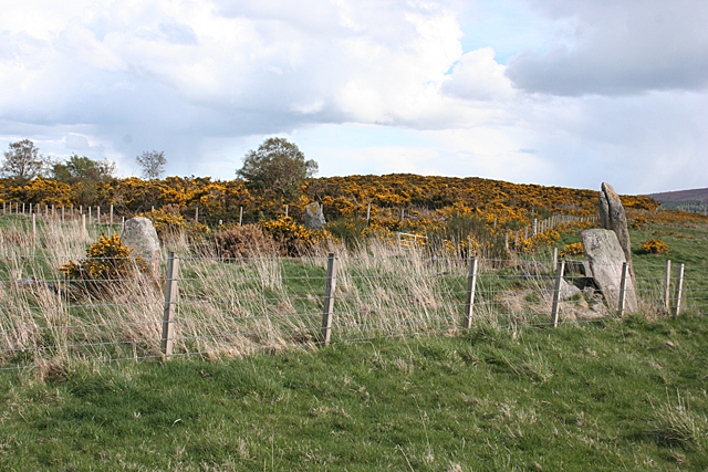
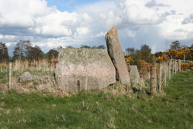
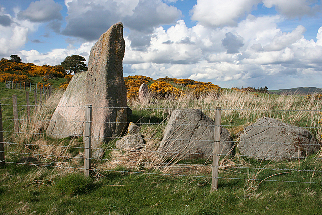
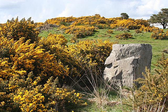
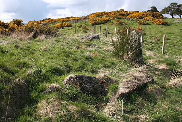
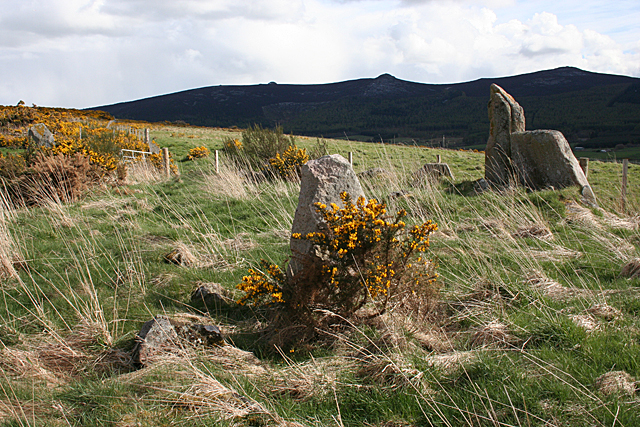
Berry Hill is a popular destination for hikers and nature enthusiasts due to its accessible trails and picturesque scenery. The terrain consists of heather-covered moorland, rocky outcrops, and scattered woodland, providing a diverse environment for flora and fauna. The hill is known for its abundance of wildflowers during the spring and summer months, adding a burst of color to the landscape.

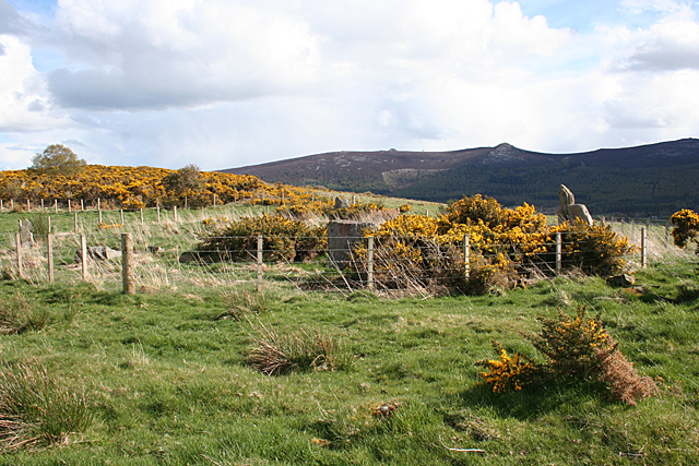
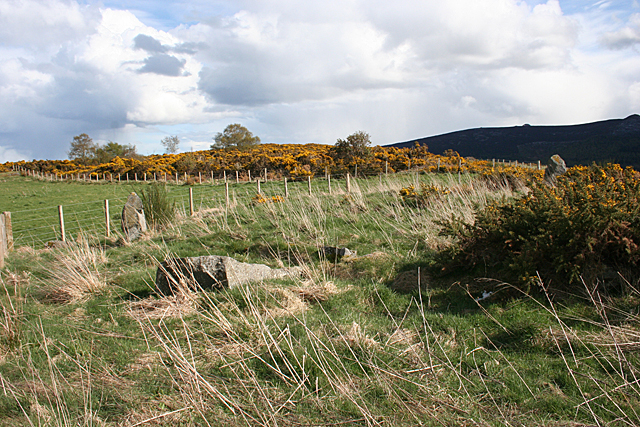
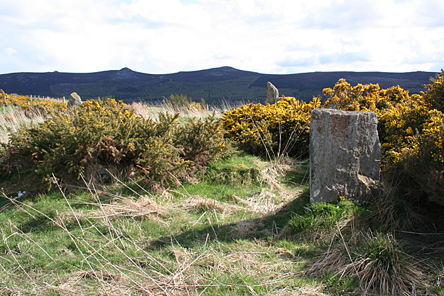
At the summit of Berry Hill, visitors can enjoy stunning vistas of the Cairngorms National Park, with its majestic mountain ranges and glacial valleys. On a clear day, it is possible to see as far as Lochnagar, one of Scotland's most iconic mountains.

The hill is easily accessible, with a well-marked trail that starts from the village of Tarland. The path is suitable for all fitness levels, although some sections may be steep and require a moderate level of fitness. It is advisable to wear appropriate footwear and carry essential supplies such as water and snacks.

Overall, Berry Hill offers a rewarding outdoor experience for those seeking tranquility and natural beauty. Whether it is a leisurely stroll or a more challenging hike, this Aberdeenshire gem provides an opportunity to immerse oneself in the stunning Scottish countryside.

If you have any feedback on the listing, please let us know in the comments section below.

Berry Hill Images

Images are sourced within 2km of 57.316903/-2.5524812 or Grid Reference NJ6625. Thanks to Geograph Open Source API. All images are credited.

Achreolink when still open
New Mains, Oyne
New Mains, Oyne
The village of Oyne from the slopes of Bennachie This view is from the narrow and muddy footpath that runs along the north side of the hill, parallel to the Old Aberdeen Turnpike.
The village of Oyne from the slopes of Bennachie
This view is from the narrow and muddy footpath that runs along the north side of the hill, parallel to the Old Aberdeen Turnpike.
The Iron Age Roundhouse, Archaeolink, Oyne
Winter landscape - the track to Hillbrae This photograph shows the track down to the derelict steading known as Hillbrae - Harthill Castle can be seen in the foreground
Winter landscape - the track to Hillbrae
This photograph shows the track down to the derelict steading known as Hillbrae - Harthill Castle can be seen in the foreground
Memorial Cairn, Oyne This cairn, built in memory of the late Anne Savage of Harthill Castle, stands approximately 20m north of the Gowk Stane
Memorial Cairn, Oyne
This cairn, built in memory of the late Anne Savage of Harthill Castle, stands approximately 20m north of the Gowk Stane
Harthill Castle from the west
Cave in the Bennachie hills A granite cave at Craigshannoch in the Bennachie range of hills.  A chance find on a geocache hunt in the area
Cave in the Bennachie hills
A granite cave at Craigshannoch in the Bennachie range of hills. A chance find on a geocache hunt in the area
Ordnance Survey  Flush Bracket S4935 This can be found on the wall of the school.
For more detail see : <span class="nowrap"><a title="http://www.bench-marks.org.uk/bm545" rel="nofollow ugc noopener" href="http://www.bench-marks.org.uk/bm545">Link</a><img style="margin-left:2px;" alt="External link" title="External link - shift click to open in new window" src="https://s1.geograph.org.uk/img/external.png" width="10" height="10"/></span>
Ordnance Survey Flush Bracket S4935
This can be found on the wall of the school. For more detail see : LinkExternal link
Hatton of Ardoyne Recumbent Stone Circle (1) The circle is in an enclosure between Candle Hill and Roup Hill. Nine of the stones survive, but they are rather hemmed in by the fence, and becoming overgrown with grass and whins. See <span class="nowrap"><a title="http://canmore.rcahms.gov.uk/en/site/18125/details/hatton+of+ardoyne/" rel="nofollow ugc noopener" href="http://canmore.rcahms.gov.uk/en/site/18125/details/hatton+of+ardoyne/">Link</a><img style="margin-left:2px;" alt="External link" title="External link - shift click to open in new window" src="https://s1.geograph.org.uk/img/external.png" width="10" height="10"/></span> for a full description. <a href="https://www.geograph.org.uk/photo/4452825">NJ6526 : Hatton of Ardoyne Recumbent Stone Circle (2)</a>
Hatton of Ardoyne Recumbent Stone Circle (1)
The circle is in an enclosure between Candle Hill and Roup Hill. Nine of the stones survive, but they are rather hemmed in by the fence, and becoming overgrown with grass and whins. See LinkExternal link for a full description. NJ6526 : Hatton of Ardoyne Recumbent Stone Circle (2)
Hatton of Ardoyne Recumbent Stone Circle (2) The recumbent and one flanker are two of the nine main stones still surviving. There are also several kerb stones, some of which are to either side of the two main stones. See <span class="nowrap"><a title="http://canmore.rcahms.gov.uk/en/site/18125/details/hatton+of+ardoyne/" rel="nofollow ugc noopener" href="http://canmore.rcahms.gov.uk/en/site/18125/details/hatton+of+ardoyne/">Link</a><img style="margin-left:2px;" alt="External link" title="External link - shift click to open in new window" src="https://s1.geograph.org.uk/img/external.png" width="10" height="10"/></span> for a full description. <a href="https://www.geograph.org.uk/photo/4452834">NJ6526 : Hatton of Ardoyne Recumbent Stone Circle (3)</a>
Hatton of Ardoyne Recumbent Stone Circle (2)
The recumbent and one flanker are two of the nine main stones still surviving. There are also several kerb stones, some of which are to either side of the two main stones. See LinkExternal link for a full description. NJ6526 : Hatton of Ardoyne Recumbent Stone Circle (3)
Hatton of Ardoyne Recumbent Stone Circle (3) On the left is the flanker, with the recumbent behind it. The stones in the foreground may be part of a kerb. One of the other stones still standing is in front of the nearest whin bushes.  See <span class="nowrap"><a title="http://canmore.rcahms.gov.uk/en/site/18125/details/hatton+of+ardoyne/" rel="nofollow ugc noopener" href="http://canmore.rcahms.gov.uk/en/site/18125/details/hatton+of+ardoyne/">Link</a><img style="margin-left:2px;" alt="External link" title="External link - shift click to open in new window" src="https://s1.geograph.org.uk/img/external.png" width="10" height="10"/></span> for a full description. <a href="https://www.geograph.org.uk/photo/4452845">NJ6526 : Hatton of Ardoyne Recumbent Stone Circle (4)</a>
Hatton of Ardoyne Recumbent Stone Circle (3)
On the left is the flanker, with the recumbent behind it. The stones in the foreground may be part of a kerb. One of the other stones still standing is in front of the nearest whin bushes. See LinkExternal link for a full description. NJ6526 : Hatton of Ardoyne Recumbent Stone Circle (4)
Hatton of Ardoyne Recumbent Stone Circle (4) Looking in from outside the circle. The tallest stone, the flanker is to the right, with the recumbent beside it. Just inside the fence is one of the other stones still standing, and further to the left is a fallen stone. The tip of another standing stone can be seen above the nearest standing stone. <a href="https://www.geograph.org.uk/photo/4452850">NJ6526 : Hatton of Ardoyne Recumbent Stone Circle (5)</a>
Hatton of Ardoyne Recumbent Stone Circle (4)
Looking in from outside the circle. The tallest stone, the flanker is to the right, with the recumbent beside it. Just inside the fence is one of the other stones still standing, and further to the left is a fallen stone. The tip of another standing stone can be seen above the nearest standing stone. NJ6526 : Hatton of Ardoyne Recumbent Stone Circle (5)
Hatton of Ardoyne Recumbent Stone Circle (5) This is the reciprocal of <a href="https://www.geograph.org.uk/photo/4452845">NJ6526 : Hatton of Ardoyne Recumbent Stone Circle (4)</a>, showing the other side of the stone nearest to the north of the circle.  See <span class="nowrap"><a title="http://canmore.rcahms.gov.uk/en/site/18125/details/hatton+of+ardoyne/" rel="nofollow ugc noopener" href="http://canmore.rcahms.gov.uk/en/site/18125/details/hatton+of+ardoyne/">Link</a><img style="margin-left:2px;" alt="External link" title="External link - shift click to open in new window" src="https://s1.geograph.org.uk/img/external.png" width="10" height="10"/></span> for a full description. <a href="https://www.geograph.org.uk/photo/4452851">NJ6626 : Hatton of Ardoyne Recumbent Stone Circle (6)</a>
Hatton of Ardoyne Recumbent Stone Circle (5)
This is the reciprocal of NJ6526 : Hatton of Ardoyne Recumbent Stone Circle (4), showing the other side of the stone nearest to the north of the circle. See LinkExternal link for a full description. NJ6626 : Hatton of Ardoyne Recumbent Stone Circle (6)
Hatton of Ardoyne Recumbent Stone Circle (6) These are the stones on the east side of the circle. One still stands but the rest have fallen over.  See <span class="nowrap"><a title="http://canmore.rcahms.gov.uk/en/site/18125/details/hatton+of+ardoyne/" rel="nofollow ugc noopener" href="http://canmore.rcahms.gov.uk/en/site/18125/details/hatton+of+ardoyne/">Link</a><img style="margin-left:2px;" alt="External link" title="External link - shift click to open in new window" src="https://s1.geograph.org.uk/img/external.png" width="10" height="10"/></span> for a full description. <a href="https://www.geograph.org.uk/photo/4452858">NJ6526 : Hatton of Ardoyne Recumbent Stone Circle (7)</a>
Hatton of Ardoyne Recumbent Stone Circle (6)
These are the stones on the east side of the circle. One still stands but the rest have fallen over. See LinkExternal link for a full description. NJ6526 : Hatton of Ardoyne Recumbent Stone Circle (7)
Hatton of Ardoyne Recumbent Stone Circle (7) The north-east arc of the circle, with one standing and at least one fallen stone. Another standing one is to the right, and the east end of Bennachie is on the skyline.  See <span class="nowrap"><a title="http://canmore.rcahms.gov.uk/en/site/18125/details/hatton+of+ardoyne/" rel="nofollow ugc noopener" href="http://canmore.rcahms.gov.uk/en/site/18125/details/hatton+of+ardoyne/">Link</a><img style="margin-left:2px;" alt="External link" title="External link - shift click to open in new window" src="https://s1.geograph.org.uk/img/external.png" width="10" height="10"/></span> for a full description. <a href="https://www.geograph.org.uk/photo/4452865">NJ6526 : Hatton of Ardoyne Recumbent Stone Circle (8)</a>
Hatton of Ardoyne Recumbent Stone Circle (7)
The north-east arc of the circle, with one standing and at least one fallen stone. Another standing one is to the right, and the east end of Bennachie is on the skyline. See LinkExternal link for a full description. NJ6526 : Hatton of Ardoyne Recumbent Stone Circle (8)
Hatton of Ardoyne Recumbent Stone Circle (8) Just to the right of <a href="https://www.geograph.org.uk/photo/4452858">NJ6526 : Hatton of Ardoyne Recumbent Stone Circle (7)</a>, with the same standing stone at the far side of the circle, the flanker to the right, and another standing stone in the foreground. Bennachie is on the skyline. <a href="https://www.geograph.org.uk/photo/4452868">NJ6526 : Hatton of Ardoyne Recumbent Stone Circle (9)</a>
Hatton of Ardoyne Recumbent Stone Circle (8)
Just to the right of NJ6526 : Hatton of Ardoyne Recumbent Stone Circle (7), with the same standing stone at the far side of the circle, the flanker to the right, and another standing stone in the foreground. Bennachie is on the skyline. NJ6526 : Hatton of Ardoyne Recumbent Stone Circle (9)
Hatton of Ardoyne Recumbent Stone Circle (9) A small standing stone is in the foreground, and a larger one on the far side of the circle is at left. The flanker and recumbent are on the right, and several kerb stones are visible in the grass. On the skyline is Bennachie.  See <span class="nowrap"><a title="http://canmore.rcahms.gov.uk/en/site/18125/details/hatton+of+ardoyne/" rel="nofollow ugc noopener" href="http://canmore.rcahms.gov.uk/en/site/18125/details/hatton+of+ardoyne/">Link</a><img style="margin-left:2px;" alt="External link" title="External link - shift click to open in new window" src="https://s1.geograph.org.uk/img/external.png" width="10" height="10"/></span> for a full description. <a href="https://www.geograph.org.uk/photo/4452873">NJ6526 : Hatton of Ardoyne Recumbent Stone Circle (10)</a>
Hatton of Ardoyne Recumbent Stone Circle (9)
A small standing stone is in the foreground, and a larger one on the far side of the circle is at left. The flanker and recumbent are on the right, and several kerb stones are visible in the grass. On the skyline is Bennachie. See LinkExternal link for a full description. NJ6526 : Hatton of Ardoyne Recumbent Stone Circle (10)
Show me another place!

Berry Hill is located at Grid Ref: NJ6625 (Lat: 57.316903, Lng: -2.5524812)

Unitary Authority: Aberdeenshire

Police Authority: North East

What 3 Words

///lamplight.seating.stocks. Near Insch, Aberdeenshire

Nearby Locations

Berry Hill Ryehill

Related Wikis

Oyne

Oyne is a small village in rural Aberdeenshire at the bottom of Bennachie in Scotland. == Locality == The village has limited local resources. It once...

Oyne railway station

Oyne railway station is a former railway station serving the small village of Oyne, Aberdeenshire. == History == Oyne station was built by the Great North...

Buchanstone railway station

Buchanstone railway station is a former railway station in Aberdeenshire. On the Great North of Scotland Railway, the station was on the north side of...

Westhall Castle

Westhall Castle, also known as Westhall House, is a country house located to the north of Oyne, in Aberdeenshire, Scotland. The house includes a 16th-century...

Nearby Amenities

Located within 500m of 57.316903,-2.5524812
Ele: 173
Natural: peak
Lat/Long: 57.3169252/-2.5524352
Power: pole
Lat/Long: 57.3208519/-2.5559333
Power: pole
Lat/Long: 57.3204457/-2.5544702
Power: pole
Lat/Long: 57.3200134/-2.5529574
Power: pole
Lat/Long: 57.3195115/-2.5492144
Power: pole
Lat/Long: 57.3192762/-2.5480181
Power: pole
Lat/Long: 57.3190445/-2.5468916
Power: pole
Lat/Long: 57.318891/-2.5460735
Power: pole
Lat/Long: 57.3187592/-2.5454298
Power: pole
Lat/Long: 57.3153104/-2.5594982
Power: pole
Lat/Long: 57.3156867/-2.5587206
Power: pole
Lat/Long: 57.3161793/-2.5576875
Power: pole
Lat/Long: 57.3166536/-2.5567015
Power: pole
Lat/Long: 57.3171219/-2.5556863
Power: pole
Lat/Long: 57.3184566/-2.5590142
Power: pole
Lat/Long: 57.3180416/-2.5579811
Power: pole
Lat/Long: 57.3175818/-2.5568292
Power: pole
Lat/Long: 57.3168775/-2.5550634
Power: pole
Lat/Long: 57.3163378/-2.5542118
Power: pole
Lat/Long: 57.3158985/-2.5535036
Power: pole
Lat/Long: 57.3152934/-2.5525445
Power: pole
Lat/Long: 57.3148771/-2.5514845
Power: pole
Lat/Long: 57.3144245/-2.5503775
Power: pole
Lat/Long: 57.3140312/-2.5495013
Power: pole
Lat/Long: 57.3135883/-2.5484749
Generator Method: photovoltaic
Generator Output Electricity: yes
Generator Source: solar
Generator Type: solar_photovoltaic_panel
Location: roof
Power: generator
Lat/Long: 57.3199446/-2.547023
The data included in this document is from www.openstreetmap.org. The data is made available under ODbL.

Have you been to Berry Hill?

Leave your review of Berry Hill below (or comments, questions and feedback).