Brandcrook Hill

Hill, Mountain in Westmorland Eden

England

Brandcrook Hill

Stamp Hill Farm Viewed from a passing train. The yard in the foreground appears to have been surfaced since an earlier photo <a href="https://www.geograph.org.uk/photo/3820658">NY6526 : Stamp Hill Farm</a>.
Stamp Hill Farm Credit: Stephen Craven

Brandcrook Hill is a prominent hill located in the county of Westmorland, England. Situated in the picturesque Lake District National Park, it offers breathtaking views and is a popular destination for hikers and nature enthusiasts.

With an elevation of approximately 441 meters (1,447 feet), Brandcrook Hill stands as a notable landmark in the region. Its distinct shape and rocky terrain make it easily recognizable from afar. The hill is composed mainly of limestone, giving it a rugged and weathered appearance.

Surrounded by lush green meadows and rolling hills, Brandcrook Hill provides a haven for a wide variety of flora and fauna. The hillside is adorned with vibrant wildflowers during the spring and summer months, creating a picturesque landscape. It is also home to several species of birds, including peregrine falcons, buzzards, and ravens, making it a popular spot for birdwatching.

A network of well-maintained trails and footpaths crisscrosses the hill, offering visitors the opportunity to explore its beauty. The ascent to the summit is moderately challenging, rewarding hikers with stunning panoramic views of the surrounding countryside, including the nearby Lake Windermere.

Brandcrook Hill is steeped in history, with evidence of ancient settlements and burial mounds found in the vicinity. It is believed to have been an important location during prehistoric times, serving as a vantage point for local communities. Today, it remains a cherished natural landmark, attracting visitors from far and wide to its tranquil and scenic surroundings.

If you have any feedback on the listing, please let us know in the comments section below.

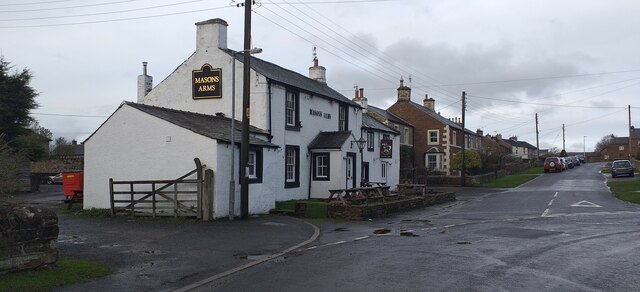
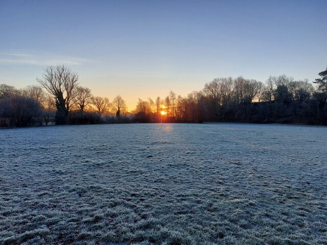
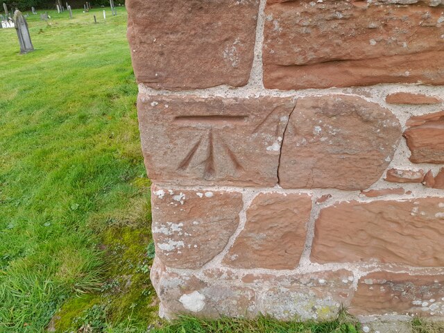
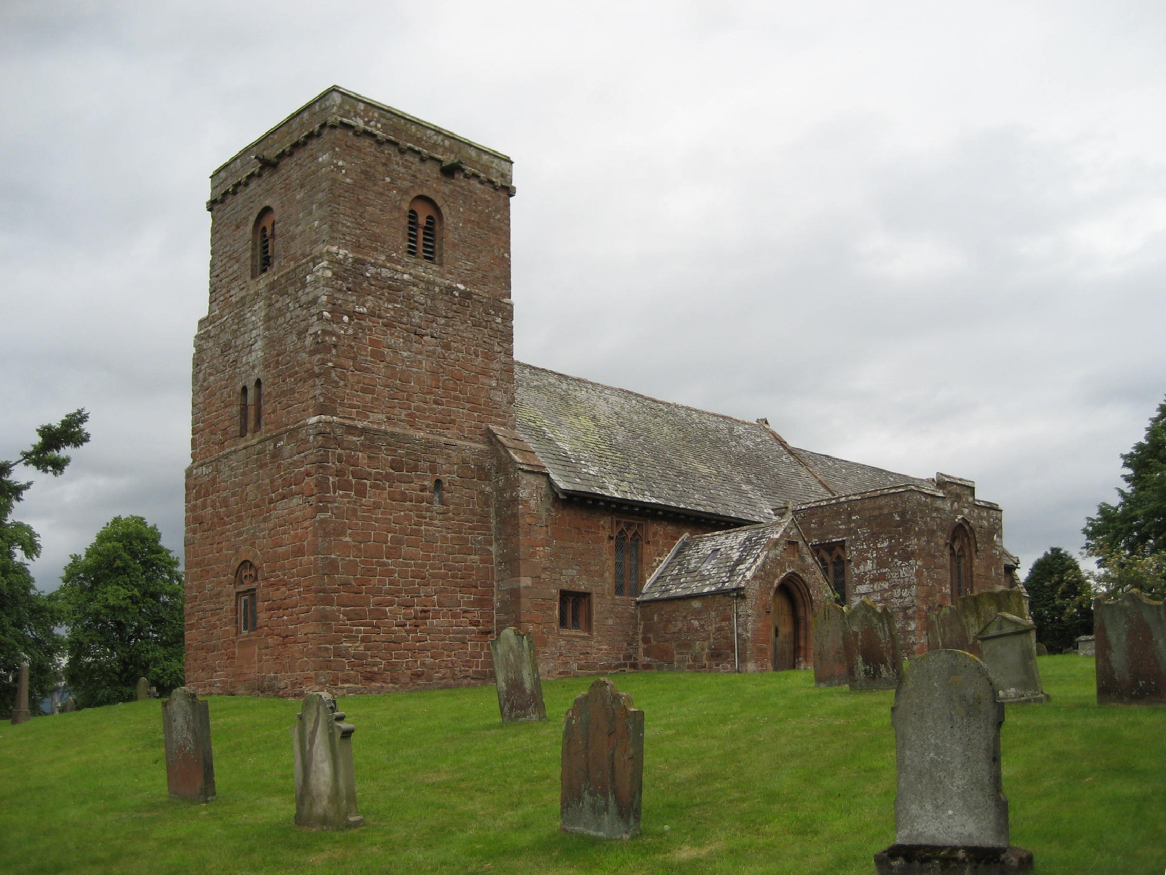
Brandcrook Hill Images

Images are sourced within 2km of 54.614613/-2.5332756 or Grid Reference NY6524. Thanks to Geograph Open Source API. All images are credited.

Stamp Hill Farm Viewed from a passing train. The yard in the foreground appears to have been surfaced since an earlier photo <a href="https://www.geograph.org.uk/photo/3820658">NY6526 : Stamp Hill Farm</a>.
Stamp Hill Farm
Viewed from a passing train. The yard in the foreground appears to have been surfaced since an earlier photo NY6526 : Stamp Hill Farm.
The Masons Arms, Long Marton The Masons Arms, Long Marton, a public house and restaurant.
The Masons Arms, Long Marton
The Masons Arms, Long Marton, a public house and restaurant.
Bolton, frosty sunrise
Edenfold, Bolton
Edenfold, Bolton
Bolton Bridge, Bolton
Frosty field with sunrise near Bolton
Minor road towards Long Marton
Road junction near Brampton
Benchmark, Long Marton, Bridge 253 Detail of an Ordnance Survey cut benchmark on the end pier of the south east abutment of Park Lane Bridge on the Settle to Carlisle railway, railway engineers’ bridge reference number SAC/253.  The benchmark marks a height of 132.4021m above mean sea level (Ordnance Datum Newlyn) last verified in 1955.
Benchmark, Long Marton, Bridge 253
Detail of an Ordnance Survey cut benchmark on the end pier of the south east abutment of Park Lane Bridge on the Settle to Carlisle railway, railway engineers’ bridge reference number SAC/253. The benchmark marks a height of 132.4021m above mean sea level (Ordnance Datum Newlyn) last verified in 1955.
Ordnance Survey Cut Mark This OS cut mark can be found on the outbuilding at Park House. It marks a point 125.605m above mean sea level.
Ordnance Survey Cut Mark
This OS cut mark can be found on the outbuilding at Park House. It marks a point 125.605m above mean sea level.
Ordnance Survey Cut Mark This damaged OS cut mark can be found on the north parapet of the bridge. It marked a point 123.819m above mean sea level.
Ordnance Survey Cut Mark
This damaged OS cut mark can be found on the north parapet of the bridge. It marked a point 123.819m above mean sea level.
Ordnance Survey Cut Mark This OS cut mark can be found on the SE abutment of the railway bridge. It marks a point 132.402m above mean sea level.
Ordnance Survey Cut Mark
This OS cut mark can be found on the SE abutment of the railway bridge. It marks a point 132.402m above mean sea level.
Ordnance Survey Cut Mark This OS cut mark can be found on the SE side of the railway bridge. It marks a point 134.612m above mean sea level.
Ordnance Survey Cut Mark
This OS cut mark can be found on the SE side of the railway bridge. It marks a point 134.612m above mean sea level.
Ordnance Survey Cut Mark This OS cut mark can be found on the NE side of the railway bridge. It marks a point 134.615m above mean sea level.
Ordnance Survey Cut Mark
This OS cut mark can be found on the NE side of the railway bridge. It marks a point 134.615m above mean sea level.
Ordnance Survey Cut Mark This OS cut mark can be found on the SW angle of the Church of St Margaret & St James. It marks a point 128.446m above mean sea level.
Ordnance Survey Cut Mark
This OS cut mark can be found on the SW angle of the Church of St Margaret & St James. It marks a point 128.446m above mean sea level.
Ordnance Survey Cut Mark This OS cut mark can be found on the NW side of the railway bridge. It marks a point 138.647m above mean sea level.
Ordnance Survey Cut Mark
This OS cut mark can be found on the NW side of the railway bridge. It marks a point 138.647m above mean sea level.
Ordnance Survey Rivet This OS rivet can be found on the SE parapet of the railway bridge. It marks a point 144.664m above mean sea level.
Ordnance Survey Rivet
This OS rivet can be found on the SE parapet of the railway bridge. It marks a point 144.664m above mean sea level.
Show me another place!

Brandcrook Hill is located at Grid Ref: NY6524 (Lat: 54.614613, Lng: -2.5332756)

Administrative County: Cumbria

District: Eden

Police Authority: Cumbria

What 3 Words

///inviting.estimates.perfumed. Near Appleby-in-Westmorland, Cumbria

Nearby Locations

Brandcrook Hill

Related Wikis

Long Marton

Long Marton is a village and civil parish in the Eden District of the English county of Cumbria. In 2011 the population was 827. The village previously...

Long Marton railway station

Long Marton railway station was a railway station which served the village of Long Marton in Cumbria, England. Situated on the Settle-Carlisle Line, it...

St Margaret and St James' Church, Long Marton

St Margaret and St James' Church is located about 0.5 miles (0.8 km) to the south of the village of Long Marton, Cumbria, England. It is an active Anglican...

Broom, Cumbria

Broom is a hamlet near the village of Long Marton, in the Eden district, in the county of Cumbria, England. == Location == It is located about two miles...

Kirkby Thore railway station

Kirkby Thore railway station was a railway station situated on the Eden Valley Railway between Penrith and Kirkby Stephen East. It served the village of...

Kirkby Thore

Kirkby Thore is a small village and civil parish in Cumbria, England (grid reference NY639257), in the historic county of Westmorland. It is close to the...

All Saints Church, Bolton

All Saints Church is in the village of Bolton, Cumbria, England. It is an active Anglican parish church in the deanery of Appleby, the archdeaconry of...

Eden Grove School

Eden Grove School was a residential special school in Bolton near the town of Appleby-in-Westmorland in Cumbria, England. The school was opened in September...

Nearby Amenities

Located within 500m of 54.614613,-2.5332756
Note: FIXME - way continues; survey required
Lat/Long: 54.6161577/-2.5302976
Nether Hills
Place: locality
Lat/Long: 54.6185585/-2.5364177
Brandcrook Hill
Place: locality
Lat/Long: 54.6154398/-2.5346756
Power: pole
Lat/Long: 54.6127288/-2.5394646
Power: pole
Lat/Long: 54.6127035/-2.5383229
Power: pole
Lat/Long: 54.6126745/-2.5369219
Power: pole
Lat/Long: 54.6126493/-2.5355383
Power: pole
Lat/Long: 54.6126101/-2.5338867
Power: pole
Lat/Long: 54.6125811/-2.5322939
Power: pole
Lat/Long: 54.6125445/-2.5307033
Power: pole
Lat/Long: 54.6125142/-2.529043
Power: pole
Lat/Long: 54.6124953/-2.5279775
The data included in this document is from www.openstreetmap.org. The data is made available under ODbL.

Have you been to Brandcrook Hill?

Leave your review of Brandcrook Hill below (or comments, questions and feedback).