Ipstones

Settlement in Staffordshire Staffordshire Moorlands

England

Ipstones

Cherryeye Bridge, Caldon Canal Presumably the Cherryeye name comes from the unusual shape of the bridgehole. This furthest stretch of the Caldon Canal east of Flint Mill Lock is exceptionally narrow and is similar in some respects to the Llangollen Canal west of Trevor.
Cherryeye Bridge, Caldon Canal Credit: Stephen McKay

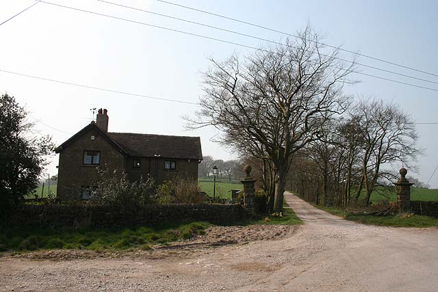
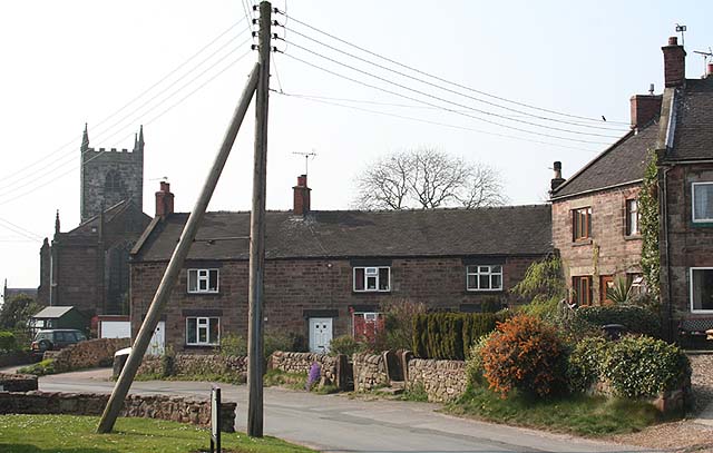
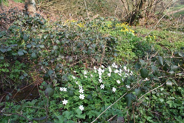
Ipstones is a small rural village located in the county of Staffordshire, England. Situated on the southern edge of the Peak District National Park, Ipstones showcases picturesque countryside views and a strong sense of community. The village is nestled amidst rolling hills and farmland, providing a tranquil and idyllic setting for its residents.

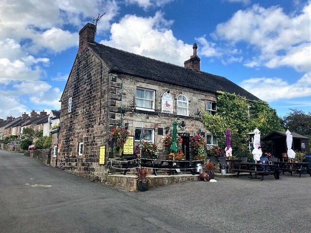
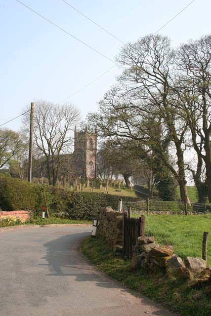
With a population of around 1,200 people, Ipstones maintains a close-knit community atmosphere. The village is home to a range of amenities to cater to the needs of its residents, including a primary school, a village hall, a post office, and a local pub. The St. Leonard's Church, a Grade II listed building, is a prominent feature in the village and serves as a hub for religious and community events.

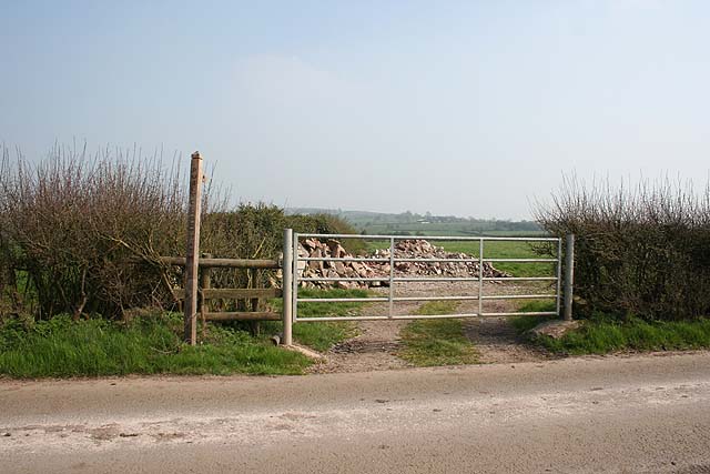
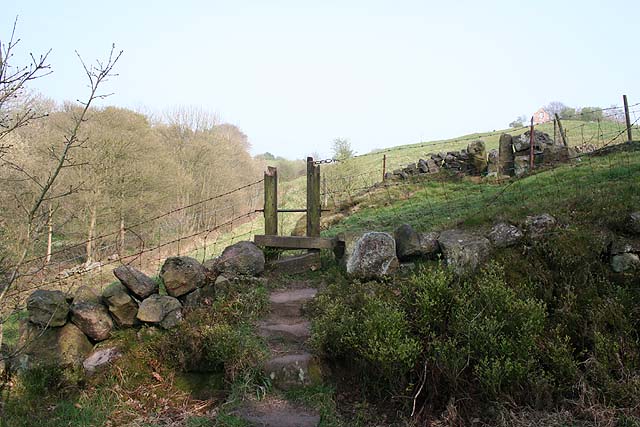
Ipstones benefits from its proximity to the Peak District, offering residents and visitors easy access to stunning natural landscapes and outdoor activities. The area is popular with hikers, cyclists, and nature enthusiasts, with numerous walking trails and cycling routes to explore. Additionally, the village is within reach of various historical and cultural attractions, including the Alton Towers theme park and the Churnet Valley Railway.

Despite its rural location, Ipstones is well-connected to nearby towns and cities. The A523 road passes through the village, providing convenient transportation links to Stoke-on-Trent, Leek, and other neighboring areas. Overall, Ipstones offers a peaceful and scenic retreat for those seeking a quintessential English countryside experience.

If you have any feedback on the listing, please let us know in the comments section below.
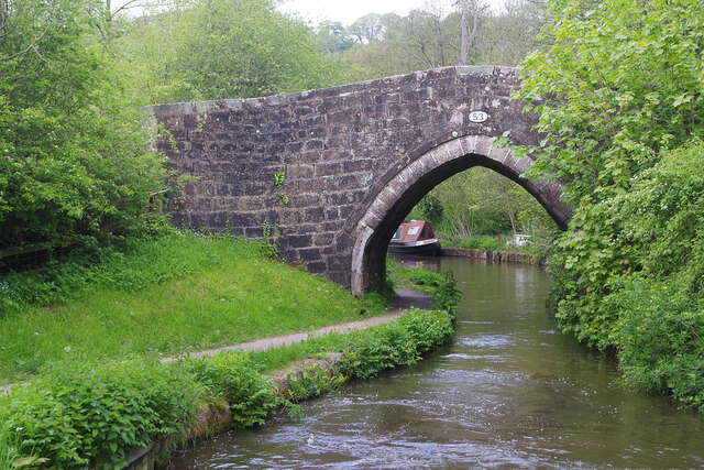
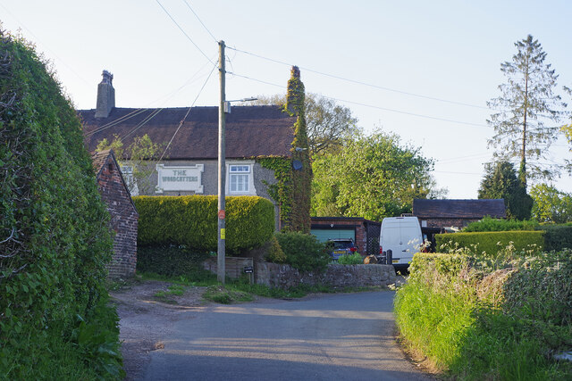
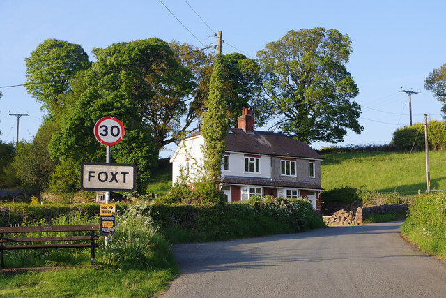
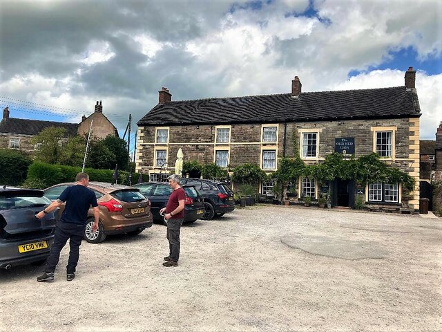
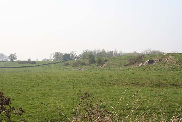
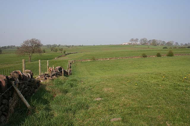
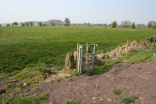
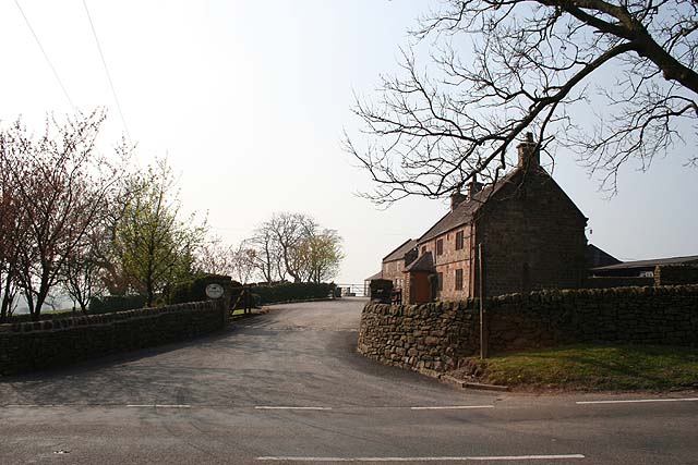
Ipstones Images

Images are sourced within 2km of 53.046596/-1.970343 or Grid Reference SK0249. Thanks to Geograph Open Source API. All images are credited.

Cherryeye Bridge, Caldon Canal Presumably the Cherryeye name comes from the unusual shape of the bridgehole. This furthest stretch of the Caldon Canal east of Flint Mill Lock is exceptionally narrow and is similar in some respects to the Llangollen Canal west of Trevor.
Cherryeye Bridge, Caldon Canal
Presumably the Cherryeye name comes from the unusual shape of the bridgehole. This furthest stretch of the Caldon Canal east of Flint Mill Lock is exceptionally narrow and is similar in some respects to the Llangollen Canal west of Trevor.
Woodcutters Row, Foxt Adjacent to the steep road up from Froghall to Foxt is a terrace of cottages called Woodcutters Row including, at the east end, the former pub seen here. See also <a href="https://www.geograph.org.uk/photo/3666275">SK0248 : The Woodcutters' Arms and Woodcutters Row</a> which suggests the pub ceased to be operational sometime in the 1960s.
Woodcutters Row, Foxt
Adjacent to the steep road up from Froghall to Foxt is a terrace of cottages called Woodcutters Row including, at the east end, the former pub seen here. See also SK0248 : The Woodcutters' Arms and Woodcutters Row which suggests the pub ceased to be operational sometime in the 1960s.
Entering Foxt The Staffordshire village of Foxt, high above the Churnet Valley, has an unusual name of Olde English origin. This is the approach heading up the hill from Froghall.
Entering Foxt
The Staffordshire village of Foxt, high above the Churnet Valley, has an unusual name of Olde English origin. This is the approach heading up the hill from Froghall.
The Fox & Goose, Foxt The Fox & Goose seems an appropriate name for this attractive pub in the village of Foxt. It has spectacular views across the Churnet valley.
The Fox & Goose, Foxt
The Fox & Goose seems an appropriate name for this attractive pub in the village of Foxt. It has spectacular views across the Churnet valley.
The Old Red Lion in Ipstones
The Sea Lion Public House, Ipstones Well-appointed pub tucked away in a quiet corner of the village.
The Sea Lion Public House, Ipstones
Well-appointed pub tucked away in a quiet corner of the village.
High Street, Ipstones
Footpath to Summer Hill Little-used footpath cutting a corner on the no-through road to Ladyedge and Brown Edge Farm.
Footpath to Summer Hill
Little-used footpath cutting a corner on the no-through road to Ladyedge and Brown Edge Farm.
Sharpcliffe Lodge At the entrance to the track to Sharpcliffe Hall.
Sharpcliffe Lodge
At the entrance to the track to Sharpcliffe Hall.
Rock outcrop near Sharpcliffe Lodge This unnamed wood contains a number of large outcropping rocks.
Rock outcrop near Sharpcliffe Lodge
This unnamed wood contains a number of large outcropping rocks.
White Chimneys From the B5053; the well marked on the map is just visible as a sedgy patch in the field to the left of this picture. A few rocks outcrop on the bank to the right.
White Chimneys
From the B5053; the well marked on the map is just visible as a sedgy patch in the field to the left of this picture. A few rocks outcrop on the bank to the right.
View to New House Farm Undulating farmland between New House Farm and Ipstones.
View to New House Farm
Undulating farmland between New House Farm and Ipstones.
Redundant gate Nice to see money being spent on rights-of-way but this nearly-new gate struck me as rather a waste of money...
Redundant gate
Nice to see money being spent on rights-of-way but this nearly-new gate struck me as rather a waste of money...
New House Farm Home to a farm supplies business (selling gates, fencing, drainage pipes etc.) as well as a working farm.
New House Farm
Home to a farm supplies business (selling gates, fencing, drainage pipes etc.) as well as a working farm.
Stocks Green and Ipstones church Pretty village corner. The bird on the wire was a Starling (who'd just finished doing what comes naturally with her mate).
Stocks Green and Ipstones church
Pretty village corner. The bird on the wire was a Starling (who'd just finished doing what comes naturally with her mate).
St. Leonard's, Ipstones From the road to the northwest. St. Leonard's Church was rebuilt in 1790.
St. Leonard's, Ipstones
From the road to the northwest. St. Leonard's Church was rebuilt in 1790.
Footpath near Coltstone With the imaginatively named "The Clough" to the left.
Footpath near Coltstone
With the imaginatively named "The Clough" to the left.
Wood Anemones and Marsh Marigolds Growing in damp ground where the footpath from Coltstone crosses The Clough.
Wood Anemones and Marsh Marigolds
Growing in damp ground where the footpath from Coltstone crosses The Clough.
Show me another place!

Ipstones is located at Grid Ref: SK0249 (Lat: 53.046596, Lng: -1.970343)

Administrative County: Staffordshire

District: Staffordshire Moorlands

Police Authority: Staffordshire

What 3 Words

///stun.asked.props. Near Cheddleton, Staffordshire

Nearby Locations

Ipstones

Related Wikis

Ipstones

Ipstones is a village and civil parish in the north of the English county of Staffordshire. Ipstones is part of the Staffordshire Moorlands district; within...

Above Church

Above Church is a hamlet about 0.6 kilometers (0.4 mi) northwest of Ipstones in the English county of Staffordshire. It is located at grid reference SK016504...

Consall railway station

Consall railway station is a former passenger railway station of the North Staffordshire Railway (NSR) and is now a preserved station on the Churnet Valley...

Staffordshire Moorlands (UK Parliament constituency)

Staffordshire Moorlands is a constituency represented in the House of Commons of the UK Parliament since 2010 by Karen Bradley, a Conservative who served...

Nearby Amenities

Located within 500m of 53.046596,-1.970343
Ipstones
Is In Country: UK
Is In County: Staffordshire
Place: village
Wikidata: Q6065503
Wikipedia: en:Ipstones
Lat/Long: 53.046002/-1.9701779
Pub
Sea Lion
Fixme: is this still trading
Lat/Long: 53.0449857/-1.968701
Pub
The Linden Tree
Old Name: The Golden Lion
Lat/Long: 53.0447697/-1.9711794
Bus Stop
Marquis of Granby PH
Bus: yes
Naptan AtcoCode: 3800C808500
Naptan Bearing: NE
Naptan CommonName: Marquis of Granby PH
Naptan Indicator: Adj
Naptan Landmark: Marquis of Granby PH
Naptan Street: Square
Naptan Verified: no
Public Transport: platform
Source: naptan_import
Lat/Long: 53.0467147/-1.9702396
Bus Stop
Marquis of Granby PH
Bus: yes
Naptan AtcoCode: 3800C808501
Naptan Bearing: SW
Naptan CommonName: Marquis of Granby PH
Naptan Indicator: Opp
Naptan Landmark: Marquis of Granby PH
Naptan Street: Square
Naptan Verified: no
Public Transport: platform
Source: naptan_import
Lat/Long: 53.0464514/-1.9705542
Bus Stop
St Leonards Avenue
Bus: yes
Naptan AtcoCode: 3800C820801
Naptan Bearing: N
Naptan BusStopType: CUS
Naptan CommonName: St Leonards Avenue
Naptan Indicator: Opp
Naptan Landmark: St Leonards Ave
Naptan Street: Froghall Rd
Naptan Verified: no
Public Transport: platform
Source: naptan_import
Lat/Long: 53.0437898/-1.9711128
Bus Stop
St.Leonards Avenue
Bus: yes
Naptan AtcoCode: 3800C820802
Naptan Bearing: S
Naptan BusStopType: CUS
Naptan CommonName: St.Leonards Avenue
Naptan Indicator: Adj
Naptan Landmark: St.Leonards Ave
Naptan Street: Froghall Rd
Naptan Verified: no
Public Transport: platform
Source: naptan_import
Lat/Long: 53.0437447/-1.9708875
Bus Stop
Park Lane
Bus: yes
Naptan AtcoCode: 3800C839301
Naptan Bearing: N
Naptan CommonName: Park Lane
Naptan Indicator: Opp
Naptan Landmark: Park Ln
Naptan Street: High St
Naptan Verified: no
Public Transport: platform
Source: naptan_import
Lat/Long: 53.0492818/-1.9660918
Park Lane
Naptan AtcoCode: 3800C839302
Naptan Bearing: SW
Naptan BusStopType: CUS
Naptan CommonName: Park Lane
Naptan Indicator: Adj
Naptan Landmark: Park Ln
Naptan Street: High St
Naptan Verified: no
Source: naptan_import
Lat/Long: 53.0491919/-1.9660173
Give Way
Direction: backward
Source: bing
Lat/Long: 53.0482397/-1.9726849
Noexit: yes
Lat/Long: 53.0473501/-1.9704874
Barrier: squeezer
Source: survey
Lat/Long: 53.0465333/-1.9697115
Barrier: stile
Source: survey
Stile: squeezer
Lat/Long: 53.0502648/-1.9743573
Barrier: stile
Lat/Long: 53.04542/-1.9683333
Bench
Source: sirvey
Lat/Long: 53.0470982/-1.9713407
Barrier: stile
Source: survey
Stile: squeezer
Lat/Long: 53.0508498/-1.972255
Barrier: entrance
Source: survey;gps
Lat/Long: 53.0489062/-1.9747406
Entrance: main
Source: survey
Lat/Long: 53.0491871/-1.9750314
Slack Memorial
Heritage: 2
Heritage Operator: Historic England
Historic: memorial
Listed Status: Grade II
Lat/Long: 53.0492976/-1.9748614
Fernihough Memorial
Heritage: 2
Heritage Operator: Historic England
Historic: memorial
Listed Status: Grade II
Lat/Long: 53.0493875/-1.9747427
Oulsnam Memorial
Heritage: 2
Heritage Operator: Historic England
Historic: memorial
Listed Status: Grade II
Lat/Long: 53.0494911/-1.9748735
Man Made: survey_point
Source: visual survey;bing
Survey Point: trig_point
Lat/Long: 53.0483595/-1.9767846
Scarratt Memorial
Heritage: 2
Heritage Operator: Historic England
Historic: memorial
Listed Status: Grade II
Lat/Long: 53.0494412/-1.9749768
Man Made: street_cabinet
Operator: BT
Source: survey
Street Cabinet: communications
Lat/Long: 53.0454746/-1.9715784
Man Made: street_cabinet
Operator: BT
Source: survey
Street Cabinet: communications
Lat/Long: 53.0455077/-1.9715771
Bench
Source: survey
Lat/Long: 53.0455246/-1.9715543
Give Way
Direction: backward
Source: survey
Lat/Long: 53.0466698/-1.9703795
Power: transformer
Source: survey
Lat/Long: 53.0487535/-1.9756822
Man Made: flagpole
Source: survey
Lat/Long: 53.0471923/-1.972426
Power: transformer
Source: survey
Lat/Long: 53.0485632/-1.9729262
Barrier: stile
Source: survey
Stile: squeezer
Lat/Long: 53.0488946/-1.9733446
Telephone
Booth: K6
Covered: booth
Heritage: 2
Heritage Operator: Historic England
Listed Status: Grade II
Lat/Long: 53.0467446/-1.9705715
Barrier: stile
Lat/Long: 53.0446453/-1.9656608
Ball Memorial
Heritage: 2
Heritage Operator: Historic England
Historic: memorial
Source: survey
Lat/Long: 53.0494254/-1.975059
Prince Memorial
Heritage: 2
Heritage Operator: Historic England
Historic: memorial
Source: estimate
Lat/Long: 53.0494206/-1.9751231
Stocks Green
Place: locality
Source: OS OpenData StreetView
Lat/Long: 53.0491998/-1.9720593
Post Box
Lat/Long: 53.0421009/-1.9701919
Barrier: stile
Source: survey;gps
Stile: squeezer
Lat/Long: 53.0421581/-1.9705192
Barrier: stile
Material: stone
Source: survey;gps
Stile: squeezer
Lat/Long: 53.0495965/-1.9668742
Barrier: stile
Material: wood
Source: survey;gps
Stile: stepover
Lat/Long: 53.0499179/-1.9688863
Barrier: stile
Material: stone
Source: survey;gps
Stile: squeezer
Lat/Long: 53.0502653/-1.9697858
Barrier: entrance
Source: survey;gps
Lat/Long: 53.0505563/-1.9710058
Barrier: stile
Material: stone
Source: survey;gps
Stile: squeezer
Lat/Long: 53.0494792/-1.9733975
Barrier: stile
Steps: 0
Stile: stepover
Lat/Long: 53.0460036/-1.9770022
Barrier: stile
Steps: 1
Stile: stepover
Lat/Long: 53.0454928/-1.977043
Barrier: stile
Stile: squeezer
Lat/Long: 53.0484141/-1.9764178
Entrance: main
Lat/Long: 53.0466207/-1.9705188
Post Box
Post Box Type: pillar
Ref: ST10 290
Royal Cypher: EIIR
Royal Cypher Wikidata: Q33102113
Lat/Long: 53.0465857/-1.9705251
Generator Method: photovoltaic
Generator Output Electricity: yes
Generator Source: solar
Generator Type: solar_photovoltaic_panel
Location: roof
Power: generator
Lat/Long: 53.0444009/-1.9701157
Generator Method: photovoltaic
Generator Output Electricity: yes
Generator Source: solar
Generator Type: solar_photovoltaic_panel
Location: roof
Power: generator
Lat/Long: 53.0444477/-1.9700594
Direction: 145
Generator Method: photovoltaic
Generator Output Electricity: yes
Generator Solar Modules: 16
Generator Source: solar
Generator Type: solar_photovoltaic_panel
Location: roof
Power: generator
Lat/Long: 53.0481812/-1.9724183
Direction: 80
Generator Method: photovoltaic
Generator Output Electricity: yes
Generator Solar Modules: 8
Generator Source: solar
Generator Type: solar_photovoltaic_panel
Location: roof
Power: generator
Lat/Long: 53.0485985/-1.9718821
Direction: 260
Generator Method: photovoltaic
Generator Output Electricity: yes
Generator Solar Modules: 8
Generator Source: solar
Generator Type: solar_photovoltaic_panel
Location: roof
Power: generator
Lat/Long: 53.0485938/-1.9719474
Direction: 175
Generator Method: photovoltaic
Generator Output Electricity: yes
Generator Solar Modules: 16
Generator Source: solar
Generator Type: solar_photovoltaic_panel
Location: roof
Power: generator
Lat/Long: 53.0438124/-1.9691018
Direction: 185
Generator Method: photovoltaic
Generator Output Electricity: yes
Generator Solar Modules: 14
Generator Source: solar
Generator Type: solar_photovoltaic_panel
Location: roof
Power: generator
Lat/Long: 53.0425738/-1.969796
Direction: SSE
Generator Method: photovoltaic
Generator Output Electricity: yes
Generator Solar Modules: 16
Generator Source: solar
Generator Type: solar_photovoltaic_panel
Location: roof
Power: generator
Lat/Long: 53.0424006/-1.9694107
Direction: 55
Generator Method: photovoltaic
Generator Output Electricity: yes
Generator Solar Modules: 8
Generator Source: solar
Generator Type: solar_photovoltaic_panel
Location: roof
Power: generator
Lat/Long: 53.0484919/-1.9713465
Direction: 185
Generator Method: photovoltaic
Generator Output Electricity: yes
Generator Solar Modules: 18
Generator Source: solar
Generator Type: solar_photovoltaic_panel
Location: roof
Power: generator
Lat/Long: 53.042582/-1.9699044
Direction: S
Generator Method: photovoltaic
Generator Output Electricity: yes
Generator Solar Modules: 10
Generator Source: solar
Generator Type: solar_photovoltaic_panel
Location: roof
Power: generator
Lat/Long: 53.0437997/-1.9687808
Direction: 235
Generator Method: photovoltaic
Generator Output Electricity: yes
Generator Solar Modules: 8
Generator Source: solar
Generator Type: solar_photovoltaic_panel
Location: roof
Power: generator
Lat/Long: 53.0484801/-1.971412
Direction: 235
Generator Method: photovoltaic
Generator Output Electricity: yes
Generator Solar Modules: 16
Generator Source: solar
Generator Type: solar_photovoltaic_panel
Location: roof
Power: generator
Lat/Long: 53.0488535/-1.971555
Direction: SSW
Generator Method: photovoltaic
Generator Output Electricity: yes
Generator Solar Modules: 30
Generator Source: solar
Generator Type: solar_photovoltaic_panel
Location: roof
Power: generator
Lat/Long: 53.0487702/-1.9740129
Direction: 235
Generator Method: photovoltaic
Generator Output Electricity: yes
Generator Solar Modules: 16
Generator Source: solar
Generator Type: solar_photovoltaic_panel
Location: roof
Power: generator
Lat/Long: 53.0478997/-1.9719391
Direction: 145
Generator Method: photovoltaic
Generator Output Electricity: yes
Generator Solar Modules: 15
Generator Source: solar
Generator Type: solar_photovoltaic_panel
Location: roof
Power: generator
Lat/Long: 53.0479643/-1.9726505
Maxspeed Backward: 60 mph
Maxspeed Forward: 30 mph
Traffic Sign Backward: GB:671
Traffic Sign Forward: GB:670
Lat/Long: 53.0453256/-1.9745485
Stop
Direction: forward
Lat/Long: 53.0456078/-1.9714359
Waste Basket
Waste: trash;dog_excrement
Lat/Long: 53.0455492/-1.9713152
Stop
Direction: forward
Lat/Long: 53.046556/-1.9703978
Direction: 150
Maxspeed: national
Traffic Sign: maxspeed
Lat/Long: 53.0489921/-1.9751494
Direction: 330
Maxspeed: 30 mph
Traffic Sign: maxspeed
Lat/Long: 53.048997/-1.9751531
Barrier: bollard
Lat/Long: 53.0489029/-1.9735886
Barrier: bollard
Lat/Long: 53.0488941/-1.97357
Waste Basket
Waste: trash;dog_excrement
Lat/Long: 53.0489327/-1.9735835
Give Way
Direction: backward
Lat/Long: 53.0437102/-1.9709221
Noexit: yes
Lat/Long: 53.0424671/-1.9711589
The data included in this document is from www.openstreetmap.org. The data is made available under ODbL.

Have you been to Ipstones?

Leave your review of Ipstones below (or comments, questions and feedback).