Barbon Low Fell

Hill, Mountain in Westmorland South Lakeland

England

Barbon Low Fell

Snow on the Fells An early morning view towards Brownthwaite and Casterton Fell from Whoop Hall. Overnight snow has changed the scene.
Snow on the Fells Credit: David Dixon

Barbon Low Fell is a prominent hill located in the county of Westmorland, in the North West of England. Situated in the picturesque Yorkshire Dales National Park, it offers breathtaking views of the surrounding countryside. With an elevation of approximately 1,494 feet (455 meters), it is a popular destination for hikers, nature enthusiasts, and outdoor adventurers.

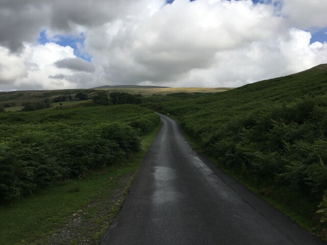
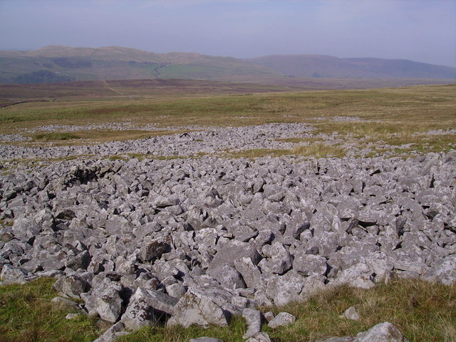
The hill is characterized by its rolling slopes and rugged terrain, which provide a challenging yet rewarding experience for those who venture to the summit. The path to the top takes visitors through a diverse landscape of grassy meadows, rocky outcrops, and dense woodlands, showcasing the natural beauty of the region.

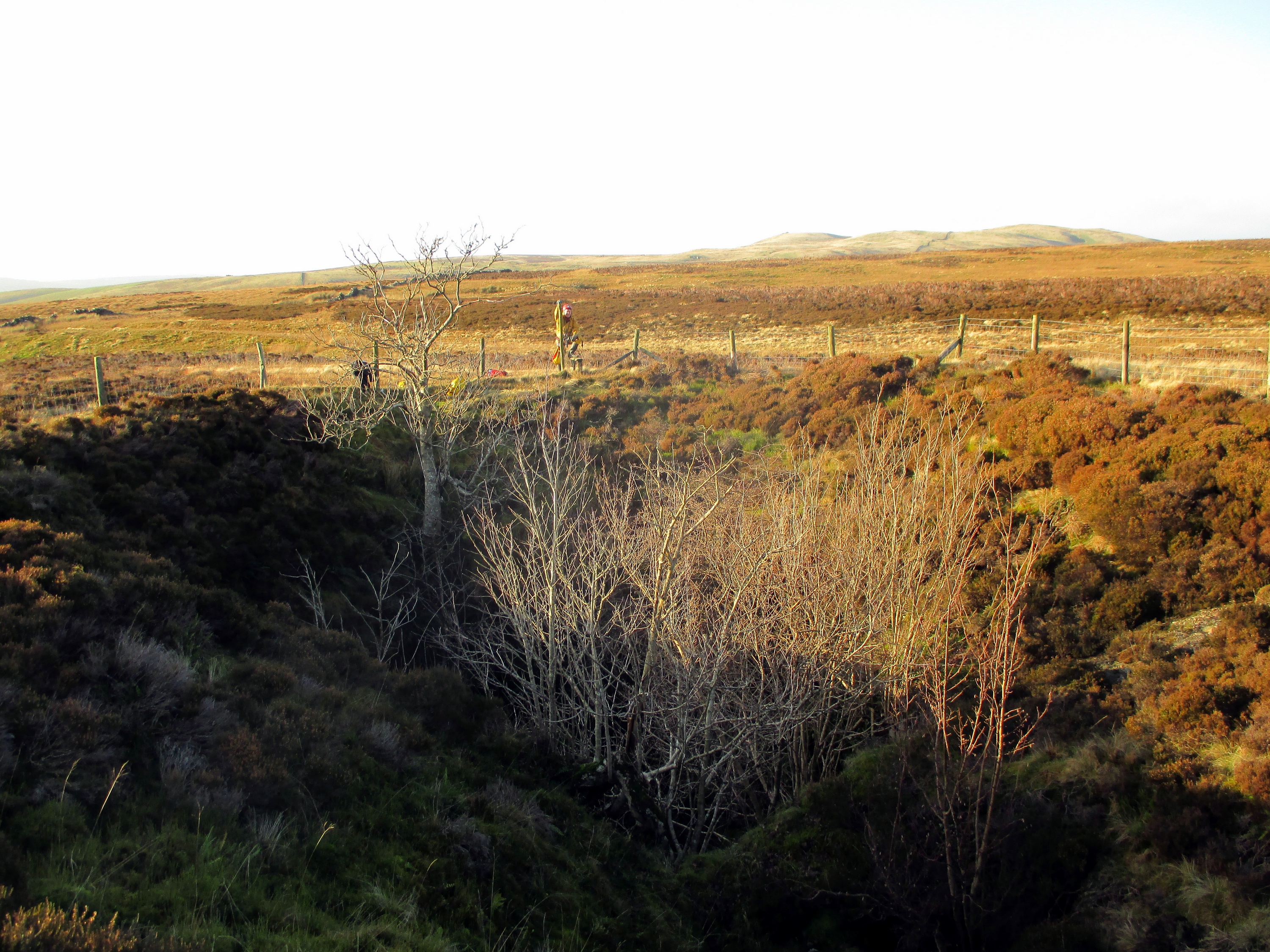
Barbon Low Fell is home to a variety of wildlife, including birds, mammals, and plant species. The hillside is dotted with vibrant wildflowers during the spring and summer months, creating a colorful and vibrant atmosphere. It is not uncommon to spot grazing sheep and cows along the way, adding to the rural charm of the area.

At the peak of Barbon Low Fell, visitors are treated to panoramic views of the surrounding countryside. On a clear day, one can see the majestic peaks of the Lake District to the west, the Howgill Fells to the east, and the expansive valleys below. The summit provides an ideal spot for a picnic or simply to soak in the tranquility and beauty of the landscape.

Overall, Barbon Low Fell is a hidden gem in Westmorland, offering visitors a chance to reconnect with nature and enjoy the stunning vistas that the Yorkshire Dales has to offer.

If you have any feedback on the listing, please let us know in the comments section below.

Barbon Low Fell Images

Images are sourced within 2km of 54.222303/-2.5381436 or Grid Reference SD6580. Thanks to Geograph Open Source API. All images are credited.

Snow on the Fells An early morning view towards Brownthwaite and Casterton Fell from Whoop Hall. Overnight snow has changed the scene.
Snow on the Fells
An early morning view towards Brownthwaite and Casterton Fell from Whoop Hall. Overnight snow has changed the scene.
Barbon High and Low fells from Scout Hill Looking across Kirkby Lonsdale valley
Barbon High and Low fells from Scout Hill
Looking across Kirkby Lonsdale valley
Path to Blindbeck Bridge Lovely path climbs gently up the dale from Barbon.
Path to Blindbeck Bridge
Lovely path climbs gently up the dale from Barbon.
Blindbeck Bridge, Barbondale The minor road from Barbon to Dentdale crosses Blindbeck Bridge.
There is an Ordnance Survey cut benchmark facing the road on the south end of the west parapet (photograph <a href="https://www.geograph.org.uk/photo/7283814">SD6582 : Benchmark, Blindbeck Bridge, Barbondale</a>).
Blindbeck Bridge, Barbondale
The minor road from Barbon to Dentdale crosses Blindbeck Bridge. There is an Ordnance Survey cut benchmark facing the road on the south end of the west parapet (photograph SD6582 : Benchmark, Blindbeck Bridge, Barbondale).
Benchmark, Blindbeck Bridge, Barbondale Detail of an Ordnance Survey cut benchmark on the east face of the west parapet of Blindbeck Bridge.  The benchmark marks a height of 177.6009m above Ordnance Datum Newlyn last verified in 1953 (location photograph <a href="https://www.geograph.org.uk/photo/7283809">SD6582 : Blindbeck Bridge, Barbondale</a>).
Benchmark, Blindbeck Bridge, Barbondale
Detail of an Ordnance Survey cut benchmark on the east face of the west parapet of Blindbeck Bridge. The benchmark marks a height of 177.6009m above Ordnance Datum Newlyn last verified in 1953 (location photograph SD6582 : Blindbeck Bridge, Barbondale).
The lane from Bullpot The lane from Bullpot continues beyond the gate as an unfenced public bridleway to Blindbeck Bridge.
In the background beyond Barbondale are Castle Knott and Calf Top.
The lane from Bullpot
The lane from Bullpot continues beyond the gate as an unfenced public bridleway to Blindbeck Bridge. In the background beyond Barbondale are Castle Knott and Calf Top.
Path to the summit, Brownthwaite The path from Gale Garth leading to the white painted trigonometrical column (trig point) on Brownthwaite.
Path to the summit, Brownthwaite
The path from Gale Garth leading to the white painted trigonometrical column (trig point) on Brownthwaite.
Benchmark, Brownthwaite Detail of the flush bracket benchmark on the concrete Ordnance Survey triangulation pillar on Brownthwaite. The flush bracket, benchmark number S5344, is on the southeast face of the pillar and marks a height of 436.9613m above mean sea level (Ordnance Datum Newlyn), last verified in 1953 (location photograph <a href="https://www.geograph.org.uk/photo/7342770">SD6580 : Triangulation Pillar, Brownthwaite</a>).
Benchmark, Brownthwaite
Detail of the flush bracket benchmark on the concrete Ordnance Survey triangulation pillar on Brownthwaite. The flush bracket, benchmark number S5344, is on the southeast face of the pillar and marks a height of 436.9613m above mean sea level (Ordnance Datum Newlyn), last verified in 1953 (location photograph SD6580 : Triangulation Pillar, Brownthwaite).
Triangulation Pillar, Brownthwaite The concrete Ordnance Survey triangulation pillar on the summit of Casterton Fell northeast of Brownthwaite Moss.
The pillar was constructed in 1949. The flush bracket benchmark number S5344 on the southeast face of the pillar marks a height of 436.9613m above mean sea level (Ordnance Datum Newlyn) last verified in 1953 (detail photograph <a href="https://www.geograph.org.uk/photo/7342742">SD6580 : Benchmark, Brownthwaite</a>).
Triangulation Pillar, Brownthwaite
The concrete Ordnance Survey triangulation pillar on the summit of Casterton Fell northeast of Brownthwaite Moss. The pillar was constructed in 1949. The flush bracket benchmark number S5344 on the southeast face of the pillar marks a height of 436.9613m above mean sea level (Ordnance Datum Newlyn) last verified in 1953 (detail photograph SD6580 : Benchmark, Brownthwaite).
Jack's Fold A Goldsworthy creation. Named after Jack who built it.
Jack's Fold
A Goldsworthy creation. Named after Jack who built it.
Brownthwaite Moss The highest point on Brownthwaite (and Barbon Low Fell) is about 600m NE of Brownthwaite Pike. The trig point is just visible. Brownthwaite Moss is between.
Brownthwaite Moss
The highest point on Brownthwaite (and Barbon Low Fell) is about 600m NE of Brownthwaite Pike. The trig point is just visible. Brownthwaite Moss is between.
Trig Point, Brownthwaite The highest point on Brownthwaite (437m). Middleton Fell is in the background, with the highest point at Calf Top (609m).
Trig Point, Brownthwaite
The highest point on Brownthwaite (437m). Middleton Fell is in the background, with the highest point at Calf Top (609m).
Gateway, Brownthwaite On the SE side of Brownthwaite, looking towards Casterton Fell (in sunlight).
Gateway, Brownthwaite
On the SE side of Brownthwaite, looking towards Casterton Fell (in sunlight).
Minor road in Barbondale
Limekilns beside Aygill The limekilns together form a grade II listed building and are reckoned to date from the eighteenth century. They're on the south side of Aygill below the confluence of Great and Little Aygill and are viewed across the stream.
Limekilns beside Aygill
The limekilns together form a grade II listed building and are reckoned to date from the eighteenth century. They're on the south side of Aygill below the confluence of Great and Little Aygill and are viewed across the stream.
Ease Gill at Ease Gill Kirk Dried-up river bed.
Ease Gill at Ease Gill Kirk
Dried-up river bed.
Casterton Fell Near Swallow Hole.
Casterton Fell
Near Swallow Hole.
Show me another place!

Barbon Low Fell is located at Grid Ref: SD6580 (Lat: 54.222303, Lng: -2.5381436)

Administrative County: Cumbria

District: South Lakeland

Police Authority: Cumbria

What 3 Words

///noted.radiates.declares. Near Kirkby Lonsdale, Cumbria

Nearby Locations

Barbon Low Fell

Related Wikis

Nearby Amenities

Located within 500m of 54.222303,-2.5381436
Natural: spring
Lat/Long: 54.2265104/-2.5359312
Height: 437m
Man Made: survey_point
Lat/Long: 54.222582/-2.5382244
Brownthwaite Pike
Natural: peak
Lat/Long: 54.2188907/-2.5417847
Power: pole
Lat/Long: 54.2224954/-2.5311531
Power: pole
Lat/Long: 54.2215925/-2.5321807
Power: pole
Lat/Long: 54.2208904/-2.532991
Power: pole
Lat/Long: 54.2202381/-2.5337691
Power: pole
Lat/Long: 54.2194794/-2.5346616
Power: pole
Lat/Long: 54.2187653/-2.5355013
Power: pole
Lat/Long: 54.2181507/-2.536203
Ford: yes
Lat/Long: 54.2214477/-2.5432987
Ford: yes
Lat/Long: 54.2211942/-2.5419932
The data included in this document is from www.openstreetmap.org. The data is made available under ODbL.

Have you been to Barbon Low Fell?

Leave your review of Barbon Low Fell below (or comments, questions and feedback).