Cartsaddle Hill

Hill, Mountain in Westmorland South Lakeland

England

Cartsaddle Hill

Bales at High Green Probably bales of haylage.
Bales at High Green Credit: Stephen Craven

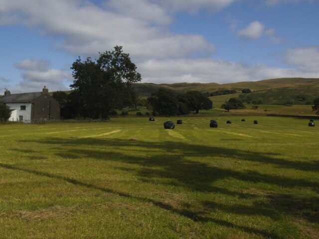
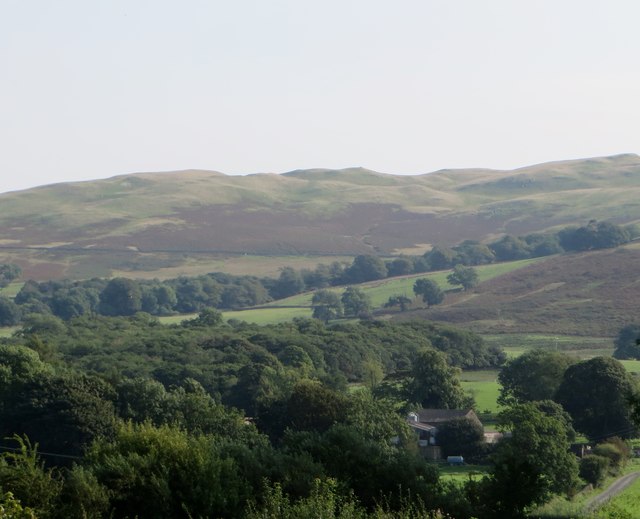
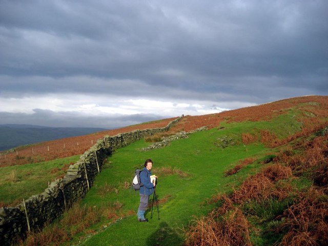
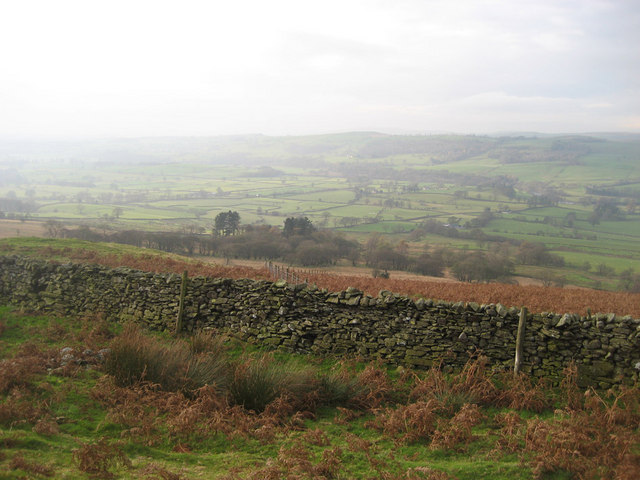
Cartsaddle Hill is a prominent hill located in the county of Westmorland, in the northwestern region of England. It is situated within the Lake District National Park, renowned for its stunning natural beauty and picturesque landscapes. Rising to an elevation of approximately 551 meters (1,808 feet), Cartsaddle Hill offers breathtaking panoramic views of the surrounding countryside.

The hill is characterized by its gentle slopes covered in lush green vegetation, typical of the region. It is composed of sedimentary rocks, primarily sandstone and siltstone, which contribute to its distinctive appearance. Cartsaddle Hill is part of the Pennines, a range of hills and mountains that extends across northern England.

Due to its strategic location and commanding views, Cartsaddle Hill has been historically significant. It was once used as a vantage point for military purposes, offering a clear view of the surrounding area. In addition, the hill has been a popular destination for hikers and outdoor enthusiasts, with well-marked trails leading to its summit.

The area surrounding Cartsaddle Hill is rich in biodiversity, with a variety of flora and fauna inhabiting its slopes. It is home to several species of birds, including the red grouse and peregrine falcon, as well as various mammals such as red deer and mountain hare.

Overall, Cartsaddle Hill is a cherished natural landmark in Westmorland, offering visitors a chance to immerse themselves in the stunning scenery of the Lake District National Park and appreciate the rich history and biodiversity of the area.

If you have any feedback on the listing, please let us know in the comments section below.

Cartsaddle Hill Images

Images are sourced within 2km of 54.27756/-2.5436093 or Grid Reference SD6487. Thanks to Geograph Open Source API. All images are credited.

Bales at High Green Probably bales of haylage.
Bales at High Green
Probably bales of haylage.
Looking towards Cartsaddle Hill From the churchyard of the Church of the Holy Ghost, Middleton.
Looking towards Cartsaddle Hill
From the churchyard of the Church of the Holy Ghost, Middleton.
Millhouse Gill at Calf Foot Southdale and Northdale Gills combine to create Millhouse Gill as the watercourse escapes the clutches of Middleton Fell.
There is a large proliferation of bracken here, making up the bulk of the local vegetation.
Millhouse Gill at Calf Foot
Southdale and Northdale Gills combine to create Millhouse Gill as the watercourse escapes the clutches of Middleton Fell. There is a large proliferation of bracken here, making up the bulk of the local vegetation.
View towards Calf Looking west over Calf Foot to the spur called Calf
View towards Calf
Looking west over Calf Foot to the spur called Calf
Mill House As the walker comes off the fell to approach Mill House, a sign will be noticed on the gate claiming no public right of way and to use your map to find another exit - this would require a detour over rough country of at least two miles. Careful study of the map shows Open Access stretches to the buildings, and thus onto the narrow lane. I chose to ignore the instructions, and recommend others do the same.
Mill House
As the walker comes off the fell to approach Mill House, a sign will be noticed on the gate claiming no public right of way and to use your map to find another exit - this would require a detour over rough country of at least two miles. Careful study of the map shows Open Access stretches to the buildings, and thus onto the narrow lane. I chose to ignore the instructions, and recommend others do the same.
View over Lunedale from above Millhouse Gill
Frozen beck Near the shooting track up Middleton Fell from Middleton Head.
Frozen beck
Near the shooting track up Middleton Fell from Middleton Head.
Becks on Middleton Fell Looking down from a shooting track onto Middleton Fell.
Becks on Middleton Fell
Looking down from a shooting track onto Middleton Fell.
Shelter on Middleton Fell A ruined shelter, possibly an old shooting hut. The Lakeland hills are on the horizon.
Shelter on Middleton Fell
A ruined shelter, possibly an old shooting hut. The Lakeland hills are on the horizon.
Luge Gill Looking down from Long Bank
Luge Gill
Looking down from Long Bank
The track to Fellside
Ellers Farm This small farm lies under the shadow of Middleton Fell near Barbon.
Ellers Farm
This small farm lies under the shadow of Middleton Fell near Barbon.
Ruined sheepfold below Middleton Fell
Heartside Plantation Looking down slope towards the River Lune
Heartside Plantation
Looking down slope towards the River Lune
Top end of wooded valley of Brow Gill
Brow Gill, Middleton Fell Looking upstream at the point where an old track zig-zags down to a ford
Brow Gill, Middleton Fell
Looking upstream at the point where an old track zig-zags down to a ford
Larum Gill River Lune valley in the background
Larum Gill
River Lune valley in the background
Luge Gill Wooded valley, seen from the intriguingly-named Cartsaddle Hill
Luge Gill
Wooded valley, seen from the intriguingly-named Cartsaddle Hill
Show me another place!

Cartsaddle Hill is located at Grid Ref: SD6487 (Lat: 54.27756, Lng: -2.5436093)

Administrative County: Cumbria

District: South Lakeland

Police Authority: Cumbria

What 3 Words

///cakes.corn.hillsides. Near Sedbergh, Cumbria

Nearby Locations

Cartsaddle Hill

Related Wikis

Calf Top

Calf Top is a mountain in the western part of the Yorkshire Dales, England. It is located in the county of Cumbria, although Lancashire and North Yorkshire...

Middleton-on-Lune railway station

Middleton-on-Lune railway station was located in Westmorland, England, (now in Cumbria), serving the hamlet and rural locale of Middleton on the Ingleton...

Middleton, Cumbria

Middleton is a village and a civil parish on the A683 road, in the South Lakeland district, in the county of Cumbria, England. Middleton has a church called...

Beckside

Beckside is a village in Cumbria, England.

Nearby Amenities

Located within 500m of 54.27756,-2.5436093
Natural: spring
Lat/Long: 54.2776291/-2.5368603
Natural: spring
Lat/Long: 54.2765266/-2.5372895
The data included in this document is from www.openstreetmap.org. The data is made available under ODbL.

Have you been to Cartsaddle Hill?

Leave your review of Cartsaddle Hill below (or comments, questions and feedback).