Doulting Sheep Sleight

Hill, Mountain in Somerset Mendip

England

Doulting Sheep Sleight

Houses on Church Lane Doulting At the far end of the house on the right is a small structure housing an old hand pump which was the supply of fresh water for the village . A bit further away is St Aldhelms well which is a much larger spring and the source of the River Sheppey.
Houses on Church Lane Doulting Credit: Nigel Mykura

Doulting Sheep Sleight is a prominent hill located in the county of Somerset, England. Rising to a height of approximately 198 meters (650 feet), it is nestled within the picturesque Mendip Hills range. The hill is located in the village of Doulting, which lies about 4 miles northwest of Shepton Mallet and 20 miles south of Bristol.

Doulting Sheep Sleight is characterized by its gently sloping grassy slopes, which offer breathtaking panoramic views of the surrounding countryside. The hill is primarily covered in lush green pastures, dotted with grazing sheep, which gives it its name.

The area surrounding Doulting Sheep Sleight is rich in history and natural beauty. It boasts several ancient sites, including the nearby Doulting Stone Quarry, which dates back to the Roman era and is famous for its honey-colored limestone. The hill also offers access to a network of walking trails, allowing visitors to explore the diverse flora and fauna of the area.

Doulting Sheep Sleight is a popular spot for outdoor enthusiasts, offering ample opportunities for walking, hiking, and nature photography. The hill's convenient location and its close proximity to other attractions, such as the historic city of Wells and the Cheddar Gorge, make it a favored destination for both locals and tourists alike.

Overall, Doulting Sheep Sleight is a beautiful and historically significant hill in Somerset, offering visitors a chance to immerse themselves in the natural beauty of the Mendip Hills while enjoying its rich cultural heritage.

If you have any feedback on the listing, please let us know in the comments section below.

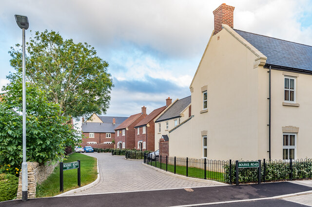
Doulting Sheep Sleight Images

Images are sourced within 2km of 51.175209/-2.5194985 or Grid Reference ST6341. Thanks to Geograph Open Source API. All images are credited.

Houses on Church Lane Doulting At the far end of the house on the right is a small structure housing an old hand pump which was the supply of fresh water for the village . A bit further away is St Aldhelms well which is a much larger spring and the source of the River Sheppey.
Houses on Church Lane Doulting
At the far end of the house on the right is a small structure housing an old hand pump which was the supply of fresh water for the village . A bit further away is St Aldhelms well which is a much larger spring and the source of the River Sheppey.
Old Water Pump in Doulting  The pump handle of this pump is now locked. It has an undated brass plate in memory of Scot Pike.
Old Water Pump in Doulting
The pump handle of this pump is now locked. It has an undated brass plate in memory of Scot Pike.
Water Pump in Doulting (detail) This shows the Brass memorial plate in memory of Scot Pike
Water Pump in Doulting (detail)
This shows the Brass memorial plate in memory of Scot Pike
Old Milestone by A37, North of Beard Hill and South of junction with A361 The Milestone is located beside the road in front of the hedge on the West of the road.  Parish of Pilton (Mendip District). Cast iron post, plated iron casting design, erected by the Shepton Mallet turnpike trust in the 19th Century. An earlier photograph can be found here: <a title="https://www.geograph.org.uk/photo/6045080" href="https://www.geograph.org.uk/photo/6045080">Link</a>

Inscription reads:-  
SHEPTON / MALLET / 2 : : ILCHEST.R / 13 : : EXETER / 60

Milestone Society National ID: SO_SMIC02
Old Milestone by A37, North of Beard Hill and South of junction with A361
The Milestone is located beside the road in front of the hedge on the West of the road.  Parish of Pilton (Mendip District). Cast iron post, plated iron casting design, erected by the Shepton Mallet turnpike trust in the 19th Century. An earlier photograph can be found here: Link Inscription reads:- SHEPTON / MALLET / 2 : : ILCHEST.R / 13 : : EXETER / 60 Milestone Society National ID: SO_SMIC02
Old Milepost by A371, top of hill by Prestleigh Welcome sign The Milepost is located in hedge, on verge by West side of the road.  Parish of Doulting (Mendip District). Cast iron post, plated iron casting design, erected by the Shepton Mallet turnpike trust in the 19th Century, piece broken off north face; fractures. An earlier photograph can be found here: <a title="https://www.geograph.org.uk/photo/6037504" href="https://www.geograph.org.uk/photo/6037504">Link</a> 

Inscription reads:-  
SHEPTON / MALLET / 2 : : CASTLE / CARY / 6 : : BRUTON / 5  

Grade II listed. List Entry Number: 1217657 <span class="nowrap"><a title="https://historicengland.org.uk/listing/the-list/list-entry/1217657" rel="nofollow ugc noopener" href="https://historicengland.org.uk/listing/the-list/list-entry/1217657">Link</a><img style="margin-left:2px;" alt="External link" title="External link - shift click to open in new window" src="https://s1.geograph.org.uk/img/external.png" width="10" height="10"/></span> 

Milestone Society National ID: SO_SMCC02
Old Milepost by A371, top of hill by Prestleigh Welcome sign
The Milepost is located in hedge, on verge by West side of the road.  Parish of Doulting (Mendip District). Cast iron post, plated iron casting design, erected by the Shepton Mallet turnpike trust in the 19th Century, piece broken off north face; fractures. An earlier photograph can be found here: Link  Inscription reads:- SHEPTON / MALLET / 2 : : CASTLE / CARY / 6 : : BRUTON / 5 Grade II listed. List Entry Number: 1217657 LinkExternal link Milestone Society National ID: SO_SMCC02
Doulting : Prestleigh : Royal Bath & West Showground Looking across the avenues at the showground.
Doulting : Prestleigh : Royal Bath & West Showground
Looking across the avenues at the showground.
Doulting : Prestleigh : Royal Bath & West Showground A busy scene at the Royal Bath & West Show.
Doulting : Prestleigh : Royal Bath & West Showground
A busy scene at the Royal Bath & West Show.
Ridge Lane Lane south of Shepton Mallet.
Ridge Lane
Lane south of Shepton Mallet.
7 - 10 Cannard's Grave Road Short terrace on Cannard's Grave Road dating from around the turn of the 19th/20th Centuries, first marked on the 1904 25 inch map.
7 - 10 Cannard's Grave Road
Short terrace on Cannard's Grave Road dating from around the turn of the 19th/20th Centuries, first marked on the 1904 25 inch map.
The Highwayman Roadside pub built c.1880, situated on a section of the Fosse Way, here part of the A37.
The Highwayman
Roadside pub built c.1880, situated on a section of the Fosse Way, here part of the A37.
Cannard's Grave Road Houses in Cannard's Grave Road with The Highwayman (see <a href="https://www.geograph.org.uk/photo/7558272">ST6241 : The Highwayman</a>) in the background.
Cannard's Grave Road
Houses in Cannard's Grave Road with The Highwayman (see ST6241 : The Highwayman) in the background.
Clarks Meadow Houses in Clarks Meadow in Tadley Acres, a development over the period 1996 - 2018 on the Duchy of Cornwall owned Field Farm.  This section of Clarks Meadow was completed in 2017-8.
Clarks Meadow
Houses in Clarks Meadow in Tadley Acres, a development over the period 1996 - 2018 on the Duchy of Cornwall owned Field Farm. This section of Clarks Meadow was completed in 2017-8.
Mistletoe Lane Houses in Mistletoe Lane in Tadley Acres, a development over the period 1996 - 2018 on the Duchy of Cornwall owned Field Farm.  Mistletoe Lane was completed in 2008-9.
Mistletoe Lane
Houses in Mistletoe Lane in Tadley Acres, a development over the period 1996 - 2018 on the Duchy of Cornwall owned Field Farm. Mistletoe Lane was completed in 2008-9.
Bourke Road Houses in Bourke Road in Tadley Acres, a development over the period 1996 - 2018 on the Duchy of Cornwall owned Field Farm.  Bourke Road was completed in 2015.
Bourke Road
Houses in Bourke Road in Tadley Acres, a development over the period 1996 - 2018 on the Duchy of Cornwall owned Field Farm. Bourke Road was completed in 2015.
Hobbs Road Houses in Hobbs Road in Tadley Acres, a development over the period 1996 - 2018 on the Duchy of Cornwall owned Field Farm.  Hobbs Road was completed in 2006-7.
Hobbs Road
Houses in Hobbs Road in Tadley Acres, a development over the period 1996 - 2018 on the Duchy of Cornwall owned Field Farm. Hobbs Road was completed in 2006-7.
Little Brooks Lane Houses in Little Brooks Lane in Tadley Acres, a development over the period 1996 - 2018 on the Duchy of Cornwall owned Field Farm.  The houses here were completed in 2007-8.
Little Brooks Lane
Houses in Little Brooks Lane in Tadley Acres, a development over the period 1996 - 2018 on the Duchy of Cornwall owned Field Farm. The houses here were completed in 2007-8.
Sherring Road Buildings in Sherring Road in Tadley Acres, a development over the period 1996 - 2018 on the Duchy of Cornwall owned Field Farm.  The buildings here were completed in 2005-6.
Sherring Road
Buildings in Sherring Road in Tadley Acres, a development over the period 1996 - 2018 on the Duchy of Cornwall owned Field Farm. The buildings here were completed in 2005-6.
Show me another place!

Doulting Sheep Sleight is located at Grid Ref: ST6341 (Lat: 51.175209, Lng: -2.5194985)

Administrative County: Somerset

District: Mendip

Police Authority: Avon and Somerset

What 3 Words

///tenure.vote.loving. Near Shepton Mallet, Somerset

Related Wikis

Mendip Vale railway station

Mendip Vale is the western terminus of the East Somerset Railway. == Services == All trains terminate at Mendip Vale, with a 5-10 minute wait while the...

Doulting Railway Cutting

Doulting Railway Cutting (grid reference ST648424) is a 2.8 hectare geological Site of Special Scientific Interest in Somerset, notified in 1971. The cutting...

St Aldhelm's Well

St Aldhelm's Well in Doulting, Somerset, England, is an ancient spring which is the source of the River Sheppey. The site is a Grade II listed building...

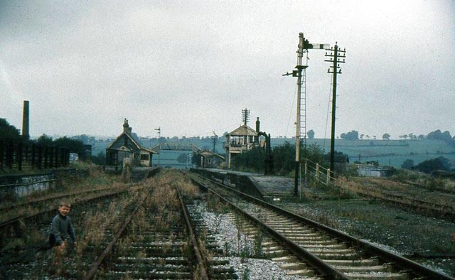
Shepton Mallet (Charlton Road) railway station

Shepton Mallet (Charlton Road) was a station on the Somerset and Dorset Joint Railway in the county of Somerset in England. Opened as Shepton Mallet on...

Nearby Amenities

Located within 500m of 51.175209,-2.5194985
Doulting Sheep Sleight
Ele: 216
Natural: peak
Source: NPE
Lat/Long: 51.1754196/-2.5194812
Power: pole
Lat/Long: 51.1785651/-2.5233968
Power: pole
Lat/Long: 51.1775496/-2.5238879
Power: pole
Lat/Long: 51.1764797/-2.524459
Power: pole
Lat/Long: 51.1753708/-2.5250123
Power: pole
Lat/Long: 51.1742939/-2.5255367
The data included in this document is from www.openstreetmap.org. The data is made available under ODbL.

Have you been to Doulting Sheep Sleight?

Leave your review of Doulting Sheep Sleight below (or comments, questions and feedback).