Inverlochy

Settlement in Inverness-shire

Scotland

Inverlochy

West End car park, Fort William
West End car park, Fort William Credit: Steven Brown

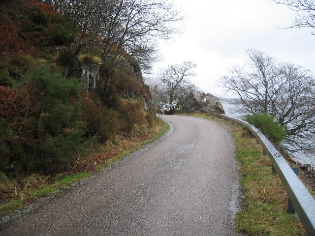
Inverlochy is a small village located in Inverness-shire, Scotland. Situated at the mouth of the River Lochy, it is nestled between the Nevis Range and Ben Nevis, the highest mountain in the British Isles. The village is approximately 3 miles north of Fort William, which serves as the local administrative center.

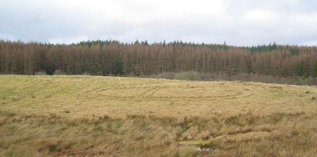
Inverlochy is renowned for its breathtaking natural beauty, attracting both locals and tourists alike. The area offers numerous opportunities for outdoor activities, including hiking, mountain biking, fishing, and skiing during the winter months. The nearby Glen Nevis is a popular destination for walkers, with its stunning waterfalls and picturesque landscapes.

Historically, Inverlochy played a significant role in Scotland's past. The Battle of Inverlochy took place here in 1645 during the English Civil War, where the Royalist forces led by the Marquess of Montrose emerged victorious over the Covenanters. Today, visitors can explore the remains of the 13th-century Inverlochy Castle, which played a pivotal role in the battle.

Despite its small size, Inverlochy offers a range of amenities to residents and visitors. There are local shops, restaurants, and accommodations available, providing essential services and catering to the needs of those exploring the area.

Overall, Inverlochy is a charming village with a rich history and is surrounded by stunning natural landscapes. Its proximity to Fort William and the Nevis Range makes it an ideal base for outdoor enthusiasts and those seeking to immerse themselves in Scotland's scenic beauty.

If you have any feedback on the listing, please let us know in the comments section below.

Inverlochy Images

Images are sourced within 2km of 56.824804/-5.094699 or Grid Reference NN1174. Thanks to Geograph Open Source API. All images are credited.

West End car park, Fort William
Sheet piling on the waterfront at Fort William Upholding the A82 road.
Sheet piling on the waterfront at Fort William
Upholding the A82 road.
Seafood restaurant, Fort William The Crannog restaurant on the shore of Loch Linnhe.
Seafood restaurant, Fort William
The Crannog restaurant on the shore of Loch Linnhe.
Landing stage, Fort William A pontoon landing stage for the passenger ferry across Loch Linnhe to Camusnagaul.
Landing stage, Fort William
A pontoon landing stage for the passenger ferry across Loch Linnhe to Camusnagaul.
Former low level observatory, Fort William At the instigation of the Scottish Meteorological Society, the summit observatory on Ben Nevis opened in October 1883. Subsequently funding of £1000 became available from the Edinburgh International Exhibition in 1886 to build a companion low level observatory in Fort William. A telegraph connection enabled simultaneous comparison of weather conditions between the summit (1345m) and this near sea level  location. The low level observatory opened in July 1890, and both observatories ran until financial difficulties eventually forced closure in 1904. (Source: The Weathermen of Ben Nevis by Marjory Roy, Royal Meteorological Society 2004).

Now the house is the Glentower B&B. See also <a href="https://www.geograph.org.uk/photo/5695715">NN0973 : Glentower Lower Observatory, Achintore Road</a> by Craig Wallace.
Former low level observatory, Fort William
At the instigation of the Scottish Meteorological Society, the summit observatory on Ben Nevis opened in October 1883. Subsequently funding of £1000 became available from the Edinburgh International Exhibition in 1886 to build a companion low level observatory in Fort William. A telegraph connection enabled simultaneous comparison of weather conditions between the summit (1345m) and this near sea level location. The low level observatory opened in July 1890, and both observatories ran until financial difficulties eventually forced closure in 1904. (Source: The Weathermen of Ben Nevis by Marjory Roy, Royal Meteorological Society 2004). Now the house is the Glentower B&B. See also NN0973 : Glentower Lower Observatory, Achintore Road by Craig Wallace.
Lochside car park, Fort William By the A82 at the southern end of the town.
Lochside car park, Fort William
By the A82 at the southern end of the town.
Fort William welcome sign A sign on the A82 entering from the south. The gaelic name translates as 'the garrison'.
Fort William welcome sign
A sign on the A82 entering from the south. The gaelic name translates as 'the garrison'.
Loch Linnhe from West End Car Park
Remains of WWII Roadblock near Camusnagaul
Remains of WWII QF/QL Decoy Site This was a site where lights were lit and fires started to decoy enemy aircraft attacking the Aluminium smelter near Fort William
Remains of WWII QF/QL Decoy Site
This was a site where lights were lit and fires started to decoy enemy aircraft attacking the Aluminium smelter near Fort William
Camusnagaul, Ardgour The ferry runs from here to Fort William across the top of Loch Linnhe.
Camusnagaul, Ardgour
The ferry runs from here to Fort William across the top of Loch Linnhe.
Fort William Primary School Disused school overlooking Loch Linnhe.
Fort William Primary School
Disused school overlooking Loch Linnhe.
Loch Linnhe, Fort William A beautiful morning in Fort William
Loch Linnhe, Fort William
A beautiful morning in Fort William
The Crannog Restaurant
Fort William station and the loch wall - 1973 Sometimes there are outbreaks of communal idiocy which can occur anywhere in Britain. In one such instance, this station was demolished and the railway trackbed used for commercial development and to build a new road.  The railway was cut back for over half a mile and a new 'station' built (in a different grid square and a far less convenient location for the centre of Fort William).
So the scene shown here will never be photographed again.
Fort William station and the loch wall - 1973
Sometimes there are outbreaks of communal idiocy which can occur anywhere in Britain. In one such instance, this station was demolished and the railway trackbed used for commercial development and to build a new road. The railway was cut back for over half a mile and a new 'station' built (in a different grid square and a far less convenient location for the centre of Fort William). So the scene shown here will never be photographed again.
Fort William looking across loch
Show me another place!

Inverlochy is located at Grid Ref: NN1174 (Lat: 56.824804, Lng: -5.094699)

Unitary Authority: Highland

Police Authority: Highlands and Islands

What 3 Words

///extremely.charge.discount. Near Fort William, Highland

Nearby Locations

Inverlochy Claggan

Related Wikis

Inverlochy, Highland

Inverlochy (Scottish Gaelic: Inbhir Lochaidh, IPA:[ˈinivɪɾʲˈɫ̪ɔxɪ]) is a village north of Fort William, Highland, Scotland. Inverlochy is part of the Great...

River Nevis

The River Nevis flows from the mountains east of Ben Nevis to its mouth near the town of Fort William in Scotland. == Overview == The river rises in the...

An Aird

An Aird is both an area of Fort William, Scotland, and also the largest dedicated shinty park in the town and is situated on the east bank of Loch Linnhe...

Nevis Radio

Nevis Community Radio Ltd (Nevis Radio) is a community radio station broadcasting from Fort William in Scotland, serving the communities of Fort William...

Nearby Amenities

Located within 500m of 56.824804,-5.094699
Traffic Calming: hump
Lat/Long: 56.8219376/-5.088966
Crossing
Crossing: traffic_signals
Lat/Long: 56.8226503/-5.0924533
Source: PGS
Lat/Long: 56.8280888/-5.0955973
Source: PGS
Lat/Long: 56.8266883/-5.100922
Source: PGS
Lat/Long: 56.8277017/-5.0961332
Source: PGS
Lat/Long: 56.8276111/-5.0963884
Source: PGS
Lat/Long: 56.8273646/-5.0968147
Created By: dmgroom_coastlines
Source: PGS
Lat/Long: 56.826924/-5.097591
Source: PGS
Lat/Long: 56.8265711/-5.0983897
Source: PGS
Lat/Long: 56.8261372/-5.0990896
Source: PGS
Lat/Long: 56.8257966/-5.0994547
Source: PGS
Lat/Long: 56.8254524/-5.0998093
Source: PGS
Lat/Long: 56.8251755/-5.1003915
Source: PGS
Lat/Long: 56.8249166/-5.1010051
Source: PGS
Lat/Long: 56.8248028/-5.1011767
Source: PGS
Lat/Long: 56.8245491/-5.1019412
Source: PGS
Lat/Long: 56.8243878/-5.1026179
Railway: switch
Lat/Long: 56.8240211/-5.091465
Fuel
Ben Nevis Services
Brand: Gleaner
Fuel HGV Diesel: yes
Fuel Diesel: yes
Fuel Octane 95: yes
Fuel Octane 98: yes
Operator: Gleaner
Shop: convenience
Source: survey
Lat/Long: 56.8241641/-5.0888139
Crossing
Bicycle: no
Crossing: traffic_signals
Crossing Ref: pelican
Lat/Long: 56.8211912/-5.0994759
Turning Circle
Lat/Long: 56.8266985/-5.0952622
Barrier: bollard
Bollard: removable
Motor Vehicle: no
Lat/Long: 56.8242419/-5.1003829
Inverlochy
Name Gd: Inbhir Lòchaidh
Name Sco: Innerlochy
Place: suburb
Wikidata: Q6060137
Wikipedia: en:Inverlochy, Highland
Lat/Long: 56.8258874/-5.0940491
Barrier: bollard
Bicycle: yes
Foot: yes
Lat/Long: 56.8218318/-5.0918578
Barrier: bollard
Bicycle: yes
Bollard: fixed
Foot: yes
Lat/Long: 56.8214485/-5.0918126
Give Way
Direction: backward
Give Way: backward
Lat/Long: 56.8252066/-5.0866196
Leisure: pitch
Lat/Long: 56.8249707/-5.0944406
Pub
Railway Social Club
Lat/Long: 56.8243503/-5.0933852
Bus Stop
Ben Nevis Ind Est
Bench: yes
Bin: no
Bus: yes
Naptan AtcoCode: 670010007
Naptan Bearing: NE
Naptan CommonName: Ben Nevis Ind Est
Naptan Indicator: opp Ben Nevis Ind Est
Naptan Landmark: Ben Nevis Ind Est
Naptan NaptanCode: 45323878
Naptan PlusbusZoneRef: FRTWLM
Naptan Street: A82
Naptan Verified: no
Public Transport: platform
Shelter: yes
Source: naptan_import
Tactile Paving: no
Lat/Long: 56.8254509/-5.0872054
Bus Stop
Ben Nevis Ind Est
Bus: yes
Direction: SW
Long Name: Fort William, at Ben Nevis Ind Est
Naptan AtcoCode: 670010008
Naptan Bearing: SW
Naptan CommonName: Ben Nevis Ind Est
Naptan Indicator: at Ben Nevis Ind Est
Naptan Landmark: Ben Nevis Ind Est
Naptan NaptanCode: 45323843
Naptan PlusbusZoneRef: FRTWLM
Naptan Street: A82
Naptan Verified: no
Public Transport: platform
Shelter: yes
Source: naptan_import
Lat/Long: 56.8244932/-5.0881266
Bus Stop
Belford Road
Bus: yes
Direction: W
Long Name: Fort William, at Nevis Bank Lane
Naptan AtcoCode: 670010011
Naptan Bearing: W
Naptan CommonName: Belford Road
Naptan Indicator: o/s Nevis Bank Hotel
Naptan Landmark: By Hotel
Naptan NaptanCode: 45323925
Naptan PlusbusZoneRef: FRTWLM
Naptan Street: Belford Road
Naptan Verified: no
Public Transport: platform
Shelter: no
Source: naptan_import
Lat/Long: 56.8215666/-5.0955902
Bus Stop
Belford Road
Bench: yes
Bus: yes
Naptan AtcoCode: 670010012
Naptan Bearing: E
Naptan CommonName: Belford Road
Naptan Indicator: opp Croft Road
Naptan Landmark: Croft Road
Naptan NaptanCode: 45323924
Naptan PlusbusZoneRef: FRTWLM
Naptan Street: Belford Road
Naptan Verified: no
Public Transport: platform
Shelter: yes
Source: naptan_import
Lat/Long: 56.821741/-5.0959146
Bus Stop
Claggan
Bus: yes
Naptan AtcoCode: 6700712005
Naptan Bearing: W
Naptan CommonName: Claggan
Naptan Indicator: By Fire Station
Naptan Landmark: Bus Shelter
Naptan NaptanCode: 45327636
Naptan Street: Ardnevis Rd
Naptan Verified: no
Public Transport: platform
Source: naptan_import
Lat/Long: 56.8222327/-5.0886618
Bus Stop
A82 (North Road)
Bus: yes
Naptan AtcoCode: 6700712006
Naptan Bearing: NE
Naptan CommonName: A82 (North Road)
Naptan Indicator: at Inverlochy Junction
Naptan Landmark: Bus Shelter
Naptan NaptanCode: 45327637
Naptan PlusbusZoneRef: FRTWLM
Naptan Street: North Road
Naptan Verified: no
Public Transport: platform
Shelter: yes
Source: naptan_import
Tactile Paving: no
Lat/Long: 56.8230972/-5.0918641
Bus Stop
A82 (North Road)
Bus: yes
Direction: SW
Long Name: Fort William, opposite Inverlochy Junction
Naptan AtcoCode: 6700712006A
Naptan Bearing: SW
Naptan CommonName: A82 (North Road)
Naptan Indicator: at Claggan Road
Naptan Landmark: Opp Oil Depot
Naptan NaptanCode: 45329375
Naptan PlusbusZoneRef: FRTWLM
Naptan Street: North Road
Naptan Verified: no
Public Transport: platform
Shelter: yes
Source: naptan_import
Lat/Long: 56.8229761/-5.0916738
Bus Stop
Inverlochy
Bus: yes
Naptan AtcoCode: 6700712794
Naptan Bearing: SW
Naptan CommonName: Inverlochy
Naptan Indicator: Bus Shelter
Naptan Landmark: Bus Shelter
Naptan NaptanCode: 45328292
Naptan PlusbusZoneRef: FRTWLM
Naptan Street: Lundy Road
Naptan Verified: no
Public Transport: platform
Shelter: yes
Source: naptan_import
Lat/Long: 56.8256243/-5.0939906
Bus Stop
Camanachd Crescent
Bus: yes
Naptan AtcoCode: 6700713422
Naptan Bearing: SE
Naptan CommonName: Camanachd Cresent
Naptan Indicator: By Nos 50-61
Naptan Landmark: Camanachd Cresent
Naptan NaptanCode: 45328723
Naptan PlusbusZoneRef: FRTWLM
Naptan Street: Camanachd Cresent
Naptan Verified: no
Public Transport: platform
Source: naptan_import
Lat/Long: 56.8225486/-5.0976712
Bus Stop
Claggan
Bus: yes
Naptan AtcoCode: 6700713452
Naptan Bearing: NE
Naptan CommonName: Claggan
Naptan Indicator: at Ardnevis Road
Naptan Landmark: Bus Shelter
Naptan NaptanCode: 45328736
Naptan Street: Melantee
Naptan Verified: no
Public Transport: platform
Source: naptan_import
Lat/Long: 56.8229443/-5.0889663
Nevis Cycles
Shop: bicycle
Lat/Long: 56.8260307/-5.0947858
Railway: switch
Lat/Long: 56.8244749/-5.0903622
Railway: switch
Lat/Long: 56.8249192/-5.0895813
Railway: switch
Lat/Long: 56.825136/-5.0893097
Railway: switch
Lat/Long: 56.8251413/-5.0893726
Railway: switch
Lat/Long: 56.8253069/-5.0891583
Railway: switch
Lat/Long: 56.8252664/-5.0891508
Railway: switch
Lat/Long: 56.8254073/-5.0892234
Railway: buffer_stop
Lat/Long: 56.8266837/-5.0883614
Railway: buffer_stop
Lat/Long: 56.8267222/-5.0884077
Railway: switch
Lat/Long: 56.8267526/-5.088517
Railway: switch
Lat/Long: 56.8269948/-5.0884667
Railway: switch
Lat/Long: 56.8272908/-5.0883877
Source: OS_OpenData_StreetView
Lat/Long: 56.8210417/-5.0979485
Post Box
Brand: Royal Mail
Brand Wikidata: Q638098
Collection Times: Mo-Fr 15:30
Note: front plate partly covered, collection times partly obscured
Operator: Royal Mail
Operator Wikidata: Q638098
Post Box Type: lamp
Ref: PH33 13
Royal Cypher: scottish_crown
Lat/Long: 56.8224746/-5.0999726
Post Box
Collection Times: Mo-Fr 16:15; Sa 12:30
Operator: Royal Mail
Operator Wikidata: Q638098
Post Box Type: pillar
Ref: PH33 2
Royal Cypher: GR
Royal Cypher Wikidata: Q33102273
Lat/Long: 56.8253973/-5.0947393
Old End of West Highland Way
Historic: boundary_stone
Lat/Long: 56.8213016/-5.0940769
Railway: switch
Lat/Long: 56.8218838/-5.1001253
Railway: signal
Ref: FRTW33
Ref Tiploc: FRTW33
Lat/Long: 56.8218978/-5.1000577
Railway: buffer_stop
Lat/Long: 56.8221461/-5.0989349
Railway: buffer_stop
Lat/Long: 56.823216/-5.0937986
Railway: buffer_stop
Lat/Long: 56.8232668/-5.0938729
Railway: switch
Lat/Long: 56.8236491/-5.0926303
Railway: switch
Lat/Long: 56.8238261/-5.0919464
Railway: switch
Lat/Long: 56.8243263/-5.090914
Railway: switch
Lat/Long: 56.8272357/-5.0885026
Barrier: bollard
Lat/Long: 56.8217255/-5.0972541
Telephone
Booth: K6
Covered: booth
Man Made: telephone_box
Source: survey
Lat/Long: 56.821392/-5.0970032
Dentist
M&S Dental Care Ltd
Healthcare: dentist
Lat/Long: 56.8208007/-5.0975958
Bicycle Parking
Bicycle Parking: stands
Capacity: 6
Covered: no
Fixme: check if these are still here
Lat/Long: 56.8237877/-5.0902198
Bicycle Parking
Bicycle Parking: stands
Capacity: 4
Covered: no
Lat/Long: 56.8253516/-5.094748
Telephone
Booth: KX100
Covered: booth
Operator: BT
Payment Coins: yes
Lat/Long: 56.8253949/-5.0947631
Bicycle Parking
Bicycle Parking: stands
Lat/Long: 56.8259348/-5.0947448
Highland Industrial Supplies
Shop: hardware
Lat/Long: 56.8248612/-5.0868152
Entrance: main
Lat/Long: 56.8237234/-5.0944217
Mike McFall Funeral Directors
Addr City: Inverlochy
Addr Street: Montrose Avenue
Operator: Mike McFall
Shop: funeral_directors
Lat/Long: 56.8256147/-5.0942946
McDonald Bros.
Addr City: Inverlochy
Addr Street: Montrose Avenue
Operator: C&S Nielsen
Shop: florist
Lat/Long: 56.8255919/-5.0945386
Aluminium Worker
Historic: monument
Lat/Long: 56.8258893/-5.0933754
Fort William Junction
Railway: junction
Wikidata: Q5472345
Wikipedia: en:Fort William Junction
Lat/Long: 56.8247186/-5.0900656
Post Box
Collection Times: Mo-Fr 16:00; Sa 12:30
Operator: Royal Mail
Operator Wikidata: Q638098
Post Box Type: pillar
Ref: PH33 36
Royal Cypher: scottish_crown
Lat/Long: 56.8250732/-5.0865117
Waste Basket
Lat/Long: 56.823016/-5.0991999
Leisure: picnic_table
Lat/Long: 56.8230365/-5.0991932
Give Way
Lat/Long: 56.823004/-5.0989504
Barrier: entrance
Lat/Long: 56.8231678/-5.0990826
Priority: backward
Traffic Calming: choker
Lat/Long: 56.8224754/-5.1000881
Poundstretcher
Brand: Poundstretcher
Brand Wikidata: Q7235675
Brand Wikipedia: en:Poundstretcher
Shop: variety_store
Website: https://www.poundstretcher.co.uk/Fort-william-652
Lat/Long: 56.8246643/-5.0890759
Glenlochy Nevis Bridge Apartments
Addr City: Fort William
Addr Postcode: PH33 6LP
Addr Street: North Road
Contact Phone: +44 7734 318796
Tourism: chalet
Website: https://www.glenlochyguesthouse.co.uk
Lat/Long: 56.822097/-5.0926501
McConechy's Tyre & Autocentre
Shop: car_repair
Lat/Long: 56.8242661/-5.0897936
Generator Method: photovoltaic
Generator Output Electricity: yes
Generator Source: solar
Generator Type: solar_photovoltaic_panel
Location: roof
Power: generator
Lat/Long: 56.8214704/-5.099574
Generator Method: photovoltaic
Generator Output Electricity: yes
Generator Source: solar
Generator Type: solar_photovoltaic_panel
Location: roof
Power: generator
Lat/Long: 56.821317/-5.0995834
Generator Method: photovoltaic
Generator Output Electricity: yes
Generator Source: solar
Generator Type: solar_photovoltaic_panel
Location: roof
Power: generator
Lat/Long: 56.8212965/-5.0996599
Generator Method: photovoltaic
Generator Output Electricity: yes
Generator Source: solar
Generator Type: solar_photovoltaic_panel
Location: roof
Power: generator
Lat/Long: 56.8257232/-5.096743
Restaurant
Brown's Restaurant
Addr Postcode: PH33 6PF
Brand: Browns
Brand Wikidata: Q4976672
Contact Phone: +44 1397 705721
Cuisine: british
Operator: Nevis Bank Hotel Ltd
Outdoor Seating: no
Payment American Express: yes
Toilets Access: customers
Lat/Long: 56.8214994/-5.0956284
Fast Food
KFC
Addr Street: Nevis Road
Alt Name: Kentucky Fried Chicken
Brand: KFC
Brand Wikidata: Q524757
Cuisine: chicken
Drive Through: yes
Internet Access: wlan
Takeaway: yes
Website: https://www.kfc.co.uk/kfc-near-me/fort-william-north-road
Lat/Long: 56.8237529/-5.0910106
Man Made: monitoring_station
Monitoring Air Quality: yes
Recording Automated: yes
Website: https://www.scottishairquality.scot/latest/site-info/FW
Lat/Long: 56.8227181/-5.1010823
Railway: buffer_stop
Lat/Long: 56.8259341/-5.0874365
Inverlochy Yard
Place: locality
Lat/Long: 56.8259485/-5.0884412
Source: PGS
Lat/Long: 56.8265922/-5.1013109
Source: PGS
Lat/Long: 56.8265745/-5.1020958
Give Way
Direction: forward
Lat/Long: 56.8249532/-5.0874286
The data included in this document is from www.openstreetmap.org. The data is made available under ODbL.

Have you been to Inverlochy?

Leave your review of Inverlochy below (or comments, questions and feedback).