Canwood Knoll

Hill, Mountain in Herefordshire

England

Canwood Knoll

Lane to Checkley
Lane to Checkley Credit: Julian P Guffogg

Canwood Knoll is a prominent hill located in Herefordshire, England. Situated in the heart of the county, it stands at an elevation of approximately 280 meters (918 feet) above sea level, making it a notable landmark in the region. The hill is part of the wider Malvern Hills range, renowned for its natural beauty and stunning landscapes.

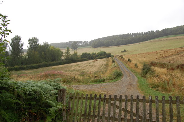
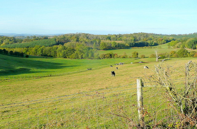
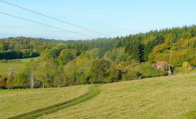
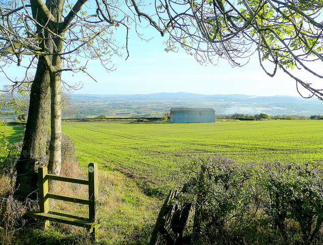
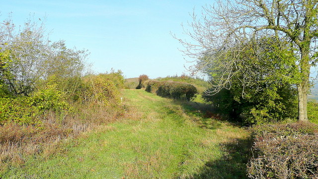
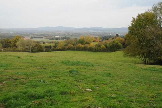
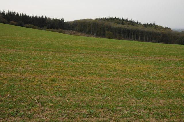
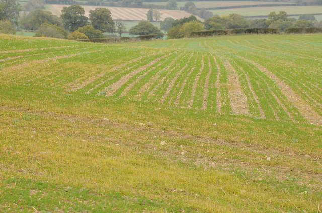
Canwood Knoll offers breathtaking panoramic views of the surrounding countryside, including the picturesque Herefordshire Plain. Its commanding position allows visitors to admire the undulating green hills, quaint villages, and meandering rivers that characterize the area.

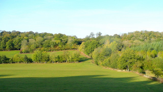
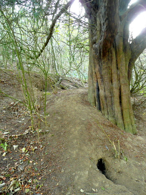
The hill is covered in lush vegetation, with an abundance of deciduous trees and colorful wildflowers, creating a vibrant and diverse ecosystem. It is home to a variety of wildlife, including deer, rabbits, and a wide range of bird species, making it a popular destination for nature enthusiasts and birdwatchers.

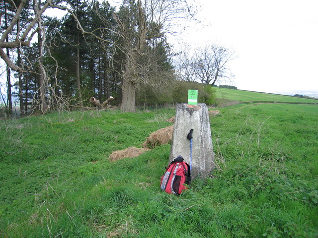
Canwood Knoll is also steeped in history, with ancient settlements and burial mounds dating back to the Iron Age and Roman period. The hill has been an important landmark for centuries, serving as a navigational point and offering strategic advantages due to its elevated position.

Visitors can explore the hill through a network of well-maintained walking trails, allowing them to experience its natural beauty up close. Its accessibility and proximity to nearby towns make it a popular destination for hikers, walkers, and families seeking a day out in the countryside.

In conclusion, Canwood Knoll is a breathtaking hill in Herefordshire, offering stunning views, rich biodiversity, and a glimpse into the region's history.

If you have any feedback on the listing, please let us know in the comments section below.

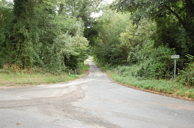
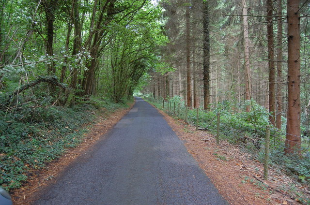
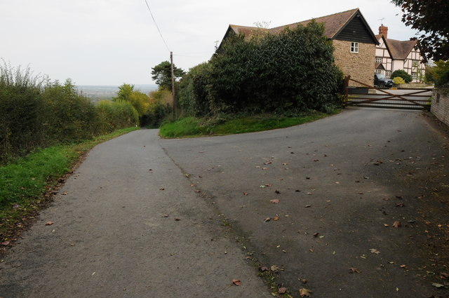
Canwood Knoll Images

Images are sourced within 2km of 52.036853/-2.5624511 or Grid Reference SO6137. Thanks to Geograph Open Source API. All images are credited.

Lane to Checkley
Lane to Checkley
Track towards Bunkers Hill
Lane through Park Coppice
Wooded hills Nurden Wood to the left and Round Hill Wood to the right.
Wooded hills
Nurden Wood to the left and Round Hill Wood to the right.
View from Woolhope Cockshoot The eye is led towards Round Hill Wood and Devereux Park.
View from Woolhope Cockshoot
The eye is led towards Round Hill Wood and Devereux Park.
Park Coppice Looking west on a fine autumn morning.
Park Coppice
Looking west on a fine autumn morning.
Badger sett, Jones's Coppice Next to a yew tree by the steep public path near the northern edge of the gridsquare.
Badger sett, Jones's Coppice
Next to a yew tree by the steep public path near the northern edge of the gridsquare.
Path to Hazel Court Looking north-east towards the Malvern Hills in the blue distance.
Path to Hazel Court
Looking north-east towards the Malvern Hills in the blue distance.
Green Lane This apparently ancient lane follows the crest of Seager Hill.
Green Lane
This apparently ancient lane follows the crest of Seager Hill.
Hop kilns, Upper Hazel Farm Hop kilns in a sorry state at Upper Hazel Farm near Durlow Common.
Hop kilns, Upper Hazel Farm
Hop kilns in a sorry state at Upper Hazel Farm near Durlow Common.
Upper Hazel Farm The farmhouse and hop kiln at Upper Hazel Farm near Durlow Common.
Upper Hazel Farm
The farmhouse and hop kiln at Upper Hazel Farm near Durlow Common.
Farmland at Durlow Common Farmland near Hazel Court at Durlow Common.
Farmland at Durlow Common
Farmland near Hazel Court at Durlow Common.
Road passing Hazel Court Road passing Hazel Court near Durlow Court.
Road passing Hazel Court
Road passing Hazel Court near Durlow Court.
Cosington Wood Cosington Wood viewed from the track to the east.
Cosington Wood
Cosington Wood viewed from the track to the east.
Fields on Seagar Hill Field left unploughed after the harvest.
Fields on Seagar Hill
Field left unploughed after the harvest.
Seager Hill Trig Bagged summit which is around the corner from this trig then regained track to gain a telling off from gamekeeper, Get Off My Land, so headed back SE from where I began.
Name: Seager Hill
Hill number: 2865
Height: 272m / 892ft
Area: 38B: West Gloucestershire, Hereford & Worcester
Class: Ma
Grid ref: SO 61365 38950
Summit feature: no feature: ground 3m S of vehicle track
Drop: 167m
Col: 105m  SO658257
Seager Hill Trig
Bagged summit which is around the corner from this trig then regained track to gain a telling off from gamekeeper, Get Off My Land, so headed back SE from where I began. Name: Seager Hill Hill number: 2865 Height: 272m / 892ft Area: 38B: West Gloucestershire, Hereford & Worcester Class: Ma Grid ref: SO 61365 38950 Summit feature: no feature: ground 3m S of vehicle track Drop: 167m Col: 105m SO658257
St George, Woolhope The North side, seen from the East end. The church was mostly rebuilt 1882-83 by Henry Woodyer, but still has notable medieval elements.
St George, Woolhope
The North side, seen from the East end. The church was mostly rebuilt 1882-83 by Henry Woodyer, but still has notable medieval elements.
St George, Woolhope The church was mostly rebuilt 1882-83 by Henry Woodyer, who added the South aisle, but it still has notable medieval elements. Set in an enormous churchyard in this magical Herefordshire village.
St George, Woolhope
The church was mostly rebuilt 1882-83 by Henry Woodyer, who added the South aisle, but it still has notable medieval elements. Set in an enormous churchyard in this magical Herefordshire village.
Show me another place!

Canwood Knoll is located at Grid Ref: SO6137 (Lat: 52.036853, Lng: -2.5624511)

Unitary Authority: County of Herefordshire

Police Authority: West Mercia

What 3 Words

///browsers.creatures.thundered. Near Brockhampton, Herefordshire

Nearby Locations

Canwood Knoll

Related Wikis

Woolhope

Woolhope is a village and civil parish in the English county of Herefordshire. The population of the civil parish was 486 at the 2011 census. The civil...

Alder's End

Alder's End is a small village in Herefordshire, England. It is about 8 miles (13 km) east of Hereford and is near the A438 road. The village falls within...

Tarrington

Tarrington is a small village in Herefordshire, England located halfway between Ledbury and Hereford on the A438 road. == The village == The village has...

Putley

Putley is a village and civil parish 8 miles (13 km) east of Hereford, in the county of Herefordshire, England. In 2011 the parish had a population of...

Nearby Amenities

Located within 500m of 52.036853,-2.5624511
Canwood Turn
Naptan AtcoCode: 2090A129800
Naptan Bearing: NW
Naptan BusStopType: CUS
Naptan CommonName: Canwood Turn
Naptan Indicator: adj
Naptan Landmark: Junction
Naptan NaptanCode: heradwpt
Naptan Street: N/K
Naptan Verified: no
Source: naptan_import
Lat/Long: 52.0379406/-2.5681249
Canwood Turn
Naptan AtcoCode: 2090A19716
Naptan Bearing: E
Naptan BusStopType: CUS
Naptan CommonName: Canwood Turn
Naptan Indicator: opp
Naptan Landmark: Junction
Naptan NaptanCode: heramjap
Naptan Street: N/K
Naptan Verified: no
Source: naptan_import
Lat/Long: 52.0380166/-2.5680975
Fixme: Does Public Footpath continue SE?
Lat/Long: 52.0390759/-2.5578735
Power: pole
Source: bing
Lat/Long: 52.0368267/-2.5683787
Power: pole
Source: bing
Lat/Long: 52.0370346/-2.5691324
Power: pole
Lat/Long: 52.0358499/-2.5678128
Park Farm Woodhope
Power: pole
Transformer: distribution
Voltage Primary: 11000
Lat/Long: 52.0382828/-2.5565703
Power: pole
Lat/Long: 52.0389254/-2.5575185
Park View
Power: pole
Transformer: distribution
Voltage Primary: 11000
Lat/Long: 52.0396819/-2.5586437
Power: pole
Lat/Long: 52.0396704/-2.5603724
Power: pole
Lat/Long: 52.0396629/-2.5616008
Power: pole
Lat/Long: 52.0396596/-2.562604
Botany Bay Cottages
Location Transition: yes
Power: pole
Transformer: distribution
Voltage Primary: 11000
Lat/Long: 52.0398147/-2.5638753
Woodcroft
Power: pole
Transformer: distribution
Voltage Primary: 11000
Lat/Long: 52.0333361/-2.5623639
Power: pole
Lat/Long: 52.0330011/-2.5634515
Power: pole
Lat/Long: 52.0327437/-2.5642294
Power: pole
Lat/Long: 52.0340028/-2.5668156
Power: pole
Lat/Long: 52.0347846/-2.567257
Power: pole
Lat/Long: 52.0330324/-2.5662678
Canwood Bungalow
Power: pole
Transformer: distribution
Voltage Primary: 11000
Lat/Long: 52.0351029/-2.5674366
The data included in this document is from www.openstreetmap.org. The data is made available under ODbL.

Have you been to Canwood Knoll?

Leave your review of Canwood Knoll below (or comments, questions and feedback).