Earn Cairn

Hill, Mountain in Kincardineshire

Scotland

Earn Cairn

Bannock Hill, North of Edzell Open moorland showing patchwork pattern of heather as a result of periodic burning of areas of the grouse moor.
Bannock Hill, North of Edzell Credit: David G Campbell

Earn Cairn is a prominent hill located in Kincardineshire, Scotland. Standing at an elevation of approximately 340 meters (1,115 feet), it offers breathtaking views of the surrounding landscape. The hill is situated near the village of Cairnbulg, northwest of the larger town of Fraserburgh.

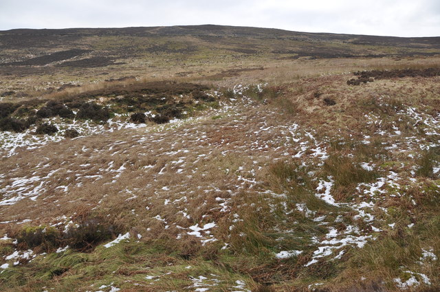
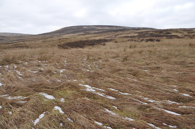
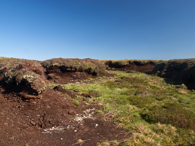
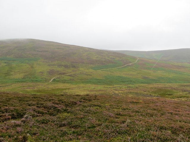
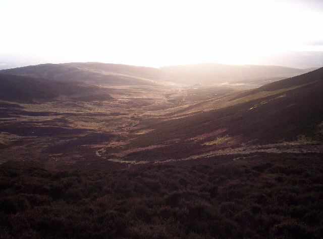
Earn Cairn is characterized by its distinctive shape and rugged terrain. Covered in heather and sparse vegetation, it boasts a unique charm that attracts both nature enthusiasts and hikers. The hill forms part of the larger Mounthooly Hill Range, which stretches across Aberdeenshire and Kincardineshire.

To reach the summit of Earn Cairn, there are various routes available, each offering different levels of difficulty. The most common approach is from the southwest, where a well-marked trail leads hikers through a mixture of moorland and rocky sections. Along the way, visitors may encounter a variety of wildlife, including deer, grouse, and various bird species.

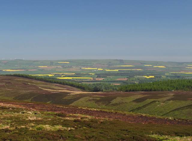
Upon reaching the top, visitors are rewarded with panoramic vistas of the surrounding countryside, including the North Sea coastline and nearby farmland. On a clear day, it is even possible to see as far as the Grampian Mountains to the west. The summit also features a small cairn, which serves as a marker for those who have successfully conquered the hill.

Overall, Earn Cairn offers a fantastic opportunity to explore the natural beauty of Kincardineshire. With its stunning views, diverse wildlife, and challenging terrain, it is a must-visit destination for outdoor enthusiasts and those seeking a peaceful escape in the Scottish countryside.

If you have any feedback on the listing, please let us know in the comments section below.

Earn Cairn Images

Images are sourced within 2km of 56.889769/-2.6493472 or Grid Reference NO6077. Thanks to Geograph Open Source API. All images are credited.

Bannock Hill, North of Edzell Open moorland showing patchwork pattern of heather as a result of periodic burning of areas of the grouse moor.
Bannock Hill, North of Edzell
Open moorland showing patchwork pattern of heather as a result of periodic burning of areas of the grouse moor.
Moorland North of Edzell Open grassland, moorland and bogs, flattened grass still recovering from recent snowfalls.
Moorland North of Edzell
Open grassland, moorland and bogs, flattened grass still recovering from recent snowfalls.
East of the Hill of Remora Boggy ground to the east of the Hill of Remora. The upper course of the Short Gormack Burn can be seen in the middle distance, and further away the summit of Clachnaben.
East of the Hill of Remora
Boggy ground to the east of the Hill of Remora. The upper course of the Short Gormack Burn can be seen in the middle distance, and further away the summit of Clachnaben.
Above the Shank of Cardowan A view from the hillside above the Shank of Cardowan, with cultivated fields in the Howe of the Mearns visible in the distance.
Above the Shank of Cardowan
A view from the hillside above the Shank of Cardowan, with cultivated fields in the Howe of the Mearns visible in the distance.
Peat Deposits near Slack Pool Extensive deposits of peat near Slack Pool. Peatlands sequester large amounts of carbon and have been dubbed "global coolers" by environmental organisations.
Peat Deposits near Slack Pool
Extensive deposits of peat near Slack Pool. Peatlands sequester large amounts of carbon and have been dubbed "global coolers" by environmental organisations.
Cross at your peril! This footbridge over the Water of Charr has had its day and would not look out of place on the set of an Indianan Jones film. The landrover track next to the Water of Charr has now been extended to a roofless ruin shown on the OS maps at ref. 605 796
Cross at your peril!
This footbridge over the Water of Charr has had its day and would not look out of place on the set of an Indianan Jones film. The landrover track next to the Water of Charr has now been extended to a roofless ruin shown on the OS maps at ref. 605 796
Headwaters of the Charr Peat clothed hills draining into the Water of Charr.
Headwaters of the Charr
Peat clothed hills draining into the Water of Charr.
Sturdy Hill Trig Pillar The triangulation pillar on Sturdy Hill with Mount Battock in the background.
Sturdy Hill Trig Pillar
The triangulation pillar on Sturdy Hill with Mount Battock in the background.
North side of Sturdy Hill Looking down the north side of Sturdy Hill with Clachnaben in the distance.
North side of Sturdy Hill
Looking down the north side of Sturdy Hill with Clachnaben in the distance.
Craigancash track The track heading over the summit of Craigancash.
Craigancash track
The track heading over the summit of Craigancash.
Moorland and hill tracks The Burn of Corbrack is where the track appears in the foreground
Moorland and hill tracks
The Burn of Corbrack is where the track appears in the foreground
Sturdy Hill View towards Mount Keen from the summit of Sturdy Hill.
Sturdy Hill
View towards Mount Keen from the summit of Sturdy Hill.
Coire between Maolearn and Sturdy Hill Saddle Hill and Bannock Hill in the distance.
Coire between Maolearn and Sturdy Hill
Saddle Hill and Bannock Hill in the distance.
A herd of deer on Craigancash
Ice Feature This was found on the eastern slope of Craigancash just up from the landrover track
Ice Feature
This was found on the eastern slope of Craigancash just up from the landrover track
Heathery hillside Mount Keen and Lochnagar in the distance and Glen Esk can also be seen.
Heathery hillside
Mount Keen and Lochnagar in the distance and Glen Esk can also be seen.
Heathery Hillside Clacnaben can just be seen in the distance
Heathery Hillside
Clacnaben can just be seen in the distance
Slack Pool A very dried up pool that seems to flow in two directions when full.Eastwards it flows into the Burn of Cauldcots through Fettercairn, and
west into the Water of Charr in Glen Dye.
Slack Pool
A very dried up pool that seems to flow in two directions when full.Eastwards it flows into the Burn of Cauldcots through Fettercairn, and west into the Water of Charr in Glen Dye.
Show me another place!

Earn Cairn is located at Grid Ref: NO6077 (Lat: 56.889769, Lng: -2.6493472)

Unitary Authority: Aberdeenshire

Police Authority: North East

What 3 Words

///never.impresses.caller. Near Laurencekirk, Aberdeenshire

Nearby Locations

Earn Cairn

Related Wikis

Colmeallie stone circle

The Colmeallie stone circle is a recumbent stone circle in Glen Esk, Angus, Scotland. It is located 8 km north of Edzell at Colmeallie Farm, adjacent to...

Fasque House

Fasque, also known as Fasque House or Fasque Castle, is a mansion in Aberdeenshire, Scotland, situated near the village of Fettercairn, in the former county...

Cairn O' Mounth

Cairn O' Mounth/Cairn O' Mount (Scottish Gaelic: Càrn Mhon) is a high mountain pass in Aberdeenshire, Scotland. The place name is a survival of the ancient...

Fettercairn distillery

Fettercairn distillery is a whisky distillery in Fettercairn. Situated under the Grampian foothills in the Howe of Mearns, Fettercairn town’s name is...

Have you been to Earn Cairn?

Leave your review of Earn Cairn below (or comments, questions and feedback).