Cock Hill

Hill, Mountain in Kincardineshire

Scotland

Cock Hill

Kettock Burn Kettock Burn is immediately below.  Hazly Grain joins it below Wolf Hill.  Clouds are touching the summit of Mount Battock in the distance.  A few minutes earlier a lone deer had been startled by my arrival from downwind and had taken off at high speed.
Kettock Burn Credit: Nigel Corby

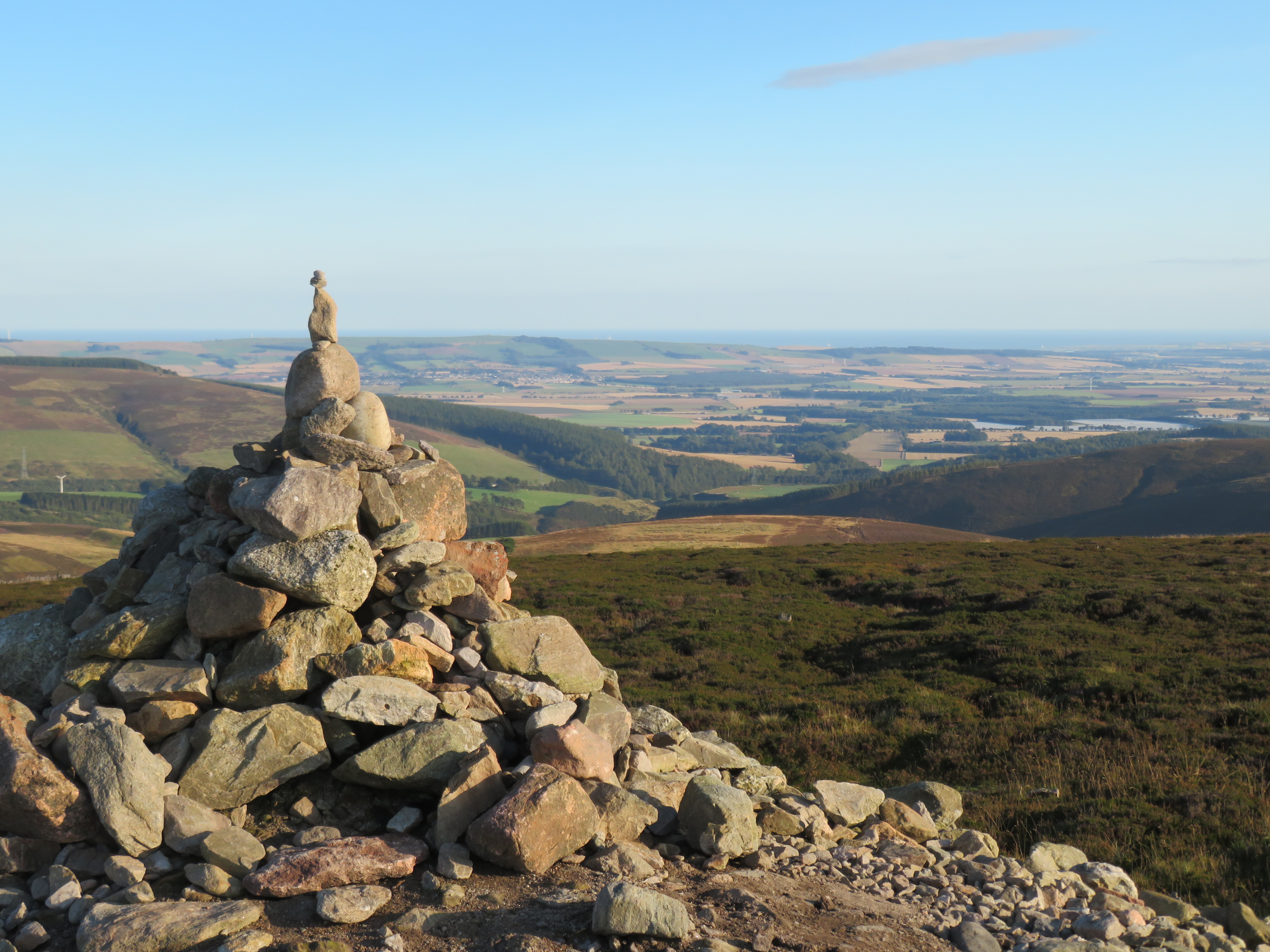
Cock Hill is a prominent hill located in Kincardineshire, Scotland. Sitting at an elevation of 229 meters (751 feet), it offers stunning panoramic views of the surrounding countryside and the North Sea. The hill is a popular destination for hikers and nature enthusiasts, with well-maintained trails leading to the summit.

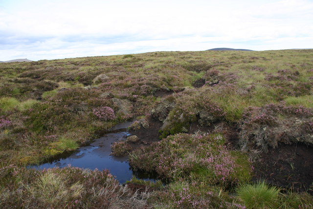
Cock Hill is characterized by its gently sloping terrain, covered in grasses and heather, making it a relatively easy climb for most visitors. The hill is also home to a variety of wildlife, including birds of prey such as kestrels and buzzards, as well as deer and other small mammals.

Visitors to Cock Hill can enjoy a peaceful and tranquil setting, away from the hustle and bustle of urban life. The hill is a great spot for picnics, photography, or simply taking in the natural beauty of the Scottish countryside.

Overall, Cock Hill is a charming and picturesque destination in Kincardineshire, offering outdoor enthusiasts the opportunity to explore the stunning landscapes of Scotland.

If you have any feedback on the listing, please let us know in the comments section below.

Cock Hill Images

Images are sourced within 2km of 56.905574/-2.6592108 or Grid Reference NO5979. Thanks to Geograph Open Source API. All images are credited.

Kettock Burn Kettock Burn is immediately below.  Hazly Grain joins it below Wolf Hill.  Clouds are touching the summit of Mount Battock in the distance.  A few minutes earlier a lone deer had been startled by my arrival from downwind and had taken off at high speed.
Kettock Burn
Kettock Burn is immediately below. Hazly Grain joins it below Wolf Hill. Clouds are touching the summit of Mount Battock in the distance. A few minutes earlier a lone deer had been startled by my arrival from downwind and had taken off at high speed.
Waird of Kettock Heather covered hillside.
Waird of Kettock
Heather covered hillside.
Boundary Fence Boundary fence between unnamed hill and Murmannoch
Boundary Fence
Boundary fence between unnamed hill and Murmannoch
Tussocks below Rough Bank Rough moorland south of Glen Dye with a view towards Mount Battock.
Tussocks below Rough Bank
Rough moorland south of Glen Dye with a view towards Mount Battock.
View towards Mount Battock Miles of moorland, but probable that there will be wind turbines here by the time you read this.
View towards Mount Battock
Miles of moorland, but probable that there will be wind turbines here by the time you read this.
White Shank Hills covered in deep peat, much of which will soon be carbon dioxide after the bog is dug up for wind turbines.
White Shank
Hills covered in deep peat, much of which will soon be carbon dioxide after the bog is dug up for wind turbines.
East of the Hill of Remora Boggy ground to the east of the Hill of Remora. The upper course of the Short Gormack Burn can be seen in the middle distance, and further away the summit of Clachnaben.
East of the Hill of Remora
Boggy ground to the east of the Hill of Remora. The upper course of the Short Gormack Burn can be seen in the middle distance, and further away the summit of Clachnaben.
Cross at your peril! This footbridge over the Water of Charr has had its day and would not look out of place on the set of an Indianan Jones film. The landrover track next to the Water of Charr has now been extended to a roofless ruin shown on the OS maps at ref. 605 796
Cross at your peril!
This footbridge over the Water of Charr has had its day and would not look out of place on the set of an Indianan Jones film. The landrover track next to the Water of Charr has now been extended to a roofless ruin shown on the OS maps at ref. 605 796
Water of Charr Beneath the moorland slopes named as Brae of Fawnyard.
Water of Charr
Beneath the moorland slopes named as Brae of Fawnyard.
Fence, Water of Charr Unusually, there are some vicious looking spikes of stiff wire on the fence posts.
Fence, Water of Charr
Unusually, there are some vicious looking spikes of stiff wire on the fence posts.
Headwaters of the Charr Peat clothed hills draining into the Water of Charr.
Headwaters of the Charr
Peat clothed hills draining into the Water of Charr.
All terrain vehicle track, Water of Charr Moorland path amongst the Charr headwaters.
All terrain vehicle track, Water of Charr
Moorland path amongst the Charr headwaters.
Sturdy Hill Trig Pillar The triangulation pillar on Sturdy Hill with Mount Battock in the background.
Sturdy Hill Trig Pillar
The triangulation pillar on Sturdy Hill with Mount Battock in the background.
North side of Sturdy Hill Looking down the north side of Sturdy Hill with Clachnaben in the distance.
North side of Sturdy Hill
Looking down the north side of Sturdy Hill with Clachnaben in the distance.
Sturdy Hill View towards Mount Keen from the summit of Sturdy Hill.
Sturdy Hill
View towards Mount Keen from the summit of Sturdy Hill.
Heathery hillside Mount Keen and Lochnagar in the distance and Glen Esk can also be seen.
Heathery hillside
Mount Keen and Lochnagar in the distance and Glen Esk can also be seen.
Heathery Hillside Clacnaben can just be seen in the distance
Heathery Hillside
Clacnaben can just be seen in the distance
Towards Cock Hill
Towards Cock Hill
Show me another place!

Cock Hill is located at Grid Ref: NO5979 (Lat: 56.905574, Lng: -2.6592108)

Unitary Authority: Aberdeenshire

Police Authority: North East

What 3 Words

///speeded.lanes.mountain. Near Laurencekirk, Aberdeenshire

Nearby Locations

Cock Hill

Related Wikis

Colmeallie stone circle

The Colmeallie stone circle is a recumbent stone circle in Glen Esk, Angus, Scotland. It is located 8 km north of Edzell at Colmeallie Farm, adjacent to...

Cairn O' Mounth

The Cairn o' Mount or Cairn o' Mounth is a hill in Aberdeenshire, Scotland, rising to 455 metres (1,493 ft). The B974 road crosses its summit, connecting...

Millden

Millden is a hamlet, estate and farmstead in Glenesk, Angus, Scotland. It is situated in the upper course of the Glen Esk valley, where the Burn of Turret...

Fasque House

Fasque, also known as Fasque House or Fasque Castle, is a mansion in Aberdeenshire, Scotland, situated near the village of Fettercairn, in the former county...

Nearby Amenities

Located within 500m of 56.905574,-2.6592108
Cock Hill
Ele: 438
Natural: peak
Lat/Long: 56.9053433/-2.6585125
The data included in this document is from www.openstreetmap.org. The data is made available under ODbL.

Have you been to Cock Hill?

Leave your review of Cock Hill below (or comments, questions and feedback).