Gaylock Hill

Hill, Mountain in Cumberland Carlisle

England

Gaylock Hill

Black Preston in view The end point of a short Cumbrian walk is in view.  Spadeadam Forest can be noted in the distance.

This photograph was taken during the Coronavirus (COVID-19) pandemic of 2020/21.
Black Preston in view Credit: James T M Towill

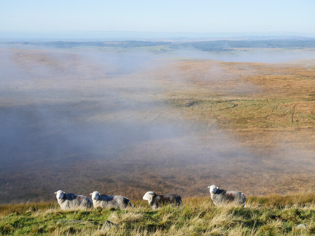
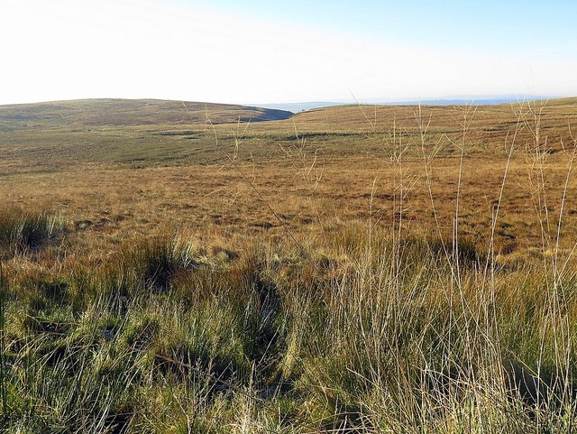
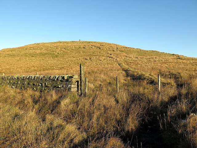
Gaylock Hill is a prominent geographical feature located in Cumberland, a historic county in the northwest of England. This hill, also known as Gaylock Fell, rises majestically to an elevation of approximately 520 meters (1,706 feet) above sea level, making it one of the highest points in the region.

Situated within the breathtaking Lake District National Park, Gaylock Hill offers visitors an unparalleled panoramic view of the surrounding landscape. From its summit, one can feast their eyes on the vast expanse of unspoiled natural beauty, including lush green valleys, shimmering lakes, and towering mountains. On a clear day, it is even possible to catch a glimpse of the Irish Sea, adding to the hill's allure.

The hill's name, "Gaylock," is believed to have originated from the Old Norse language, meaning "steep hill." This designation accurately reflects the terrain of Gaylock Hill, characterized by its steep slopes and rugged terrain. As a result, it has become a popular destination for hikers and outdoor enthusiasts seeking a challenging and rewarding climb.

The fauna and flora of Gaylock Hill are equally captivating. The hill is home to a diverse array of wildlife, including red deer, mountain hares, and a variety of birds. Additionally, its slopes are adorned with heather, ferns, and mosses, providing a vibrant and picturesque landscape.

In summary, Gaylock Hill is a magnificent hill/mountain in Cumberland, England, renowned for its mesmerizing views, challenging terrain, and rich biodiversity. Whether one seeks adventure, natural beauty, or a peaceful retreat, this remarkable hill offers an experience that is sure to leave a lasting impression.

If you have any feedback on the listing, please let us know in the comments section below.

Gaylock Hill Images

Images are sourced within 2km of 55.092637/-2.630077 or Grid Reference NY5977. Thanks to Geograph Open Source API. All images are credited.

Black Preston in view The end point of a short Cumbrian walk is in view.  Spadeadam Forest can be noted in the distance.

This photograph was taken during the Coronavirus (COVID-19) pandemic of 2020/21.
Black Preston in view
The end point of a short Cumbrian walk is in view. Spadeadam Forest can be noted in the distance. This photograph was taken during the Coronavirus (COVID-19) pandemic of 2020/21.
Bewcastle Hammer on Black Preston 'Bewcastle Hammer' is the name given by another Geograph contributor to this installation on Black Preston.  Retreating valley fog can be noted in the distance.

This photograph was taken during the Coronavirus (COVID-19) pandemic of 2020/21.
Bewcastle Hammer on Black Preston
'Bewcastle Hammer' is the name given by another Geograph contributor to this installation on Black Preston. Retreating valley fog can be noted in the distance. This photograph was taken during the Coronavirus (COVID-19) pandemic of 2020/21.
Herdwick sheep on Black Preston All manner of noises were used to get this part of a flock of Herdwick sheep to look at the camera: mixed results in the end!

This photograph was taken during the Coronavirus (COVID-19) pandemic of 2020/21.
Herdwick sheep on Black Preston
All manner of noises were used to get this part of a flock of Herdwick sheep to look at the camera: mixed results in the end! This photograph was taken during the Coronavirus (COVID-19) pandemic of 2020/21.
White Preston from Black Preston Rather bleak grazing moorland punctuated by a couple of minor summits.  White Preston features some communications infrastructure for RAF Spadeadam.

This photograph was taken during the Coronavirus (COVID-19) pandemic of 2020/21.
White Preston from Black Preston
Rather bleak grazing moorland punctuated by a couple of minor summits. White Preston features some communications infrastructure for RAF Spadeadam. This photograph was taken during the Coronavirus (COVID-19) pandemic of 2020/21.
Millennium Cairn on Black Preston Erected by a local farmer to commemorate his family's link to this land.  A beautiful view of this corner of Cumbria can be obtained after the short climb from the nearby track.

This photograph was taken during the Coronavirus (COVID-19) pandemic of 2020/21.
Millennium Cairn on Black Preston
Erected by a local farmer to commemorate his family's link to this land. A beautiful view of this corner of Cumbria can be obtained after the short climb from the nearby track. This photograph was taken during the Coronavirus (COVID-19) pandemic of 2020/21.
Hazelgill Crag Hazelgill Crags is a second location in the area for a rock inscribed with runes. The other is at Barron's Pike <a href="https://www.geograph.org.uk/photo/5209139">NY5975 : Is this the inscribed rock at Barron's Pike?</a>. They were supposed to have been discovered by a shepherd, in 1872 and 1864 respectively. They are believed to be forgeries of the mid-19th century. 

At Hazelgill Crags, the inscription, comprising one row of characters, is described as being visible on the north-west face of a cleft in the natural rock outcrop.

A large quarry has been opened up behind the crags <a href="https://www.geograph.org.uk/photo/5211147">NY5976 : Quarry at Hazelgill Crag</a>
Hazelgill Crag
Hazelgill Crags is a second location in the area for a rock inscribed with runes. The other is at Barron's Pike NY5975 : Is this the inscribed rock at Barron's Pike?. They were supposed to have been discovered by a shepherd, in 1872 and 1864 respectively. They are believed to be forgeries of the mid-19th century. At Hazelgill Crags, the inscription, comprising one row of characters, is described as being visible on the north-west face of a cleft in the natural rock outcrop. A large quarry has been opened up behind the crags NY5976 : Quarry at Hazelgill Crag
Quarry at Hazelgill Crag
Forest at Bullcleugh Gate
Disused quarry near Bullcleugh Gate
White Preston from the west
Lady Moss
Lady Moss
Black Preston A large cairn has been constructed on the hill <a href="https://www.geograph.org.uk/photo/1868739">NY5876 : Millennium cairn on Black Preston (3)</a>
Black Preston
A large cairn has been constructed on the hill NY5876 : Millennium cairn on Black Preston (3)
Track near Black Moss Black Preston is in the distance.
Track near Black Moss
Black Preston is in the distance.
Drystone Wall
Drystone Wall
Sheep Fold
Sheep Fold
Boundary Fence
Boundary Fence
Drystone Wall
Drystone Wall
Crying Crags
Crying Crags
Show me another place!

Gaylock Hill is located at Grid Ref: NY5977 (Lat: 55.092637, Lng: -2.630077)

Administrative County: Cumbria

District: Carlisle

Police Authority: Cumbria

What 3 Words

///damage.trickled.iceberg. Near Greenhead, Northumberland

Nearby Locations

Gaylock Hill White Preston

Related Wikis

Sighty Crag

Sighty Crag is a[hill in the southern part of the Kielder Forest region in northern England, a region which also includes its fellow Marilyns of Peel Fell...

Bewcastle Castle

Bewcastle Castle is a ruined castle in the parish of Bewcastle in the English county of Cumbria, a few miles from the Scottish border. == History == The...

Bewcastle Cross

The Bewcastle Cross is an Anglo-Saxon cross which is still in its original position within the churchyard of St Cuthbert's church at Bewcastle, in the...
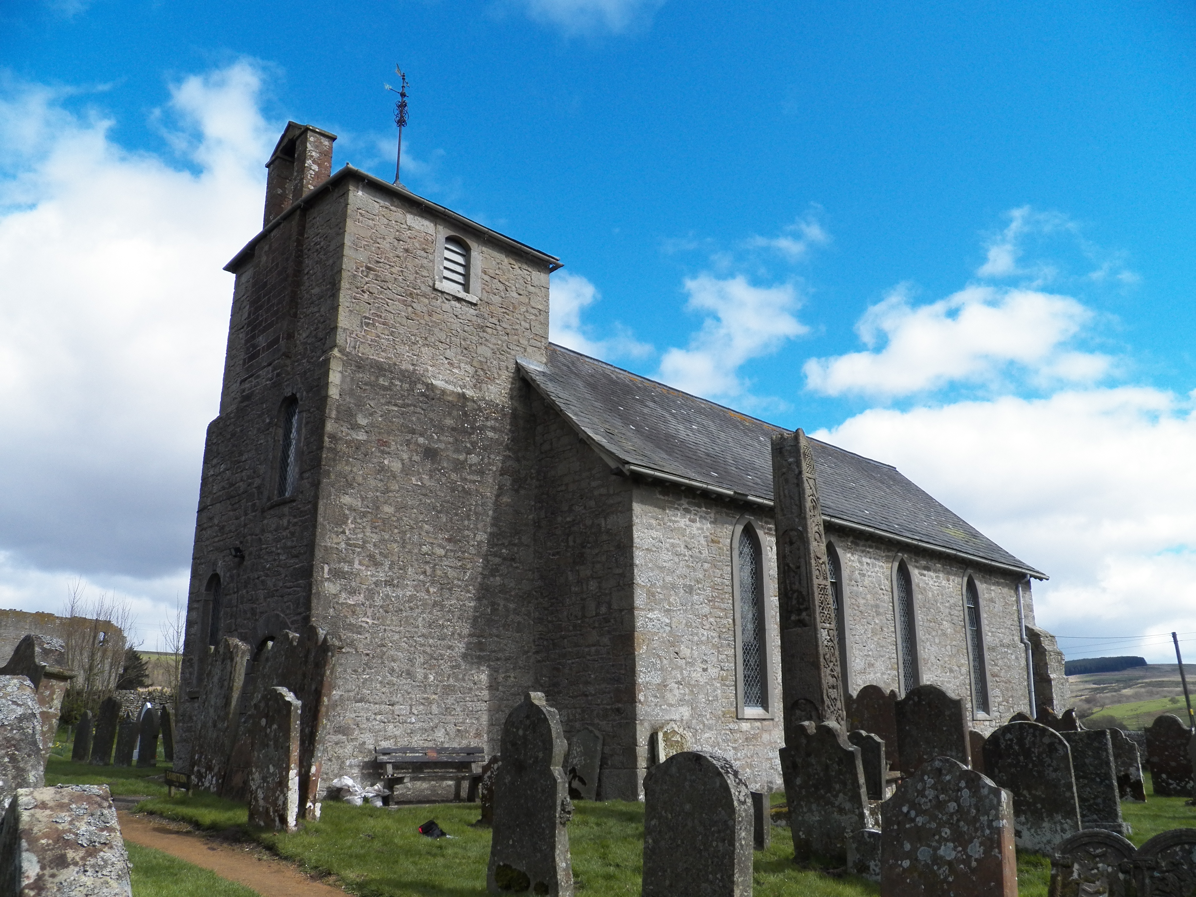
Bewcastle

Bewcastle is a large civil parish in the Cumberland unitary authority area of Cumbria, England. It is in the historic county of Cumberland. According to...

Nearby Amenities

Located within 500m of 55.092637,-2.630077
Gaylock Hill
Natural: hill
Lat/Long: 55.0960038/-2.6285318
Gaylock Hill
Place: locality
Lat/Long: 55.0960554/-2.6279186
The data included in this document is from www.openstreetmap.org. The data is made available under ODbL.

Have you been to Gaylock Hill?

Leave your review of Gaylock Hill below (or comments, questions and feedback).