Barcaldine

Settlement in Argyllshire

Scotland

Barcaldine

Junction of forestry roads near Barcaldine
Junction of forestry roads near Barcaldine Credit: Steven Brown

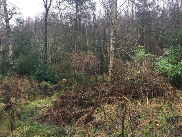
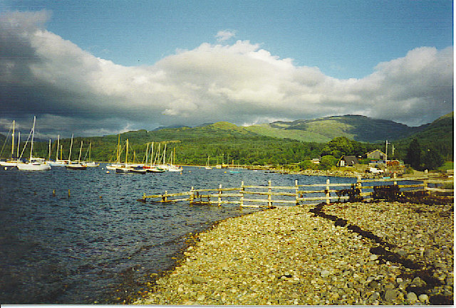
Barcaldine is a small village located in the historic county of Argyllshire, Scotland. Situated on the west coast of Scotland, it lies approximately 10 miles north of Oban and overlooks the picturesque Loch Creran. The village is nestled amidst stunning scenery, with rolling hills and dense forests surrounding it.

Barcaldine is known for its rich history, dating back to medieval times. The area has several ancient sites, including the ruins of Barcaldine Castle, a 17th-century tower house that once served as the ancestral seat of the Campbells of Barcaldine. Today, the castle stands as a reminder of the area's past and attracts visitors interested in Scottish history.

Despite its small size, Barcaldine offers a range of amenities for residents and visitors alike. The village has a primary school, a community hall, and a local pub, which serves as a social hub for the community. There are also several self-catering cottages and guesthouses available for tourists looking to explore the beautiful surroundings.

The village is an ideal base for outdoor enthusiasts, as it is surrounded by numerous walking and cycling trails. The nearby Loch Creran provides opportunities for fishing and boating, while the surrounding hills offer breathtaking views and opportunities for hillwalking and wildlife spotting.

In conclusion, Barcaldine is a charming village in Argyllshire, Scotland, known for its rich history, stunning scenery, and range of outdoor activities. Whether you are interested in exploring ancient ruins, enjoying the outdoors, or simply experiencing the tranquility of rural Scotland, Barcaldine is sure to captivate visitors.

If you have any feedback on the listing, please let us know in the comments section below.

Barcaldine Images

Images are sourced within 2km of 56.517747/-5.31745 or Grid Reference NM9641. Thanks to Geograph Open Source API. All images are credited.

Junction of forestry roads near Barcaldine
Forestry road near Barcaldine
Loch Creran Loch Creran with anchored boats photographed from the Oban Sea Life Centre.
Loch Creran
Loch Creran with anchored boats photographed from the Oban Sea Life Centre.
Woodland near Barcaldine
Standing Stone near to Achanrear Trig Point
Achanrear Trig Point Flush Bracket 10247
Barcaldine Walled Garden The walled garden for Barcaldine House is now a sheltered Camping and Caravanning Club Site. Lovely spot spoiled only by the midges.
Barcaldine Walled Garden
The walled garden for Barcaldine House is now a sheltered Camping and Caravanning Club Site. Lovely spot spoiled only by the midges.
Standing stone at Barcaldine <span class="nowrap"><a title="https://canmore.org.uk/site/23308/barcaldine" rel="nofollow ugc noopener" href="https://canmore.org.uk/site/23308/barcaldine">Link</a><img style="margin-left:2px;" alt="External link" title="External link - shift click to open in new window" src="https://s1.geograph.org.uk/img/external.png" width="10" height="10"/></span>
Standing stone at Barcaldine
Forestry road near Barcaldine
Waterfall Rushing stream after a day of heavy rain. Normally just a trickle.
Waterfall
Rushing stream after a day of heavy rain. Normally just a trickle.
A forestry track leaves the B845 south of Barcaldine
Bridge over Dearg Abhainn near Barcaldine
Junction of forest roads in Barcaldine Forest
Forestry road in Barcaldine Forest
Quarry in Barcaldine Forest Marked as disused on the map but it is currently in use.
Quarry in Barcaldine Forest
Marked as disused on the map but it is currently in use.
Barcaldine Forest
Barcaldine Forest
Small gravel quarry in Barcaldine Forest
Show me another place!

Barcaldine is located at Grid Ref: NM9641 (Lat: 56.517747, Lng: -5.31745)

Unitary Authority: Argyll and Bute

Police Authority: Argyll and West Dunbartonshire

Also known as: Am Barra Calltainn

What 3 Words

///scornful.engine.behaving. Near Oban, Argyll & Bute

Related Wikis

Barcaldine House

Barcaldine House is a historic mansion in Barcaldine near Oban, Scotland, now a hotel. == History == === Campbell ownership 1709–1842 === The lands were...

Barcaldine, Argyll

Barcaldine (Scottish Gaelic: Am Barra Calltainn) is a small settlement in Scotland centred on the historic Barcaldine House and located on the banks of...

Barcaldine railway station

Barcaldine was a railway station located in Barcaldine, Argyll and Bute, near the southern shore of Loch Creran. It was on the Ballachulish branch line...

Loch Creran

Loch Creran is a sea loch in Argyll, on the west coast of Scotland. It is about 10 kilometres (6.2 mi) long from its head at Invercreran to its mouth on...

Nearby Amenities

Located within 500m of 56.517747,-5.31745
Barcaldine
Name En: Barcaldine
Name Gd: Am Barra Calltainn
Place: village
Wikidata: Q4859818
Wikipedia: en:Barcaldine, Argyll
Lat/Long: 56.52127/-5.3193858
Post Box
Ref: PA37 161
Source: survey
Lat/Long: 56.5216676/-5.3183636
Barrier: bollard
Bollard: removable
Lat/Long: 56.5198674/-5.3143753
Bus Stop
Bench: yes
Bin: no
Lit: no
Shelter: yes
Lat/Long: 56.5217482/-5.3189392
Power: pole
Lat/Long: 56.5137539/-5.3146336
Power: pole
Lat/Long: 56.5143414/-5.3152612
Power: pole
Lat/Long: 56.5150562/-5.3159854
Power: pole
Lat/Long: 56.515597/-5.3165366
Power: pole
Lat/Long: 56.5158908/-5.3175652
Power: pole
Lat/Long: 56.5161275/-5.3184061
Power: pole
Lat/Long: 56.5164072/-5.3193784
Power: pole
Lat/Long: 56.5166432/-5.3201884
Power: pole
Lat/Long: 56.5170946/-5.3214933
Power: pole
Lat/Long: 56.517443/-5.3225139
Power: pole
Lat/Long: 56.5177375/-5.3233695
Power: pole
Lat/Long: 56.5187089/-5.3240146
Power: pole
Lat/Long: 56.5198697/-5.3229685
Power: pole
Lat/Long: 56.5204978/-5.3222376
Power: pole
Lat/Long: 56.520844/-5.3218152
Power: pole
Lat/Long: 56.5213501/-5.3211916
Power: pole
Lat/Long: 56.5166488/-5.3248239
Power: pole
Lat/Long: 56.5169567/-5.3236083
Power: pole
Lat/Long: 56.5172411/-5.3224733
Power: pole
Lat/Long: 56.5175547/-5.321298
Power: pole
Lat/Long: 56.5179573/-5.3200739
Power: pole
Lat/Long: 56.5187415/-5.3197112
Power: pole
Lat/Long: 56.519652/-5.3192699
Power: pole
Lat/Long: 56.519968/-5.3204049
Power: pole
Lat/Long: 56.5192939/-5.3175579
Power: pole
Lat/Long: 56.5189638/-5.3159646
Power: pole
Lat/Long: 56.5187742/-5.3150821
Power: pole
Lat/Long: 56.5185355/-5.3138962
Power: pole
Lat/Long: 56.5179796/-5.3137371
Power: pole
Lat/Long: 56.5175969/-5.3138198
Power: pole
Lat/Long: 56.5172984/-5.3138898
Power: pole
Lat/Long: 56.5169824/-5.3139514
Power: pole
Lat/Long: 56.5221884/-5.3169991
Power: pole
Lat/Long: 56.5218852/-5.3175054
Power: pole
Lat/Long: 56.5216553/-5.3180952
Power: pole
Lat/Long: 56.5214604/-5.3185752
Power: pole
Lat/Long: 56.5213399/-5.3188695
Power: pole
Lat/Long: 56.521071/-5.3194265
Power: pole
Lat/Long: 56.5212998/-5.3188653
Power: pole
Lat/Long: 56.5218008/-5.3188368
Post Box
Lat/Long: 56.5180269/-5.3145157
The data included in this document is from www.openstreetmap.org. The data is made available under ODbL.

Have you been to Barcaldine?

Leave your review of Barcaldine below (or comments, questions and feedback).