Cutty Hillock

Hill, Mountain in Fife

Scotland

Cutty Hillock

Milestone, Cambo The milestone stands beside the A917.  

Milestones are the original roadside heritage features with many dating back hundreds of years and these historic items are under threat from highway developments.
Milestone, Cambo Credit: Maigheach-gheal

Cutty Hillock is a prominent hill located in the county of Fife, Scotland. Rising to an elevation of approximately 270 meters (886 feet), it offers breathtaking panoramic views of the surrounding countryside. Situated near the village of Falkland, Cutty Hillock is a popular destination for outdoor enthusiasts, hikers, and nature lovers.

Covered in lush green vegetation, the hill is characterized by its gentle slopes and a well-defined path that leads to the summit. The trail is easily accessible, making it suitable for individuals of all fitness levels. As visitors ascend the hill, they are treated to stunning vistas of the picturesque Fife landscape, including rolling hills, fertile farmlands, and scenic woodlands.

Cutty Hillock is also known for its rich historical significance. It is believed that the hill served as a vantage point and defensive site during ancient times. Archaeological remains, including ancient fortifications, have been discovered on its slopes, further enhancing its allure.

The area surrounding Cutty Hillock is teeming with wildlife, providing a haven for various species of birds, mammals, and plants. Nature enthusiasts can spot red deer, rabbits, and a variety of bird species, including buzzards and kestrels. In the spring and summer months, the hill is adorned with colorful wildflowers, creating a vibrant and enchanting atmosphere.

Overall, Cutty Hillock offers a captivating blend of natural beauty and historical significance. Whether one seeks a peaceful walk in nature, breathtaking views, or a glimpse into the past, this hill in Fife provides a memorable experience for all who visit.

If you have any feedback on the listing, please let us know in the comments section below.

Cutty Hillock Images

Images are sourced within 2km of 56.275375/-2.6565141 or Grid Reference NO5909. Thanks to Geograph Open Source API. All images are credited.

Milestone, Cambo The milestone stands beside the A917.  

Milestones are the original roadside heritage features with many dating back hundreds of years and these historic items are under threat from highway developments.
Milestone, Cambo
The milestone stands beside the A917. Milestones are the original roadside heritage features with many dating back hundreds of years and these historic items are under threat from highway developments.
Milestone and bench mark, Cambo The milestone stands beside the A917 and it has an Ordnance Survey bench mark on it.  For a wider view of the milestone <a href="https://www.geograph.org.uk/photo/2776313">NO6010 : Milestone, Cambo</a> and for further information on the cut mark and others in the area <span class="nowrap"><a title="http://www.bench-marks.org.uk/bm38082" rel="nofollow ugc noopener" href="http://www.bench-marks.org.uk/bm38082">Link</a><img style="margin-left:2px;" alt="External link" title="External link - shift click to open in new window" src="https://s1.geograph.org.uk/img/external.png" width="10" height="10"/></span>
Milestone and bench mark, Cambo
The milestone stands beside the A917 and it has an Ordnance Survey bench mark on it. For a wider view of the milestone NO6010 : Milestone, Cambo and for further information on the cut mark and others in the area LinkExternal link
Milestone, Cambo Milestones did not come into general use until the Turnpike Act of 1766 made them compulsory on turnpike roads, these roads were built by private enterprise under licence from the Government and maintained by tolls on those who used them.  Before this Act milestones were put up occasionally, often as charitable acts and commemorations.   Many Turnpike Act stones still exist.  They are usually 2-3 ft high, with the initial letter or abbreviation of the nearest market town shown on two faces, and the distance from it.
Milestone, Cambo
Milestones did not come into general use until the Turnpike Act of 1766 made them compulsory on turnpike roads, these roads were built by private enterprise under licence from the Government and maintained by tolls on those who used them. Before this Act milestones were put up occasionally, often as charitable acts and commemorations. Many Turnpike Act stones still exist. They are usually 2-3 ft high, with the initial letter or abbreviation of the nearest market town shown on two faces, and the distance from it.
East Newhall farm Abandoned and falling apart, yet there is planning permission for conversion of these buildings into a micro-distillery for single malt whisky.
East Newhall farm
Abandoned and falling apart, yet there is planning permission for conversion of these buildings into a micro-distillery for single malt whisky.
East Newhall farm Seen from the west. The central tower, which makes this abandoned farm look rather like a small castle, was originally a doocot around which the steading was built.
East Newhall farm
Seen from the west. The central tower, which makes this abandoned farm look rather like a small castle, was originally a doocot around which the steading was built.
Fairies at the bottom of the garden At Cambo House it looks as though they may even have angels at the bottom of their garden. This is part of their annual 'Snowdrops by Starlight' display in Cambo Estate.
Fairies at the bottom of the garden
At Cambo House it looks as though they may even have angels at the bottom of their garden. This is part of their annual 'Snowdrops by Starlight' display in Cambo Estate.
The Cambo milestone in its setting On the east side of the A917 road between Crail and Kingsbarns.
The Cambo milestone in its setting
On the east side of the A917 road between Crail and Kingsbarns.
The Cambo milestone - detail
Kingsbarns Distillery A recently commissioned malt whisky distillery with visitor centre which has been created in the previously derelict buildings of East Newhall farm. See <a href="https://www.geograph.org.uk/photo/2806045">NO6010 : East Newhall farm</a>
Kingsbarns Distillery
A recently commissioned malt whisky distillery with visitor centre which has been created in the previously derelict buildings of East Newhall farm. See NO6010 : East Newhall farm
A917 north of Grassmiston
Randerston Farm
Randerston Farm
East Newhall
East Newhall
Cambo Ruins Some abandoned agricultural buildings close to the burn running through the Cambo estate
Cambo Ruins
Some abandoned agricultural buildings close to the burn running through the Cambo estate
Cambo Snowdrops Some of the famous snowdrops <span class="nowrap"><a title="http://www.cambosnowdrops.com/" rel="nofollow ugc noopener" href="http://www.cambosnowdrops.com/">Link</a><img style="margin-left:2px;" alt="External link" title="External link - shift click to open in new window" src="https://s1.geograph.org.uk/img/external.png" width="10" height="10"/></span>
Cambo Snowdrops
Some of the famous snowdrops LinkExternal link
East Newhall A once fine and substantial farm building now gone to ruin.
East Newhall
A once fine and substantial farm building now gone to ruin.
Near East Newhall Farmland between Newhall and the Crail St Andrews road.
Near East Newhall
Farmland between Newhall and the Crail St Andrews road.
By East Newhall Farm road between East and West Newhall
By East Newhall
Farm road between East and West Newhall
East Newhall The St Andrews to Crail road, the A917, by East Newhall
East Newhall
The St Andrews to Crail road, the A917, by East Newhall
Show me another place!

Cutty Hillock is located at Grid Ref: NO5909 (Lat: 56.275375, Lng: -2.6565141)

Unitary Authority: Fife

Police Authority: Fife

What 3 Words

///economies.factory.dissolves. Near Crail, Fife

Nearby Locations

Cutty Hillock

Related Wikis

Crail railway station

Crail railway station served the burgh of Crail, Fife, Scotland from 1883 to 1966 on the Fife Coast Railway. == History == The station opened on 1 September...
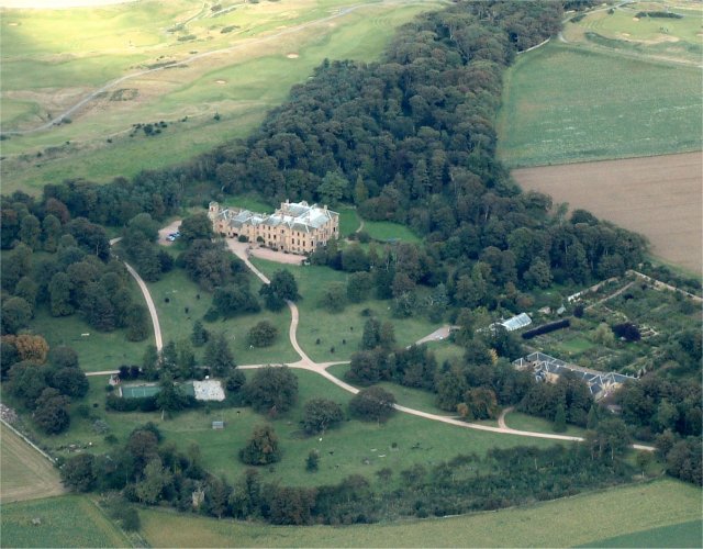
Cambo Estate

Cambo Estate lies close to the village of Kingsbarns in north-east Fife, Scotland. It is within the East Neuk, 10 kilometres (6.2 mi) south-east of St...

Crail Parish Church

Crail Parish Church is an ancient church building in Crail, Fife, Scotland. It is Category A listed, its oldest part dating to the 12th century. The walls...

Crail

Crail (); Scottish Gaelic: Cathair Aile) is a former royal burgh, parish and community council area (Royal Burgh of Crail and District) in the East Neuk...

Crail Tolbooth and Town Hall

Crail Tolbooth and Town Hall is a municipal structure in Crail, Fife, Scotland. The building, which stands in Marketgate, at its junction with Tolbooth...

Golf Hotel

The Golf Hotel is a hotel and restaurant in Crail, Fife, Scotland. It is a Category A listed building dating to the early 18th century, although one source...

Kingsbarns railway station

Kingsbarns railway station served the village of Kingsbarns, Fife, Scotland from 1883 to 1930 on the Fife Coast Railway. == History == The station opened...

Kingsbarns Golf Links

Kingsbarns Golf Links is a seaside Scottish links golf course along 1.8 miles of shoreline near St Andrews, Scotland. It opened in 2000 and has been rated...

Nearby Amenities

Located within 500m of 56.275375,-2.6565141
Generator Method: wind_turbine
Generator Source: wind
Generator Type: horizontal_axis
Power: generator
Lat/Long: 56.2736877/-2.6639866
Power: pole
Lat/Long: 56.2743998/-2.6489088
Power: pole
Lat/Long: 56.2748481/-2.6495281
Power: pole
Lat/Long: 56.2751767/-2.6499847
Power: pole
Lat/Long: 56.2755711/-2.6509063
Power: pole
Lat/Long: 56.2759783/-2.651828
Power: pole
Lat/Long: 56.2763421/-2.6527052
The data included in this document is from www.openstreetmap.org. The data is made available under ODbL.

Have you been to Cutty Hillock?

Leave your review of Cutty Hillock below (or comments, questions and feedback).