Gorsty Knoll

Hill, Mountain in Gloucestershire Forest of Dean

England

Gorsty Knoll

Cyclists on the old tramway The Bix Slade porting of the Forest of Dean is full of old stone and coal workings.
This remnant of a horse-drawn tramway was finally decommissioned in 1946 and is now part of the extensive path and cycleway network in the forest.
Cyclists on the old tramway Credit: Jonathan Billinger

Gorsty Knoll is a prominent hill located in the picturesque county of Gloucestershire, England. Rising to an elevation of approximately 200 meters above sea level, it is renowned for its stunning panoramic views and natural beauty. Situated on the edge of the Cotswold Hills, it offers visitors a chance to immerse themselves in the captivating rural landscape of the region.

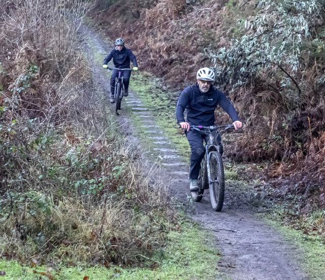
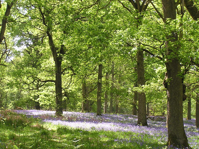
Covered in lush greenery and dotted with ancient trees, Gorsty Knoll is a haven for wildlife enthusiasts and nature lovers. It is home to a diverse range of flora and fauna, including wildflowers, butterflies, and various bird species. The hill's undulating terrain provides ample opportunities for leisurely walks and hikes, allowing visitors to explore the surrounding countryside and discover hidden gems along the way.

At the summit of Gorsty Knoll, one can enjoy breathtaking vistas of the Gloucestershire countryside. On clear days, the views stretch for miles, encompassing rolling hills, charming villages, and meandering rivers. The hill's strategic location also makes it a popular spot for paragliding enthusiasts, who take advantage of the favorable winds and the expansive vistas for an exhilarating experience.

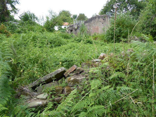
Gorsty Knoll's historical significance cannot be overlooked either. It is believed to have been a site of ancient settlements, with evidence of Iron Age and Roman occupation discovered in the vicinity. This adds an extra layer of intrigue to the hill, attracting history buffs and archaeology enthusiasts.

Overall, Gorsty Knoll is a captivating natural landmark, offering visitors a chance to connect with the stunning Gloucestershire countryside, immerse themselves in nature, and enjoy awe-inspiring views that showcase the region's beauty.

If you have any feedback on the listing, please let us know in the comments section below.

Gorsty Knoll Images

Images are sourced within 2km of 51.781469/-2.5981896 or Grid Reference SO5809. Thanks to Geograph Open Source API. All images are credited.

Cyclists on the old tramway The Bix Slade porting of the Forest of Dean is full of old stone and coal workings.
This remnant of a horse-drawn tramway was finally decommissioned in 1946 and is now part of the extensive path and cycleway network in the forest.
Cyclists on the old tramway
The Bix Slade porting of the Forest of Dean is full of old stone and coal workings. This remnant of a horse-drawn tramway was finally decommissioned in 1946 and is now part of the extensive path and cycleway network in the forest.
Bixslade Quarry. The stone dressing sheds by Cannop Ponds, the actual sandstone quarry is at SO598107
Bixslade Quarry.
The stone dressing sheds by Cannop Ponds, the actual sandstone quarry is at SO598107
Bluebells A common sight in the Forest of Dean during late spring/early summer. these bluebells are pictured under the oaks of Nagshead Plantation.
Bluebells
A common sight in the Forest of Dean during late spring/early summer. these bluebells are pictured under the oaks of Nagshead Plantation.
Bixslade stoneworks The workshops of the Forest of Dean Stone Firms Ltd, in 2008 after considerable modernisation.
Bixslade stoneworks
The workshops of the Forest of Dean Stone Firms Ltd, in 2008 after considerable modernisation.
Wildlife Pond This pond,is a good place to see Dragonflies in the summer.Just out of square is the lower Bird hide.
Wildlife Pond
This pond,is a good place to see Dragonflies in the summer.Just out of square is the lower Bird hide.
Forestry commission Track This track going over Cleave Hill,is at the top end of the RSPB Nagshead Nature Reserve.
Forestry commission Track
This track going over Cleave Hill,is at the top end of the RSPB Nagshead Nature Reserve.
Forest Track This track is going over Nagshead Hill,within the Nagshead Plantation.
Forest Track
This track is going over Nagshead Hill,within the Nagshead Plantation.
B4234, New Road, near Parkend Looking south-east, into the October morning sun.
This is the main north-south route through the Forest of Dean.
B4234, New Road, near Parkend
Looking south-east, into the October morning sun. This is the main north-south route through the Forest of Dean.
A ludicrous prohibition Yes, I agree, making tracks through the forest in the Nagshead Reserve is not on! But what on earth is wrong with using the road in the background?
A ludicrous prohibition
Yes, I agree, making tracks through the forest in the Nagshead Reserve is not on! But what on earth is wrong with using the road in the background?
Clearing, Nagshead Plantation Within the RSPB reserve, an open area with a natural looking boundary between forest and clearing. Edges of woodland are usually very rich in wildlife.
Clearing, Nagshead Plantation
Within the RSPB reserve, an open area with a natural looking boundary between forest and clearing. Edges of woodland are usually very rich in wildlife.
Track junction, Nagshead Plantation Heading downhill towards the information centre. A substantial logging road is crossed here.
Track junction, Nagshead Plantation
Heading downhill towards the information centre. A substantial logging road is crossed here.
Path, Nagshead Plantation An area of old oaks with holly understorey. No commercial conifers in this part of the reserve. I expected wood warblers and pied flycatchers and was not disappointed. 
The bluebells has yet to flower, Dean bluebells always appear to be a bit later than some other places.
Path, Nagshead Plantation
An area of old oaks with holly understorey. No commercial conifers in this part of the reserve. I expected wood warblers and pied flycatchers and was not disappointed. The bluebells has yet to flower, Dean bluebells always appear to be a bit later than some other places.
Birdwatchers, Nagshead A path in old oak wood. The folk with the telescope were amongst singing wood warblers.
Birdwatchers, Nagshead
A path in old oak wood. The folk with the telescope were amongst singing wood warblers.
The remains of the Titanic Steelworks The Titanic steelworks were so named because Robert Mushet the owner was experimenting with Titanium at that time.  Robert Mushet was working on solving the problems with the Bessemer steel making process.
The remains of the Titanic Steelworks
The Titanic steelworks were so named because Robert Mushet the owner was experimenting with Titanium at that time. Robert Mushet was working on solving the problems with the Bessemer steel making process.
Stoneworks, Cannop
Stoneworks, Cannop
Lay-by and bend in the road (B4234), south of Cannop Ponds, Forest of Dean
West Dean : Track A track heading through the woods.
West Dean : Track
A track heading through the woods.
Signed long loop path, RSPB Nagshead There is a short and a  long loop to the north of the car park.
Signed long loop path, RSPB Nagshead
There is a short and a long loop to the north of the car park.
Show me another place!

Gorsty Knoll is located at Grid Ref: SO5809 (Lat: 51.781469, Lng: -2.5981896)

Administrative County: Gloucestershire

District: Forest of Dean

Police Authority: Gloucestershire

What 3 Words

///wager.suspend.erupts. Near Coleford, Gloucestershire

Related Wikis

Gorsty Knoll

Gorsty Knoll is a small hamlet, located in the Forest of Dean, Gloucestershire, England. The internationally important remains of Darkhill Ironworks and...

Milkwall railway station

Milkwall railway station is a disused station on the former Severn and Wye Railway. It served the village of Milkwall, Gloucestershire, England. The station...

Darkhill Ironworks

Darkhill Ironworks, and the neighbouring Titanic Steelworks, are internationally important industrial remains associated with the development of the iron...

Milkwall

Milkwall is a village in the Forest of Dean in Gloucestershire, England. It lies between the village of Sling to the south, and the town of Coleford to...

Perrygrove railway station

Perrygrove railway station is the home of the 15 in (381 mm) gauge Perrygrove Railway. The railway was opened in 1996 and is a heritage railway. There...
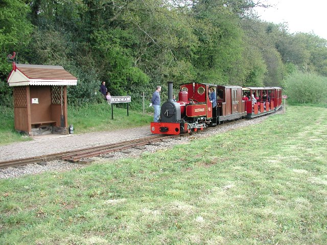
Perrygrove Railway

Perrygrove Railway is a minimum-gauge railway of 15 in (381 mm) gauge. It is located at Perrygrove Farm in the Forest of Dean, near Coleford, Gloucestershire...

Coalway

Coalway is a village in the West Forest of Dean region of Gloucestershire, England, approximately one mile south-east of the town of Coleford. Within the...

Heywood railway station (Perrygrove Railway)

Heywood railway station is a request stop on the 15 in (381 mm) gauge Perrygrove Railway. The line was opened in 1996 and is a heritage railway. There...

Nearby Amenities

Located within 500m of 51.781469,-2.5981896
Bus Stop
Palmers Flat
Bus: yes
Naptan AtcoCode: 1600GLA06085
Naptan Bearing: S
Naptan CommonName: Palmers Flat
Naptan NaptanCode: glogpdmt
Naptan Street: Edenwall Rd
Naptan Verified: no
Public Transport: platform
Source: naptan_import
Lat/Long: 51.785796/-2.5998331
Bus Stop
Palmers Flat
Bus: yes
Naptan AtcoCode: 1600GLF208
Naptan Bearing: N
Naptan CommonName: Palmers Flat
Naptan NaptanCode: gloagada
Naptan Street: Edenwall Rd
Naptan Verified: no
Public Transport: platform
Source: naptan_import
Lat/Long: 51.7858135/-2.5999348
Bus Stop
Gorsty Knoll
Bus: yes
Naptan AtcoCode: 1600GLF209
Naptan Bearing: S
Naptan CommonName: Gorsty Knoll
Naptan NaptanCode: gloadwtp
Naptan Street: Edenwall Rd
Naptan Verified: no
Public Transport: platform
Source: naptan_import
Lat/Long: 51.7821132/-2.6008715
Bus Stop
Gorsty Knoll
Bus: yes
Naptan AtcoCode: 1600GLF210
Naptan Bearing: N
Naptan CommonName: Gorsty Knoll
Naptan Indicator: Opp
Naptan NaptanCode: gloadwtm
Naptan Street: Edenwall Rd
Naptan Verified: no
Public Transport: platform
Source: naptan_import
Lat/Long: 51.7821126/-2.6009875
Bus Stop
KWT Coaches Garage
Naptan AtcoCode: 1600GLF784
Naptan Bearing: SW
Naptan CommonName: KWT Coaches Garage
Naptan NaptanCode: gloadwpj
Naptan Street: Off Station Rd
Naptan Verified: no
Source: naptan_import
Lat/Long: 51.7801341/-2.6028311
Bus Stop
Lower Palmers Flat
Bus: yes
Naptan AtcoCode: 1600GLF869
Naptan Bearing: N
Naptan CommonName: Lower Palmers Flat
Naptan NaptanCode: glogjwtp
Naptan Street: B4431
Naptan Verified: no
Public Transport: platform
Source: naptan_import
Lat/Long: 51.7834122/-2.5965107
Bus Stop
Lower Palmers Flat
Bus: yes
Naptan AtcoCode: 1600GLF870
Naptan Bearing: S
Naptan CommonName: Lower Palmers Flat
Naptan NaptanCode: glogjwtw
Naptan Street: B4431
Naptan Verified: no
Public Transport: platform
Source: naptan_import
Lat/Long: 51.7833949/-2.59638
Turning Circle
Source: Bing
Source Name: OS_OpenData_Locator
Lat/Long: 51.7811108/-2.6041423
Gorsty Knoll
Place: hamlet
Source: OS_OpenData_StreetView
Wikidata: Q5586899
Lat/Long: 51.7802134/-2.5975137
Palmers Flat
Note: Signed on Station Road at junction
Place: locality
Lat/Long: 51.7824779/-2.6003701
Crossing: informal
Lat/Long: 51.7782932/-2.593919
Golf: pin
Lat/Long: 51.7850791/-2.6017149
Golf: pin
Lat/Long: 51.783711/-2.6020221
Golf: pin
Lat/Long: 51.7825068/-2.6022911
Give Way
Direction: backward
Lat/Long: 51.781005/-2.6015295
Post Box
Brand: Royal Mail
Brand Wikidata: Q638098
Operator: Royal Mail
Operator Wikidata: Q638098
Post Box Type: wall
Royal Cypher: EIIR
Royal Cypher Wikidata: Q33102113
Lat/Long: 51.7843519/-2.6004928
Give Way
Direction: forward
Lat/Long: 51.7822819/-2.6008147
Give Way
Direction: backward
Lat/Long: 51.780623/-2.6029068
Power: pole
Lat/Long: 51.7784088/-2.5934172
Power: pole
Lat/Long: 51.7790991/-2.5934735
Power: pole
Lat/Long: 51.7796268/-2.5932911
Power: pole
Lat/Long: 51.7803736/-2.5930792
Power: pole
Lat/Long: 51.7813311/-2.59276
Power: pole
Lat/Long: 51.7821242/-2.5932026
Power: pole
Lat/Long: 51.7829904/-2.5936773
Power: pole
Lat/Long: 51.7835878/-2.5936157
Power: pole
Lat/Long: 51.7844249/-2.5935017
Milkwall
Historic Railway: station
Railway: site
Wikidata: Q104870591
Wikipedia: en:Milkwall railway station
Lat/Long: 51.780771/-2.6017477
The data included in this document is from www.openstreetmap.org. The data is made available under ODbL.

Have you been to Gorsty Knoll?

Leave your review of Gorsty Knoll below (or comments, questions and feedback).