Black Knowe

Hill, Mountain in Northumberland

England

Black Knowe

'The Forks' Rally stage 9 Here the stage climbs up towards the Scottish border.
'The Forks' Rally stage 9 Credit: T Eyre

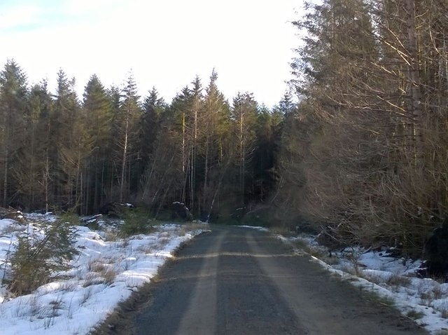
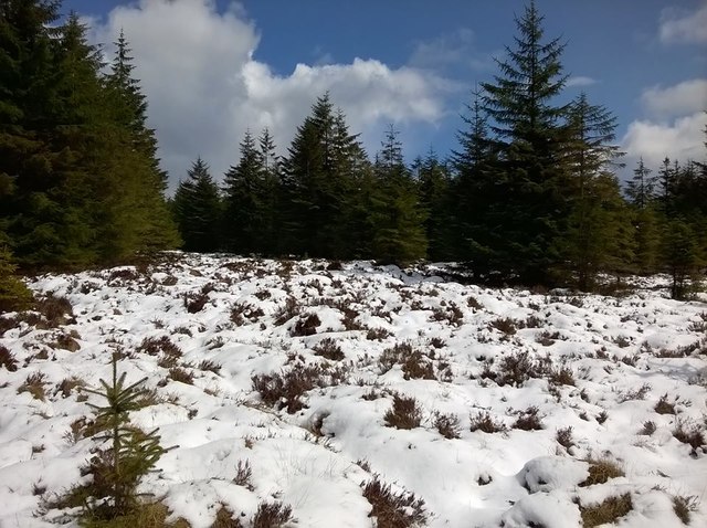
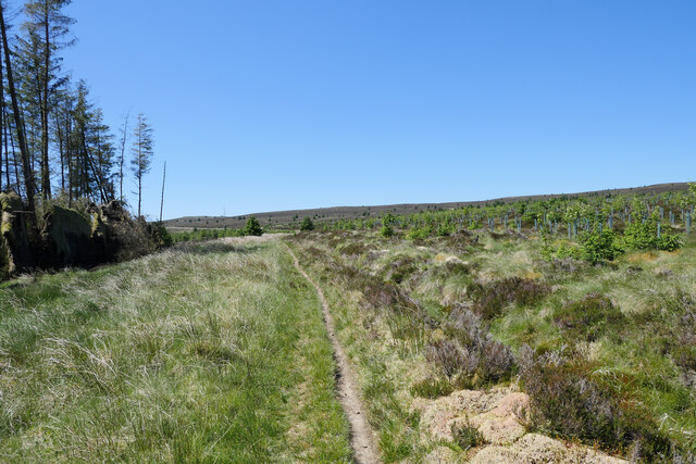
Black Knowe is a prominent hill located in the county of Northumberland, England. Rising to an elevation of approximately 345 meters (1,132 feet), it is a notable feature within the North Pennines Area of Outstanding Natural Beauty. The hill is nestled within a picturesque landscape, surrounded by rolling moorland, lush green meadows, and scattered woodland.

Black Knowe boasts a distinctive conical shape, with a summit that offers breathtaking panoramic views of the surrounding countryside. On clear days, visitors are rewarded with stunning vistas that stretch as far as the eye can see, encompassing the expansive Northumberland National Park and beyond.

The hill is a popular destination for outdoor enthusiasts, hikers, and nature lovers alike. Its well-marked trails and footpaths provide opportunities for leisurely walks, challenging hikes, and even mountain biking. The diverse and abundant wildlife found in the area, including red grouse, curlew, and golden plover, adds to the attraction for birdwatchers and nature photographers.

Black Knowe is steeped in history, with evidence of human occupation dating back thousands of years. Ancient burial mounds and stone circles can be found scattered across its slopes, offering a glimpse into the area's rich past. The hill also played a significant role during the industrial revolution, with the remnants of lead mines and quarries still visible today.

Overall, Black Knowe is a captivating and enchanting destination, offering visitors a chance to immerse themselves in the natural beauty and rich heritage of the Northumberland countryside.

If you have any feedback on the listing, please let us know in the comments section below.

Black Knowe Images

Images are sourced within 2km of 55.218073/-2.6592972 or Grid Reference NY5891. Thanks to Geograph Open Source API. All images are credited.

'The Forks' Rally stage 9 Here the stage climbs up towards the Scottish border.
'The Forks' Rally stage 9
Here the stage climbs up towards the Scottish border.
'The Forks' Rally stage 10 Nearing the Scottish border.
'The Forks' Rally stage 10
Nearing the Scottish border.
'The Forks' Rally stage 11 In Scotland, with lots of snow.
'The Forks' Rally stage 11
In Scotland, with lots of snow.
Scottish Border The Scottish border on the last day of April.
Scottish Border
The Scottish border on the last day of April.
Near the Scottish border This is on the English side.
Near the Scottish border
This is on the English side.
'The Forks' Rally stage 12 Still in Scotland.
'The Forks' Rally stage 12
Still in Scotland.
View to Kielder Forest Approaching Bloody Bush on the Larriston Fells with the expansive Kielder Forest in the distance.
View to Kielder Forest
Approaching Bloody Bush on the Larriston Fells with the expansive Kielder Forest in the distance.
Late afternoon shower at Bloody Bush The old toll pillar at Bloody Bush on the Scotland/England border.
Late afternoon shower at Bloody Bush
The old toll pillar at Bloody Bush on the Scotland/England border.
Gateway to England Bloody Bush on the Larriston Fells is a scenic, rather bleak spot between the massive Kielder Forest and Newcastleton Forest.  The stone posts, sans gate, and old toll pillar to the right are reminders of a past time when this was a road for coal to be taken from Tynedale to the Scottish Borders.
Gateway to England
Bloody Bush on the Larriston Fells is a scenic, rather bleak spot between the massive Kielder Forest and Newcastleton Forest. The stone posts, sans gate, and old toll pillar to the right are reminders of a past time when this was a road for coal to be taken from Tynedale to the Scottish Borders.
The Scotland/England border at Bloody Bush Scotland the left, England to the right.  Unimpressive!
The Scotland/England border at Bloody Bush
Scotland the left, England to the right. Unimpressive!
Inscription on the Old Toll Pillar, Bloody Bush With thanks to fellow Geograph contributor, Andrew Curtis, the inscription reads:

THE MARCH BETWEEN NORTHUMBERLAND AND ROXBURGHSHIRE
[left] Willowbog, the Property of Sir J.E. Swinburn Bart. Capheaton
[right] Dinlabyre, the Property of William Oliver Rutherford, Esqr.
Private Road upon which a Toll Gate is erected near Oakenshaw Bridge at which the following Toll rates are exacted, viz.:-
1st For horses employed in leading coals - 2d. each
2nd All other horses - 3d. do.
3rd Cattle - 1d. do.
4th Sheep, Calves, Swine - 1/2d. do.
The above tolls exacted once a day.
N.B.-Persons evading or refusing to pay at the above mentioned toll gate will be prosecuted for trespass.
DISTANCES FROM THIS PLACE BLOODY BUSH
To Lewisburn Colliery - 5 miles
Mounces - 8 do.
Bellingham - 23 do.
Hexham - 37 do.
Dinlabyre - 31/2 do.
Castleton - 71/2 do.
Hawick - 21 do.
Jedburgh - 25 do.
Inscription on the Old Toll Pillar, Bloody Bush
With thanks to fellow Geograph contributor, Andrew Curtis, the inscription reads: THE MARCH BETWEEN NORTHUMBERLAND AND ROXBURGHSHIRE [left] Willowbog, the Property of Sir J.E. Swinburn Bart. Capheaton [right] Dinlabyre, the Property of William Oliver Rutherford, Esqr. Private Road upon which a Toll Gate is erected near Oakenshaw Bridge at which the following Toll rates are exacted, viz.:- 1st For horses employed in leading coals - 2d. each 2nd All other horses - 3d. do. 3rd Cattle - 1d. do. 4th Sheep, Calves, Swine - 1/2d. do. The above tolls exacted once a day. N.B.-Persons evading or refusing to pay at the above mentioned toll gate will be prosecuted for trespass. DISTANCES FROM THIS PLACE BLOODY BUSH To Lewisburn Colliery - 5 miles Mounces - 8 do. Bellingham - 23 do. Hexham - 37 do. Dinlabyre - 31/2 do. Castleton - 71/2 do. Hawick - 21 do. Jedburgh - 25 do.
Old Milepost and Toll Pillar, Bloody Bush Brick pillar with stone insert, on the bridleway, Kielder Parish (Tynedale District), Bloody Bush at plantation boundary, North-east side of path. Erected by the estate owner; C19.

Inscription reads:-
The MARCH between NORTHUMBERLAND &
ROXBURGHSHIRE
WILLOWBOG the  } {DINLABYRE the
PROPERTY of Sir} {PROPERTY of
J.E. SWINBURN  } {WILLIAM OLIVER
Bart CAPHEATON } {RUTHERFORD ESQ
PRIVATE ROAD upon which a Toll
Gate is erected near Oakenshaw Bridge
at which the following Toll Rates are ex=
acted VIZ 1st For horses
employed in leading coals 2d each
2nd all other horses      3 do.
3rd cattle                1 do.
4th sheep, calves, swine  ½
The above tolls exacted once a day.
N.B. Persons evading or refuseing to
pay at the above mentioned toll gate
will be prosecuted for trespass. 
DISTANCE from this place. 
                   BLOODYBUSH 
To Lewisburn Colliery 5 miles 
   Mounces            8 do. 
   Bellingham         23 -- 
   Hexham             37 -- 
   Dinlabyre          3½ -- 
   Castleton          7½ -- 
   Hawick             21 -- 
   Jedburgh           25 --

Grade II* listed. List Entry Number: 1044859
<span class="nowrap"><a title="https://historicengland.org.uk/listing/the-list/list-entry/1044859" rel="nofollow ugc noopener" href="https://historicengland.org.uk/listing/the-list/list-entry/1044859">Link</a><img style="margin-left:2px;" alt="External link" title="External link - shift click to open in new window" src="https://s1.geograph.org.uk/img/external.png" width="10" height="10"/></span>

Milestone Society National ID: NB_HXJB37.
Old Milepost and Toll Pillar, Bloody Bush
Brick pillar with stone insert, on the bridleway, Kielder Parish (Tynedale District), Bloody Bush at plantation boundary, North-east side of path. Erected by the estate owner; C19. Inscription reads:- The MARCH between NORTHUMBERLAND & ROXBURGHSHIRE WILLOWBOG the } {DINLABYRE the PROPERTY of Sir} {PROPERTY of J.E. SWINBURN } {WILLIAM OLIVER Bart CAPHEATON } {RUTHERFORD ESQ PRIVATE ROAD upon which a Toll Gate is erected near Oakenshaw Bridge at which the following Toll Rates are ex= acted VIZ 1st For horses employed in leading coals 2d each 2nd all other horses 3 do. 3rd cattle 1 do. 4th sheep, calves, swine ½ The above tolls exacted once a day. N.B. Persons evading or refuseing to pay at the above mentioned toll gate will be prosecuted for trespass. DISTANCE from this place. BLOODYBUSH To Lewisburn Colliery 5 miles Mounces 8 do. Bellingham 23 -- Hexham 37 -- Dinlabyre 3½ -- Castleton 7½ -- Hawick 21 -- Jedburgh 25 -- Grade II* listed. List Entry Number: 1044859 LinkExternal link Milestone Society National ID: NB_HXJB37.
Old Bridge Marker by Coal Grain Bridge, Bloody Bush Road Bridge Marker in parish of Kielder (Tynedale District), Bloody Bush Road, forestry track, parapet of Coal Grain Bridge.

Surveyed

Milestone Society National ID: NB_KIEL02br
Old Bridge Marker by Coal Grain Bridge, Bloody Bush Road
Bridge Marker in parish of Kielder (Tynedale District), Bloody Bush Road, forestry track, parapet of Coal Grain Bridge. Surveyed Milestone Society National ID: NB_KIEL02br
Old Bridge Marker by Bloody Bush Road, Kielder parish Bridge Marker in parish of Kielder (Tynedale District), Bloody Bush Road, forestry track.

Inscription reads:-
CLINT
SIKE

Surveyed

Milestone Society National ID: NB_KIEL04br
Old Bridge Marker by Bloody Bush Road, Kielder parish
Bridge Marker in parish of Kielder (Tynedale District), Bloody Bush Road, forestry track. Inscription reads:- CLINT SIKE Surveyed Milestone Society National ID: NB_KIEL04br
Old Bridge Marker by Bloody Bush Road, Kielder parish Bridge Marker in parish of Kielder (Tynedale District), Bloody Bush Road, forestry track.

Inscription reads:-
BLOODY
BUSH
BURN

Surveyed

Milestone Society National ID: NB_KIEL03br
Old Bridge Marker by Bloody Bush Road, Kielder parish
Bridge Marker in parish of Kielder (Tynedale District), Bloody Bush Road, forestry track. Inscription reads:- BLOODY BUSH BURN Surveyed Milestone Society National ID: NB_KIEL03br
Buck Burn The Buck Burn viewed from a forestry track north west of Willowbog.

This photograph was taken during the Coronavirus (COVID-19) pandemic of 2020/21/22.
Buck Burn
The Buck Burn viewed from a forestry track north west of Willowbog. This photograph was taken during the Coronavirus (COVID-19) pandemic of 2020/21/22.
Leaving the forest behind Bound for Bloody Bush and looking back at the forest.

This photograph was taken during the Coronavirus (COVID-19) pandemic of 2020/21/22.
Leaving the forest behind
Bound for Bloody Bush and looking back at the forest. This photograph was taken during the Coronavirus (COVID-19) pandemic of 2020/21/22.
A narrow path to Bloody Bush The narrow path to Bloody Bush, leaving the Kielder Forest behind.  Yet more evidence of Storm Arwen's impact on forestry in the area on 26/27 November 2021 can be noted on the left.  

This photograph was taken during the Coronavirus (COVID-19) pandemic of 2020/21/22.
A narrow path to Bloody Bush
The narrow path to Bloody Bush, leaving the Kielder Forest behind. Yet more evidence of Storm Arwen's impact on forestry in the area on 26/27 November 2021 can be noted on the left. This photograph was taken during the Coronavirus (COVID-19) pandemic of 2020/21/22.
Show me another place!

Black Knowe is located at Grid Ref: NY5891 (Lat: 55.218073, Lng: -2.6592972)

Unitary Authority: Northumberland

Police Authority: Northumbria

What 3 Words

///chariots.speeds.shiny. Near Teviothead, Scottish Borders

Nearby Locations

Black Knowe

Related Wikis

Scottish Marches

Scottish Marches was the term used for the Anglo-Scottish border during the late medieval and early modern eras, characterised by violence and cross-border...

Kielder railway station

Kielder railway station is a closed railway station that served the village hamlet of Kielder, Northumberland. == History == Kielder railway station was...

Kielder Forest Star Camp

The Kielder Forest Star Camp is an annual star party held each autumn and spring in Kielder Forest. The five night event is based on the Kielder Campsite...

Kielder

Kielder is a small, remote village in western Northumberland, England. Located at the head of Kielder Water and in the north west of Kielder Forest, the...

Nearby Amenities

Located within 500m of 55.218073,-2.6592972
Black Knowe
Created By: Potlatch 0.10f
Natural: peak
Lat/Long: 55.2179448/-2.6581942
Source: npe
Lat/Long: 55.216036/-2.6660368
The data included in this document is from www.openstreetmap.org. The data is made available under ODbL.

Have you been to Black Knowe?

Leave your review of Black Knowe below (or comments, questions and feedback).