Hill of Mayen

Hill, Mountain in Banffshire

Scotland

Hill of Mayen

Track near Moss-Side of Mayen With forested Catstone Hill beyond.
Track near Moss-Side of Mayen Credit: Alan Hodgson

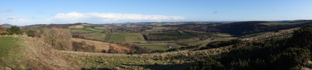
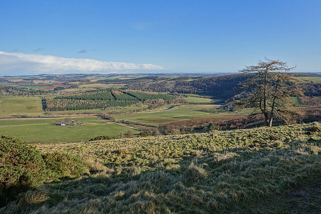
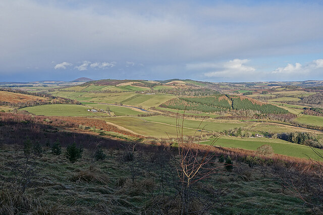
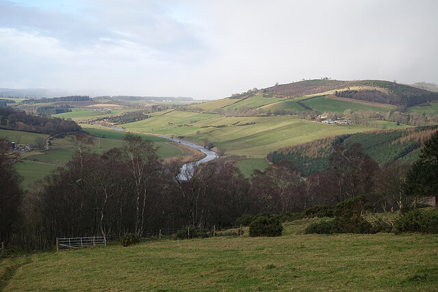
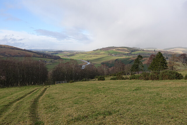
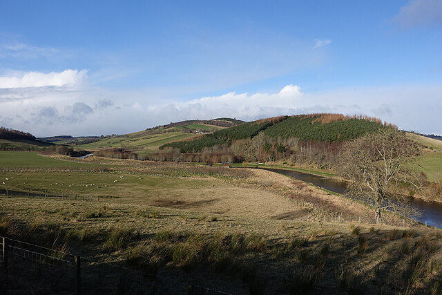
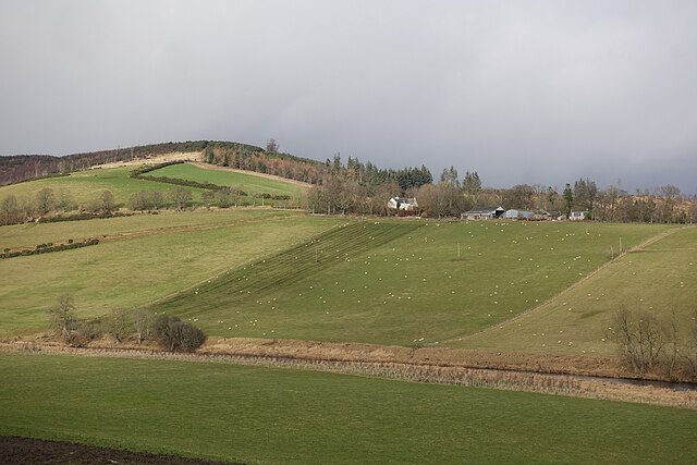
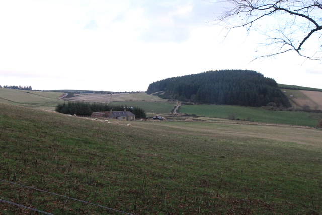
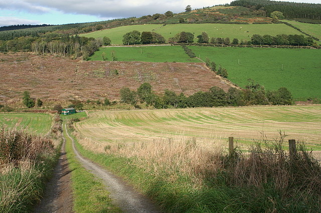
Hill of Mayen is a prominent hill located in Banffshire, Scotland. Rising to an altitude of approximately 282 meters (925 feet), it offers panoramic views of the surrounding countryside. Situated near the village of Aberchirder, the hill is a popular destination for outdoor enthusiasts and nature lovers.

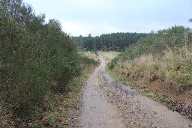
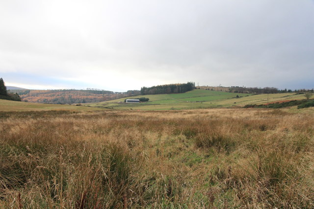
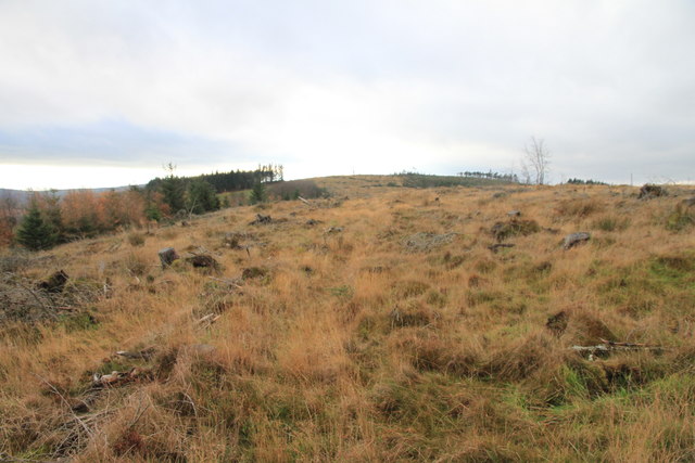
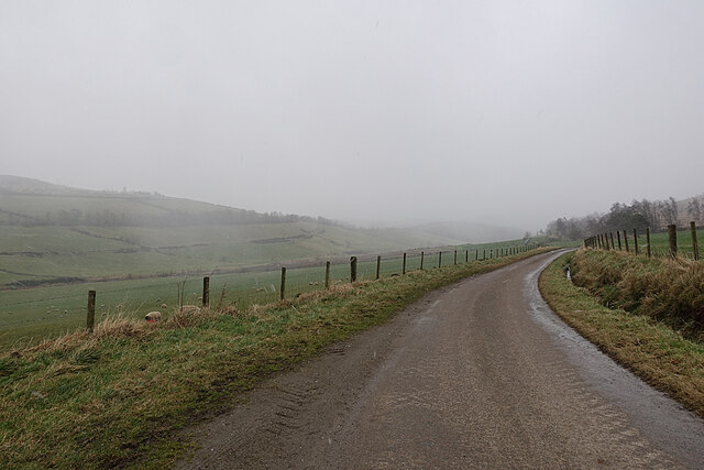
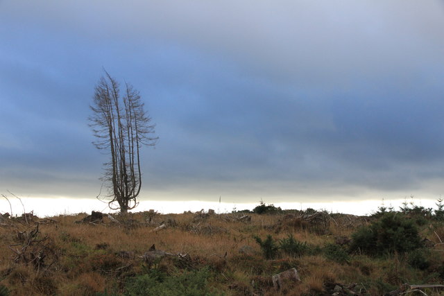
Covered in heather and grass, Hill of Mayen boasts a gentle slope that makes it accessible to hikers of all abilities. Its well-maintained trails and paths provide an enjoyable and rewarding experience for visitors. The hill's summit offers breathtaking vistas, allowing visitors to admire the picturesque landscapes of Banffshire and beyond.

Rich in biodiversity, Hill of Mayen is home to a variety of plant and animal species. The hill's vegetation includes heather, grasses, and wildflowers, providing habitats for insects, birds, and small mammals. It is not uncommon to spot red grouse, rabbits, or even the occasional deer while exploring its slopes.

The hill's proximity to Aberchirder makes it easily accessible for both locals and tourists. Its tranquil setting and natural beauty make it an ideal spot for picnics, leisurely walks, or simply enjoying the peacefulness of the Scottish countryside. Whether it's a family outing, a romantic stroll, or a solitary hike, Hill of Mayen offers a serene escape from the hustle and bustle of everyday life.

In conclusion, Hill of Mayen in Banffshire is a stunning natural landmark, offering visitors a chance to immerse themselves in the scenic beauty of the Scottish countryside. With its gentle slopes, well-marked trails, and breathtaking views, it is a must-visit destination for those seeking tranquility and a connection with nature.

If you have any feedback on the listing, please let us know in the comments section below.

Hill of Mayen Images

Images are sourced within 2km of 57.525606/-2.7063134 or Grid Reference NJ5748. Thanks to Geograph Open Source API. All images are credited.

Track near Moss-Side of Mayen With forested Catstone Hill beyond.
Track near Moss-Side of Mayen
With forested Catstone Hill beyond.
Cairn of Mayen
Cairn of Mayen
Hill of Retenach Viewed from Hill of Cairns.
Hill of Retenach
Viewed from Hill of Cairns.
Mayen and the River Deveron In the middle distance is Mayen, which is almost surrounded by a meander of the River Deveron, which turns from flowing south-eastwards to flowing northwards in just a couple of miles. The glen of the Deveron between Rothiemay and Turriff is an excellent example of incised meanders, where the twisting course of an ancient river has been preserved as the river has cut down into the underlying bedrock. The bedrock here is mainly pelite and psammite, formed by metamorphosis of mudstones and sandstones deposited in a deep sea environment between 500 and 1000 million years ago.
Mayen and the River Deveron
In the middle distance is Mayen, which is almost surrounded by a meander of the River Deveron, which turns from flowing south-eastwards to flowing northwards in just a couple of miles. The glen of the Deveron between Rothiemay and Turriff is an excellent example of incised meanders, where the twisting course of an ancient river has been preserved as the river has cut down into the underlying bedrock. The bedrock here is mainly pelite and psammite, formed by metamorphosis of mudstones and sandstones deposited in a deep sea environment between 500 and 1000 million years ago.
River Deveron The glen of the Deveron between Rothiemay and Turriff is an excellent example of incised meanders, where the twisting course of an ancient river has been preserved as the river has cut down into the underlying bedrock. The bedrock here is mainly pelite and psammite, formed by metamorphosis of mudstones and sandstones deposited in a deep sea environment between 500 and 1000 million years ago.
River Deveron
The glen of the Deveron between Rothiemay and Turriff is an excellent example of incised meanders, where the twisting course of an ancient river has been preserved as the river has cut down into the underlying bedrock. The bedrock here is mainly pelite and psammite, formed by metamorphosis of mudstones and sandstones deposited in a deep sea environment between 500 and 1000 million years ago.
Mayen and the River Deveron The glen of the Deveron between Rothiemay and Turriff is an excellent example of incised meanders, where the twisting course of an ancient river has been preserved as the river has cut down into the underlying bedrock. The bedrock here is mainly pelite and psammite, formed by metamorphosis of mudstones and sandstones deposited in a deep sea environment between 500 and 1000 million years ago. Mayen is the low hill on the opposite bank of the river from here.
Mayen and the River Deveron
The glen of the Deveron between Rothiemay and Turriff is an excellent example of incised meanders, where the twisting course of an ancient river has been preserved as the river has cut down into the underlying bedrock. The bedrock here is mainly pelite and psammite, formed by metamorphosis of mudstones and sandstones deposited in a deep sea environment between 500 and 1000 million years ago. Mayen is the low hill on the opposite bank of the river from here.
River Deveron The glen of the Deveron between Rothiemay and Turriff is an excellent example of incised meanders, where the twisting course of an ancient river has been preserved as the river has cut down into the underlying bedrock. The bedrock here is mainly pelite and psammite, formed by metamorphosis of mudstones and sandstones deposited in a deep sea environment between 500 and 1000 million years ago. Mayen is the cluster of buildings on the slope above the opposite bank.
River Deveron
The glen of the Deveron between Rothiemay and Turriff is an excellent example of incised meanders, where the twisting course of an ancient river has been preserved as the river has cut down into the underlying bedrock. The bedrock here is mainly pelite and psammite, formed by metamorphosis of mudstones and sandstones deposited in a deep sea environment between 500 and 1000 million years ago. Mayen is the cluster of buildings on the slope above the opposite bank.
River Deveron The glen of the Deveron between Rothiemay and Turriff is an excellent example of incised meanders, where the twisting course of an ancient river has been preserved as the river has cut down into the underlying bedrock. The bedrock here is mainly pelite and psammite, formed by metamorphosis of mudstones and sandstones deposited in a deep sea environment between 500 and 1000 million years ago. We were slightly hesitant because we were following a published walk description directing us straight across a field, and we were concerned about disturbing cattle, but the old maps confirm that there was a proper road here for a long time. We saw no cattle or other livestock, otherwise we would have gone round the edge of the field instead of straight across. Under the 'Right to Roam' (Land Reform (Scotland) Act 2003) we are of course entitled to walk across a field, even if it contains livestock, but I don't relish the idea of trying to explain the law to a belligerent bull or angry cow.
River Deveron
The glen of the Deveron between Rothiemay and Turriff is an excellent example of incised meanders, where the twisting course of an ancient river has been preserved as the river has cut down into the underlying bedrock. The bedrock here is mainly pelite and psammite, formed by metamorphosis of mudstones and sandstones deposited in a deep sea environment between 500 and 1000 million years ago. We were slightly hesitant because we were following a published walk description directing us straight across a field, and we were concerned about disturbing cattle, but the old maps confirm that there was a proper road here for a long time. We saw no cattle or other livestock, otherwise we would have gone round the edge of the field instead of straight across. Under the 'Right to Roam' (Land Reform (Scotland) Act 2003) we are of course entitled to walk across a field, even if it contains livestock, but I don't relish the idea of trying to explain the law to a belligerent bull or angry cow.
River Deveron The River Deveron, looking upstream in the direction of Milltown of Rothiemay, with Tower Hill to the right above the incised meander. The glen of the Deveron between Rothiemay and Turriff is an excellent example of incised meanders, where the twisting course of an ancient river has been preserved as the river has cut down into the underlying bedrock. The bedrock here is mainly pelite and psammite, formed by metamorphosis of mudstones and sandstones deposited in a deep sea environment between 500 and 1000 million years ago.
River Deveron
The River Deveron, looking upstream in the direction of Milltown of Rothiemay, with Tower Hill to the right above the incised meander. The glen of the Deveron between Rothiemay and Turriff is an excellent example of incised meanders, where the twisting course of an ancient river has been preserved as the river has cut down into the underlying bedrock. The bedrock here is mainly pelite and psammite, formed by metamorphosis of mudstones and sandstones deposited in a deep sea environment between 500 and 1000 million years ago.
Woodfold Farm One of a series of farms on the slope above the right bank of the River Deveron.
Woodfold Farm
One of a series of farms on the slope above the right bank of the River Deveron.
Mains of Mayen Viewed from above the opposite bank of the River Deveron.
Mains of Mayen
Viewed from above the opposite bank of the River Deveron.
Snow Shower So much for getting some sunlit shots from the road on the right bank of the River Deveron. The weather had been getting steadily worse, and we found ourselves walking into the teeth of an icy shower. This is the view back, with the camera facing away from the windblown snow.
Snow Shower
So much for getting some sunlit shots from the road on the right bank of the River Deveron. The weather had been getting steadily worse, and we found ourselves walking into the teeth of an icy shower. This is the view back, with the camera facing away from the windblown snow.
View North West from the Hill of Retenach There was no sign of the Cairns of Keith mentioned on the map.
View North West from the Hill of Retenach
There was no sign of the Cairns of Keith mentioned on the map.
Hill of Retanach The hill has been cleared of useful trees but no sign of the Cairns of Keith mentioned on the OS map.
Hill of Retanach
The hill has been cleared of useful trees but no sign of the Cairns of Keith mentioned on the OS map.
Cairns of Mayen Farm Buildings With the tree covered Catstone Hill beyond.
Cairns of Mayen Farm Buildings
With the tree covered Catstone Hill beyond.
River Deveron from Marnoch Cemetery
Pool by the fishing hut on the Rothiemay beat, River Deveron. A very successful salmon and sea trout river, the River Deveron fishing season lasts from 11th February till the 31st of October.
Pool by the fishing hut on the Rothiemay beat, River Deveron.
A very successful salmon and sea trout river, the River Deveron fishing season lasts from 11th February till the 31st of October.
Rothiemay beat fishing hut. The hut is situated on the banks of the River Deveron.
Rothiemay beat fishing hut.
The hut is situated on the banks of the River Deveron.
Show me another place!

Hill of Mayen is located at Grid Ref: NJ5748 (Lat: 57.525606, Lng: -2.7063134)

Unitary Authority: Moray

Police Authority: North East

What 3 Words

///midwinter.coffee.completed. Near Aberchirder, Aberdeenshire

Nearby Locations

Hill of Mayen Mayen Wood

Related Wikis

Mountains Burn

Mountains Burn is a burn which marks the boundary of the parish of Huntly, Aberdeenshire, Scotland. == References ==

Fourman Hill

Fourman Hill is a hill located west of Bogniebrae, Aberdeenshire, Scotland. It has an elevation of 1,127 feet (344 m). A cairn near the summit marked the...

Milltown of Rothiemay

Milltown of Rothiemay (Scottish Gaelic: Ràth a' Mhuigh) is a small inland village, built mostly of granite, in the north-east of Scotland and is within...

Yonder Bognie

Yonder Bognie is a stone circle in Aberdeenshire, Scotland. It is located in an agricultural field under private ownership and is a scheduled monument...

Bognie Castle

Bognie Castle (also called Conzie Castle) is a ruined castle near Huntly and Banff in the Aberdeenshire region of Scotland. It was built in the 17th century...

Bogniebrae

Bogniebrae () is a small rural settlement in Aberdeenshire, Scotland. It is located at the junction of the A97 and B9001 roads, six miles (ten kilometres...

River Isla, Moray

The River Isla (Scottish Gaelic: Uisge Ìle) is a tributary of the River Deveron in North-East Scotland. The area surrounding it is known as Strathisla...

Avochie Castle

Avochie Castle is a ruined tower house, dating from the 16th century, or early 17th century, around 4.5 miles (7.2 km) north of Huntly, east of the river...

Nearby Amenities

Located within 500m of 57.525606,-2.7063134
Hill of Mayen
Ele: 186
Natural: peak
Lat/Long: 57.5256306/-2.7065693
Power: pole
Lat/Long: 57.5212624/-2.7083441
Power: pole
Lat/Long: 57.5293221/-2.7031949
Power: pole
Lat/Long: 57.529756/-2.703836
The data included in this document is from www.openstreetmap.org. The data is made available under ODbL.

Have you been to Hill of Mayen?

Leave your review of Hill of Mayen below (or comments, questions and feedback).