Black Hill
Hill, Mountain in Northumberland
England
Black Hill
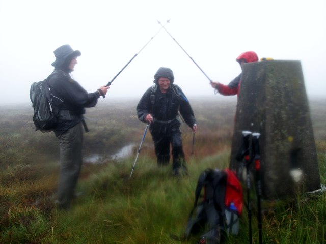
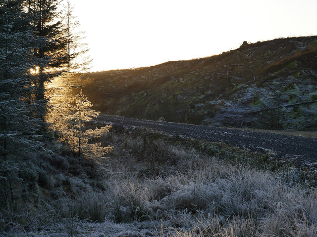
Black Hill is a prominent hill located in Northumberland, England. Situated within the North Pennines Area of Outstanding Natural Beauty, it is part of the Pennine range and stands at an elevation of 609 meters (1,998 feet). Although not classified as a mountain, it offers breathtaking views and is a popular destination for hikers and nature enthusiasts.
The hill is characterized by its distinctive black peat and heather-covered slopes, which give it its name. It is predominantly composed of Carboniferous limestone, but also includes patches of sandstone and shale. The rugged terrain and steep gradients make it a challenging yet rewarding climb for experienced walkers.
At the summit, visitors are rewarded with stunning panoramic views of the surrounding landscape. On clear days, it is possible to see as far as the Cheviot Hills to the north and the Lake District to the south. The area is also home to a diverse range of wildlife, including rare bird species such as golden plovers and curlews.
Black Hill is a designated Site of Special Scientific Interest due to its geological and ecological importance. It is also part of the North Pennines Special Protection Area, which aims to preserve the region's unique habitats and species.
Access to Black Hill is primarily via footpaths and trails, with several starting points in the nearby villages of Blanchland and Edmundbyers. Visitors are advised to come prepared with appropriate hiking gear and to be mindful of the weather conditions, as the hill can be exposed and prone to sudden changes in climate.
If you have any feedback on the listing, please let us know in the comments section below.
Black Hill Images
Images are sourced within 2km of 55.155468/-2.673816 or Grid Reference NY5784. Thanks to Geograph Open Source API. All images are credited.


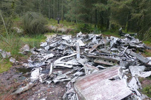
![Handley Page Halifax DK116 crash site, Glendhu Hill The crash site on Glendhu Hill, which wasn&#039;t forested at the time of the crash on 15 October 1944. The crew of Halifax DK116 (1667 HCU) had taken off from RAF Sandtoft near Scunthorpe on a cross country navigation exercise when the port inner engine caught fire. Attempts to extinguish the fire were unsuccessful and the crew prepared to bail out. However, only three of the crew managed to leave before the aircraft dived into Glendhu Hill in the Kielder Forest, Northumberland, barely a mile from the Scottish border.
Various reports suggest the pilot put the Halifax into a dive in an attempt to put the fire out but from which it failed to recover and/or that the remaining crew tried to save the life of the rear gunner who was allegedly trapped in his turret. However, after the three men bailed out no-one knows for sure what happened.
CREW
Killed
P/O Herbert George Haddrell (Pilot, aged 30)
Sgt John Neilson (Flight Engineer, aged 24)
W/O Maurice Fredrick James (Air Gunner, aged 22)
W/O Geoffrey Symonds (Air Gunner)
Survived
Sgt John Mahony (Navigator, aged 22) [Killed in action six months later]
Sgt Reid (Wireless Operator)
Sgt Hammond (Air Gunner)
One of the four Bristol Hercules engines was dug out from under 20&#039; of peat in the 1970s.](https://s1.geograph.org.uk/geophotos/06/35/85/6358509_f49b7d82.jpg)
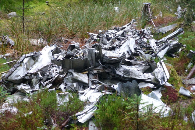
![An oil cooler from Handley Page Halifax DK116 An oil cooler from one of the four Bristol Hercules engines still identifiable at the crash site. Glendhu Hill which wasn&#039;t forested at the time of the crash on 15 October 1944. The crew of Halifax DK116 (1667 HCU) had taken off from RAF Sandtoft near Scunthorpe on a cross country navigation exercise when the port inner engine caught fire. Attempts to extinguish the fire were unsuccessful and the crew prepared to bail out. However, only three of the crew managed to leave before the aircraft dived into Glendhu Hill in the Kielder Forest, Northumberland, barely a mile from the Scottish border.
Various reports suggest the pilot put the Halifax into a dive in an attempt to put the fire out but from which it failed to recover and/or that the remaining crew tried to save the life of the rear gunner who was allegedly trapped in his turret. However, after the three men bailed out no-one knows for sure what happened.
CREW
Killed
P/O Herbert George Haddrell (Pilot, aged 30)
Sgt John Neilson (Flight Engineer, aged 24)
W/O Maurice Fredrick James (Air Gunner, aged 22)
W/O Geoffrey Symonds (Air Gunner)
Survived
Sgt John Mahony (Navigator, aged 22) [Killed in action six months later]
Sgt Reid (Wireless Operator)
Sgt Hammond (Air Gunner)
One of the four Bristol Hercules engines was dug out from under 20&#039; of peat in the 1970s.](https://s1.geograph.org.uk/geophotos/06/35/85/6358521_f8a6bee4.jpg)
![An undercarriage wheel from Handley Page Halifax DK116 An undercarriage wheel still is identifiable at the crash site. Glendhu Hill which wasn&#039;t forested at the time of the crash on 15 October 1944. The crew of Halifax DK116 (1667 HCU) had taken off from RAF Sandtoft near Scunthorpe on a cross country navigation exercise when the port inner engine caught fire. Attempts to extinguish the fire were unsuccessful and the crew prepared to bail out. However, only three of the crew managed to leave before the aircraft dived into Glendhu Hill in the Kielder Forest, Northumberland, barely a mile from the Scottish border.
Various reports suggest the pilot put the Halifax into a dive in an attempt to put the fire out but from which it failed to recover and/or that the remaining crew tried to save the life of the rear gunner who was allegedly trapped in his turret. However, after the three men bailed out no-one knows for sure what happened.
CREW
Killed
P/O Herbert George Haddrell (Pilot, aged 30)
Sgt John Neilson (Flight Engineer, aged 24)
W/O Maurice Fredrick James (Air Gunner, aged 22)
W/O Geoffrey Symonds (Air Gunner)
Survived
Sgt John Mahony (Navigator, aged 22) [Killed in action six months later]
Sgt Reid (Wireless Operator)
Sgt Hammond (Air Gunner)
One of the four Bristol Hercules engines was dug out from under 20&#039; of peat in the 1970s.](https://s2.geograph.org.uk/geophotos/06/35/85/6358534_9497a45b.jpg)
![Looking over Handley Page Halifax DK116 crash site to the summit of Glendhu Hill The crash site on Glendhu Hill, which wasn&#039;t forested at the time of the crash on 15 October 1944. The crew of Halifax DK116 (1667 HCU) had taken off from RAF Sandtoft near Scunthorpe on a cross country navigation exercise when the port inner engine caught fire. Attempts to extinguish the fire were unsuccessful and the crew prepared to bail out. However, only three of the crew managed to leave before the aircraft dived into Glendhu Hill in the Kielder Forest, Northumberland, barely a mile from the Scottish border.
Various reports suggest the pilot put the Halifax into a dive in an attempt to put the fire out but from which it failed to recover and/or that the remaining crew tried to save the life of the rear gunner who was allegedly trapped in his turret. However, after the three men bailed out no-one knows for sure what happened.
CREW
Killed
P/O Herbert George Haddrell (Pilot, aged 30)
Sgt John Neilson (Flight Engineer, aged 24)
W/O Maurice Fredrick James (Air Gunner, aged 22)
W/O Geoffrey Symonds (Air Gunner)
Survived
Sgt John Mahony (Navigator, aged 22) [Killed in action six months later]
Sgt Reid (Wireless Operator)
Sgt Hammond (Air Gunner)
One of the four Bristol Hercules engines was dug out from under 20&#039; of peat in the 1970s.](https://s2.geograph.org.uk/geophotos/06/35/85/6358546_70476186.jpg)
![Handley Page Halifax DK116 crash debris Debris just downslope from the main crash site on Glendhu Hill (which wasn&#039;t afforested at the time).
15 October 1944. The crew of Halifax DK116 (1667 HCU) had taken off from RAF Sandtoft near Scunthorpe on a cross country navigation exercise when the port inner engine caught fire. Attempts to extinguish the fire were unsuccessful and the crew prepared to bail out. However only three of them managed to leave before the aircraft dived into Glendhu Hill in the Kielder Forest, Northumberland, barely a mile from the Scottish border.
Various reports suggest the pilot put the Halifax into a dive in an attempt to put the fire out but from which it failed to recover and/or that the remaining crew tried to save the life of the rear gunner who was allegedly trapped in his turret. But really after the 3 men bailed out no-one knows for sure what happened.
CREW
Killed
P/O Herbert George Haddrell (Pilot, aged 30)
Sgt John Neilson (Flight Engineer, aged 24)
W/O Maurice Fredrick James (Air Gunner, aged 22)
W/O Geoffrey Symonds (Air Gunner)
Survived
Sgt John Mahony (Navigator, aged 22) [Killed in action six months later]
Sgt Reid (Wireless Operator)
Sgt Hammond (Air Gunner)
One of the engines was dug out under 20&#039; of peat in the 1970s.](https://s2.geograph.org.uk/geophotos/06/35/85/6358558_bed08683.jpg)


Black Hill is located at Grid Ref: NY5784 (Lat: 55.155468, Lng: -2.673816)
Unitary Authority: Northumberland
Police Authority: Northumbria
What 3 Words
///speedy.vibrating.playing. Near Langholm, Dumfries & Galloway
Nearby Locations
Related Wikis

Scottish Marches
Scottish Marches was the term used for the Anglo-Scottish border during the late medieval and early modern eras, characterised by violence and cross-border...

Sighty Crag
Sighty Crag is a hill in the southern part of the Kielder Forest region in northern England, a region which also includes its fellow Marilyns of Peel Fell...

Liddel Castle
Liddel Castle is a ruined castle in Liddesdale, by the Liddel Water, near Castleton in the Scottish Borders area of Scotland, in the former county of Roxburghshire...

Blackpool Gate
Blackpool Gate is a settlement in the civil parish of Bewcastle, which is in the district of the City of Carlisle in the county of Cumbria, England. It...

Dinlabyre
Dinlabyre is a village on the B6357 in Liddesdale, on the edge of the Newcastleton Forest, close to Castleton, in the Scottish Borders area of Scotland...

Mangerton Tower
Mangerton Tower is a ruined Scottish tower castle house formerly belonging to the Armstrong family. Mangerton Tower is at Mangerton in Newcastleton or...

Castleton, Scottish Borders
Castleton (Scottish Gaelic: Baile Chaisteil) is a civil parish in the Scottish Borders area of Scotland, in the former Roxburghshire, in the extreme south...

Newcastleton railway station
Newcastleton railway station served the village of Newcastleton, Scottish Borders, Scotland from 1862 to 1969 on the Border Union Railway. == History... ==
Nearby Amenities
Located within 500m of 55.155468,-2.673816Have you been to Black Hill?
Leave your review of Black Hill below (or comments, questions and feedback).