Berry Hill

Hill, Mountain in Gloucestershire Forest of Dean

England

Berry Hill

Towards Berry Hill Golfcourse in the foreground
Towards Berry Hill Credit: Peter Randall-Cook

Berry Hill is a small village located in the Forest of Dean district of Gloucestershire, England. Situated on a hill, it offers picturesque views of the surrounding countryside and is known for its natural beauty. The village is located just a few miles northeast of Coleford and is easily accessible by road.

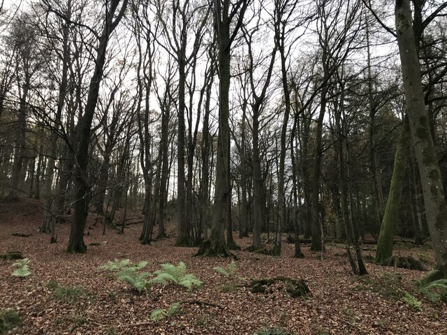
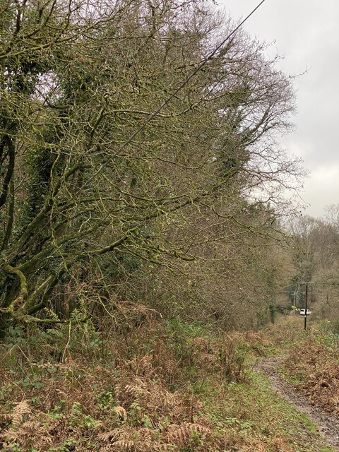
The hill itself is a prominent feature of the village, offering a vantage point for visitors to enjoy stunning vistas of the Forest of Dean and the Wye Valley. The area is characterized by lush greenery, with dense woodlands and rolling hills that attract outdoor enthusiasts and nature lovers.

Historically, Berry Hill was a mining village, with coal mining being a significant industry in the region during the 19th and early 20th centuries. Today, remnants of this industrial past can still be seen in the form of disused mine shafts and old buildings.

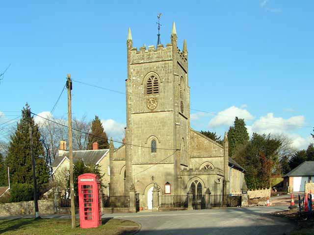
The village has a close-knit community and offers a range of amenities, including a primary school, a church, and a village hall. There are also several pubs and restaurants that provide a warm and welcoming atmosphere for locals and visitors alike.

Berry Hill is an ideal destination for those seeking a peaceful retreat in the heart of the Gloucestershire countryside. With its stunning natural surroundings and rich history, it offers a unique experience for all who visit.

If you have any feedback on the listing, please let us know in the comments section below.

Berry Hill Images

Images are sourced within 2km of 51.812672/-2.6251775 or Grid Reference SO5612. Thanks to Geograph Open Source API. All images are credited.

Towards Berry Hill Golfcourse in the foreground
Towards Berry Hill
Golfcourse in the foreground
Bracelands Campsite Popular Caravan and Camping site.
Bracelands Campsite
Popular Caravan and Camping site.
Forest Holidays Site, Forest of Dean
Stowefield Quarry from the South East Road Tarmac is produced at this quarry from the dolomitic limestone
Stowefield Quarry from the South East
Road Tarmac is produced at this quarry from the dolomitic limestone
New Build - Berry Hill - Five Acres Development of many new houses at Berry Hill
New Build - Berry Hill - Five Acres
Development of many new houses at Berry Hill
Berry Hill & Five Acres - Housing Development Planned Green Fields earmarked for new houses
Berry Hill & Five Acres - Housing Development Planned
Green Fields earmarked for new houses
Ruined barn
Ruined barn
Houses on Bicknor Street
View at Hillersland
View at Hillersland
Santa Claus
Santa Claus
Forest from the path corner
House on Woodland Road
Christchurch, Berry Hill
Bug Hotel Accommodation for insects at Forest Holidays.
Bug Hotel
Accommodation for insects at Forest Holidays.
Archery targets Recreational facilities at Forest Retreat in the Forest of Dean.
Archery targets
Recreational facilities at Forest Retreat in the Forest of Dean.
Woodland track at Broom Hill
Woodland chalets Holiday accommodation at Forest Retreat.
Woodland chalets
Holiday accommodation at Forest Retreat.
Staunton - Showing most of the homes in the village Drone photo showing the extent of Staunton village.
Staunton - Showing most of the homes in the village
Drone photo showing the extent of Staunton village.
Show me another place!

Berry Hill is located at Grid Ref: SO5612 (Lat: 51.812672, Lng: -2.6251775)

Administrative County: Gloucestershire

District: Forest of Dean

Police Authority: Gloucestershire

What 3 Words

///compiled.scatter.untruth. Near Coleford, Gloucestershire

Related Wikis

Berry Hill, Gloucestershire

Berry Hill is a village in Gloucestershire, England, 1.5 miles north of the town of Coleford. Berry Hill includes the settlements of Five Acres to the...

Five Acres High School

Five Acres High School, formerly Lakers School, is an academy in Coleford, Gloucestershire. Simon Phelps is the Headteacher, Five Acres is an Academy which...

Royal Forest of Dean College

Royal Forest of Dean College was a college of further education located close to the town of Coleford, in the Forest of Dean in west Gloucestershire. It...

Slaughter Stream Cave

Slaughter Stream Cave, also known as Wet Sink, is a cave system in the Wye Valley, Forest of Dean. A series of fixed ladders and two pitches lead to sporting...

Dingle Wood

Dingle Wood (grid reference SO562115) is a 9.95-hectare (24.6-acre) biological Site of Special Scientific Interest in Gloucestershire, notified in 1972...

Staunton (near Coleford)

Staunton is a village and civil parish in the Forest of Dean in west Gloucestershire, England, close to the border with Wales. == Location == Staunton...

Mile End, Gloucestershire

Mile End is a small village in the English county of Gloucestershire. It belongs to the civil parish of Coleford, which is also its post town. Mile End...

Stowfield quarry

Stowfield quarry is a quarry in the Forest of Dean about 2 km south of Staunton, near Coleford, Gloucestershire, England. == References ==

Nearby Amenities

Located within 500m of 51.812672,-2.6251775
Bus Stop
Woodland Rd
Naptan AtcoCode: 1600GL1155
Naptan Bearing: NW
Naptan BusStopType: CUS
Naptan CommonName: Woodland Rd
Naptan NaptanCode: gloadmpj
Naptan Street: Woodland Rd
Naptan Verified: no
Source: naptan_import
Lat/Long: 51.8136431/-2.6238774
Bus Stop
Woodland Rd
Naptan AtcoCode: 1600GL1156
Naptan Bearing: SE
Naptan BusStopType: CUS
Naptan CommonName: Woodland Rd
Naptan NaptanCode: gloadmpt
Naptan Street: Woodland Rd
Naptan Verified: no
Source: naptan_import
Lat/Long: 51.813671/-2.6236892
Bus Stop
Crossroads
Naptan AtcoCode: 1600GL1159
Naptan Bearing: W
Naptan CommonName: Crossroads
Naptan NaptanCode: gloadmwg
Naptan Street: Park Rd
Naptan Verified: no
Source: naptan_import
Lat/Long: 51.8127513/-2.622487
Bus Stop
Crossroads
Naptan AtcoCode: 1600GL1160
Naptan Bearing: E
Naptan CommonName: Crossroads
Naptan NaptanCode: gloadmwt
Naptan Street: Park Rd
Naptan Verified: no
Source: naptan_import
Lat/Long: 51.812864/-2.6222958
Bus Stop
Eastville Caravan Park
Naptan AtcoCode: 1600GL9160
Naptan Bearing: SE
Naptan CommonName: Eastville Caravan Park
Naptan NaptanCode: gloadpjm
Naptan Street: Coopers Rd
Naptan Verified: no
Source: naptan_import
Lat/Long: 51.8142263/-2.6190112
Bus Stop
Christchurch Camp Sites
Naptan AtcoCode: 1600GLA36772
Naptan Bearing: NW
Naptan CommonName: Christchurch Camp Sites
Naptan NaptanCode: glogmpdw
Naptan Street: Broom Hill
Naptan Verified: no
Source: naptan_import
Lat/Long: 51.8133289/-2.6271516
Bus Stop
The Horsepool
Naptan AtcoCode: 1600GLA56975
Naptan Bearing: N
Naptan CommonName: The Horsepool
Naptan NaptanCode: glogmpwd
Naptan Street: Tudor Walk
Naptan Verified: no
Source: naptan_import
Lat/Long: 51.8118414/-2.6211254
Bus Stop
The Horsepool
Naptan AtcoCode: 1600GLA56976
Naptan Bearing: S
Naptan CommonName: The Horsepool
Naptan Indicator: Opp
Naptan NaptanCode: glogmpwg
Naptan Street: Tudor Walk
Naptan Verified: no
Source: naptan_import
Lat/Long: 51.8117883/-2.6209651
Bus Stop
Christ Church
Naptan AtcoCode: 1600GLF399
Naptan Bearing: S
Naptan CommonName: Christ Church
Naptan NaptanCode: gloadmtg
Naptan Street: Ross Rd
Naptan Verified: no
Source: naptan_import
Lat/Long: 51.8136741/-2.623109
Bus Stop
Christ Church
Naptan AtcoCode: 1600GLF400
Naptan Bearing: N
Naptan CommonName: Christ Church
Naptan Indicator: Opp
Naptan NaptanCode: gloadmtd
Naptan Street: Ross Rd
Naptan Verified: no
Source: naptan_import
Lat/Long: 51.8138443/-2.6232419
Bus Stop
Bridewell Farm
Naptan AtcoCode: 1600GLF641
Naptan Bearing: NW
Naptan BusStopType: CUS
Naptan CommonName: Bridewell Farm
Naptan NaptanCode: gloadmjw
Naptan Street: Woodland Rd
Naptan Verified: no
Source: naptan_import
Lat/Long: 51.8159995/-2.6254478
Bus Stop
Bridewell Farm
Naptan AtcoCode: 1600GLF642
Naptan Bearing: SE
Naptan CommonName: Bridewell Farm
Naptan Indicator: Opp
Naptan NaptanCode: gloadmpa
Naptan Street: Woodland Rd
Naptan Verified: no
Source: naptan_import
Lat/Long: 51.8160001/-2.6253317
Christchurch
Place: village
Lat/Long: 51.8129502/-2.6229464
The Dairy
Shop: convenience
Lat/Long: 51.8126255/-2.6210725
Atm
Lat/Long: 51.8126438/-2.6210204
Historic Amenity: toilets
Lat/Long: 51.8128674/-2.6267457
Barrier: cattle_grid
Motor Vehicle: yes
Lat/Long: 51.8135344/-2.6284699
Forest Retreat
Note: Reception for Forest Holidays Cottages, Christchurch camp site. Has convenience store, coffee shop and food service.
Opening Hours: 08:00-20:00
Shop: convenience
Toilets Wheelchair: yes
Wheelchair: yes
Lat/Long: 51.8134071/-2.6274457
Barrier: cattle_grid
Lat/Long: 51.8132572/-2.6274585
Man Made: water_tap
Lat/Long: 51.8134817/-2.6272633
Public Bookcase
Defibrillator
Booth: K6
Colour: red
Covered: booth
Defibrillator Location: inside red phone box (that is now used as book exchange) opposite Christchurch, Ross Road, Berry Hill
Disused Amenity: telephone
Emergency: defibrillator
Man Made: telephone_box
Public Bookcase Type: phone_box
Lat/Long: 51.8134869/-2.6233557
Fire Extinguisher
Emergency: fire_extinguisher
Lat/Long: 51.8114856/-2.629664
Waste Basket
Waste: dog_excrement
Lat/Long: 51.811469/-2.6296157
Fire Extinguisher
Emergency: fire_extinguisher
Lat/Long: 51.8109193/-2.6288633
Fire Extinguisher
Emergency: fire_extinguisher
Lat/Long: 51.8105448/-2.6293307
Fire Extinguisher
Emergency: fire_extinguisher
Lat/Long: 51.8122803/-2.6324274
Fire Extinguisher
Emergency: fire_extinguisher
Lat/Long: 51.8127733/-2.6320911
Waste Basket
Waste: dog_excrement
Lat/Long: 51.8124978/-2.6310955
Fire Extinguisher
Emergency: fire_extinguisher
Lat/Long: 51.8125334/-2.6310686
Recycling
Recycling Type: container
Lat/Long: 51.8129148/-2.6303766
Leisure: picnic_table
Lat/Long: 51.8124149/-2.6296699
Leisure: picnic_table
Lat/Long: 51.8121222/-2.6297342
Leisure: firepit
Lat/Long: 51.8121097/-2.6299139
Fire Extinguisher
Emergency: fire_extinguisher
Lat/Long: 51.8122698/-2.6255491
Waste Basket
Waste: dog_excrement
Lat/Long: 51.8111785/-2.6265199
Fire Extinguisher
Emergency: fire_extinguisher
Lat/Long: 51.8115933/-2.6282523
Fire Extinguisher
Emergency: fire_extinguisher
Lat/Long: 51.8110607/-2.6271858
Fire Extinguisher
Emergency: fire_extinguisher
Lat/Long: 51.8129629/-2.6288608
Fire Extinguisher
Emergency: fire_extinguisher
Lat/Long: 51.8135171/-2.628014
Bicycle Parking
Lat/Long: 51.8133043/-2.6276779
Bench
Lat/Long: 51.8133367/-2.6274418
Defibrillator
Emergency: defibrillator
Lat/Long: 51.8135068/-2.6272535
Waste Basket
Waste: dog_excrement
Lat/Long: 51.8135521/-2.6272347
Bench
Lat/Long: 51.8130288/-2.627607
Leisure: picnic_table
Lat/Long: 51.8132849/-2.627931
Leisure: picnic_table
Lat/Long: 51.8132061/-2.6279558
Leisure: picnic_table
Lat/Long: 51.8130912/-2.6279133
Leisure: picnic_table
Lat/Long: 51.8130824/-2.6281151
Leisure: picnic_table
Lat/Long: 51.8131722/-2.6283151
Leisure: picnic_table
Lat/Long: 51.8130485/-2.6282673
Charging Station
Brand: Pod Point
Brand Wikidata: Q42888154
Description: "Zach-Elle" 7kW
Operator: Pod Point
Operator Wikidata: Q42888154
Lat/Long: 51.8127535/-2.6274635
Grit Bin
Lat/Long: 51.8128549/-2.6275854
Waste Basket
Waste: dog_excrement
Lat/Long: 51.8121652/-2.62659
Fire Extinguisher
Emergency: fire_extinguisher
Lat/Long: 51.8122745/-2.6281277
Waste Basket
Waste: dog_excrement
Lat/Long: 51.8124874/-2.6282904
Fire Extinguisher
Emergency: fire_extinguisher
Lat/Long: 51.8122745/-2.6288211
The data included in this document is from www.openstreetmap.org. The data is made available under ODbL.

Have you been to Berry Hill?

Leave your review of Berry Hill below (or comments, questions and feedback).