Black Hillock

Hill, Mountain in Aberdeenshire

Scotland

Black Hillock

Knock Saul Summit The process of placing trig points on top of prominent hills and mountains began in 1935 to assist in the accurate retriangulation of Great Britain. The Ordnance Survey's first trig point was erected on 18 April 1936 near Cold Ashby, Northamptonshire. In low-lying or flat areas some trig points are only a few metres above sea level and one is even at −1 m (near Little Ouse, Cambridgeshire, TL61718 89787). When all the trig points were in place, it was possible in clear weather to see at least two other trig points from any one trig point, but subsequent vegetation growth means that this is not necessarily still the case. Careful measurements of the angles between the lines-of-sight of the other trig points then allowed the construction of a system of triangles which could then be referenced back to a single baseline to construct a highly accurate measurement system that covered the entire country.
Knock Saul Summit Credit: Ralph Greig

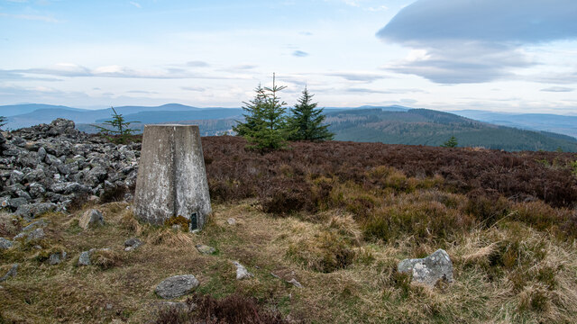
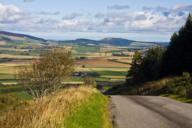
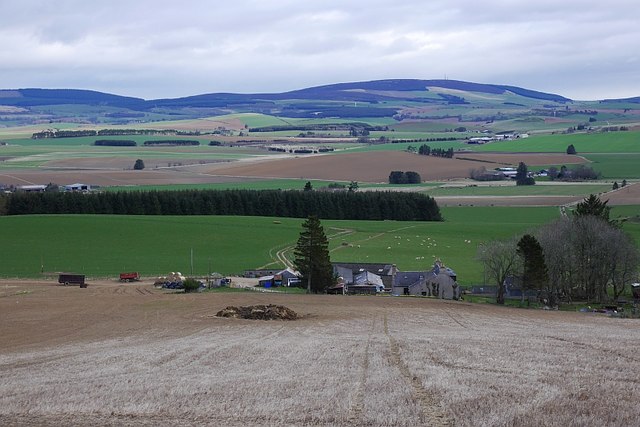
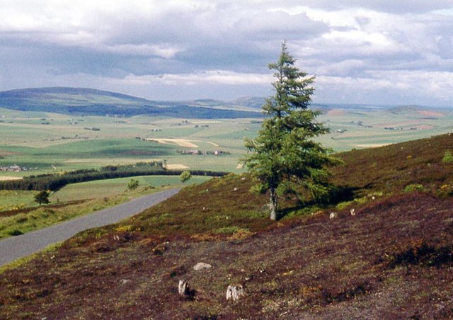
Black Hillock is a prominent hill located in Aberdeenshire, Scotland. It is situated in the eastern part of the county, approximately 10 miles west of the town of Fraserburgh. With an elevation of approximately 327 meters (1,073 feet), it offers stunning panoramic views of the surrounding countryside.

The hill is characterized by its distinctive black rock formations, which give it its name. These formations are the result of volcanic activity millions of years ago. The hill is mainly composed of granite and basalt, creating a diverse geological landscape.

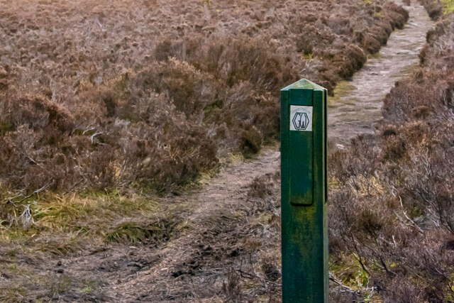
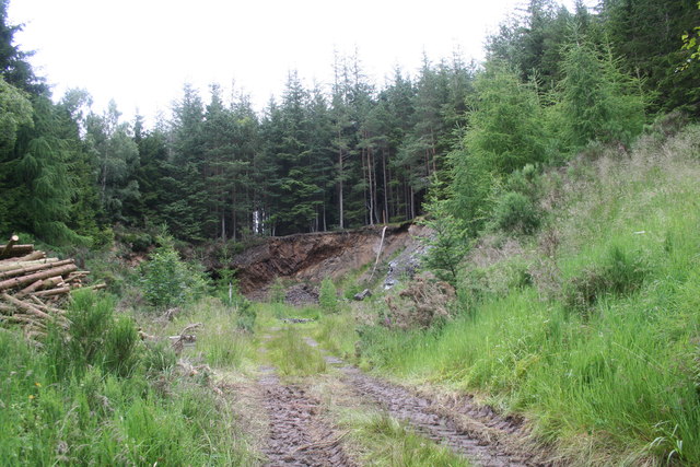
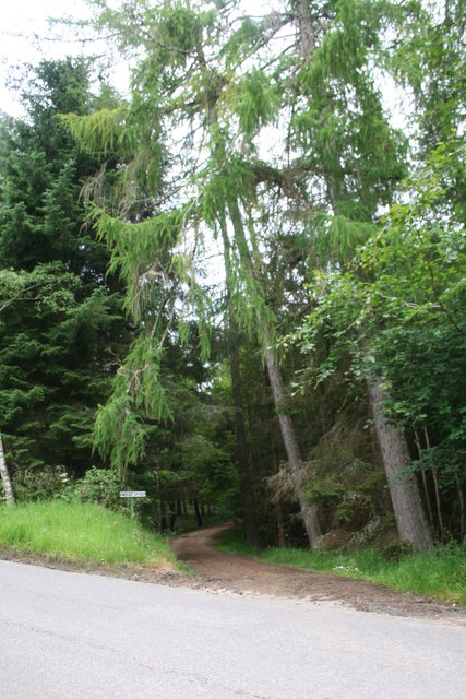
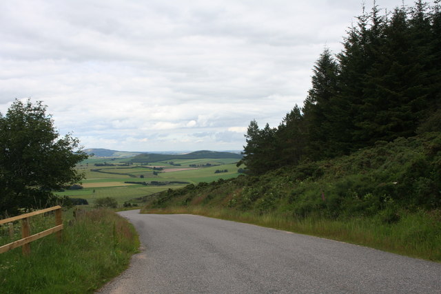
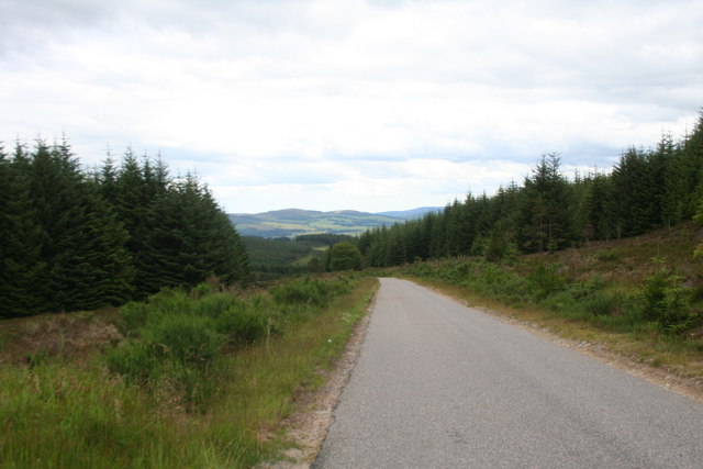
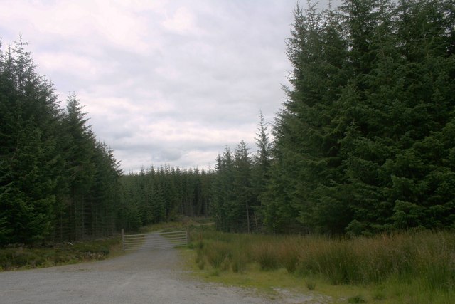
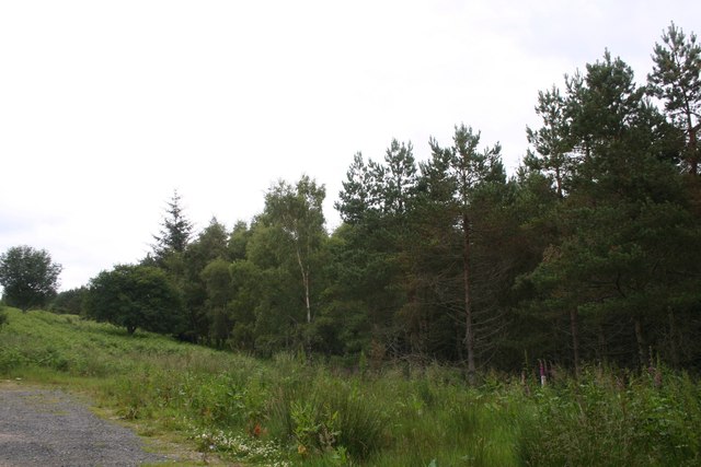
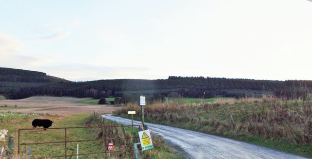
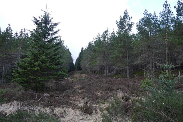
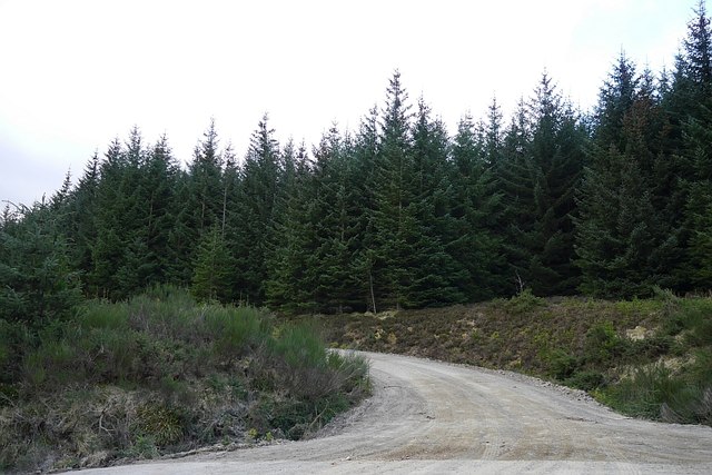
Black Hillock is a popular destination for hikers and outdoor enthusiasts, offering several well-marked trails that cater to different skill levels. The paths wind their way through heather-covered moorland and pockets of woodland, providing opportunities for wildlife spotting and birdwatching.

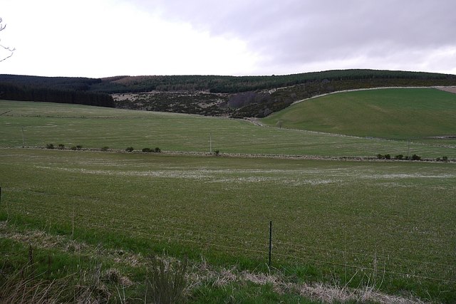
At the summit of Black Hillock, visitors are rewarded with breathtaking vistas of Aberdeenshire's rolling hills, farmland, and coastal areas. On clear days, it is even possible to catch a glimpse of the North Sea in the distance.

The hill is known for its historical significance as well. In the vicinity of Black Hillock, there are remnants of ancient settlements and stone circles, indicating human occupation in the area dating back thousands of years.

Overall, Black Hillock is a captivating natural landmark, offering a combination of scenic beauty, geological interest, and historical intrigue to those who venture to its slopes.

If you have any feedback on the listing, please let us know in the comments section below.

Black Hillock Images

Images are sourced within 2km of 57.297796/-2.7195138 or Grid Reference NJ5623. Thanks to Geograph Open Source API. All images are credited.

Knock Saul Summit The process of placing trig points on top of prominent hills and mountains began in 1935 to assist in the accurate retriangulation of Great Britain. The Ordnance Survey's first trig point was erected on 18 April 1936 near Cold Ashby, Northamptonshire. In low-lying or flat areas some trig points are only a few metres above sea level and one is even at −1 m (near Little Ouse, Cambridgeshire, TL61718 89787). When all the trig points were in place, it was possible in clear weather to see at least two other trig points from any one trig point, but subsequent vegetation growth means that this is not necessarily still the case. Careful measurements of the angles between the lines-of-sight of the other trig points then allowed the construction of a system of triangles which could then be referenced back to a single baseline to construct a highly accurate measurement system that covered the entire country.
Knock Saul Summit
The process of placing trig points on top of prominent hills and mountains began in 1935 to assist in the accurate retriangulation of Great Britain. The Ordnance Survey's first trig point was erected on 18 April 1936 near Cold Ashby, Northamptonshire. In low-lying or flat areas some trig points are only a few metres above sea level and one is even at −1 m (near Little Ouse, Cambridgeshire, TL61718 89787). When all the trig points were in place, it was possible in clear weather to see at least two other trig points from any one trig point, but subsequent vegetation growth means that this is not necessarily still the case. Careful measurements of the angles between the lines-of-sight of the other trig points then allowed the construction of a system of triangles which could then be referenced back to a single baseline to construct a highly accurate measurement system that covered the entire country.
Waymarker on the Gordon Way
Old Quarry An old quarry off the Suie road being used to store tree thinnings.
Old Quarry
An old quarry off the Suie road being used to store tree thinnings.
Road to Knockespock An access road to knockespock House off the Suie road.
Road to Knockespock
An access road to knockespock House off the Suie road.
Downhill from Suie The road downhill to Knockespock and beyond.
Downhill from Suie
The road downhill to Knockespock and beyond.
Forest Road The road passing through Whitehaugh Wood on the left and Knockespock on the right.
Forest Road
The road passing through Whitehaugh Wood on the left and Knockespock on the right.
Forest Road A forestry road off the Suie road.
Forest Road
A forestry road off the Suie road.
Woodland Edge The edge of woodland on Suie.
Woodland Edge
The edge of woodland on Suie.
The road down from Suie Hill
Towerlodge; access to Knockespock House Off Premnay to Ford road, near Little Newton.
Towerlodge; access to Knockespock House
Off Premnay to Ford road, near Little Newton.
Hill of Johnston From the minor road near Bridge of Johnston.
Hill of Johnston
From the minor road near Bridge of Johnston.
Access road to Courtiestown farm From the Leslie-Clatt minor road near Bridge of Johnston.
Access road to Courtiestown farm
From the Leslie-Clatt minor road near Bridge of Johnston.
Field above Newtonhill View from the elbow on the Military Road.
Field above Newtonhill
View from the elbow on the Military Road.
Ride, Monach Conifers beside the Suie Hill road.
Ride, Monach
Conifers beside the Suie Hill road.
Logging road, Knockespock Forest A newish road, it has yet to make it on to the consumer scale Ordnance Survey maps.
Logging road, Knockespock Forest
A newish road, it has yet to make it on to the consumer scale Ordnance Survey maps.
Fields beneath Suie Hill
Field corner, Suie Edge of the moorland with a rowan tree.
Field corner, Suie
Edge of the moorland with a rowan tree.
The Suie hill road above rural Aberdeenshire
Show me another place!

Black Hillock is located at Grid Ref: NJ5623 (Lat: 57.297796, Lng: -2.7195138)

Unitary Authority: Aberdeenshire

Police Authority: North East

What 3 Words

///skinny.windmill.dislikes. Near Alford, Aberdeenshire

Nearby Locations

Black Hillock

Related Wikis

Castle Croft

Castle Croft was located near New Leslie farm, about 5 kilometres (3.1 mi) south-west of Insch, in Aberdeenshire, Scotland. It was the property of the...

Terpersie Castle

Terpersie Castle (originally built as Dalpersie House) is a 16th-century tower house in Tullynessle, Aberdeenshire, Scotland, located 5 kilometres (3...

Tullynessle

Tullynessle is a hamlet in Aberdeenshire, Scotland, three miles NNW of Alford.The settlement contains the Category A listed Terpersie Castle, a privately...

Clatt

Clatt (Gaelic cleithe, 'concealed'), is a village in Aberdeenshire, Scotland. The remains of a morthouse are located in the cemetery of the old church...

Gordon Way

The Gordon Way is a waymarked hiking trail in Aberdeenshire, Scotland. It runs for 11+1⁄2 miles (18.5 km) through the Bennachie Forest. The route was one...

Ardlair Stone

The Ardlair Stone is a class I Pictish stone that stands in a field in Ardlair, Kennethmont, Aberdeenshire, Scotland. It is associated with a number of...

Auchleven

Auchleven (Scottish Gaelic: Achadh Leamhan) is a village in Aberdeenshire, Scotland. Located approximately 4 miles (6 kilometres) south of Insch, 17 mi...

Forbes, Aberdeenshire

Forbes is a hamlet by Tullynessle in Aberdeenshire, Scotland. It is connected to Tullynessle 1 3/4 miles from Alford. == See also == Clan Forbes ��2�...

Nearby Amenities

Located within 500m of 57.297796,-2.7195138
Power: pole
Lat/Long: 57.293926/-2.7158394
Power: pole
Lat/Long: 57.2941199/-2.7147329
The data included in this document is from www.openstreetmap.org. The data is made available under ODbL.

Have you been to Black Hillock?

Leave your review of Black Hillock below (or comments, questions and feedback).