Rotten Hill

Hill, Mountain in Lancashire Lancaster

England

Rotten Hill

Cairn and shelter This cairn and shelter are not marked on old OS maps so must be of fairly recent (<50 years ago) construction.
Cairn and shelter Credit: Phil Johnstone

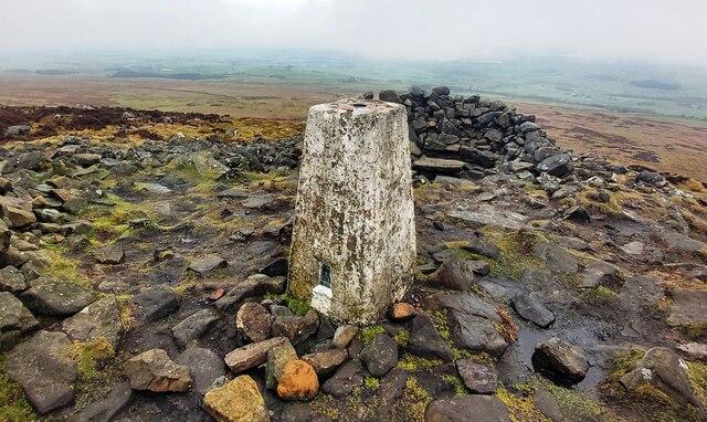
Rotten Hill is a small hill located in the county of Lancashire, England. Situated in the southern part of the county, it forms part of the Pennine Hills, a range of hills and mountains that stretch across Northern England. Rotten Hill is approximately 438 meters (1,437 feet) in height and offers stunning panoramic views of the surrounding countryside.

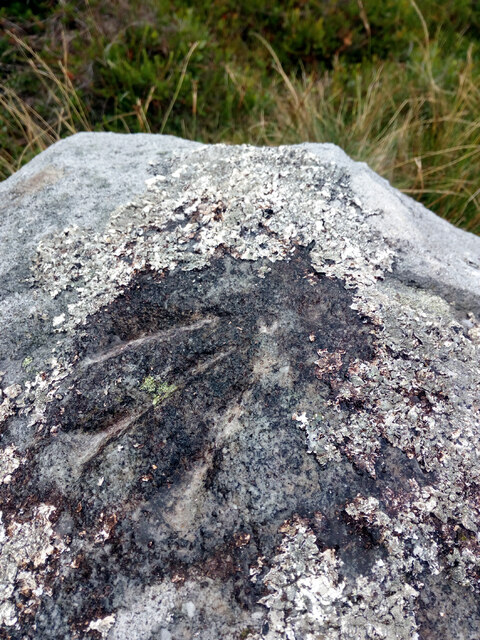
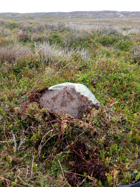
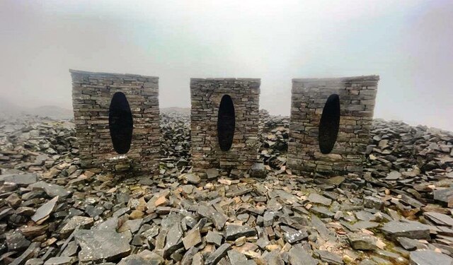
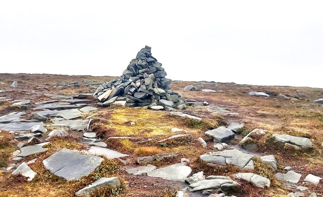
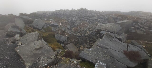
The hill is known for its rugged and rocky terrain, making it a popular destination for hikers and nature enthusiasts. Its slopes are covered with heather, grasses, and various wildflowers, creating a vibrant and picturesque landscape. The hill is also home to a diverse range of wildlife, including birds, rabbits, and occasionally deer.

Rotten Hill has historical significance as well. It is believed to have been a strategic vantage point during ancient times, as evidenced by the presence of an Iron Age hillfort on its summit. The hillfort comprises earthworks and ditches, serving as a defensive structure.

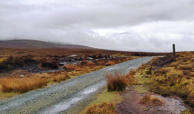
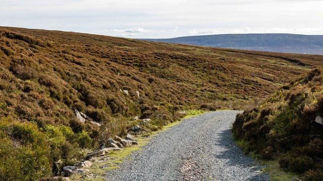
Access to Rotten Hill is relatively easy, with several footpaths and trails leading to the summit. These paths are well-maintained, ensuring a safe and enjoyable experience for visitors. The hill is particularly popular during the summer months when the weather is favorable for outdoor activities.

Overall, Rotten Hill in Lancashire offers a unique blend of natural beauty, historical significance, and recreational opportunities, making it a must-visit destination for those exploring the region.

If you have any feedback on the listing, please let us know in the comments section below.

Rotten Hill Images

Images are sourced within 2km of 54.013912/-2.6870325 or Grid Reference SD5557. Thanks to Geograph Open Source API. All images are credited.

Cairn and shelter This cairn and shelter are not marked on old OS maps so must be of fairly recent (<50 years ago) construction.
Cairn and shelter
This cairn and shelter are not marked on old OS maps so must be of fairly recent (<50 years ago) construction.
OS Bench Mark This OS pivot bench mark from the 19th century levelling was hard to spot, being covered in lichen. In fact we were sitting on the rock, having failed to find it. Even after clearing the lichen and washing, it is still quite hard to see. 1399.5 feet above old datum.
OS Bench Mark
This OS pivot bench mark from the 19th century levelling was hard to spot, being covered in lichen. In fact we were sitting on the rock, having failed to find it. Even after clearing the lichen and washing, it is still quite hard to see. 1399.5 feet above old datum.
OS Bench Mark OS pivot bench mark from the 19th century levelling. It was mostly hidden by moss, which had perhaps protected it from erosion. After clearing and washing, it is now very clear. 1354.3 feet above old datum.
OS Bench Mark
OS pivot bench mark from the 19th century levelling. It was mostly hidden by moss, which had perhaps protected it from erosion. After clearing and washing, it is now very clear. 1354.3 feet above old datum.
Quernmore Jubilee Tower A folly prospect tower below Hare Appletree Fell. It has no visible windows or doors just an outside flight of stairs to the viewing platform
Quernmore Jubilee Tower
A folly prospect tower below Hare Appletree Fell. It has no visible windows or doors just an outside flight of stairs to the viewing platform
Jubilee Tower, Quernmore A useful viewing platform
Jubilee Tower, Quernmore
A useful viewing platform
Sculpture featuring three stone sentry boxes on Grit Fell In a disused quarry
Sculpture featuring three stone sentry boxes on Grit Fell
In a disused quarry
Cabin and Car Park on Grit Fell
Junction Marker on Cabin Flat
Boundary Stone and Ladder Stile on Grit Fell
Cairn on Grit Fell
Cairn on Grit Fell
Trig Pillar - Clougha Pike
Old Quarry Workings on Plover Moss
Lee Fell Track on Lee Fell near Grizedale Head.
Lee Fell
Track on Lee Fell near Grizedale Head.
Grizedale Head Luncheon hut for shooters at Grizedale Head.
Grizedale Head
Luncheon hut for shooters at Grizedale Head.
Grit Fell Vehicle parked up on Grit Fell.
Grit Fell
Vehicle parked up on Grit Fell.
Stone Sculpture A stone sculpture in a disused quarry.
Stone Sculpture
A stone sculpture in a disused quarry.
Vickery Rock
Vickery Rock
Show me another place!

Rotten Hill is located at Grid Ref: SD5557 (Lat: 54.013912, Lng: -2.6870325)

Administrative County: Lancashire

District: Lancaster

Police Authority: Lancashire

What 3 Words

///gazed.exit.sprayer. Near Caton, Lancashire

Nearby Locations

Rotten Hill

Related Wikis

Grit Fell

Grit Fell is a lonely hill between Clougha Pike and Ward's Stone in the Forest of Bowland in Lancashire, England. Covered by heather and large bogs, it...

Clougha Pike

Clougha Pike ( KLUUF-ə) is a hill in the Forest of Bowland in Lancashire, England. From the west it looms over the Conder Valley, the city of Lancaster...

River Grizedale

The River Grizedale, also known as Grizedale Beck, is a river in Lancashire, England. The river rises at Grizedale Head between Abbeystead Fell, Cabin...

Grizedale Bridge

Grizedale Bridge is a Grade II listed bridge in the English parish of Over Wyresdale, Lancashire. The structure, which dates to the 19th century, carries...

Nearby Amenities

Located within 500m of 54.013912,-2.6870325
Ford: yes
Lat/Long: 54.0153399/-2.6920308
Hunting Stand
Hunting Stand: grouse_butt
Lat/Long: 54.0138054/-2.688944
Hunting Stand
Hunting Stand: grouse_butt
Lat/Long: 54.0132901/-2.6892471
Hunting Stand
Hunting Stand: grouse_butt
Lat/Long: 54.0128393/-2.6894563
Hunting Stand
Hunting Stand: grouse_butt
Lat/Long: 54.0123775/-2.6895556
Hunting Stand
Hunting Stand: grouse_butt
Lat/Long: 54.0119874/-2.6894282
Hunting Stand
Hunting Stand: grouse_butt
Lat/Long: 54.0115579/-2.6892015
Hunting Stand
Hunting Stand: grouse_butt
Lat/Long: 54.0111592/-2.6889186
Man Made: manhole
Manhole: water
Lat/Long: 54.0107904/-2.6847893
Man Made: manhole
Manhole: water
Lat/Long: 54.0108124/-2.684792
Man Made: manhole
Manhole: water
Lat/Long: 54.0103553/-2.6900659
Man Made: manhole
Manhole: water
Lat/Long: 54.0103321/-2.6900759
Ford: yes
Lat/Long: 54.0137502/-2.6943906
The data included in this document is from www.openstreetmap.org. The data is made available under ODbL.

Have you been to Rotten Hill?

Leave your review of Rotten Hill below (or comments, questions and feedback).